Weather or Not: Miami’s Dynamic Week of Sun, Storms, and Safety Precautions
By
Amy Freeze
Explore the detailed weather dynamics over Miami this week with Meteorologist Amy Freeze. From sunny skies to storm alerts, learn how to prepare for every scenario.
This week in Miami presents a mosaic of weather conditions—sunny spells, partial clouds, and sudden storms. Navigate through this climatic variability with tips from Amy Freeze!
Meteorologist Amy Freeze guides you through a week of diverse weather patterns in Miami. Experience everything from the warmth of 84-degree highs to the caution needed during severe storm warnings. This blog post goes beyond the forecast, delivering actionable advice for dealing with fluctuating weather conditions and ensuring your safety.
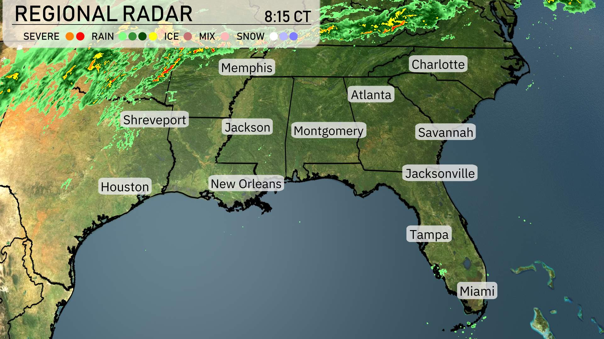
The Regional Radar indicates a dynamic weather pattern across the Southeast today. In the northern parts of the region, a line of storms is stretching across Tennessee, moving eastward over Nashville and towards the Appalachian range. Expect thunderstorms and heavy rainfall in these areas.
Farther south, in Mississippi and the vicinity of Jackson, rain is prevalent, with showers extending toward Montgomery. This band of precipitation is making its way eastward, bringing potential thunderstorms to Atlanta later today.
While it’s relatively calm along the Gulf Coast, areas around New Orleans are experiencing some cloud cover, but no precipitation is expected there for now. As we move into Florida, scattered thunderstorms are expected near Miami and Fort Lauderdale, while Tampa and Jacksonville might see rain showers later in the day. Coastal cities like Savannah and Charleston will enjoy relatively clear skies, though cloud cover will increase later.
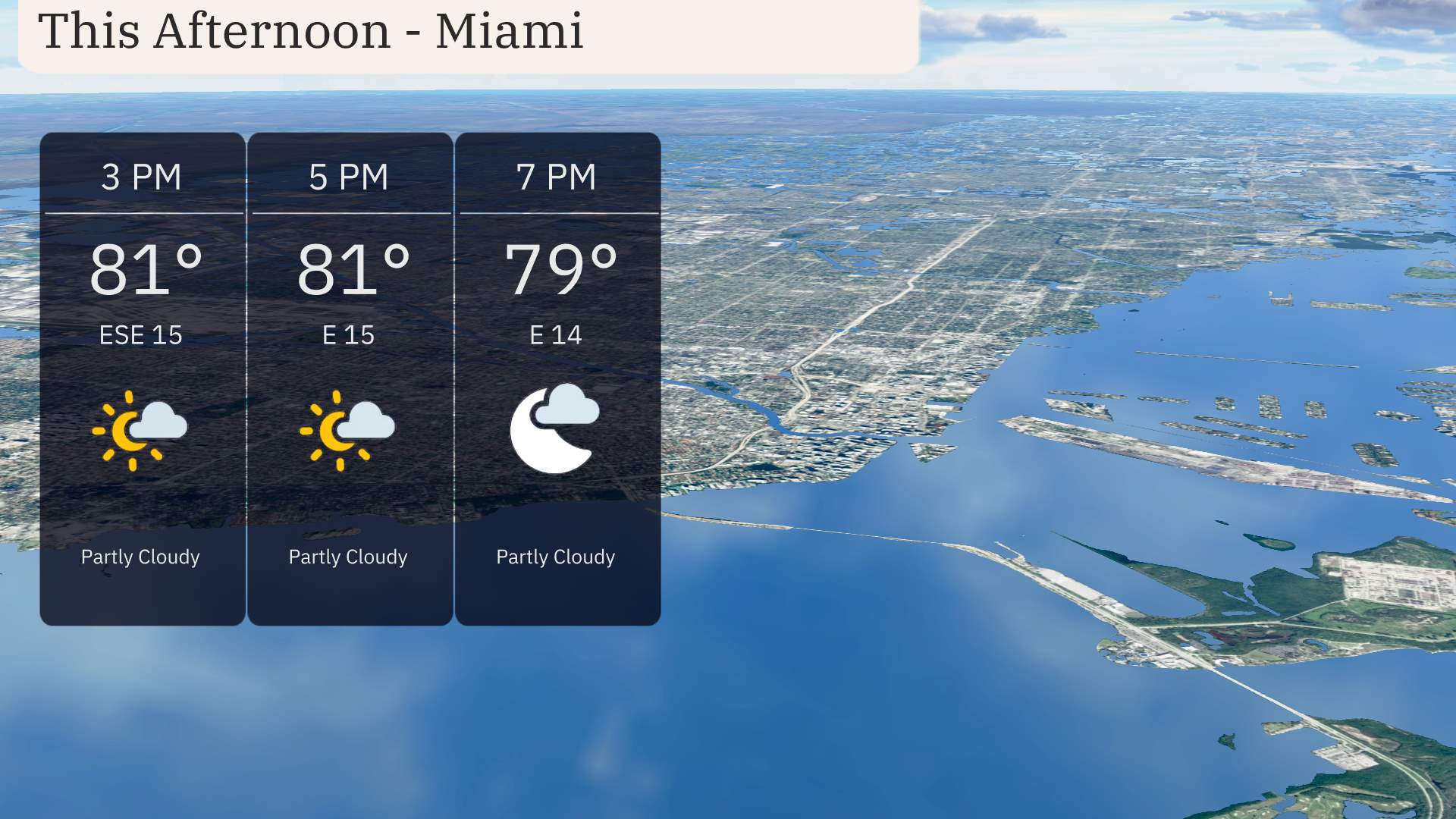
Miami’s afternoon weather features temperatures holding steady at 81 degrees with an east-southeast breeze at 15 miles per hour. Skies are partly cloudy, providing a mix of sun and shade. As we progress toward evening, temperatures slightly dip to 79 degrees by 7 PM under partly cloudy conditions, with an east wind at 14 miles per hour.
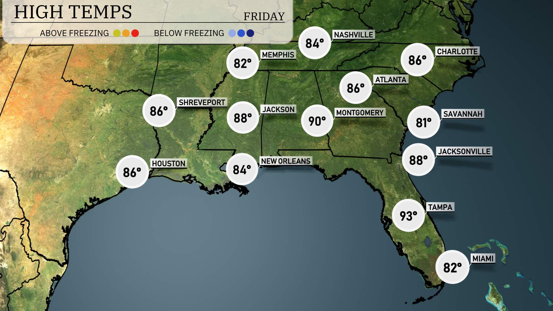
Let’s dive into today’s regional high temperatures across the Southeast.
In New Orleans, it’s feeling quite warm, reaching a high of 84 degrees. Jackson is slightly hotter at 88 degrees, while Montgomery hits an impressive 90. Over in Shreveport and Houston, temperatures are consistent at 86 degrees.
As we shift toward the east, Atlanta will enjoy a balmy 86 degrees, while in Jacksonville, temperatures soar to 88. Notably, Savannah is a bit cooler with a high of 81 degrees. Further down in Florida, Tampa’s basking in the heat with a high of 93, while Miami sits at a more moderate 82 degrees.
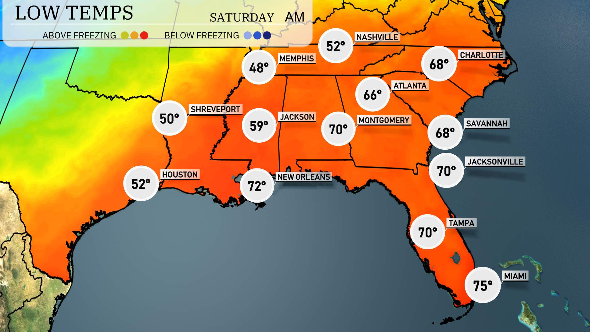
Expect a brisk 33 degrees in Memphis. Nashville won’t be far behind with a low of 35 degrees. In Jackson, temperatures will dip to 39. Shreveport is forecasted to see a low of 50 degrees. Meanwhile, Montgomery will cool down to 59. Atlanta will experience a mild night at 55 degrees. Over in Florida, Jacksonville is set for 61 and Tampa will be a bit more comfortable at 65. Miami will enjoy a warmer evening with a low of 69 degrees.
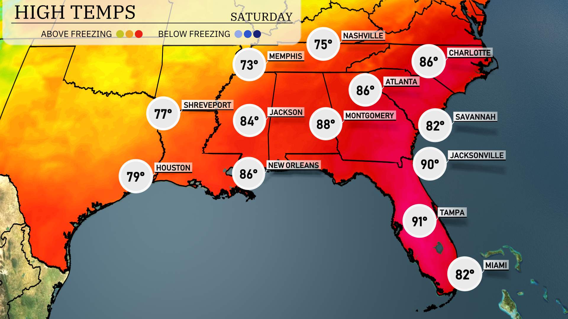
High temperatures for the Southeast region tomorrow are expected to be notably warm, significantly above average for early April.
Atlanta is on track to reach 88 degrees, while Montgomery will see a high of 86. Jackson is looking at a warm 84 degrees, with Memphis also enjoying a mild 75. Down in Florida, Jacksonville is forecasted to hit 90 degrees, and Tampa may reach an impressive 91.
This warm-up is driven by a strong ridge of high pressure settling in, influencing the warm air flow across the region. Expect some coastal breezes in areas like Miami, with temperatures around 82 degrees.
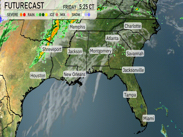
A powerful weather pattern sets up across the Southeast tomorrow. Expect a strong line of storms moving from Shreveport and Jackson towards Montgomery and Atlanta through the day. This frontal system contains thunderstorms capable of heavy rains and damaging winds. Prepare for localized flooding, especially in areas already saturated. Storm activity diminishes as it progresses farther east. Temperatures behind the front will cool slightly, yet conditions stabilize as we head into the weekend.
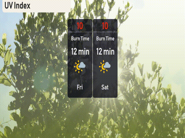
The UV index in Miami is at a very high level of 10 for both Friday and Saturday, with a burn time of 12 minutes in direct sunlight. It’s crucial to limit your sun exposure and protect your skin with sunscreen, hats, and sunglasses. Stay safe in the sun!