Miami Mornings: Sun, Showers, and Surprises in the Forecast!
By
Amy Freeze
Explore the swings of Miami’s weather from calm mornings to stormy afternoons. Stay ahead with our detailed daily forecasts.
This week in Miami, experience a rollercoaster of weather conditions from warm sunny days to unexpected thunderstorms. Get the details on what to expect each day!
Welcome to our detailed coverage of Miami’s weather. Starting with tomorrow’s forecast featuring scattered thunderstorms, tune in daily for updates as we track high temperatures and storm warnings. With our insightful commentary and practical tips, you’ll be prepared whether it’s rain or shine. Explore our complete guide to this week in Miami’s weather, topped with safety tips for navigating those UV-rich days.
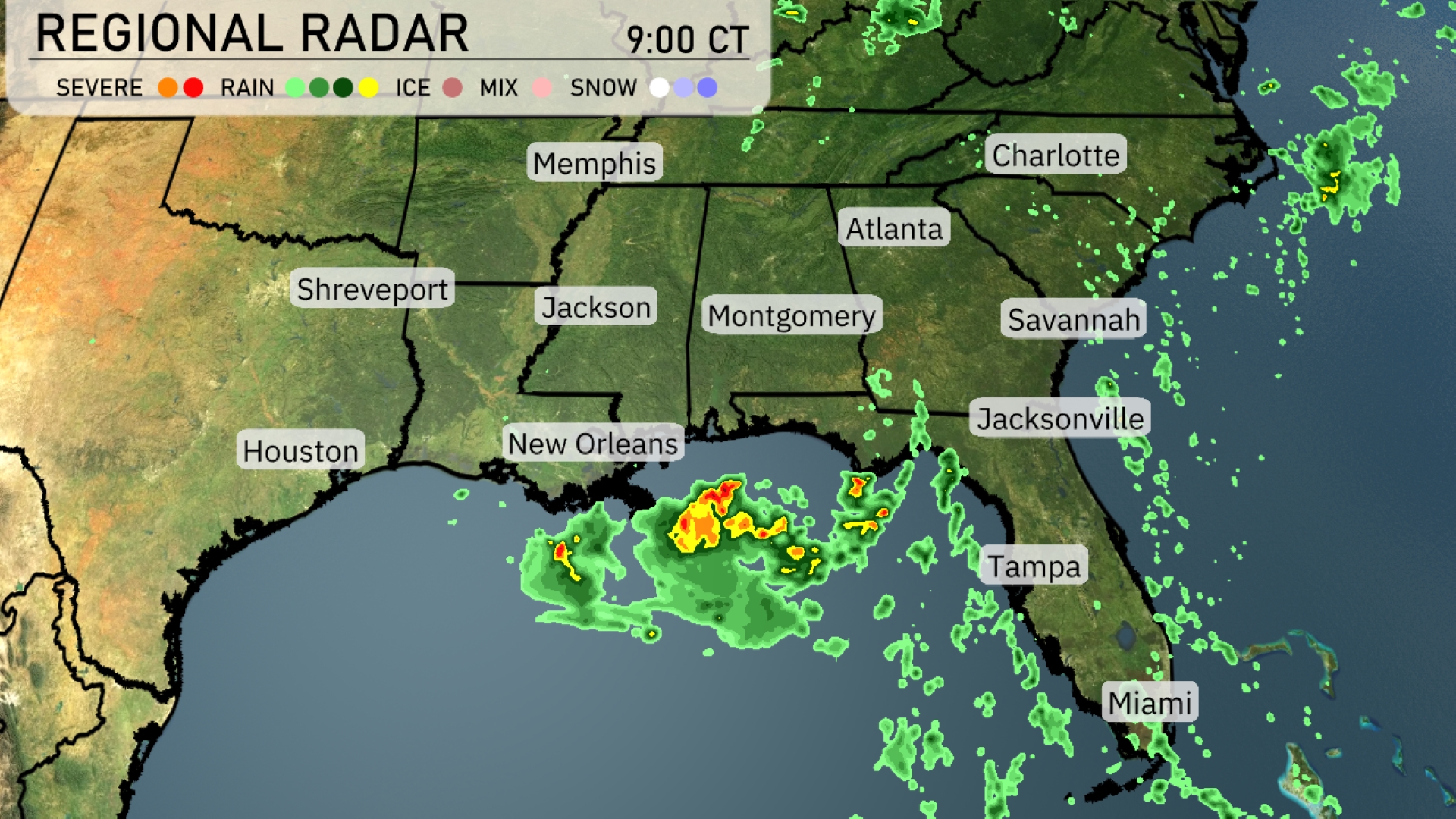
The Southeast region is currently experiencing scattered thunderstorms, particularly around the New Orleans area, with heavy rain bands visible moving across the Gulf and towards the southern parts of Louisiana. Jacksonville and the surrounding areas in Florida are seeing intermittent showers as the rain patches move eastward. There are clouds spreading across from Atlanta to Charlotte, indicating an incoming wet weather system. Memphis and Shreveport are in clear conditions at this hour.
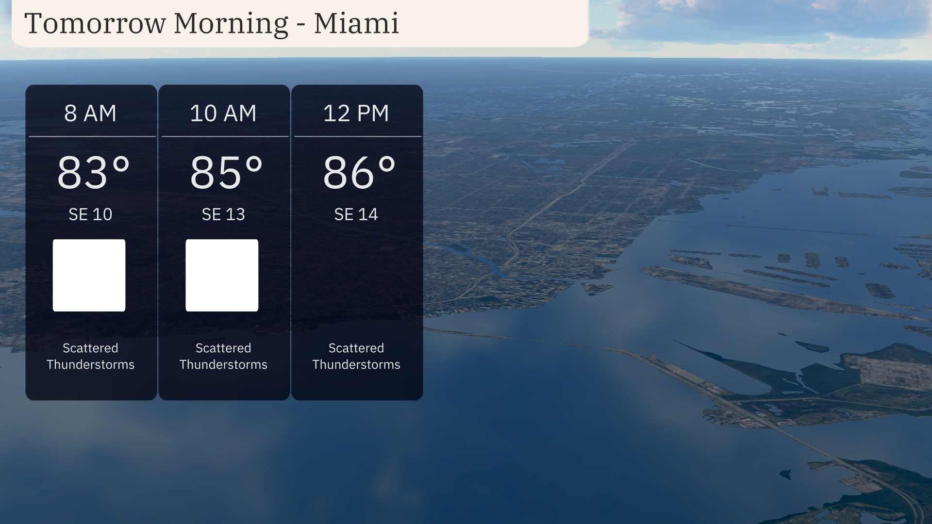
Miami’s Tomorrow Morning begins with scattered thunderstorms and temperatures at 83 degrees by 8 AM. Winds are coming from the southeast at 10 miles per hour and will pick up slightly as the morning progresses. By 10 AM, the temperature climbs to 85 degrees with winds at 13 miles per hour. Prepare for a breezy end to the morning, as temperatures reach 86 degrees by noon with southeast winds at 14 miles per hour.
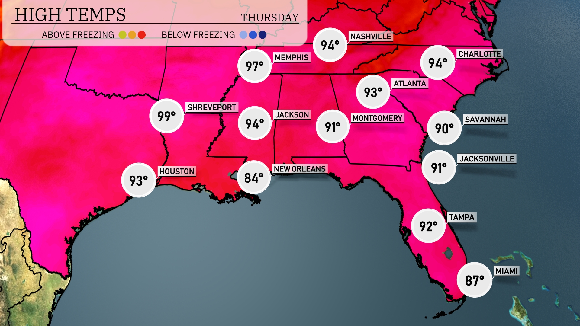
Tomorrow, high temperatures across the Southeast will soar into the upper 90s. Shreveport is expected to reach a sweltering 99 degrees, while Jackson won’t be far behind at 94. In Memphis, temperatures will hit 97 degrees, and Atlanta is forecasted for a high of 93. New Orleans will be a bit cooler at 84 degrees, with Tampa reaching 92. This warm trend is influenced by high pressure dominating the region, keeping conditions dry and sunny.
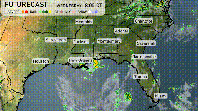
A cold front is set to sweep across the Southeast, arriving in Atlanta by tomorrow morning. Expect embedded thunderstorms stretching from Houston to Jacksonville, with the most intense activity near New Orleans. Strong thunderstorms may bring heavy downpours and the risk of flash flooding, particularly from southern Mississippi to Montgomery. Rainfall could exceed one inch, potentially disrupting the morning commute in areas like Atlanta and Savannah. Wednesday evening should clear up slightly, leading to cooler and drier conditions by Thursday.
The UV index in Miami is very high at 11 on Wednesday, with just 11 minutes until burn time in direct sunlight. On Thursday, the UV index drops to 8, still high with a burn time of 17 minutes.
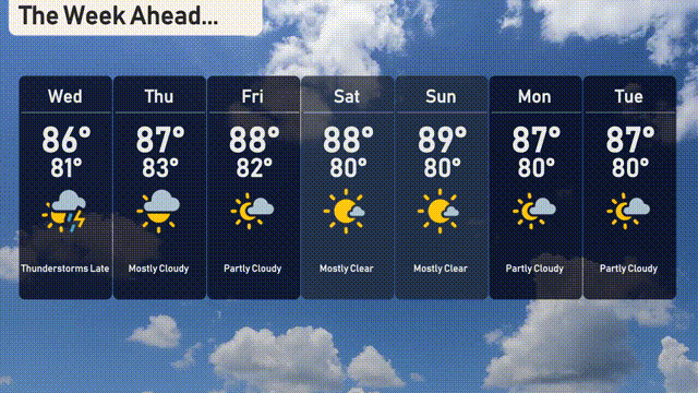
Wednesday: Thunderstorms are expected later in the day with a high of 86 degrees and a low of 81 degrees.
Thursday: Mostly cloudy skies with temperatures reaching up to 87 degrees and a low of 83 degrees.
Friday: Partly cloudy and warm with a high of 88 degrees, cooling to 82 degrees overnight.
Saturday: Enjoy mostly clear skies with temperatures peaking at 88 degrees and a low of 80 degrees.
Sunday: Another mostly clear day with a high of 89 degrees and a low of 80 degrees.
Monday: Partly cloudy conditions with temperatures reaching 87 degrees and a low of 80 degrees.
Tuesday: Partly cloudy again with temperatures holding steady at a high of 87 degrees and a low of 80 degrees.