Morning Rays to Stormy Days: Miami’s Dynamic Weather Forecast
By
Amy Freeze
From sunny mornings at 79°F to storm warnings with a chance of severe weather, get all your Miami weather insights here!
Warm mornings and stormy afternoons are in the forecast for Miami. Read about tomorrow’s sunny start and upcoming thunderstorms.
Miami Tomorrow Morning News begins with a sunny outlook at 79°F, perfect for morning outings. However, Southeast faces an active weather pattern with storms stretching from Savannah to Miami. Find out how Jacksonville, Tampa, and other cities are managing the rain, and what Nashville’s clear skies mean for you. With temperatures varying across Southeast, get the full scoop on what to expect, including a detailed 7-day forecast with temperature trends and storm warnings. Stay prepared with safety tips for high UV days.
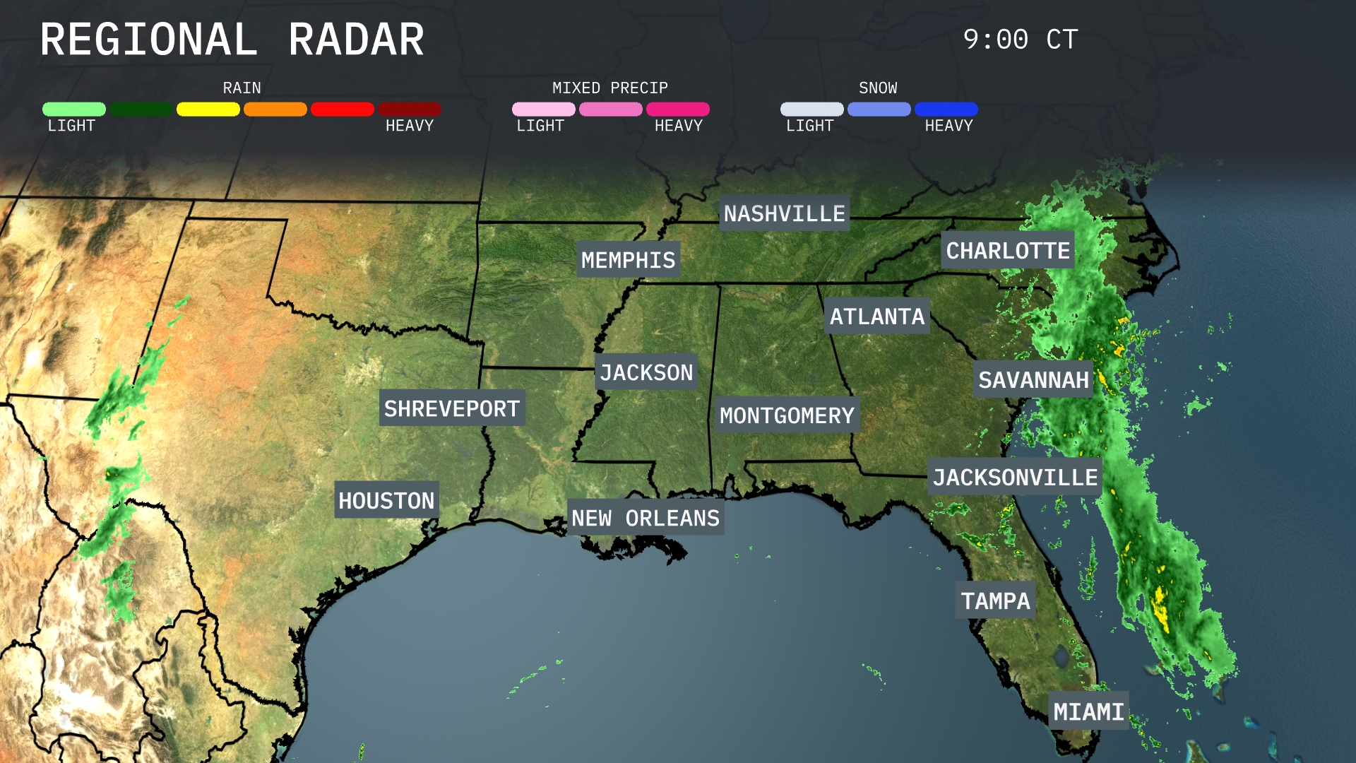
Across the Southeast region, a substantial rain system is sweeping through the coastal areas from Savannah to Miami, bringing heavy precipitation and potential thunderstorms. Jacksonville and Tampa are experiencing moderate rain, with conditions expected to continue as the system progresses inland. Clear skies dominate northwards towards Nashville and Memphis, offering a pleasant break from active weather. Some showers are also approaching the Houston area from the west, which could lead to brief bouts of rain later in the day.
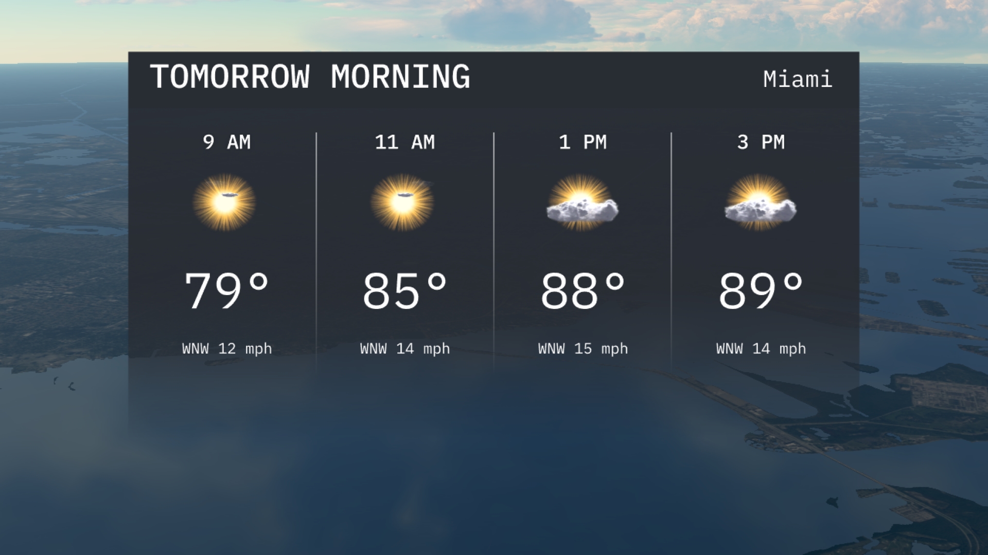
Tomorrow morning in Miami begins with a warm 79 degrees at 9 AM, with sunshine dominating the sky. The temperature rises to 85 degrees by 11 AM, as a light WNW breeze of 14 miles per hour keeps the air feeling fresh. Expect sunny conditions continuing mid-morning, perfect for outdoor activities.
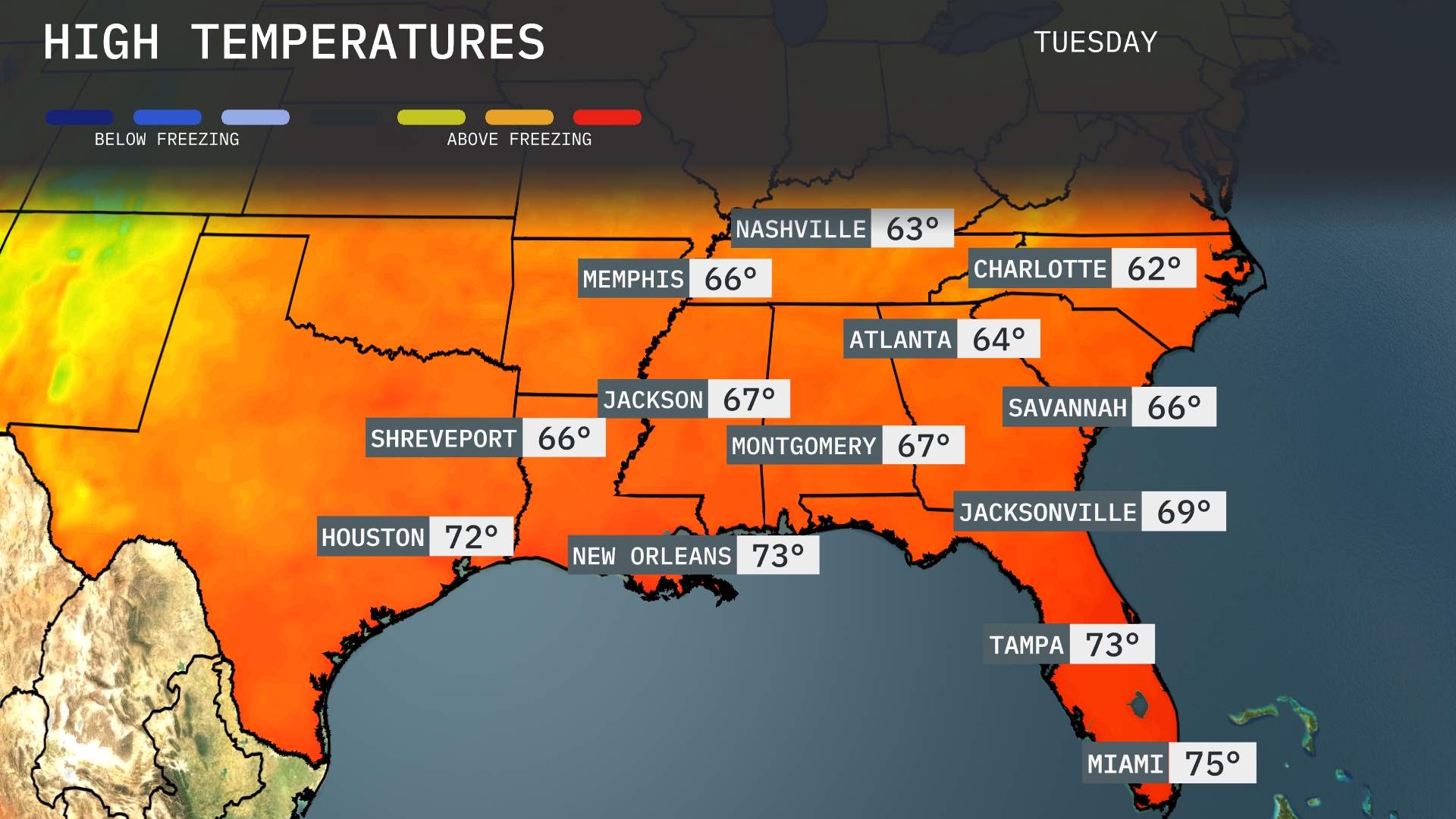
Tomorrow, Atlanta can expect a high of 64 degrees. Montgomery will see temperatures reaching 67, while Jackson also warms up to 67. In New Orleans, the forecast indicates a mild day with highs hitting 73 degrees. Further south, Miami will enjoy the warmest conditions at 75 degrees, signifying above-average temperatures for this time of year across much of the Southeast.
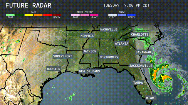
A cold front pushes into the Southeast tomorrow, bringing a wave of thunderstorms from New Orleans to Jacksonville. While heavy rain and gusty winds are the primary impacts, there’s a slim chance for isolated severe storms, particularly along the Gulf Coast. As the front moves inland, expect cooler air to filter in, dropping temperatures by around 10 degrees, especially noticeable in areas like Atlanta and Birmingham by evening. Rainfall could exceed an inch in some local spots, raising the risk of flash flooding, particularly in urban areas. Keep an eye out as conditions change rapidly with this active weather pattern.
The UV index in Miami today will be very high, with a burn time of just 17 minutes under direct sunlight. Make sure to wear sunscreen and protective clothing to minimize sunburn risk. Tomorrow, the UV index remains high, reducing the burn time to 12 minutes, so take necessary precautions if outdoors!
For the 7 day forecast in Miami:
Tuesday: We’ll see mostly sunny skies with a high of 90 degrees and a low of 75 degrees.
Wednesday: Temperatures cool slightly to a high of 87 degrees and a low of 77, with rain likely.
Thursday: Expect a high of 84 degrees and a low of 76 degrees, with continued rain.
Friday: More rain is expected, with a high of 82 degrees and a low of 76 degrees.
Saturday: Showers are on the way with highs reaching 83 degrees and lows around 76 degrees.
Sunday: Rainy conditions continue with a high of 84 degrees and a low of 76.
Monday: The wet trend stays with us, reaching a high of 84 degrees and a low of 77 degrees.