Ahead of the Storm: Miami’s Dynamic Weather Forecast Unveiled
By
Amy Freeze
Explore Miami's complex weather patterns from morning showers to thunderstorm alerts with Meteorologist Amy Freeze. Stay informed and prepared with the latest updates.
Amy Freeze gives a thorough update on Miami’s weather, from morning showers to potential thunderstorms. Know what to expect and how to prepare with the latest forecast details.
Join Meteorologist Amy Freeze for an in-depth look at the Southeast’s weather conditions, highlighting Miami. With morning rain, rising temperatures, and storm warnings, stay ahead of the weather game. For a detailed 7-day forecast and strategies to handle intense sun exposure, visit the full article at https://amyfreeze.ai/
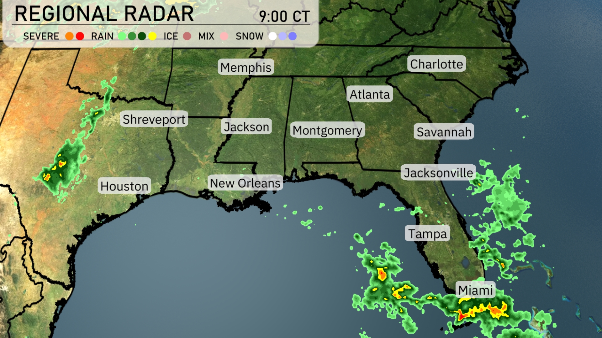
The Southeast is currently witnessing scattered showers, predominantly affecting Florida, with areas near Miami experiencing the most intense precipitation. The rain is inching towards Jacksonville, potentially extending northward. New Orleans and the broader area in Louisiana are encountering rain showers moving eastward. Regions around Shreveport and Houston are experiencing lighter scattered rain. Cities like Atlanta, Savannah, and Charlotte are enjoying clear conditions for now, but the expanding cloud cover suggests changes may be brewing.
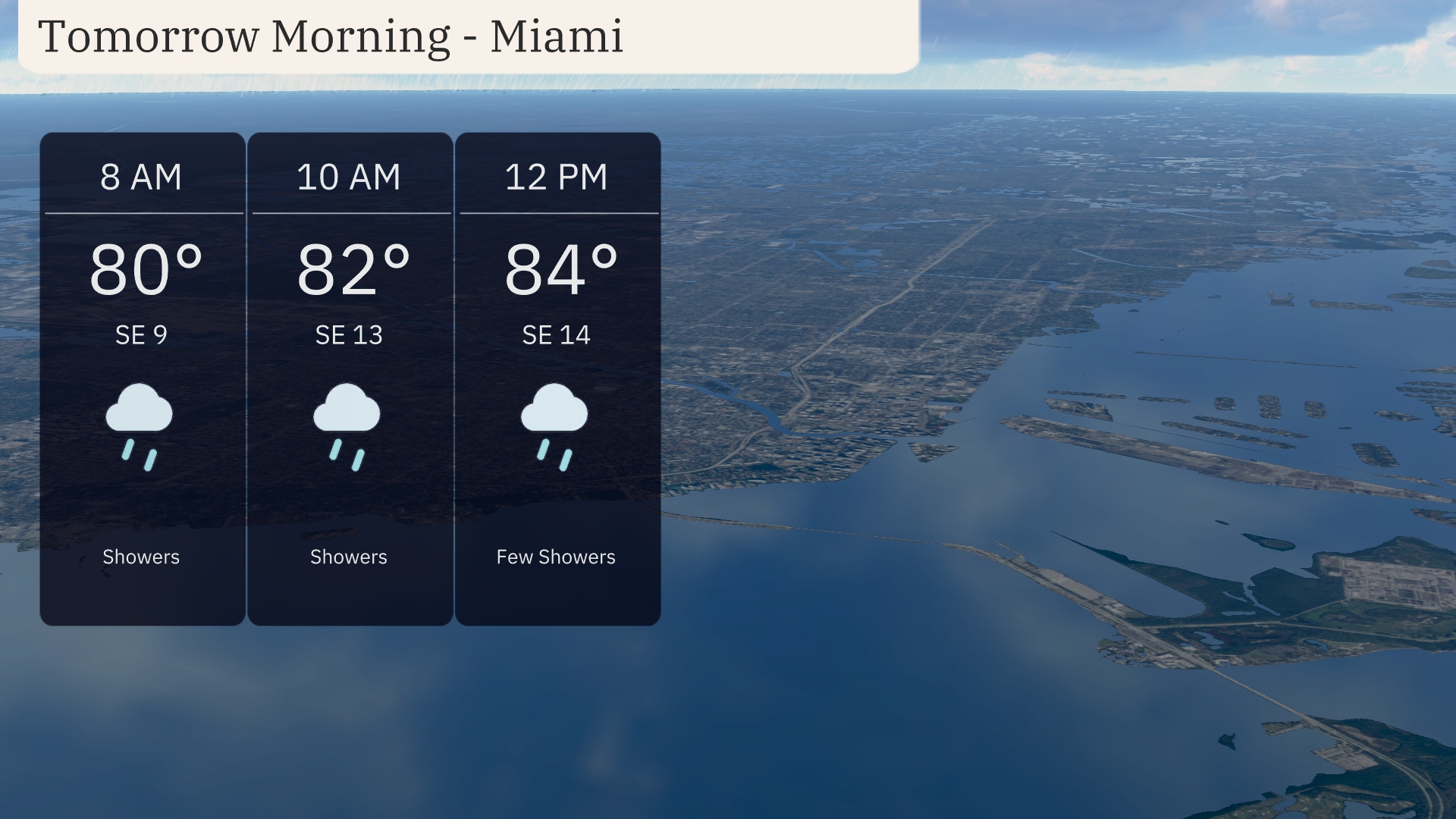
Temperatures in Miami tomorrow morning start at 80 degrees at 8 AM, warming slightly to 84 degrees by noon. Expect showers throughout the morning, with winds from the southeast blowing at 9 to 14 miles per hour. As the morning progresses, showers might taper off to a few by midday, with increasing humidity. A mix of showers and mild southeast winds will define your morning commute.
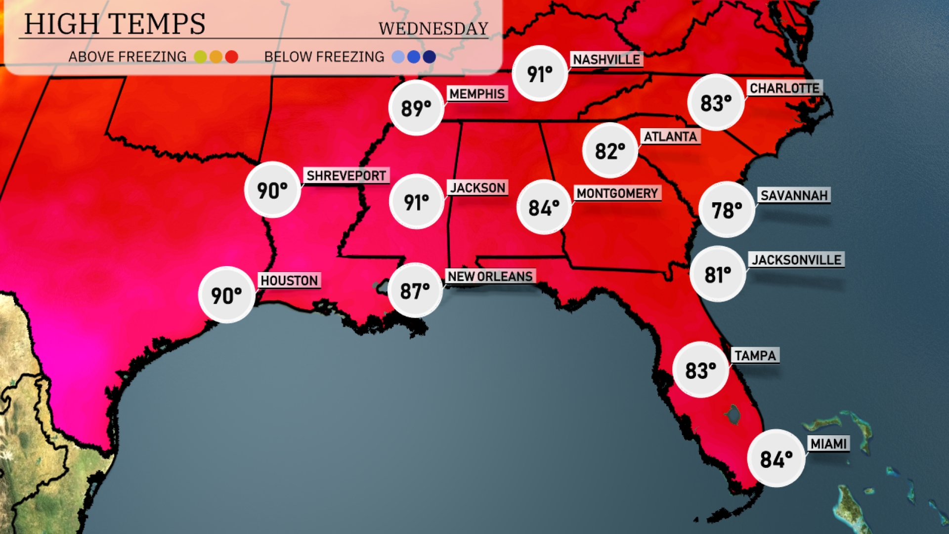
Tomorrow Jackson will lead the way with a high of 91 degrees, closely followed by Memphis at 89. Houston is also reaching the 90-degree mark, while New Orleans sits at a warm 87. Montgomery and Atlanta will be slightly cooler, hitting 84 and 82 degrees respectively.
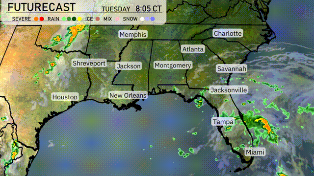
A cold front will approach the Southeastern region, bringing thunderstorms from Houston to New Orleans and towards Montgomery on Tuesday evening. Areas from Shreveport to Jacksonville should remain on alert for potential heavy rainfall and thunderstorms. By Wednesday, showers and storms will spread from Atlanta down to Tampa, offering relief from the recent dry spell but causing possible flooding concerns. Winds will pick up near the Gulf Coast, and temperatures will likely drop following the frontal passage. Prepare for cooler and drier conditions to emerge later in the week across much of the Southeast.
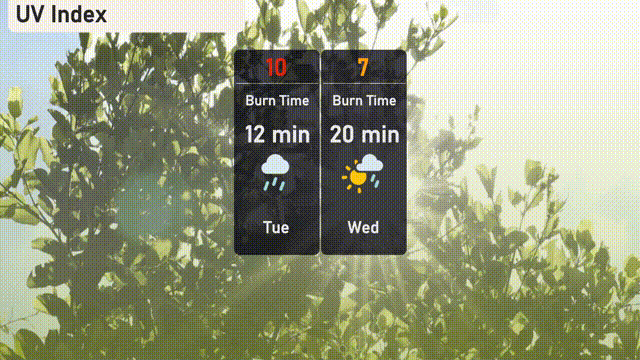
The UV index in Miami reaches an extreme level of 10 on Tuesday, so be cautious, as sunburn can occur in just 12 minutes! On Wednesday, the index decreases to a high of 7, with a burn time of about 20 minutes in the sunshine. This means taking advantage of shade, applying a broad-spectrum sunscreen, and wearing protective clothing is important.
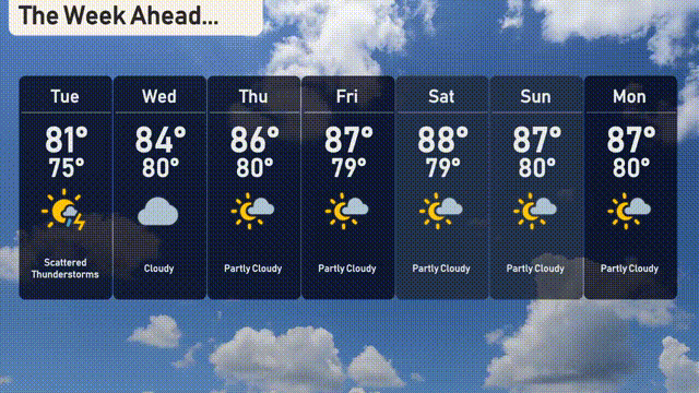
For the 7 Day Forecast in Miami:
Tuesday: Scattered thunderstorms are expected with temperatures peaking at 81 degrees and dipping to a low of 75 degrees.
Wednesday: Cloudy skies throughout the day with a high temperature of 84 degrees and a low of 80 degrees.
Thursday: Partly cloudy conditions will bring a high of 86 degrees and a low of 80 degrees.
Friday: The day will be partly cloudy, with temperatures reaching up to 87 degrees and a low of 79 degrees.
Saturday: Expect partly cloudy skies with the high climbing to 88 degrees and a low of 79 degrees.
Sunday: The partly cloudy trend continues, with a high of 87 degrees and temperatures dropping to a low of 80 degrees.
Monday: Wrap up the week with partly cloudy weather, the high will be 87 degrees and the low will sit at 80 degrees.