Navigating Through Miami’s Skies: A Forecast of Sunshine and Showers
By
Amy Freeze
Discover what the upcoming week holds for Miami with Amy Freeze's comprehensive weather analysis. From clear skies to rainy predictions, stay ahead of the weather!
Catch up on the latest weather trends in Miami with Amy Freeze’s update. From warm mornings to rainy evenings, know what to expect before you step out!
Greetings from Amy Freeze with an essential forecast for Miami this week. Expect a blend of partly cloudy to clear skies with a gradual progression to more dynamic weather conditions. Detailed analysis covers everything from temperature fluctuations to storm alerts with practical advice on how to stay prepared. Explore comprehensive daily summaries and stay informed about severe weather potentials looming later in the week.
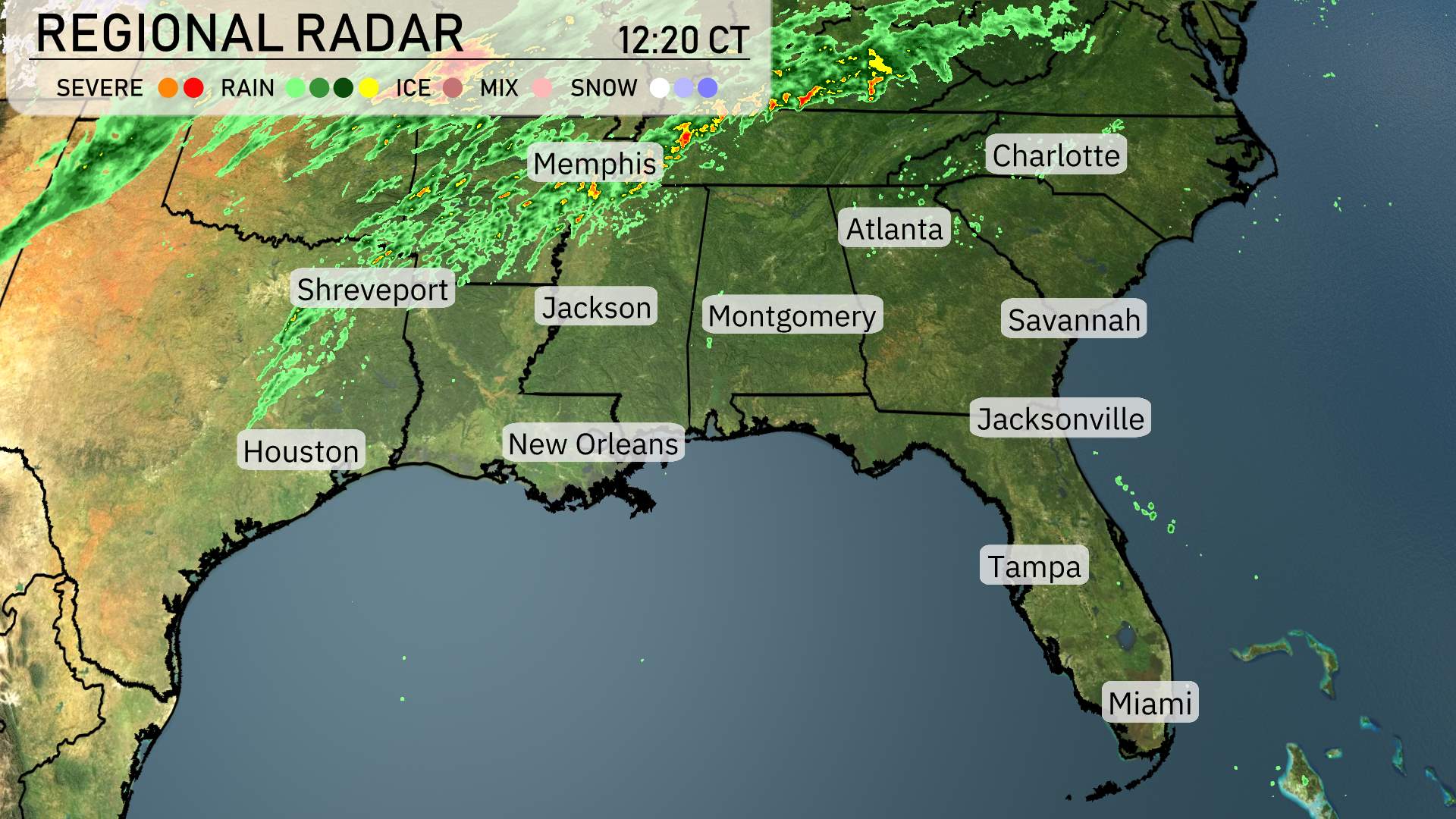
The southeast region is currently experiencing a variety of weather conditions. A line of showers and thunderstorms is pushing through Memphis and advancing toward Northern Mississippi. More showers are affecting areas along the Tennessee border. In contrast, cities like Atlanta and Charlotte are relatively calm at this time.
There’s light rain moving into areas near Jackson, Mississippi, and progressing toward Montgomery. Eastern Louisiana is getting its share of scattered showers, with clouds continuing to build.
To the far south, from New Orleans to Jacksonville, skies are mostly clear, offering a dry reprieve. Coastal cities, including Savannah and Tampa, are enjoying mild conditions with no rain in sight, while Miami also remains dry and pleasant.
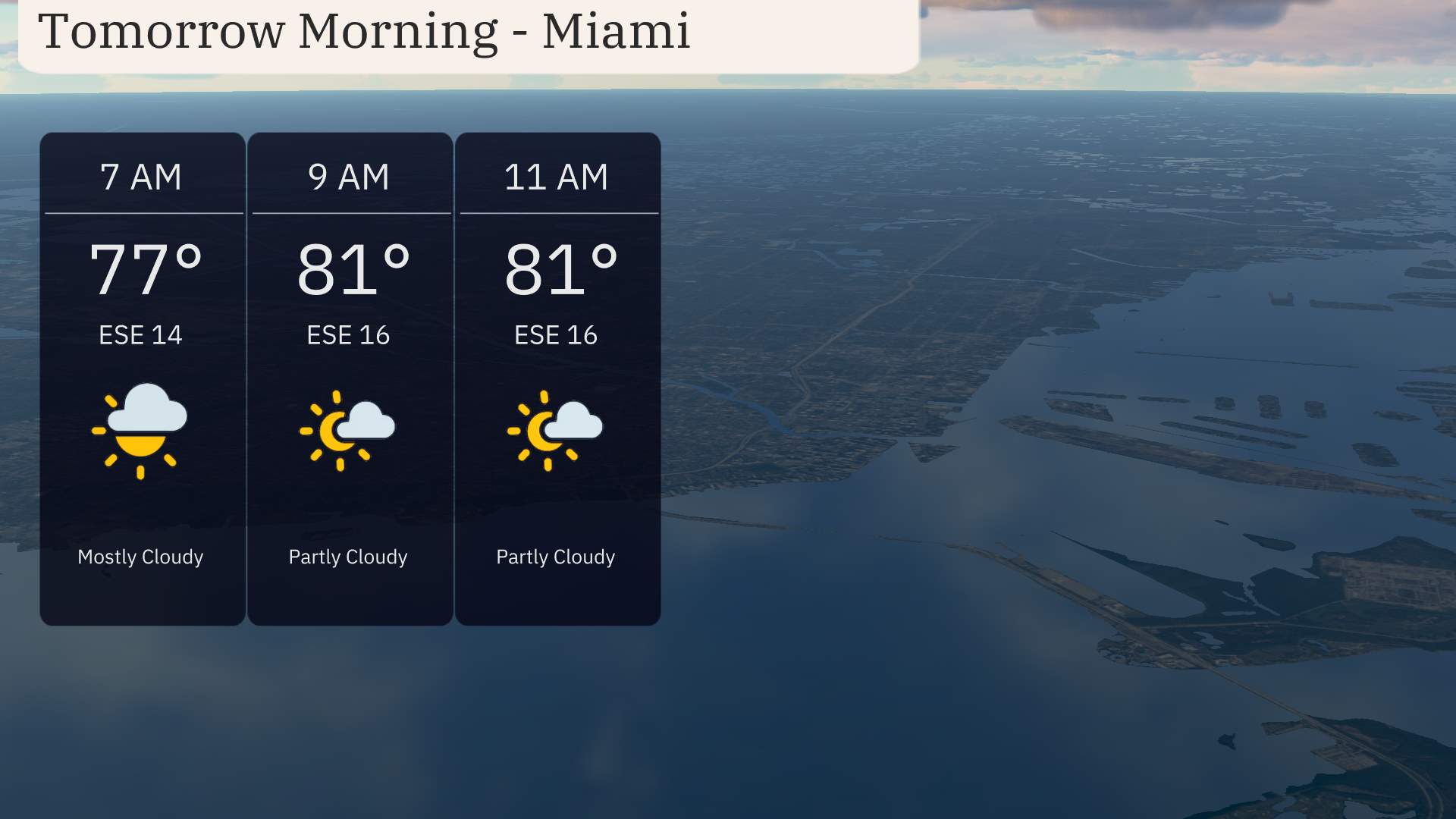
Expect a warm start in Miami tomorrow morning, with temperatures climbing from 77 degrees at 7 AM to 81 degrees by 9 AM, remaining steady into 11 AM. Skies will transition from mostly cloudy to partly cloudy as the morning progresses. There will be an east-southeast wind at 16 mph providing a gentle breeze throughout the morning.
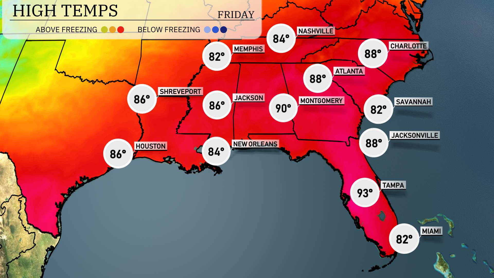
For tomorrow, the Southeast will experience above-average daytime temperatures across the region. Atlanta is set to reach a high of 88 degrees. Montgomery is expected to top out at 90 degrees, while Jacksonville will also see 88 degrees. Savannah will have a slightly cooler day, hitting 82 degrees.
New Orleans anticipates a comfortable high of 84 degrees, though Houston will be right there with 86 degrees. Memphis is looking at a high of 82 degrees, while Jackson will see similar warmth at 86 degrees. Following the pattern, Tampa will push the boundaries with a high of 93 degrees, signaling some intense heat for the Florida peninsula.
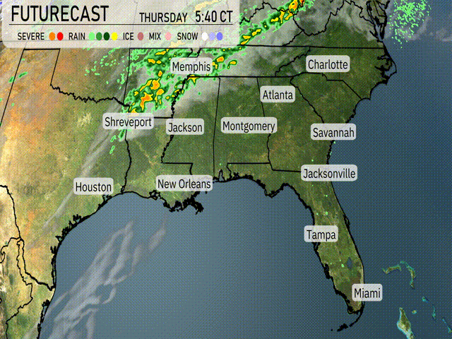
Be on the lookout for shifting weather in the Southeast as a cold front pushes in. Expect thunderstorms stretching from Shreveport to Jackson, moving into Alabama and Georgia. By midday Thursday, showers will approach Atlanta, while the potential for severe weather, including damaging winds, exists for New Orleans and Houston. Rain totals up to an inch might be seen, potentially causing localized flooding.
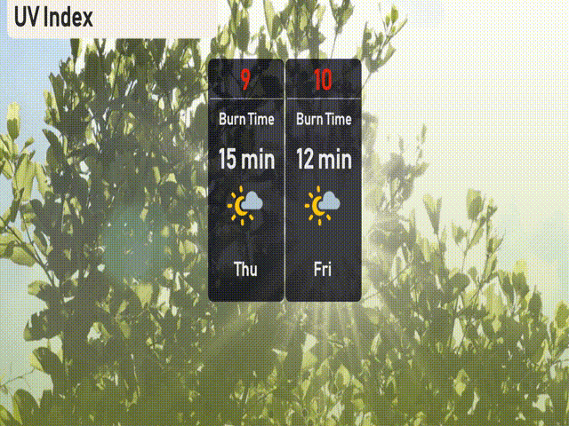
The UV index in Miami will be very high on Thursday with a value of 9, indicating a burn time of about 15 minutes in direct sunlight. On Friday, the UV index escalates to an extreme level of 10, with a quicker burn time of just 12 minutes.
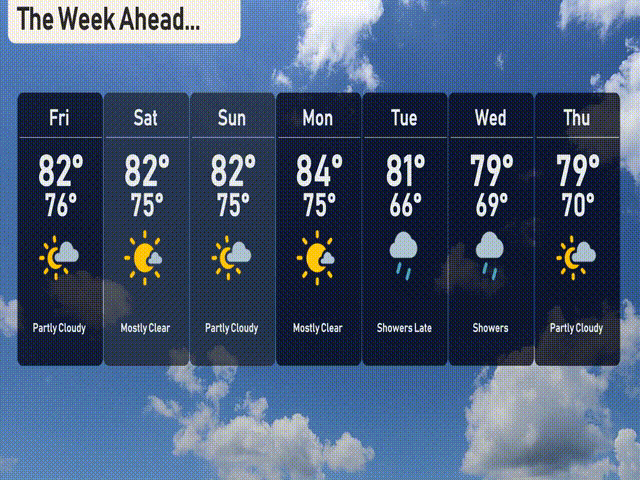
For the 7-day forecast in Miami:
Friday: Partly cloudy with a high of 82 degrees, cooling down to 76 at night.
Saturday: Mostly clear skies await, with temperatures reaching up to 82 degrees during the day and 75 at night.
Sunday: Look forward to mostly clear weather, and temperatures staying warm with a high of 82 and a low of 75.
Monday: Mostly clear again, with a daytime high of 84 degrees and a low of 75.
Tuesday: Showers are expected later in the day, with a high of 81 degrees, dropping to 66 overnight.
Wednesday: Plan for more showers with a high of 79 and a low of 69.
Thursday: The week is mostly wrapped up with partly cloudy conditions and a high of 79, while nighttime temperatures drop to 70.
Hope that helps! Enjoy your day and stay prepared for those showers midweek!