Southeast Soaks & Sunshine: A Complete Miami Weather Outlook for Tomorrow
By
Amy Freeze
From gentle morning showers to potentially gusty thunderstorms, discover what Miami's weather has in store for you on July 15th, 2025.
Tomorrow in Miami: a forecast of 84°F with thunderstorms and a refreshing breeze. Stay updated with what’s happening in the Southeast’s skies on July 15, 2025.
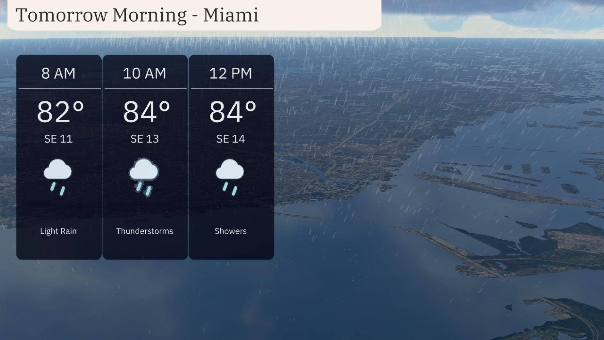
Welcome to your detailed Miami weather forecast for tomorrow, July 15, 2025. Starting the day at a warm 82°F and peaking at 84°F, Miami will experience light rain that turns to thunderstorms by mid-morning, accompanied by southeast winds of 13-14 mph. Whether you’re in Miami or traveling through the Southeast, our comprehensive guide will help you prepare for a day balancing between thunderstorms and sunshine.
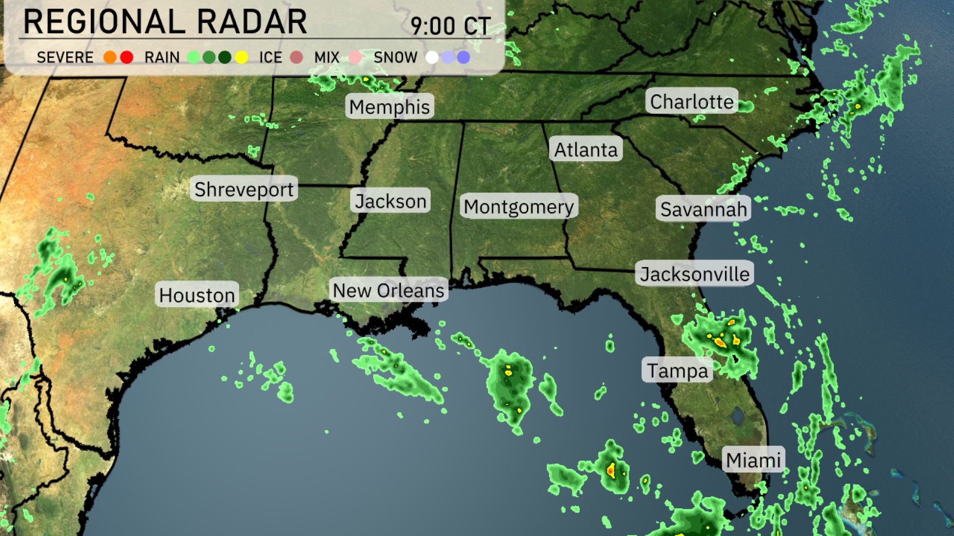
On the Regional Radar, clusters of rain are moving across Northern Florida, specifically impacting Jacksonville and Tampa, with storms also approaching Miami. Showers are developing and spreading northeastward towards the Georgia coastline, increasing cloud cover over Savannah. The Gulf Coast cities like New Orleans are currently observing clearer skies with minimal precipitation. In contrast, the Tennessee River Valley, including Memphis and Atlanta, is relatively calm with little cloud activity at this time.
Tomorrow morning in Miami, expect temperatures starting at 82 degrees at 8 AM, rising to 84 degrees by noon. The morning will be marked by light rain turning into thunderstorms around 10 AM, accompanied by southeast winds at 13 to 14 miles per hour. By noon, showers will continue with a warm, humid pattern. Keep your umbrella handy and prepare for some gusty moments.
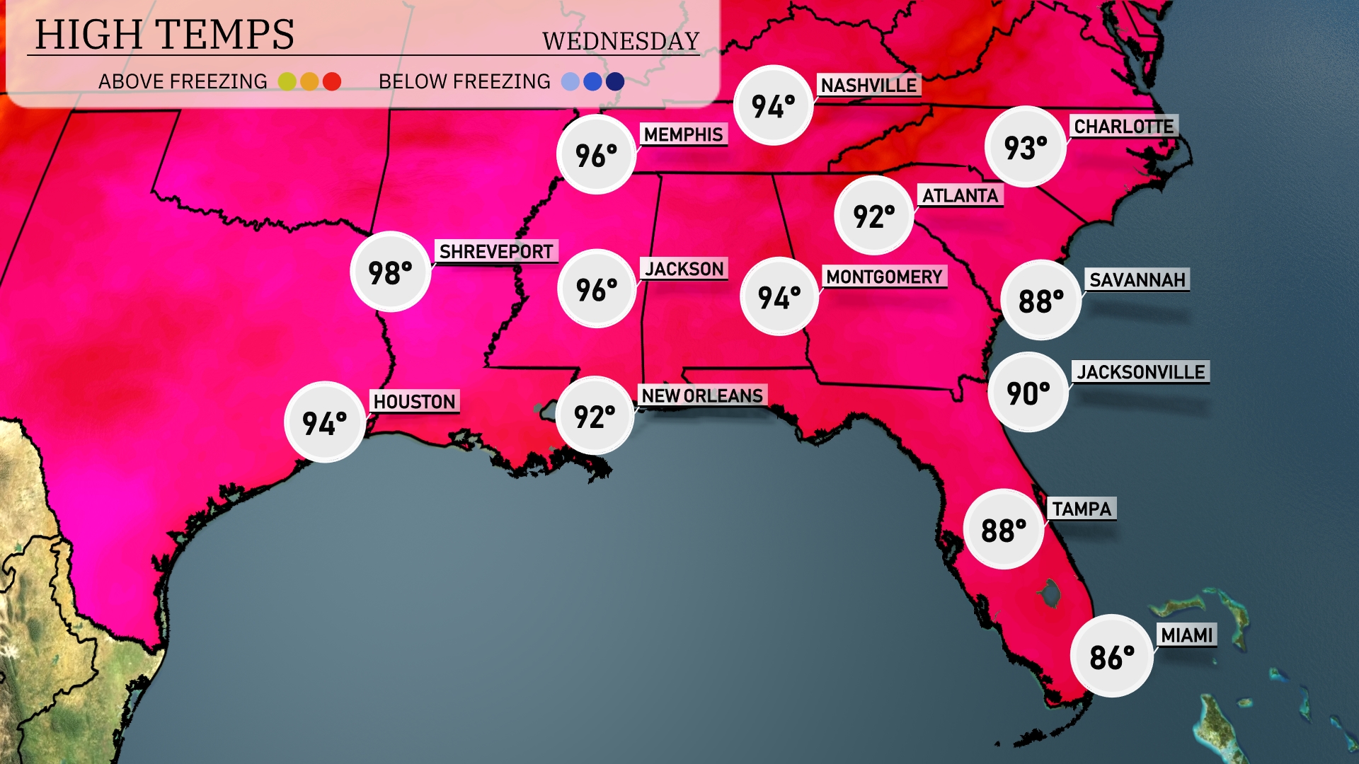
Tomorrow in Shreveport, expect a sizzling high of 98 degrees. Houston will see a warm 94 degrees, while New Orleans reaches a comfortable 92. Moving east, Jackson will hit 96 degrees, and Montgomery is forecasted at 94. Atlanta will experience a high of 92, with Jacksonville and Savannah both warming up to 90 and 88 degrees, respectively. These temperatures are above average for the season, influenced by a persistent heat ridge dominating the Southeast.
A cold front sweeps through the Southeast, bringing a line of thundershowers from Jacksonville to Savannah. Look out for scattered storms lurking near Tampa as well. Expect heavier rainfall and potential gusty winds, especially from late today into Wednesday morning. Temperatures will cool down slightly but remain seasonably warm across the region. This could cause minor flooding in low-lying areas, so stay alert.
The UV index in Miami is set to be high at 8 on Tuesday with a burn time of just 17 minutes, so make sure to apply that sunscreen and seek shade. Expect similar conditions on Wednesday with another high UV index of 8 and quick burn time. Stay sun-safe!
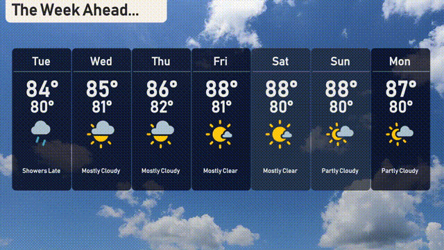
For the 7-day forecast in Miami:
Tuesday: Look for showers late in the day with temperatures reaching a high of 84 degrees and a low of 80 degrees.
Wednesday: Mostly cloudy skies, with a high of 85 degrees and a low near 81 degrees.
Thursday: The clouds persist as temperatures peak at 86 degrees and drop to 82 degrees overnight.
Friday: Expect mostly clear skies with a daytime high of 88 degrees and a nighttime low of 81 degrees.
Saturday: Another mostly clear day with highs of 88 degrees and lows around 80 degrees.
Sunday: Partly cloudy, with a warmer day hitting a high of 88 degrees and a low of 80 degrees.
Monday: The start of the week remains partly cloudy with temperatures reaching 87 degrees and a low of 80 degrees.
Enjoy the week ahead!