Storm Watch: Miami Braces for Thunderstorms with a Splash of Sunshine
By
Amy Freeze
Miami faces a dynamic weather weekend with impending thunderstorms and warm sunny days. Get the full Southeast weather rundown and prepare for the week ahead.
Discover what’s brewing over Miami! From thunderstorms moving towards Tampa to crystal-clear conditions in Jacksonville, learn how the weather will unfold in our comprehensive Southeast update.
This weekend in Miami sets a picturesque scene of weather contrasts. Expect a range of conditions, from strong thunderstorms to partly cloudy skies with peaks of sunshine. As we navigate through the week, temperatures will sizzle across the Southeast, with stormy afternoons expected. A cold front sweeping through will bring cooler temps and some much-needed rain relief. Dive into our detailed seven-day forecast to plan your week accordingly.
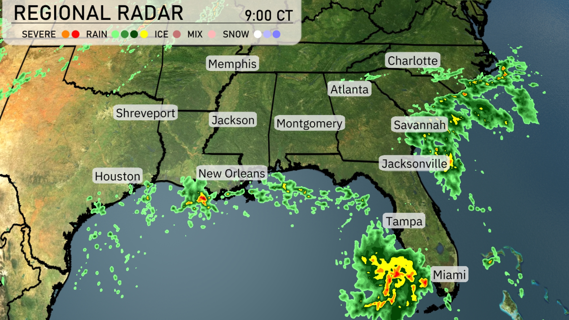
A cluster of strong thunderstorms is impacting the Miami area with heavy rain moving northwest towards Tampa. Scattered showers are present along the Gulf Coast, from New Orleans to Houston, as rain bands push inland. The skies over Jacksonville remain mostly clear, but clouds and rain are advancing toward Savannah, indicating a change in weather soon. The central regions, including Atlanta and Montgomery, are enjoying clear conditions, giving them a break from the recent weather activity.
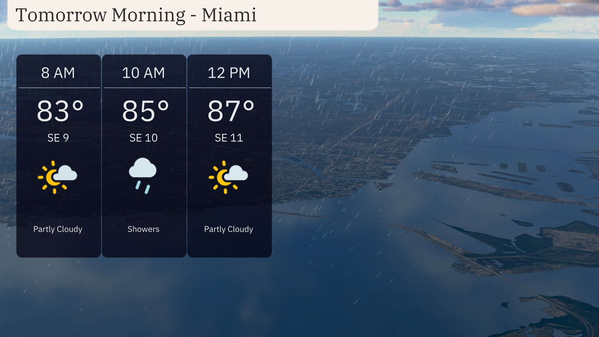
Tomorrow morning in Miami starts with a partly cloudy sky as temperatures reach 83 degrees by 8 AM. A southeast wind at 9 miles per hour sets the tone. Showers may develop by 10 AM, with temperatures rising to 85 degrees and the southeast wind increasing slightly to 10 miles per hour. By noon, expect a return to partly cloudy conditions with temperatures peaking at 87 degrees and a light breeze from the southeast at 11 miles per hour.
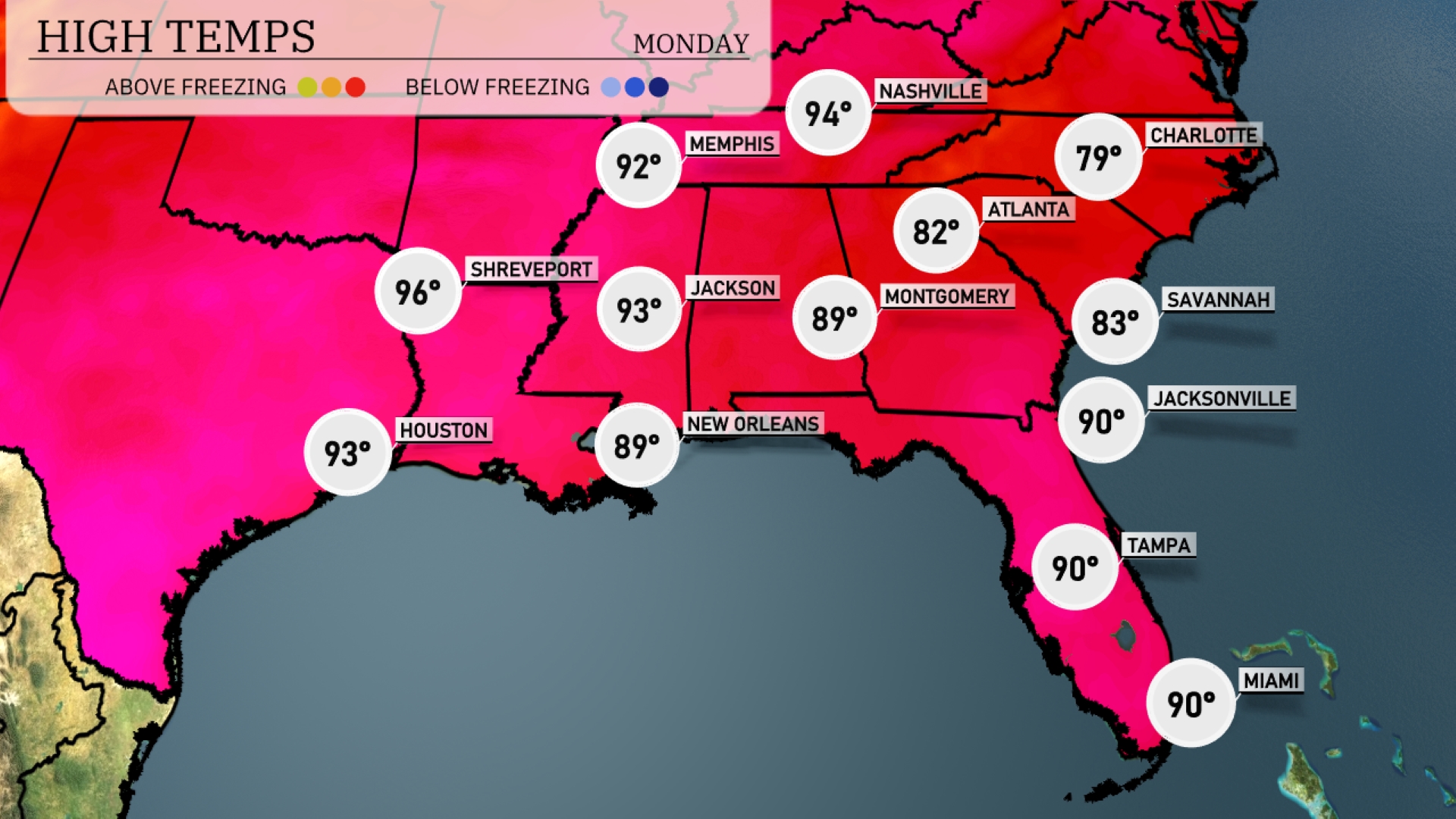
Tomorrow, temperatures in the Southeast will be sizzling. Shreveport is set to reach a high of 96 degrees, while Houston will see 93 degrees. In Jackson, expect a high of 93, and New Orleans will be warm at 89 degrees. Atlanta’s high will hit 82 degrees, with Jacksonville and Tampa also reaching 90 degrees.
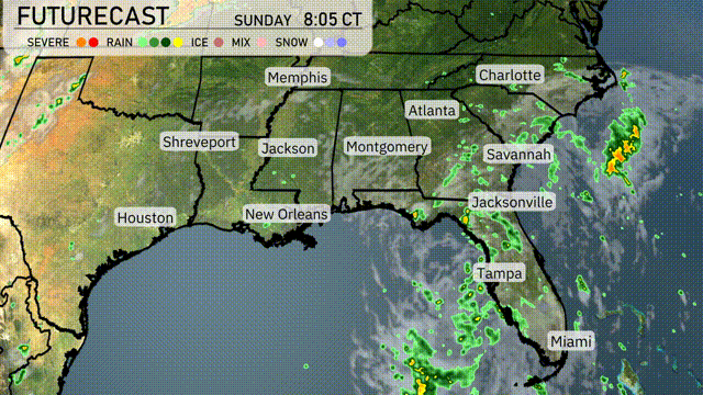
A cold front is advancing across the Southeast tomorrow, bringing a change in conditions. Expect showers and thunderstorms from New Orleans to Jacksonville with locally heavy rainfall, especially around Savannah and Atlanta during the afternoon hours. Some storms could produce gusty winds and frequent lightning, so stay weather aware. Temperatures throughout the region will dip into the lower 80s in the wake of the front, offering some relief from the recent heat.
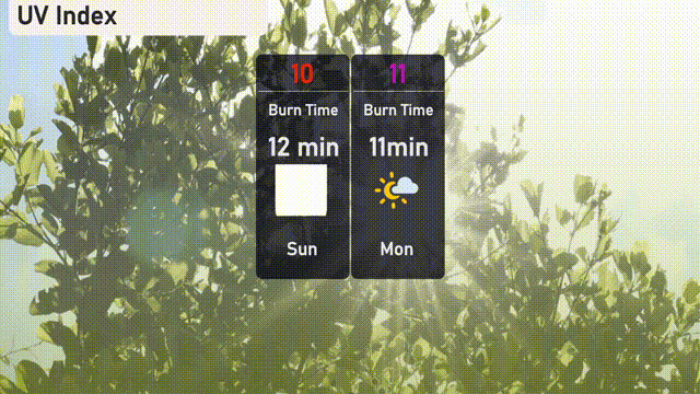
Miami can expect a very high UV index of 10 on Sunday, which means sunburn could occur within about 12 minutes. On Monday, the UV index climbs even higher to 11, with potential skin damage happening in just 11 minutes.
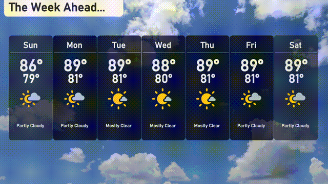
For the 7-day forecast in Miami:
Sunday: Partly cloudy skies with a high of 86 degrees and a low of 79 degrees.
Monday: The day will warm up to a high of 89 degrees with a low around 81 degrees, staying partly cloudy.
Tuesday: Expect mostly clear conditions with temperatures reaching a high of 89 degrees and a low of 81 degrees.
Wednesday: Another mostly clear day, with a high around 88 degrees and a low near 80 degrees.
Thursday: Mostly clear skies continue, bringing a high of 89 degrees and a low of 81 degrees.
Friday: The trend of mostly clear weather persists, as highs remain at 89 degrees and lows at 81 degrees.
Saturday: Partly cloudy with temperatures peaking at 89 degrees and a low near 81 degrees.