Miami’s Week Ahead: Clear Skies with a Chance of Showers
By
Amy Freeze
This week in Miami starts with sunny mornings and shifts towards possible late evening thunderstorms. Read more about what to expect from the weather in Southeast!
Kickstart your week in Miami with a sunny forecast, but don’t pack away your umbrella just yet! Evening thunderstorms might just make an appearance. Stay tuned for daily updates!
Welcome to your weekly Miami weather forecast! Enjoy the mild mornings with temperatures climbing up to a cozy 84°F by midday. Though skies start clear, anticipate possible thunderstorms rolling in by the evening, potentially bringing heavy rains. Dive into each day’s specifics from sunny outlooks to stormy potentials across the Southeast. Gear up appropriately and keep an eye on the sky!
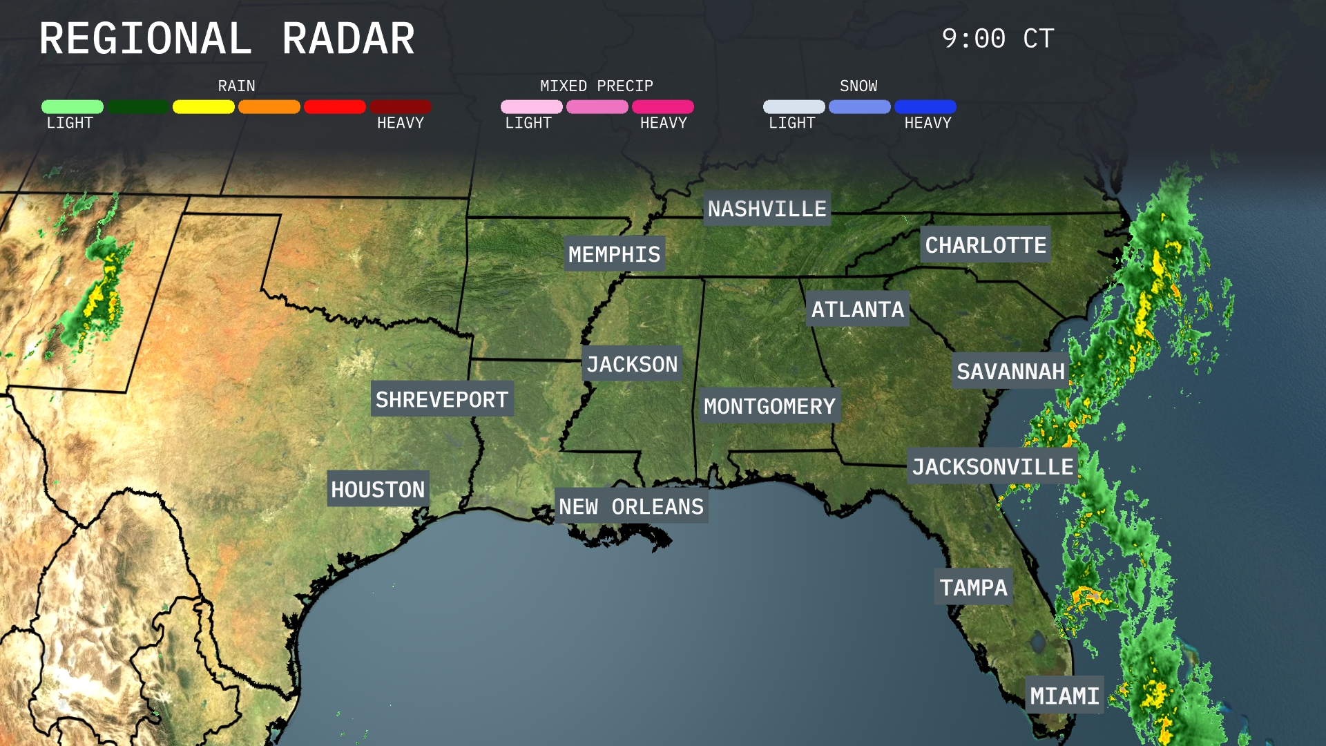
The Southeast is seeing clear skies with a few clouds. Off the coast, a band of rain is pushing eastward which could bring showers as it moves inland. Areas from Jacksonville northward to Savannah and Charleston should be prepared for some rainfall as the system makes its approach. Elsewhere, cities like Atlanta, Charlotte, and New Orleans are enjoying dry conditions at this time.
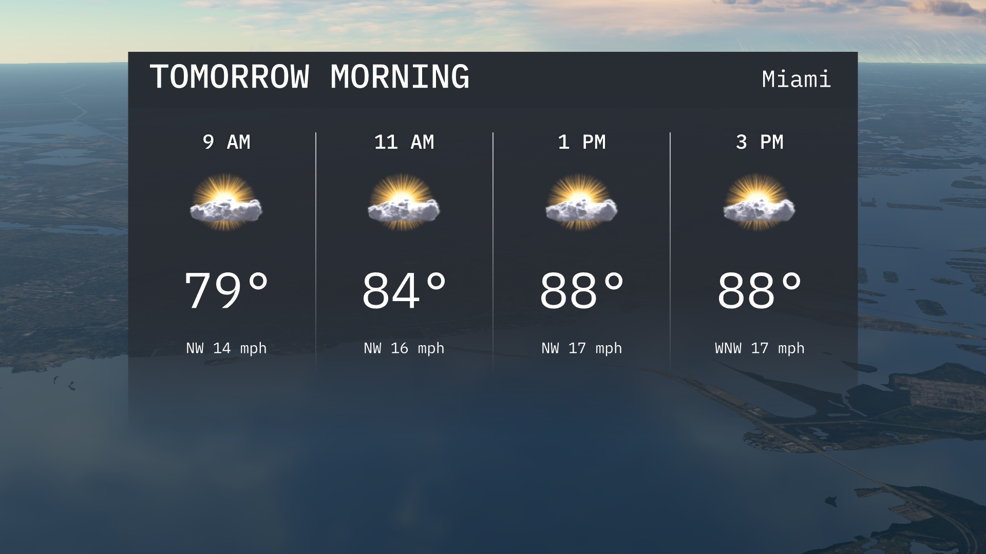
The morning in Miami begins with temperatures around 79 degrees at 9 am, climbing to 84 degrees by 11 am. Expect a partly sunny sky throughout the morning with a northwest wind blowing at 14 to 16 miles per hour. The day carries on to warmer temperatures, reaching into the upper 80s by early afternoon. Keep in mind, winds will slightly pick up to 17 miles per hour as the day progresses.
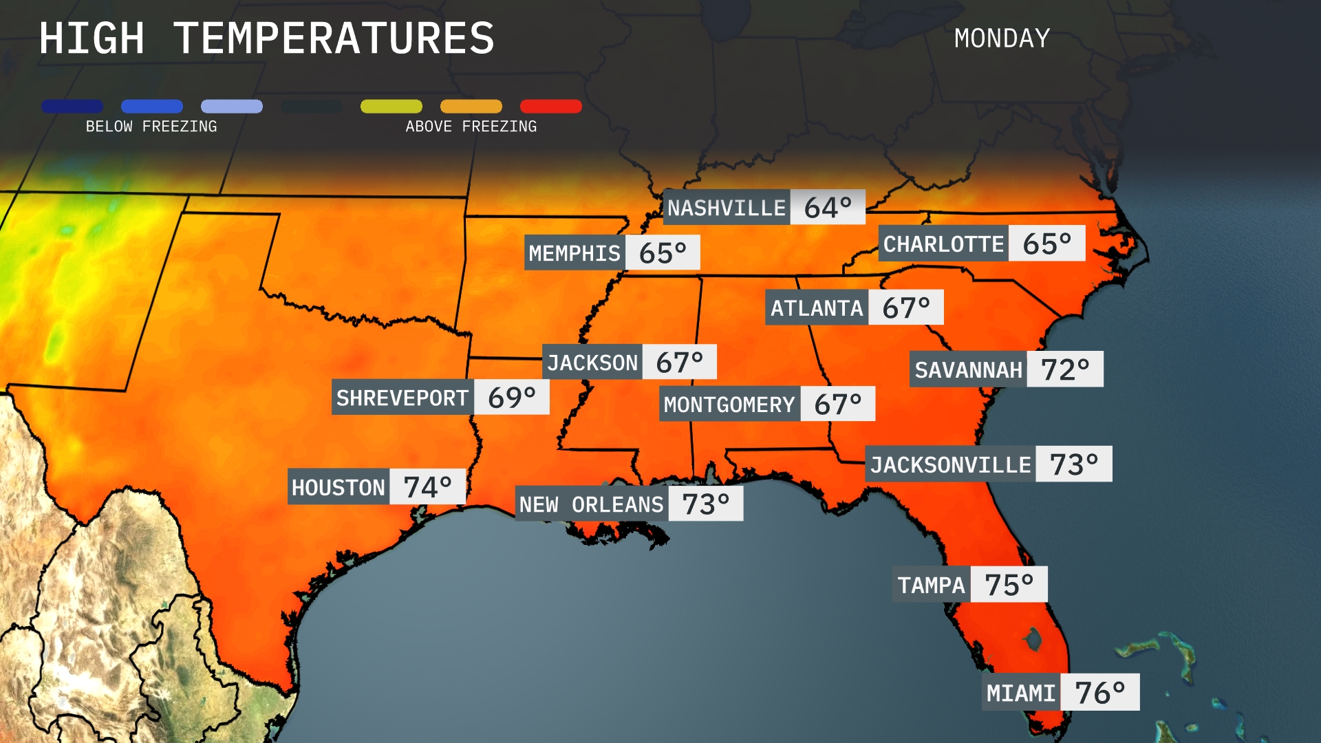
Tomorrow, Memphis will see a high of 65 degrees, while Nashville lags slightly behind at 64. Jackson warms up to 67 degrees, with Montgomery just a bit cooler at 67. Atlanta is expected to reach 67 degrees too, while Savannah enjoys a warmer 72. Down in Florida, Jacksonville hits 73, and Tampa will warm up even more to 75 degrees, with Miami topping off at 76 degrees, indicating overall mild temperatures throughout the Southeast region.
A warm front is set to move into the Southeast, bringing scattered thunderstorms from New Orleans to Jacksonville throughout Monday night. The greatest intensity of storms is expected late into the evening, with potential for heavy rain and localized flooding, especially in low-lying areas. A noticeable increase in humidity accompanies temperatures rising into the mid-80s by Tuesday afternoon. However, a cool, dry air mass follows, leading to clearer skies and a drop in temperatures by midweek. Keep watch for any updates, especially concerning flash flood advisories.
The UV index in Miami is high today, with a burn time of about 17 minutes under clear skies. Tomorrow, the UV index remains elevated, with sun exposure potentially leading to burns in about 15 minutes. Remember to use sunscreen and wear protective gear to stay safe in the sun!
For the 7 day forecast in Miami:
Monday: Expect partly sunny skies with a high of 89 degrees and a low of 76 degrees.
Tuesday: Partly cloudy conditions continue with a high of 89 degrees and a low around 75 degrees.
Wednesday: A mix of sun and clouds. Highs will reach 87 degrees, cooling to 76 degrees overnight.
Thursday: Anticipate partly sunny weather, temperatures peaking at 84 degrees and a low of 76 degrees.
Friday: Mostly cloudy, high will be around 84 degrees and the nighttime low will be 77 degrees.
Saturday: Showers and storms are more likely. Temperatures will peak at 84 degrees, with a low of 77 degrees.
Sunday: Expect mostly cloudy skies and a high of 84 degrees, with nighttime temperatures around 77 degrees.