Miami Morning Moods: Sunny Spells to Thunder Rolls
By
Amy Freeze
Explore the dynamic shift in Miami's weather from peaceful mornings to tempestuous evenings. A detailed look at the upcoming weather changes.
Expect a sunny start in Miami tomorrow, but watch out for an advancing line of storms! Stay tuned for real-time updates.
Welcome to an exciting week of weather in Miami! Start your morning with a pleasant 84°F, but don’t get too comfortable. A line of storms stretches from Texas to Alabama, nearing our vicinity. With evening temps dipping below usual and a robust storm system by mid-week, be ready for sudden weather shifts. Stay updated with our daily forecasts to navigate Miami’s erratic weather efficiently.
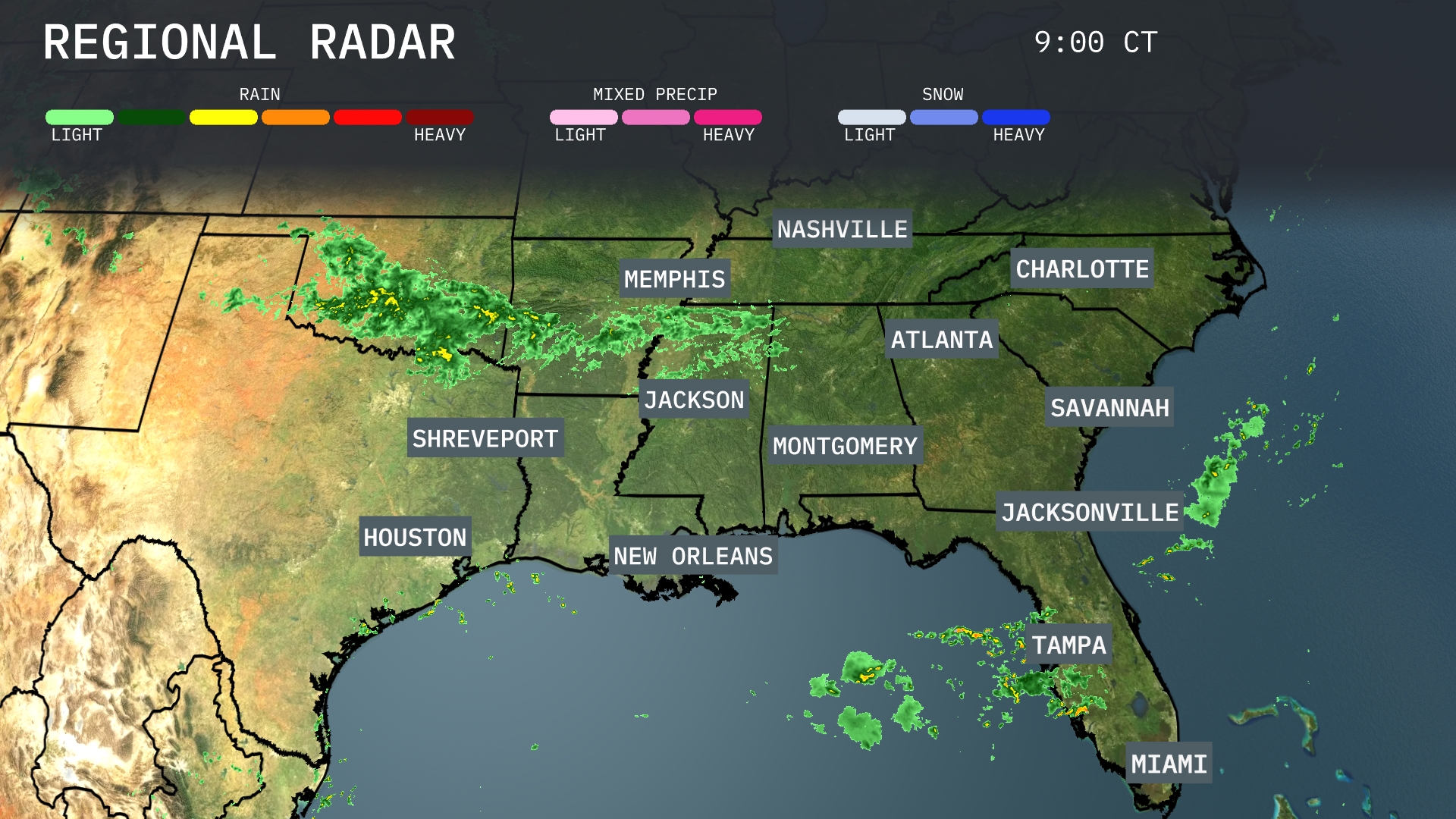
A line of storms is advancing across the Southeast, with heavy precipitation stretching from Texas through Mississippi and extending towards Alabama. Houston and Shreveport are currently experiencing rain, with showers expected to move into Jackson. A separate cluster of showers is situated just off the coast of Miami, and eastern Georgia is seeing rain as the system edges towards South Carolina. While the rain mainly focuses on the southern stretches, parts of Tennessee remain cloud-covered as the systems converge.
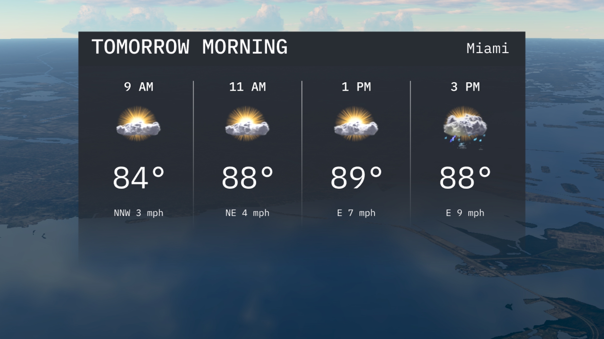
Morning in Miami starts with temperatures around 84 degrees at 9 AM, accompanied by a mild northwest. By 11 AM, temperatures rise to 88 degrees with a northeast wind and partly cloudy skies. Cloud cover increases slightly leading into midday with temperatures peaking near 89 degrees, along with an east wind at 7 miles per hour.
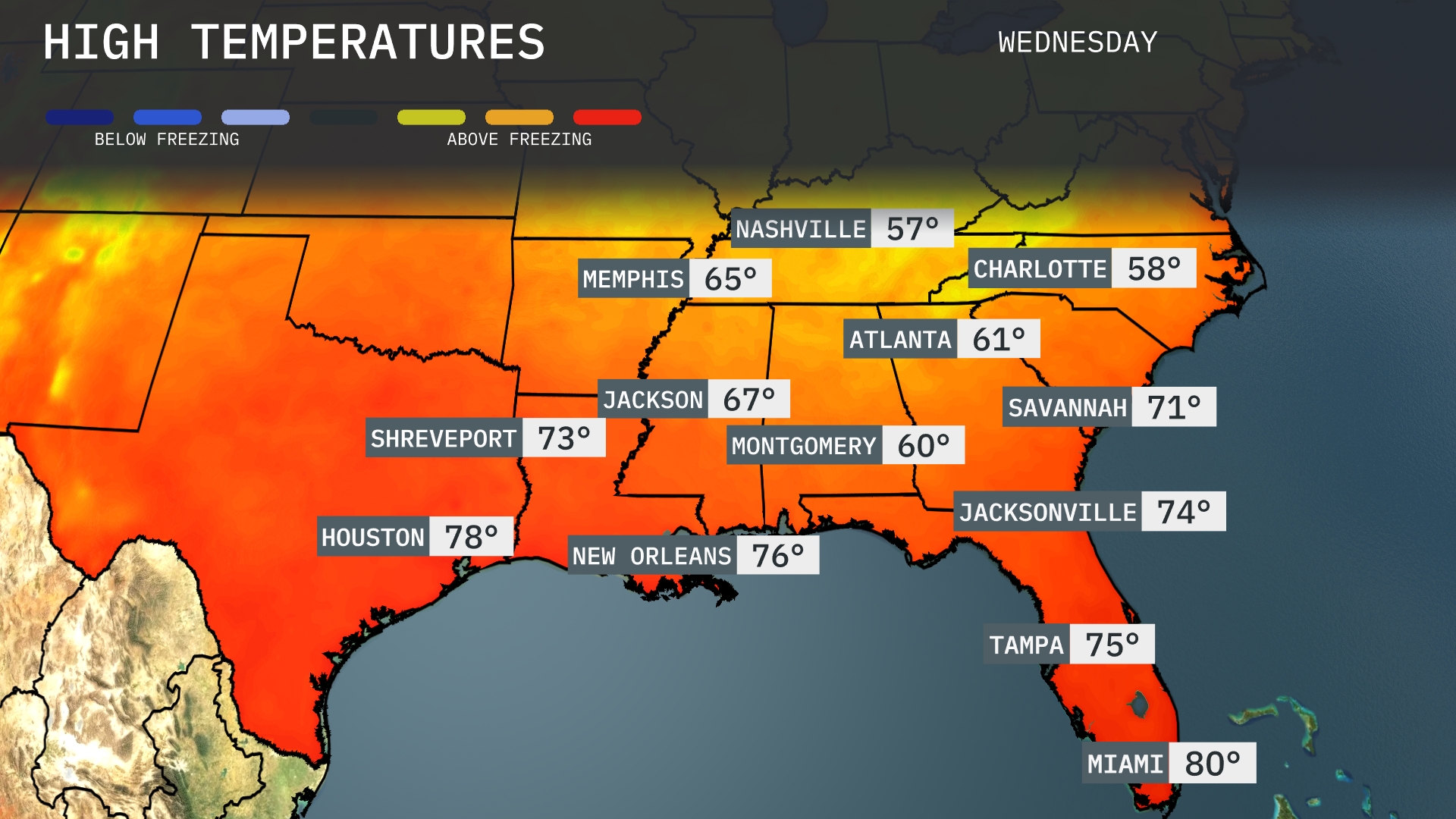
Tomorrow, Atlanta will see a high of 61 degrees, while Nashville remains cooler at 57. Memphis is expected to warm up to 65 degrees, and Jackson will reach 67. In contrast, warmer temperatures are anticipated in the Gulf Coast with New Orleans hitting 76 degrees and Houston at 78. Miami will round out the region with a balmy high of 80 degrees, marking above-average readings for much of the Southeast.
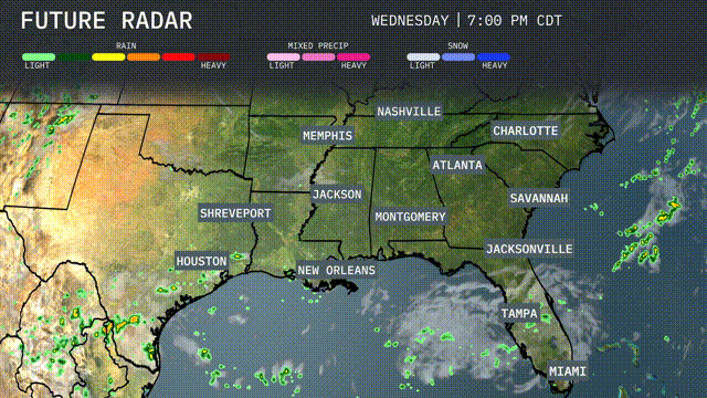
A robust storm system is set to impact the Southeast by late Tuesday into Wednesday. Heavy thunderstorms will sweep through New Orleans, moving into Montgomery and Birmingham, increasing the risk of flash flooding with several inches of rainfall expected. The cold front will bring cooler temperatures Thursday, with drier air filtering in behind it. Be prepared for gusty winds as the storms pass, particularly in coastal regions. Temperatures will drop to the mid-70s after the front passes, leading to more comfortable weather for the latter part of the week.
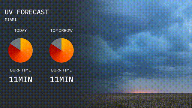
The UV index in Miami for today is very high, with a rating that results in a burn time of just 11 minutes. Exercise caution if you’re outside, as the strong sun exposure carries a risk for quick sunburn. Tomorrow maintains a similar pattern with an equally high UV index.
For the 7-day outlook in Miami:
Wednesday: Expect scattered thunderstorms with a high of 89 degrees and a low of 80 degrees.
Thursday: Another round of thunderstorms with highs around 88 degrees and lows at 80 degrees.
Friday: Thunderstorms remain likely, peaking at 88 degrees in the afternoon and dropping to 79 degrees at night.
Saturday: Thunderstorms continue, with a high of 88 degrees and a low of 80 degrees. Rain chances rise to 60%.
Sunday: Watch for more thunderstorms; temperatures could reach 87 degrees, cooling to 78 as night falls.
Monday: Mostly cloudy and still stormy, with a daytime high of 86 degrees and an overnight low of 77 degrees.
Tuesday: Thunderstorms persist, as highs reach 86 degrees and lows settle at 77 degrees.