Storms on the Horizon: Your Comprehensive Miami Weather Guide
By
Amy Freeze
Stay ahead of the weather with our detailed forecast for Miami and surrounding areas. From thunderstorms to sunny days, here’s what to expect this week.
Get ready for a weather rollercoaster in Miami and the Southeast with sunny skies and thunderstorms all predicted this week. Check out our full forecast!
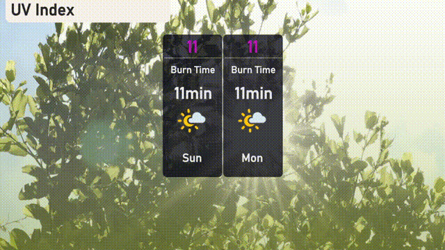
Welcome to your detailed weather forecast for Miami and the Southeast United States. This week promises a variety of conditions, from warm sunny skies to impending thunderstorms. In Miami, temperatures are set to hover pleasantly in the mid-80s, but don’t let the sun deceive you — a UV index of 11 means you’ll need plenty of sun protection. Meanwhile, a cold front moving in could bring thunderstorms with potential for heavy rainfall. Stay prepared and informed with our day-by-day breakdown, including tips on how to stay safe during severe weather conditions. Visit our blog for more in-depth analysis and updates: https://amyfreeze.ai/
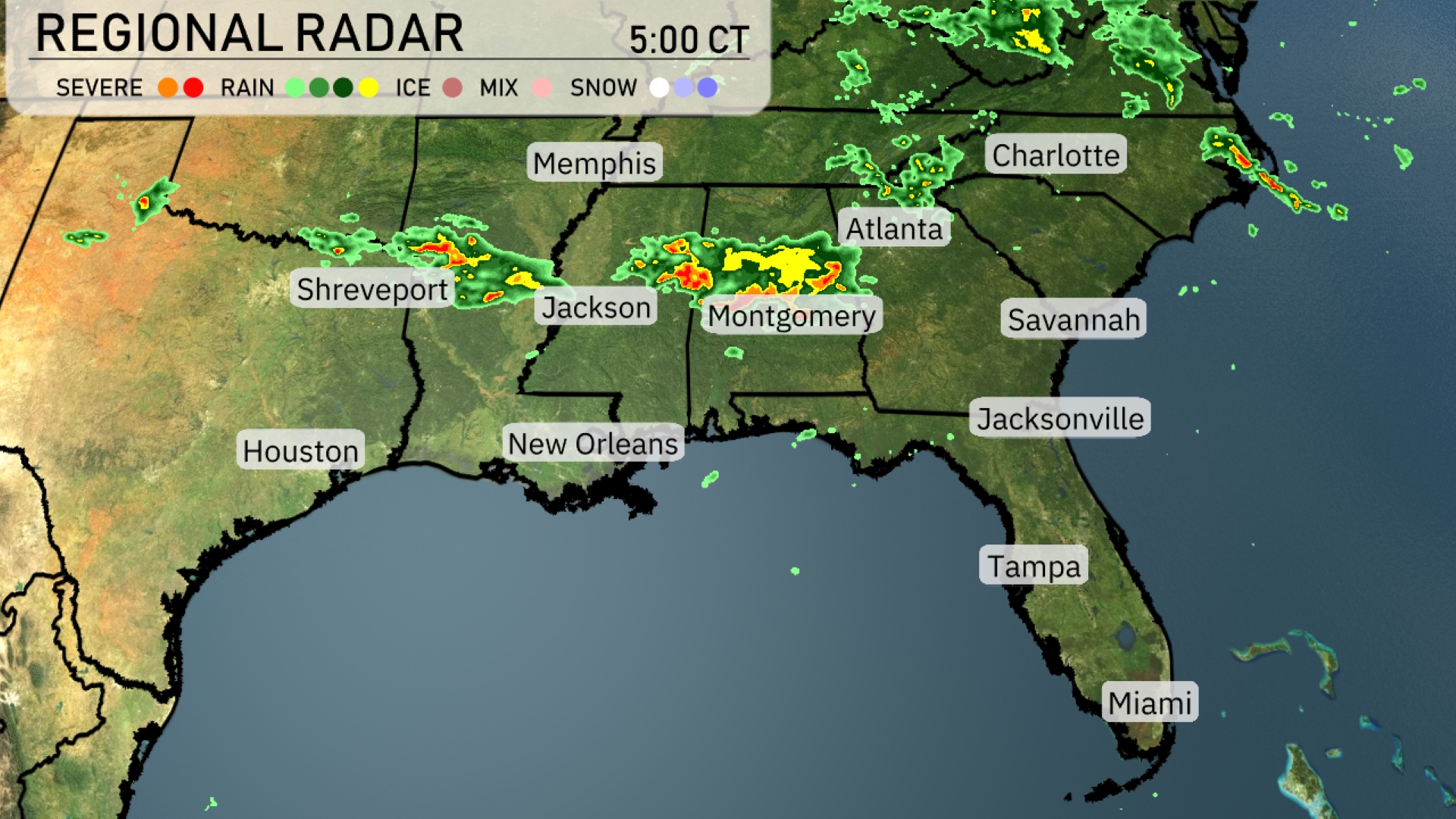
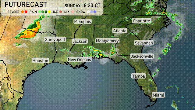
On the Regional Radar, a line of storms stretches across the Southeast, impacting areas from Shreveport through Jackson and into Montgomery, with intense thunderstorms moving eastward. Rain is predominating from Memphis to Atlanta, where showers are becoming heavier. Charlotte is experiencing light rain, while increasing cloud cover over Savannah suggests impending showers. Florida remains mostly clear, with no significant weather disturbances noted.
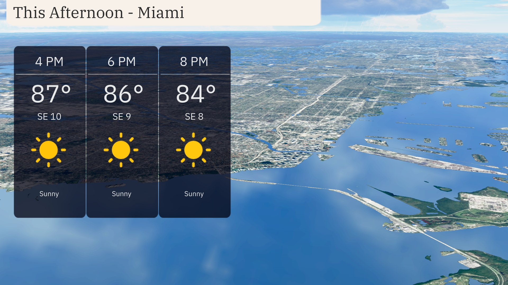
In Miami this afternoon, temperatures will hover around 87 degrees at 4 PM, gradually cooling to 84 degrees by 8 PM. Expect predominantly sunny skies with a gentle southeast breeze, ranging from 10 to 8 miles per hour.
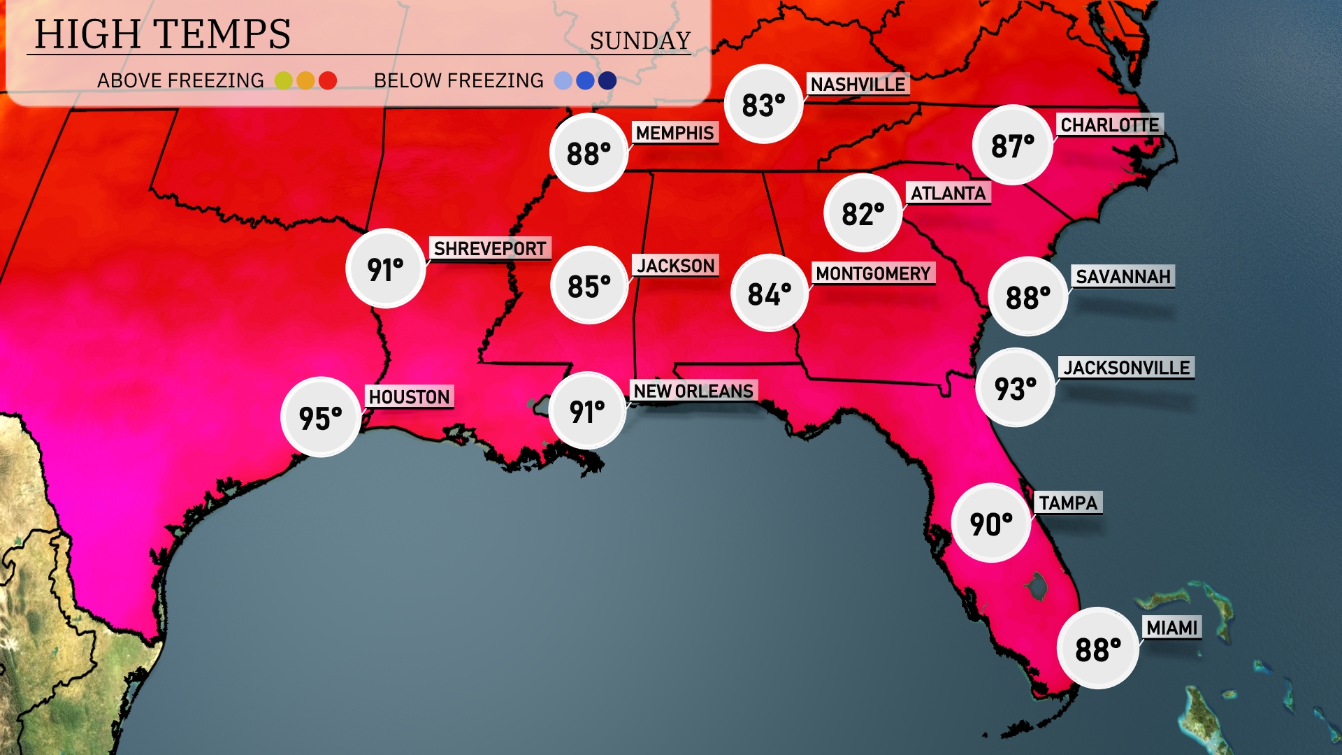
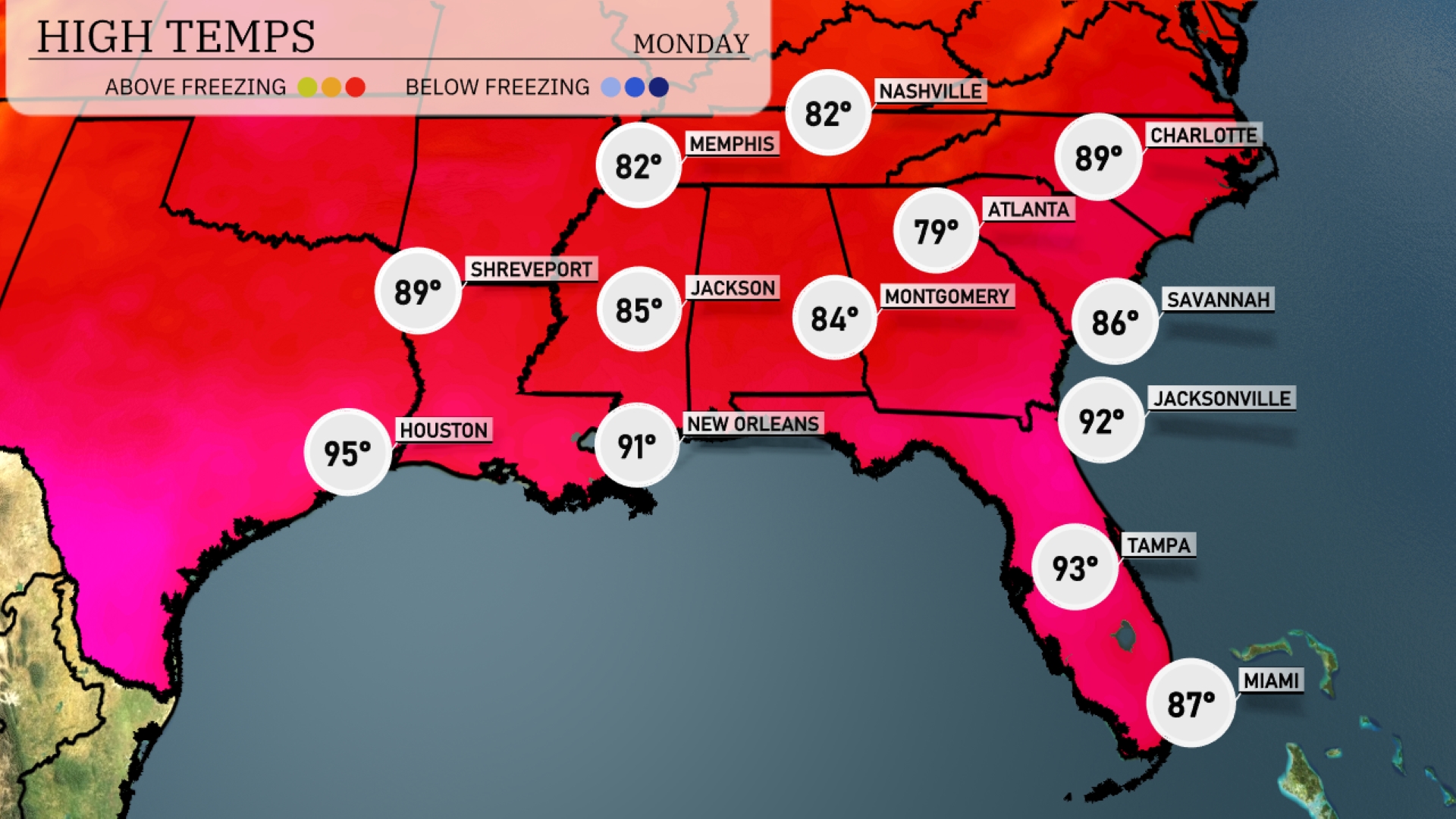
Today’s high temperatures across the Southeast are quite warm. Houston temperatures soar to 95 degrees, making it the hottest city in the region. In New Orleans, we’re looking at a high of 91, while Shreveport will reach 91 as well. Notably, Jacksonville sees a high of 93, but nearby areas like Atlanta remain a bit cooler at 82 degrees.
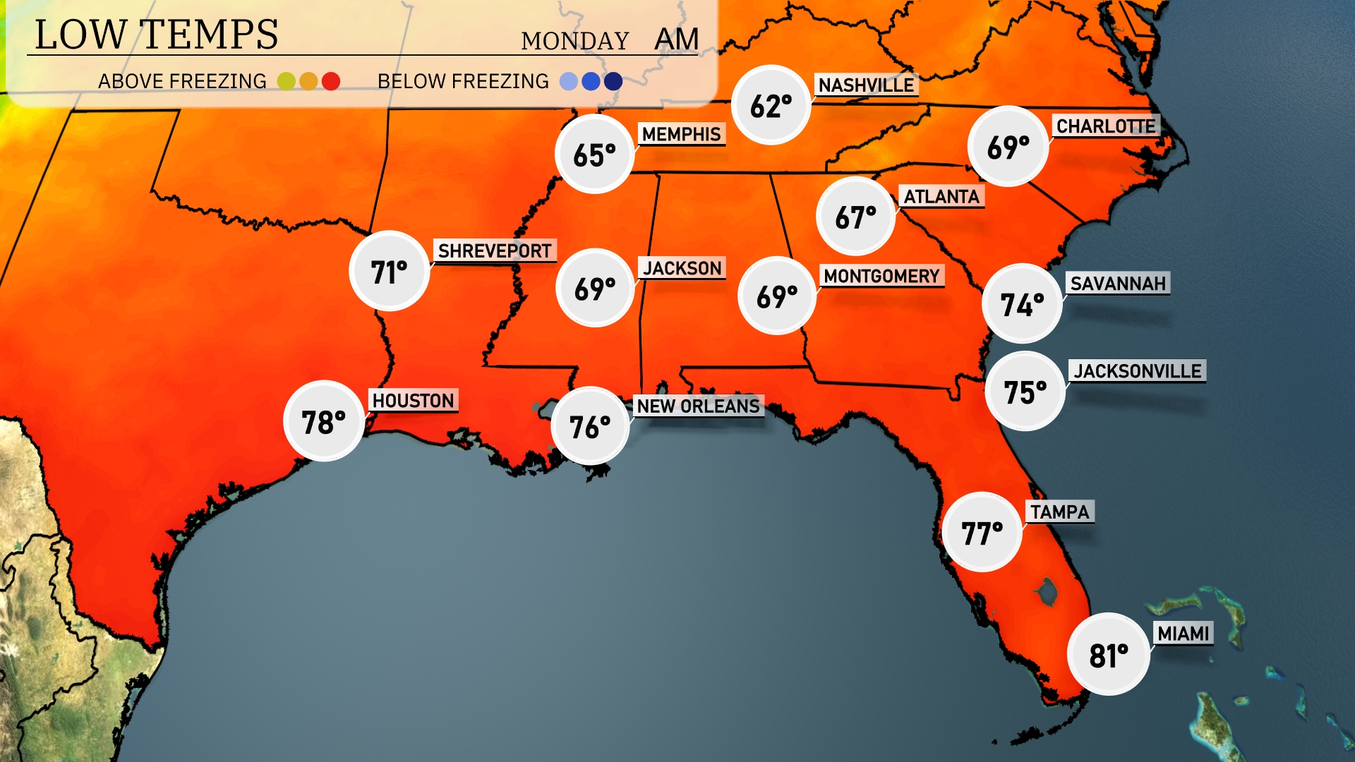
Tonight, Memphis will cool down to 62 degrees, while Nashville will drop to 65. Shreveport is expected to dip to 71 degrees, with Jackson not far behind at 69. Coastal cities like Miami will stay warmer at 81, while Atlanta’s low stands at 67 degrees.
Tomorrow, Atlanta will reach a high of 84 degrees, while Jacksonville sizzles at 92. New Orleans is expected to soar to 91 degrees, indicating a warmer trend across the region. Montgomery will warm up to 84 degrees, and Charlotte will also see a high of 89 degrees.
Expect a dynamic weather shift across the Southeast tomorrow as a cold front moves in from the west. Thunderstorms with the potential for heavy rainfall and gusty winds are anticipated from Houston to Atlanta, especially during midday. Severe weather risks are present, particularly for the central Gulf Coast, where isolated storms may become intense. By the evening, areas from Jackson to Montgomery could experience heavy showers, impacting the commute.
UV index in Miami is exceptionally high at 11 both today and tomorrow, with burn times as short as 11 minutes in direct sunlight. Take full precautions with broad-spectrum sunscreen, hats, and sunglasses.