Miami Weather: A Sunny Day with a Chance of Thunderstorms
By
Amy Freeze
Explore today's weather dynamics across Miami and the Southeast, from warm afternoons to stormy evenings.
This afternoon, Miami welcomes warm weather with temperatures soaring to 86 degrees. Don’t miss out on our complete forecast, detailing a shifting pattern to potential thunderstorms. Visit now: https://amyfreeze.ai/
Miami Afternoon News on June 27, 2025, provides comprehensive weather forecasts for Miami and the Southeast. It discusses expected temperatures, weather patterns, including a significant incoming cold front that may lead to thunderstorms with possible impacts like high rainfall and local flooding. Also, explore weekend forecasts with tips on handling UV exposure. For a detailed guide on what to expect weather-wise in the coming days, click here: https://amyfreeze.ai/
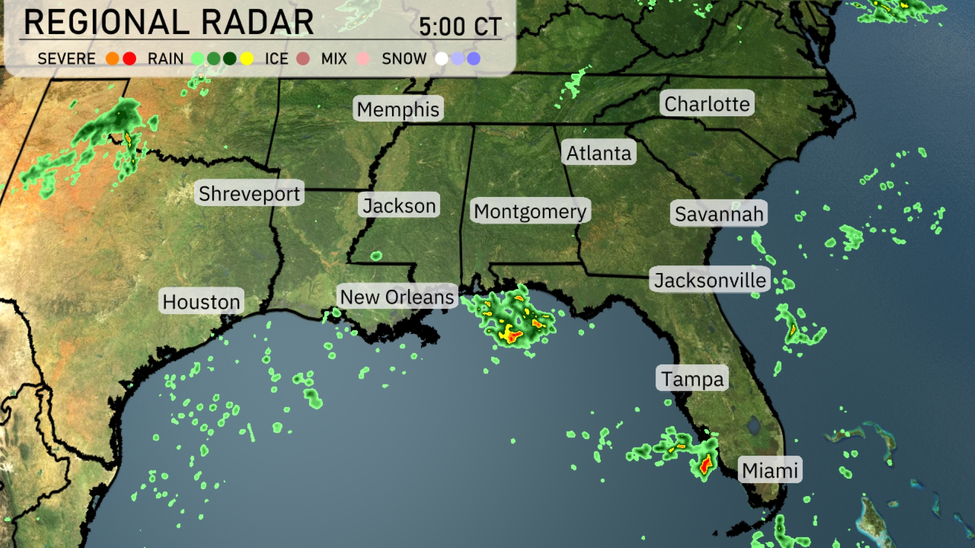
A line of storms is currently stretching from New Orleans over the Gulf of Mexico, with showers extending towards Jacksonville. Scattered rain is depicted around Montgomery, moving into the southeastern part of the United States. Miami is under light rain, while clouds are building toward Atlanta signaling an upcoming change in weather. Central Alabama remains mostly calm, with clouds thickening farther west towards Shreveport.
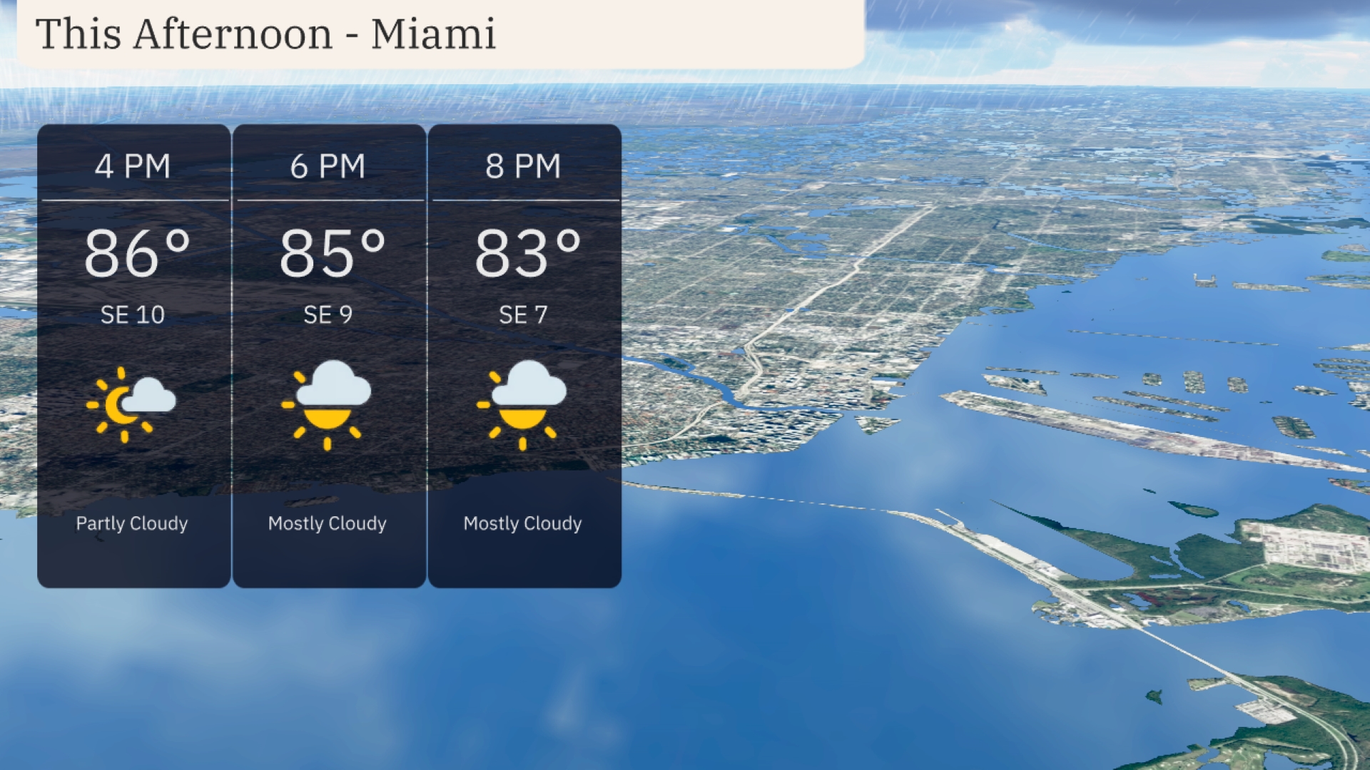
Temperatures in Miami this afternoon will reach 86 degrees by 4 PM, with a southeast wind at 10 miles per hour bringing a partly cloudy sky. As the evening approaches, expect mostly cloudy conditions with temperatures slightly cooling to 85 degrees by 6 PM, and further dropping to 83 degrees by 8 PM. Winds will continue from the southeast, gentle at 9 to 7 miles per hour into the evening.
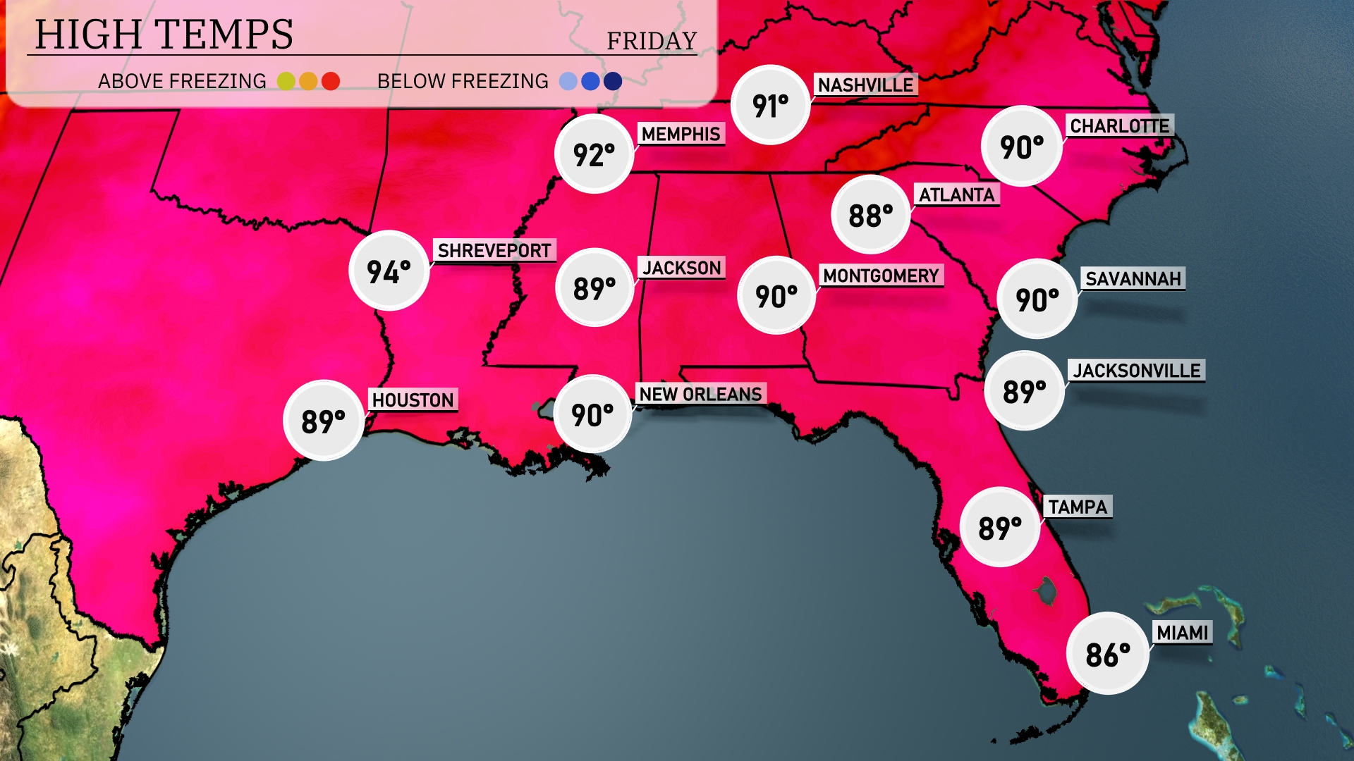
In the Southeast today, high temperatures are reaching notable levels. Shreveport is expected to hit 94 degrees, making it one of the hottest spots in the region. New Orleans and Montgomery are both forecasted for a high of 90 degrees, while Jackson is slightly cooler at 89. Over in Florida, Tampa will see a high of 89 degrees, with Jacksonville matching that temp. Miami stays more comfortable at 86 degrees, thanks to a bit of coastal influence.
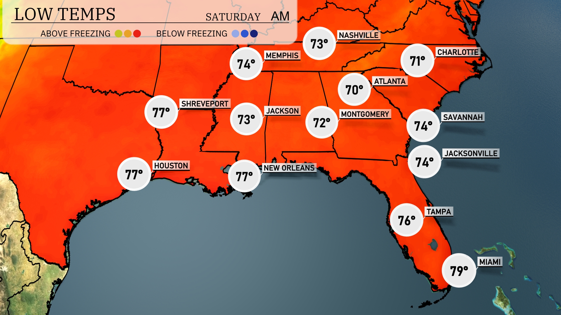
Tonight in the Southeast, temperatures will drop to 70 degrees in Montgomery and 71 in Nashville. Atlanta is expected to cool off to 70 degrees, while Memphis stays a bit warmer at 74. Farther south, New Orleans will see lows around 77 degrees, with Tampa remaining at a mild 76.
Tomorrow, the Southeast will experience some warm temperatures with notable highs. New Orleans is expected to reach 88 degrees, while Jackson sees a similar high of 91 degrees. Atlanta is set to hit 87 degrees and Montgomery will also reach 90 degrees. Miami, on the warmer side, will have a high of 87 degrees as well.
A cold front is making its way across the Southeast, bringing the potential for scattered thunderstorms from New Orleans to Jacksonville. Expect storms with heavy rain and gusty winds beginning late tonight into tomorrow morning, particularly impactful during the morning commute, especially around Atlanta and Montgomery. By Thursday, rainfall totals could range from 1 to 2 inches, elevating the risk of localized flooding, especially in low-lying areas. Temperatures will trend cooler post-front, with high temperatures dropping by about 5 to 10 degrees across the region as skies begin to clear heading into the weekend.
For Miami, expect a UV index of 9 on Friday, meaning a quick burn time of just 15 minutes in direct sunlight. It’s even higher on Saturday, reaching 11, reducing the burn time further to only 11 minutes outside.