Miami Weather This Week: From Thunderstorms to Sunshine
By
Amy Freeze
This week in Miami, temperatures swing from sunny days to stormy evenings. Amy Freeze provides an in-depth look at what to expect from our local weather.
Expect a rollercoaster of weather conditions this week in Miami, from thunderstorms to pleasant clear skies. Get ready with Meteorologist Amy Freeze’s expert insights.
Meteorologist Amy Freeze covers the fluctuating weather patterns in Miami and the broader Southeast area. The coming days bring a mix of thunderstorms and sunny intervals. Prepare as rain and cloud cover is followed by beautifully clear skies. With temperatures ranging from the mid-70s to the high-80s, it’s crucial to stay updated on potential severe weather warnings. This comprehensive guide will ensure you’re ready no matter what the skies hold. Learn more at https://amyfreeze.ai/
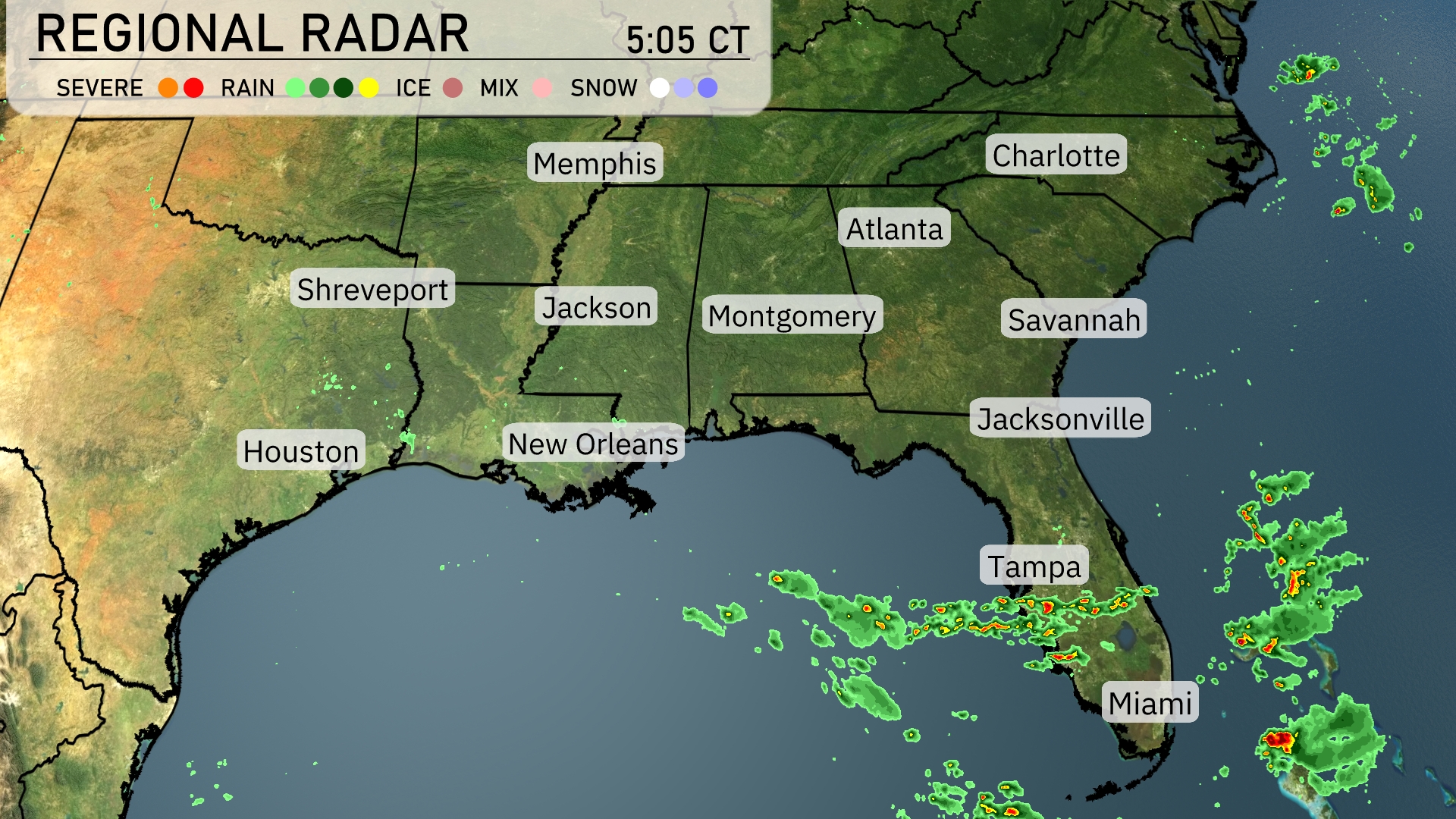
A line of storms is advancing rapidly northeast, with a focus on the coastal areas near Miami and Tampa. Miami is witnessing heavy rainfall, with these storms expected to track toward Jacksonville. The Panhandle region near Tallahassee is expected to see showers as the rain extends northward. Areas like Atlanta and Charlotte remain clear but should stay prepared as conditions evolve. Shreveport to Houston is enjoying clearer skies, keeping the Southeast diverse in weather conditions today.
Afternoon temperatures in Miami are around 80 degrees with scattered thunderstorms expected. Winds from the south-southeast at 10 miles per hour will be present, adding to the stormy feel. By 6 PM, temperatures slightly drop to 79 degrees with the continuation of scattered thunderstorms. The evening brings more thunderstorms with temperatures at 77 degrees and winds shifting to the southeast at 7 miles per hour.
Today we’re seeing some warm temperatures across the Southeast. In Shreveport, expect a high of 92 degrees, while Houston will reach 90. Jackson is forecasted to hit 89 degrees, and Montgomery will see a high of 87. Over in Atlanta, temperatures will climb to 85, while Jacksonville and Savannah both warm up nicely, each reaching 89 and 88 degrees respectively. New Orleans enjoys a slightly cooler 85 degrees, making for a pleasant day along the Gulf Coast.
Tonight Memphis will see a low of 72 degrees, while Nashville is expected to dip to 71. Jackson will cool to 69 degrees, and Atlanta will have an overnight low of 67. Farther south, Montgomery will rest at 71, with Tampa staying warm at 72. Miami rounds out the region with a comfortable low of 76 degrees.
Tomorrow Atlanta is set to reach a high of 87 degrees, while Nashville warms up to 91 degrees. In the Gulf Coast, New Orleans will see a high of 91 degrees, and Houston isn’t far behind at 89 degrees. Jackson will also hit 91 degrees, contributing to a notably warm day across much of the region. Expect similar highs in places like Montgomery and Tampa, both expected to reach 87 degrees.
A dynamic weather shift is on the horizon for the Southeast. Expect a cold front to push through Memphis to Atlanta early tomorrow, bringing scattered thunderstorms that could produce gusty winds and localized flooding, particularly in lower-lying areas. As the day progresses, showers and storms extend from New Orleans to Jacksonville. Southeast temperatures will slightly dip post-front, offering a brief respite from the heat with clearer skies by evening. Monitor for any Severe Thunderstorm Warnings, especially in Georgia and southern Alabama.
The UV index in Miami reaches a high of 8 on Monday, with a potential sunburn occurring in just 17 minutes, so remember to apply broad-spectrum sunscreen and wear a hat and sunglasses. On Tuesday, the UV index lowers to 5, reducing the burn time to approximately 27 minutes,