Clouds on the Horizon: Miami’s Mixed Weather Forecast
By
Amy Freeze
Explore Miami's dynamic weather scene – from scattered storms to balmy sunny spells, learn what the Southeast’s skies have in store for you!
Catch up on Miami’s latest weather trends! From partly cloudy skies to looming thunderstorms, find out what’s happening in the skies above the Southeast.
Welcome to our comprehensive weather update for Miami and the surrounding Southeast region. This week, you’ll experience a variety of weather patterns ranging from clear skies to thunder showers. As a cold front approaches, expect thunderstorms and gusty winds, particularly across northern Georgia. Understand how these climate patterns affect you with in-depth analyses, preventive tips and more detailed forecasts for each day of the week. For further insight, swing by our blog at https://amyfreeze.ai/!
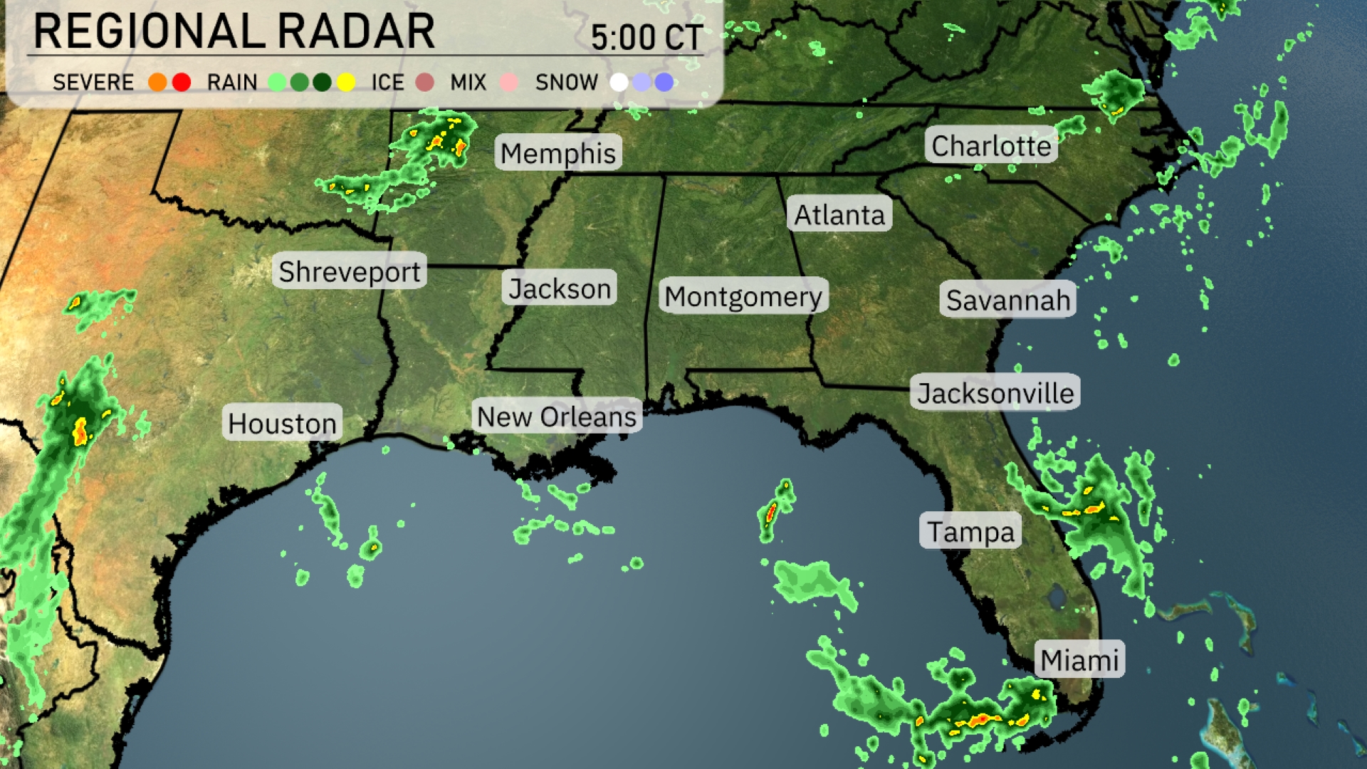
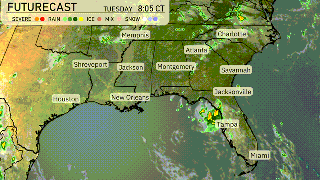
The Southeast region is seeing an active weather pattern with rain making its way through the southern coastlines of Florida, particularly impacting Miami with scattered storms. Meanwhile, light showers are beginning to form near New Orleans, moving eastward. Cloud cover is building across Atlanta and stretching towards Charlotte, setting up for potential showers later in the day. Memphis and Shreveport are experiencing clear conditions for now but some changes might be expected as systems develop.
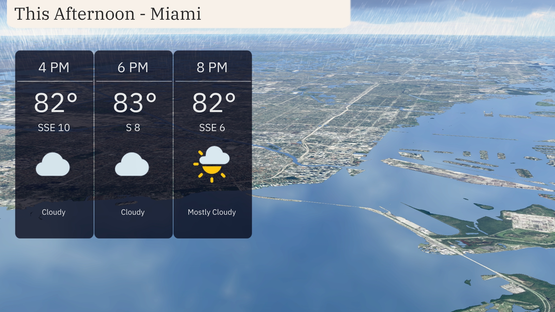
Temperatures in Miami this afternoon will hover around 82 to 83 degrees under predominantly cloudy skies. Winds are expected to come from the south-southeast at 10 miles per hour, shifting to a southern direction at 8 miles per hour by early evening. A mostly cloudy condition prevails, with a slight clearing anticipated as the evening progresses.
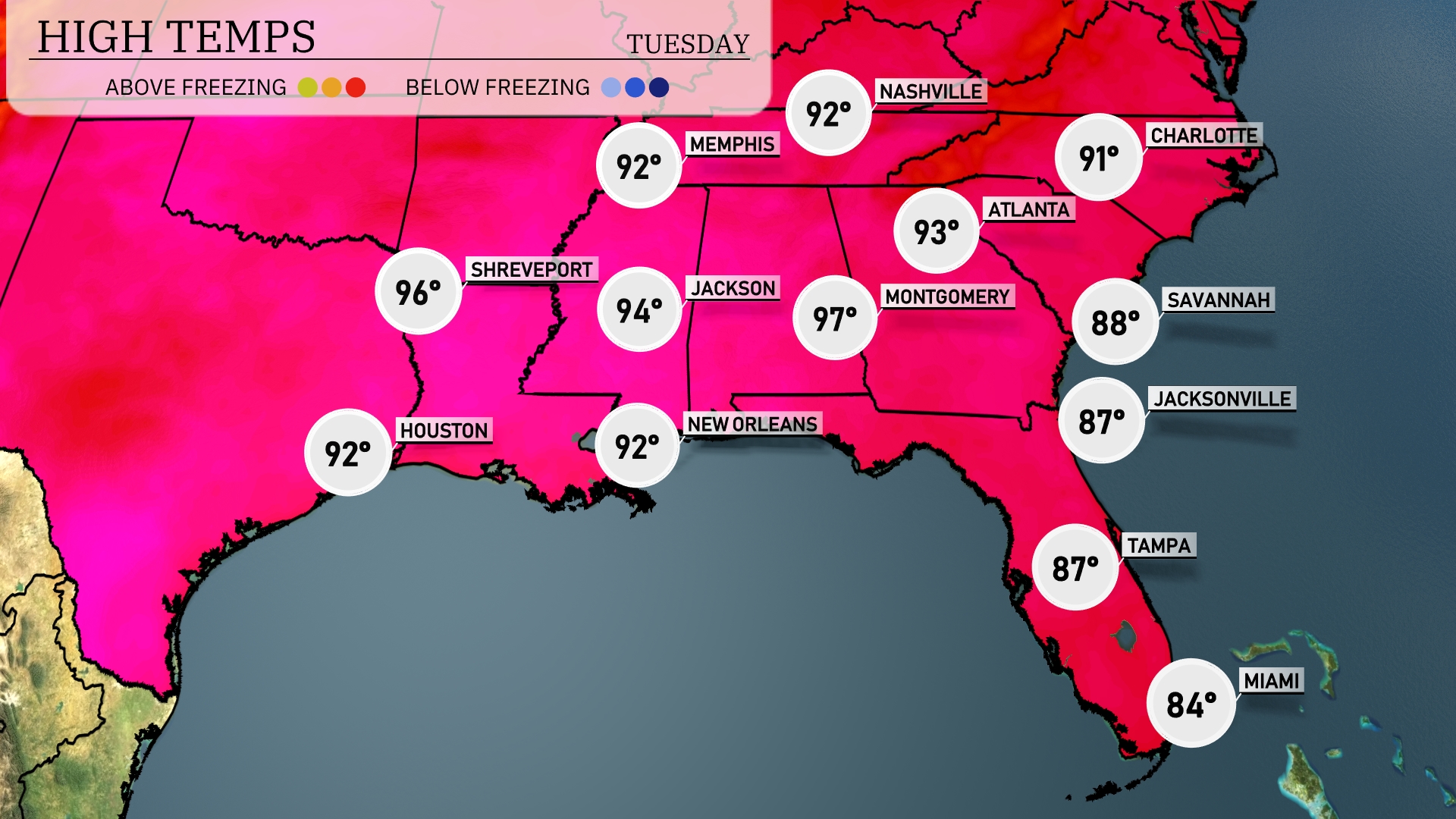
Afternoon high temperatures are climbing across the Southeast today. In Shreveport, look for a high of 96 degrees, while Houston will reach 92. Jumping over to Jackson, expect a toasty 94 degrees. Montgomery is cooking with a high of 97, whereas in Florida, Jacksonville tops out at 87, and Miami cools off at 84 degrees.
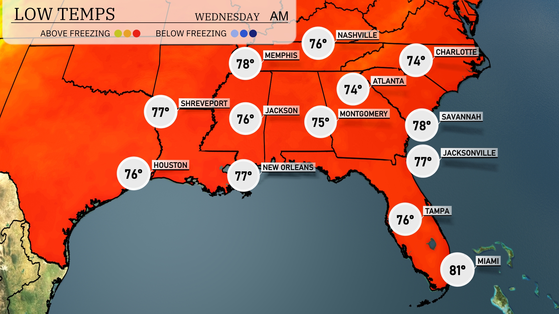
Tonight, Memphis will experience a low of 76 degrees. Nashville is expected to dip to 74. In Atlanta, temperatures will cool down to 75, while Montgomery will see a low of 74. Jacksonville is forecasted to be at 77 and Tampa will remain mild at 76 degrees.
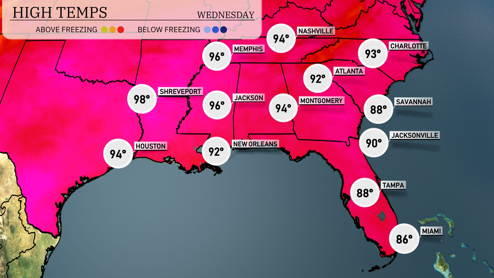
Tomorrow in Houston, expect a high of 94 degrees, while Shreveport warms up to a sizzling 98. Jackson will also see temperatures climb to 96 degrees, creating a heat wave across central areas. In New Orleans, the high is set for 92 degrees, with conditions remaining humid. Moving east, Montgomery will reach 94 degrees, and both Atlanta and Savannah will see highs around 88 degrees, slightly below average for this time of year.
Expect an active weather pattern across the Southeast tomorrow. A cold front pushes through the region, bringing thunderstorms from Alabama to the Carolinas, particularly impacting Atlanta during the early hours. We could see heavy rains from New Orleans into Montgomery with potential for localized flooding, so stay weather aware. Strong storm cells may lead to gusty winds and isolated severe weather, especially in northern Georgia.
The UV index in Miami on Tuesday will be very high at 10, with sun exposure risks peaking and a quick burn time of just 12 minutes. On Wednesday, the index drops to 8, remaining high with a burn time of 17 minutes