Miami’s Meteorological Mosaic: Sunshine, Showers, and Scorchers
By
Amy Freeze
Explore a detailed forecast of Miami and the Southeast, with a blend of sun, partial clouds, and a wave of approaching storms. Learn what this means for your week ahead!
Catch the latest on Miami’s weather, from sunny afternoons to stormy horizons. We bring you the most accurate and comprehensive weather forecasting for a safe and informed week.
This week in Miami and across the Southeast, expect a mix of clear skies and storm warnings. We delve into the specifics of each day with temperature details, weather conditions, and safety tips to ensure you’re well-prepared for any weather. From sunny days at 89°F to stormy evenings with potential severe weather, we cover all bases. Stay ahead with our full 7-day outlook and protective measures for high UV indexes.
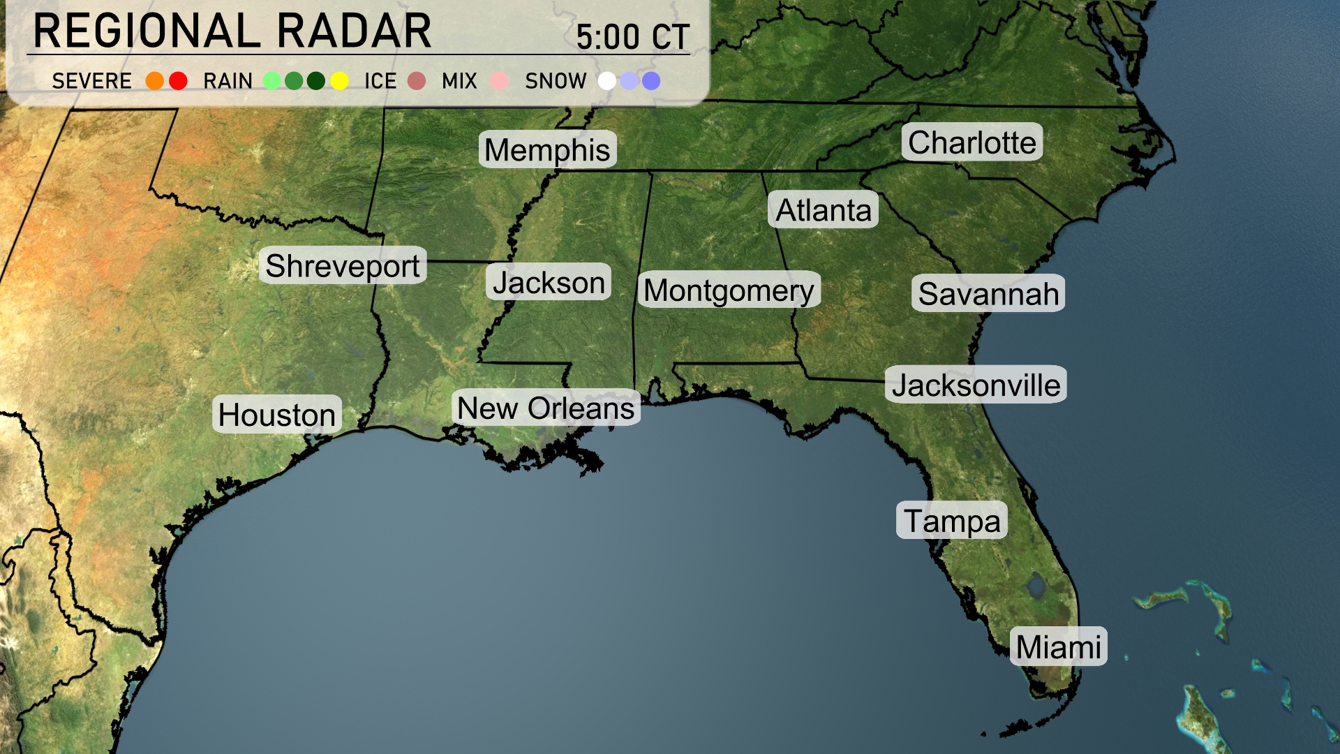
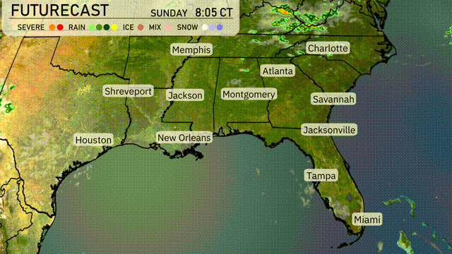
The Southeastern region is experiencing widespread cloud cover with spotty showers mostly confined to the Gulf Coast. Houston and New Orleans are seeing light rain showers, while a more organized system is bringing steady rain to Jacksonville. Miami, under a mix of clouds, is clear of precipitation for now. Areas like Montgomery and Atlanta remain cloudy but dry.
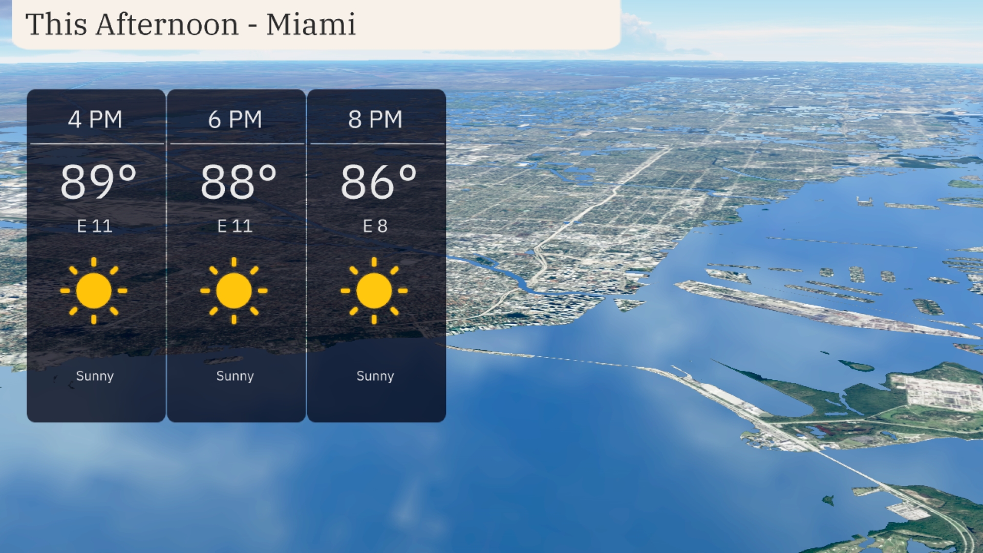
Afternoon temperatures in Miami reach 89 degrees, accompanied by a gentle east wind at 11 mph. The sunny skies continue through 6 PM with temperatures slightly dipping to 88 degrees. By 8 PM, expect temperatures to ease to 86 degrees, while the wind maintains an easterly direction at 8 mph. Clear, sunny conditions are expected to dominate.
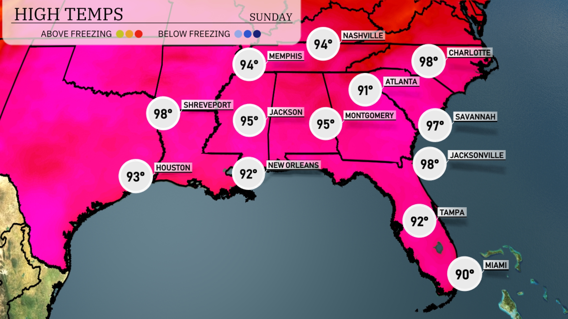
Afternoon highs across the Southeast are heating up today. In Shreveport, expect a sweltering 98 degrees, while Houston is slightly cooler at 93. Jacksonville and Savannah are both hitting a sizzling 98, and Atlanta reaches a warm 91. New Orleans will stay comfortable at 92, but jump up to 95 in Jackson, adding to the heat wave across the region. With temperatures climbing, stay hydrated and seek shade when you can!
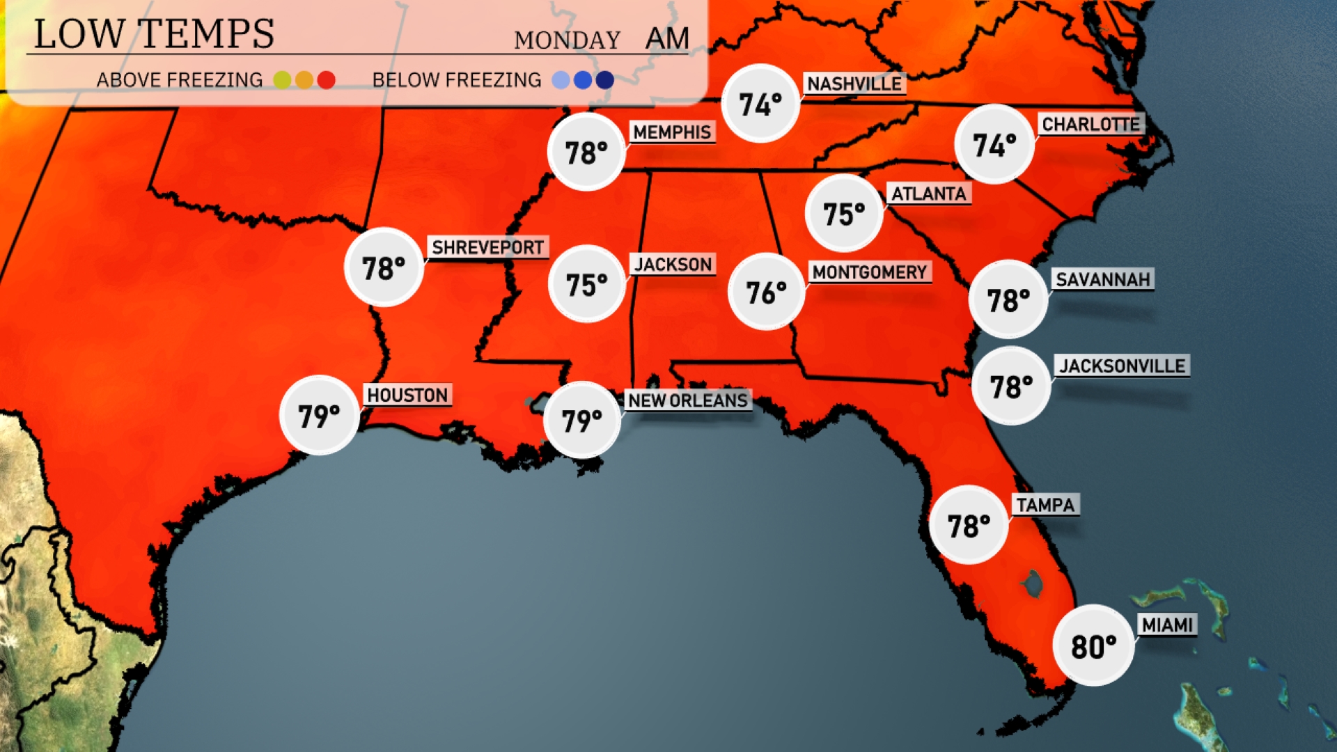
Tonight, Memphis will drop to a low of 78 degrees, while Nashville cools down to 74. Atlanta is expected to see temperatures around 75, with Montgomery at 76. Jacksonville and Savannah will both register lows of 78, while Miami remains warm at 80 degrees.
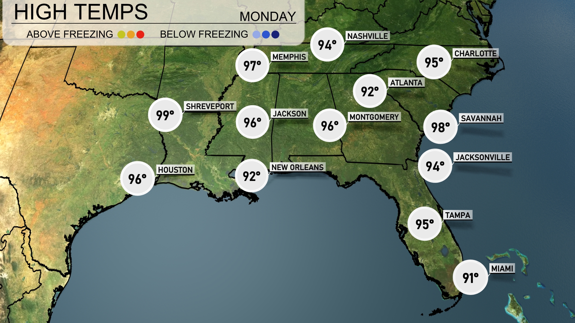
Tomorrow, Savannah is set to sizzle with a high of 98 degrees. Atlanta will reach a warm 94, while Jacksonville can expect similar conditions at 94 degrees. Memphis will be hotter at 97, and Shreveport is looking at a scorching 99 degrees. With a ridge of high pressure dominating the region, many areas will be experiencing temperatures well above average for this time of year.
A cold front is set to sweep through the Southeast, starting with overcast skies and scattered showers from Jackson to New Orleans by tomorrow morning. Thunderstorms with potential strong gusts are anticipated from Shreveport to Montgomery, intensifying as the day progresses. By the evening, expect these stormy conditions to reach Atlanta and Charlotte, with heavy rain possibly impacting commutes. Keep an eye out for isolated severe weather risks, including damaging winds. Temperatures will drop slightly after the front passes, leading to cooler and drier conditions by midweek.
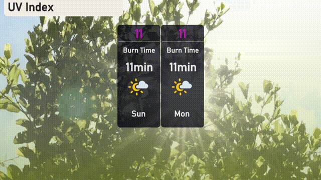
The UV index for Miami will be very high at 11 on both Sunday and Monday, with a burn time of about 11 minutes in direct sunlight. Take extra precautions if you’ll be outdoors—apply broad-spectrum sunscreen, wear protective clothing, and stay in the shade when possible.