Miami Mosaic: A Week of Sun, Sprinkles, and Storms
By
Amy Freeze
Explore the dynamic weather pattern impacting Miami this week—from scorching afternoons to refreshing evenings filled with showers and thunderstorms.
This week in Miami, weather oscillates between delightful sun and sudden showers. Get the details on daily highs and lows, and stay prepared for potential storms.
As Miami grapples with a mixture of clear skies and impending storms, let’s break down what you can expect each day. From the intense UV index today warning against sunburn in just 11 minutes to showers and storms arriving by Wednesday, it’s a week to stay alert and enjoy the pleasant bouts of sunshine wisely. Evening temps provide a perfect setting for nighttime outings while days command caution. Full insights into Miami’s weekly weather await in our detailed roundup!
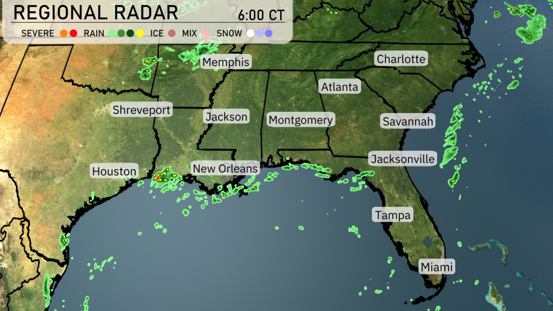
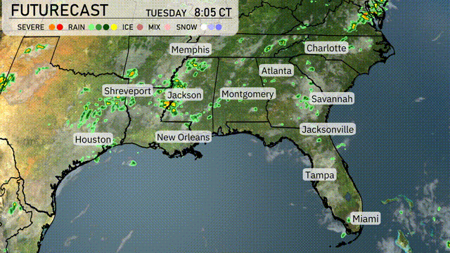
On the Regional Radar, rain showers are currently moving across the Gulf Coast, impacting New Orleans and extending over the Gulf of Mexico. Shreveport and Jackson are experiencing scattered light rainfall. Dry conditions prevail over the interior Southeast, including Atlanta and Charlotte. Expect increasing cloud cover in these areas as the day progresses, which could lead to more widespread precipitation.
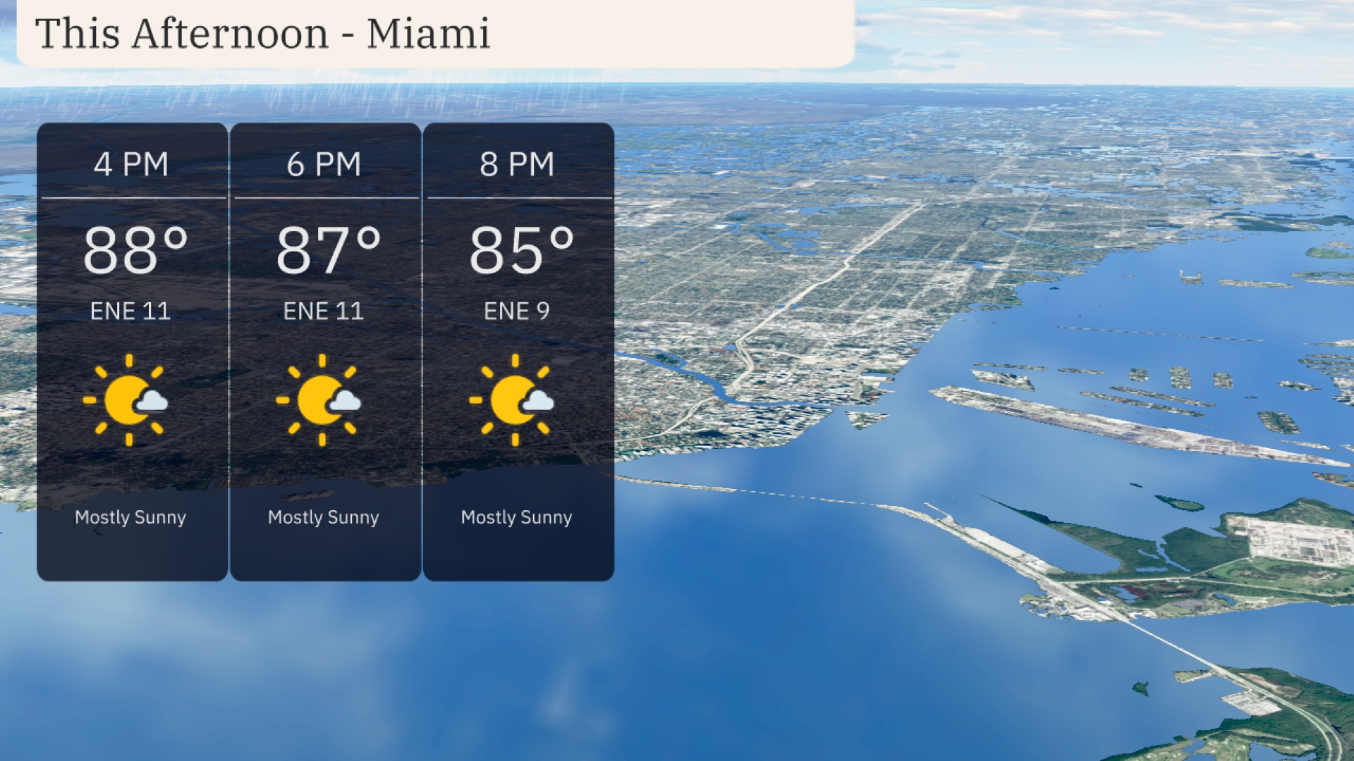
Miami temperatures this afternoon will reach 88 degrees by 4 PM, cooling slightly to 85 degrees by 8 PM. Expect mostly sunny skies with a gentle east-northeast wind blowing around 11 miles per hour, decreasing to 9 miles per hour later in the evening. It’s a splendid afternoon for outdoor activities, with plenty of sunshine and a pleasant breeze.
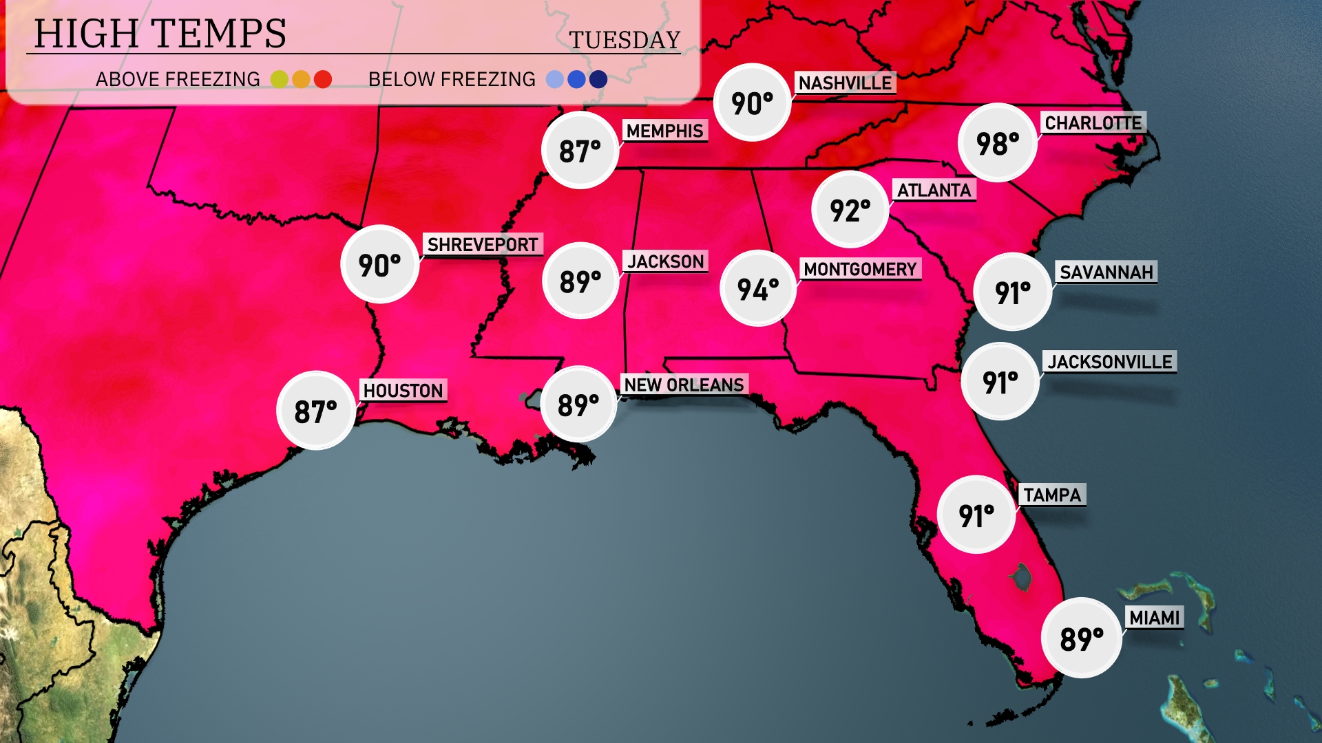
Today’s high temperatures are heating up across the Southeast. Atlanta is sweltering with a high of 98 degrees, while Montgomery reaches a warm 94 degrees. Moving south, New Orleans and Jackson are both near 89 degrees, providing a bit of relief from higher temperatures. In Florida, Jacksonville and Tampa will both see highs around 91 degrees, but Miami is slightly cooler at 89. The significant warmth in the region is indicative of a high-pressure system dominating the area, leading to mostly clear skies.
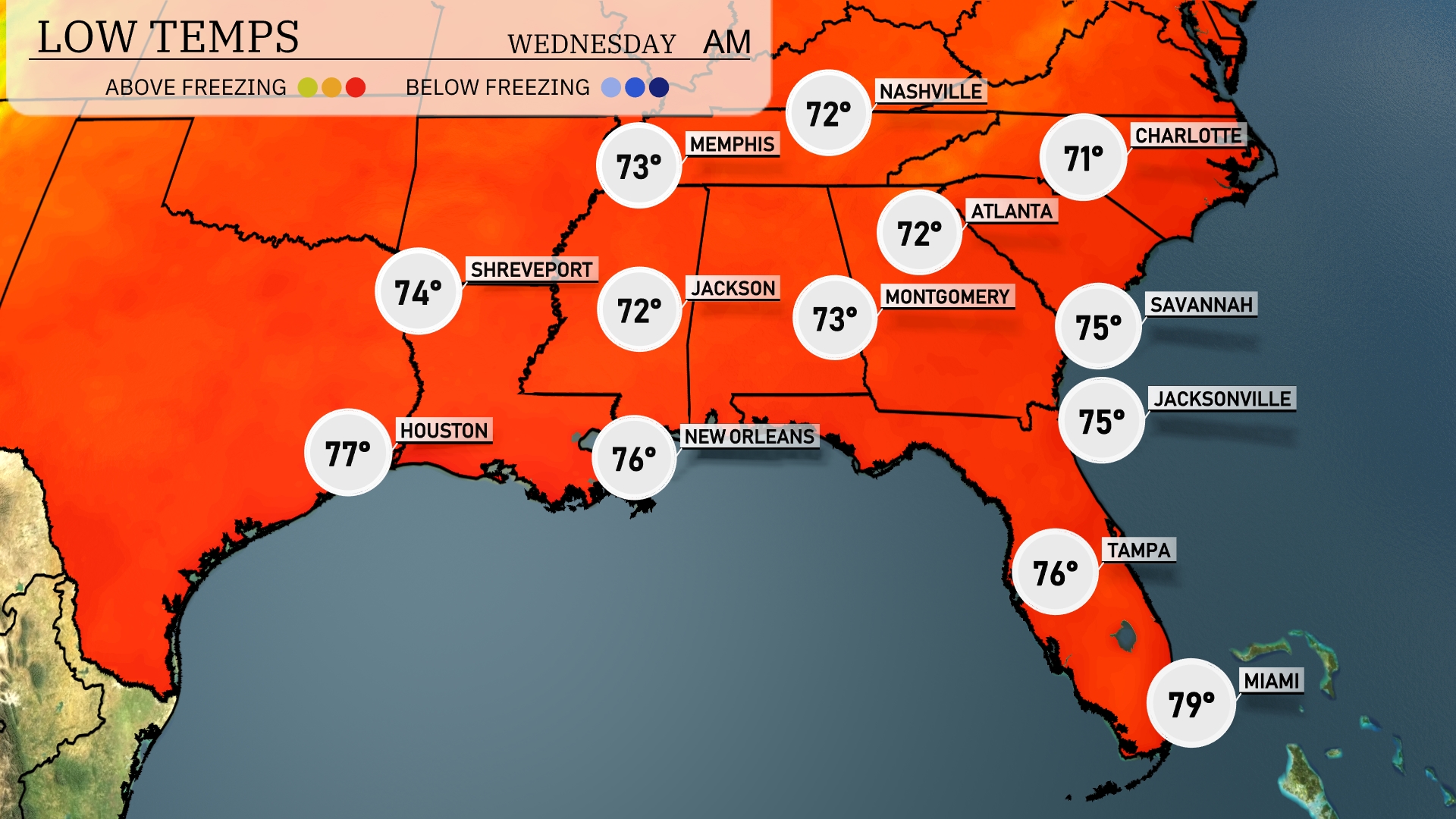
Tonight, expect Memphis to drop to 72 degrees, while Nashville will cool to 71. Jackson is set for a low of 72, with Montgomery at 73. Atlanta will also see a low of 72, and areas in Florida like Tampa and Miami will stay warmer, with lows of 76 and 79, respectively.
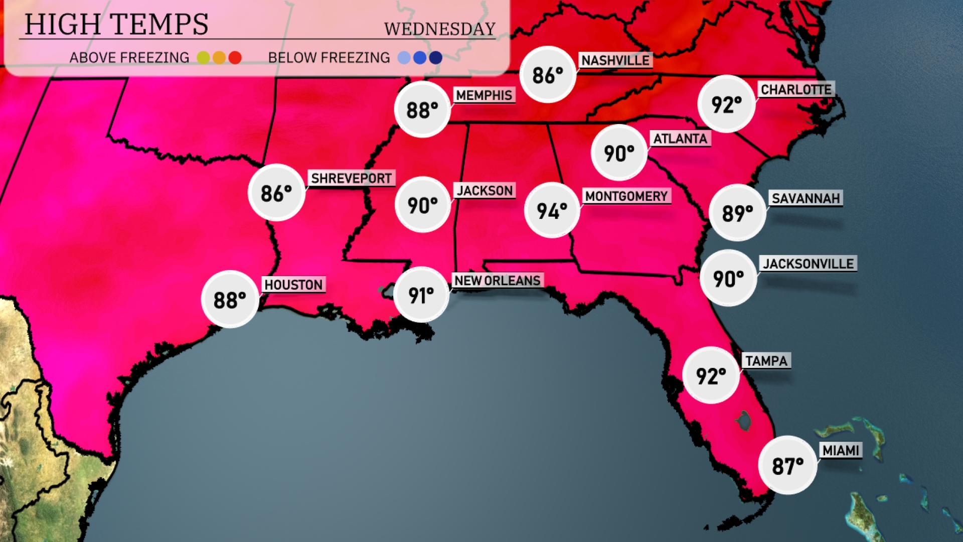
Tomorrow in Atlanta, high temperatures will reach 90 degrees. Jacksonville will also see a warm day with highs around 90 degrees. Moving west, Montgomery is expecting a sizzling 94 degrees, while New Orleans will be close behind at 91 degrees. Expect slightly cooler temperatures in Memphis at 88 degrees and Shreveport at 86 degrees.
A cold front will push into the Southeast tomorrow, bringing showers and thunderstorms from Houston to Atlanta by late afternoon. Enhanced moisture will lead to the potential for heavy rainfall, particularly from Shreveport to Jackson, raising concerns over localized flooding. Areas from Montgomery to Charlotte may experience gusty winds as storms organize along the front. Behind the front, anticipate a brief respite with cooler, drier weather by late Wednesday into Thursday. Stay aware of any severe weather watches or warnings issued by the N-W-S.
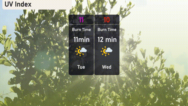
The UV index in Miami will be very high today with a daunting level of 11, meaning sunburn can occur in as little as 11 minutes. As you continue into Wednesday, the index slightly decreases to 10, but caution is still advised with a burn time of just 12 minutes.