As the sun dips below the horizon, Miami's weather takes a dramatic turn with showers, storms, and cloudy intervals. Get the detailed evening forecast and what to expect in the week ahead.
This week, Miami graces us with picturesque sunsets juxtaposed against the backdrop of incoming storms. Track the changes from partly cloudy to stormy as we cover daily weather forecasts.
Welcome to your detailed guide for Miami’s weather this week. Each day brings its unique pattern, from tranquil sunsets to potential thunderstorms thanks to a sweeping cold front. Expect variations in temperature throughout the week with the chance of localized flooding and storm impacts on daily commutes. With an extreme UV index, remember to protect yourself from direct sunlight. Stay updated and prepare accordingly to enjoy or avoid what Mother Nature has in store!
A line of storms is approaching from the west, currently targeting Memphis with severe weather. Rain showers stretch from Houston across New Orleans and are making their way toward Jackson. Additionally, light rain is falling over Tampa, while increasing cloud cover is noted in Atlanta, with showers moving toward the Carolinas. The northern part of the region remains dry with clearer skies.
For this evening in Miami, expect mostly cloudy skies transitioning to partly cloudy conditions later tonight. Temperatures will hold steady at 83 degrees by both 9 PM and 11 PM, slightly slipping to 82 degrees by 1 AM. Winds will be coming from the east-southeast at 9 miles per hour, calming down to around 6 miles per hour by 1 AM.
Tonight, Memphis is set to cool down to 73 degrees. Nashville will see a low of 68, while Atlanta drops to 69. Expect 71 degrees in Montgomery and 74 in Savannah. Jacksonville will also reach a low of 74, with Tampa not far behind at 75.
Tomorrow, Memphis will see a high of 90 degrees, while Jackson reaches 88. In New Orleans, temperatures will climb to 88 degrees and Montgomery is expected to hit 86. Along the Gulf Coast, Houston warms up to a balmy 92 degrees, with Shreveport peaking at 94.
A cold front sweeps across the Southeast starting tomorrow morning. Anticipate widespread thunderstorms with potential heavy rain from New Orleans through Montgomery up to Atlanta, affecting Wednesday morning commutes. Localized flooding is possible, particularly in areas with already saturated ground. Storms will move eastward, bringing rain to Jacksonville and Savannah by mid-afternoon. Post-frontal temperatures will drop by 5 to 10 degrees, with drier conditions expected into Thursday.
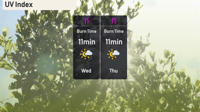
The UV index in Miami is extreme at 11, both Wednesday and Thursday, with a burn time of just 11 minutes under direct sunlight.
Wednesday: Showers are anticipated late in the day with a high of 87 degrees and a low of 80 degrees.
Thursday: Turning partly cloudy with temperatures reaching a high of 87 degrees and a low around 79 degrees.
Friday: Another partly cloudy day, expect the high to be 86 degrees with a low of 80.
Saturday: Look forward to mostly clear skies as temperatures peak at 86 degrees and drop to 81 at night.
Sunday: The day will be partly cloudy with a high of 86 degrees and a low of 80 degrees.
Monday: Continuing with partly cloudy conditions, the temperature will reach 86 degrees and settle at 80 degrees overnight.
Tuesday: The pattern persists with partly cloudy skies, a high of 86 degrees and a low of 80 degrees.