Miami’s Weekly Weather Forecast: Sun, Showers, and Strategies!
By
Amy Freeze
Stay ahead of Miami's dynamic weather with our comprehensive guide to this week's temperature trends, rain patterns, and safety tips.
This week in Miami sees a mix of partly cloudy skies, thunderstorms, and sunny days, with temperatures peaking at 87°F. Stay prepared with our daily weather insights!
Welcome to your essential guide to Miami’s weather this week, where we navigate through partly cloudy skies, potential thunderstorms, and the usual warmth of our tropical haven. From daily temperature insights to severe weather warnings, we cover everything you need to know to make your week in Miami comfortable and safe. Remember, with an extreme UV index, it’s crucial to protect yourself if you’re stepping out!
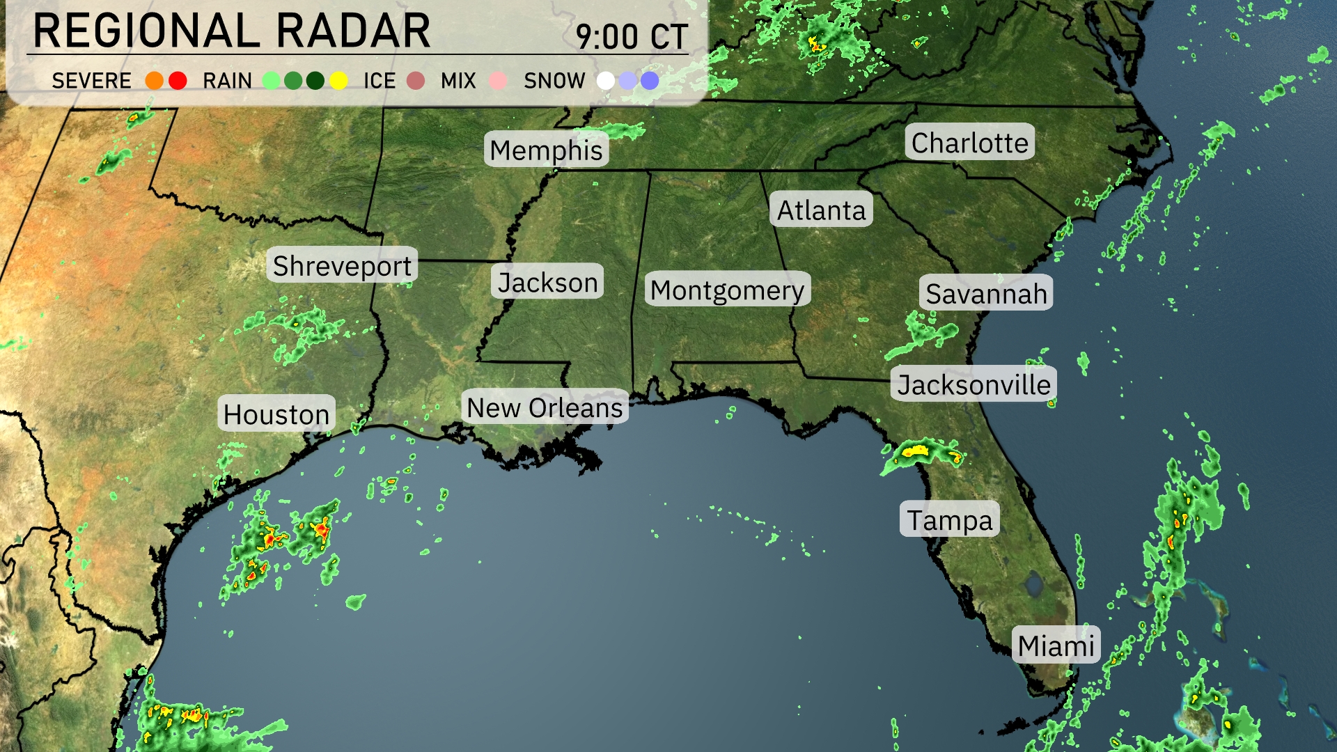
The Southeast region is currently experiencing some active weather patterns. Scattered thunderstorms are moving eastward across central Georgia, impacting areas like Atlanta and Savannah with rain and potential for heavier showers. Meanwhile, New Orleans and parts of southern Louisiana are seeing a mix of rain and scattered light storms off the coast. The Florida Peninsula, including Tampa and Miami, is witnessing scattered afternoon showers with pockets of heavier downpours offshore in the Gulf.
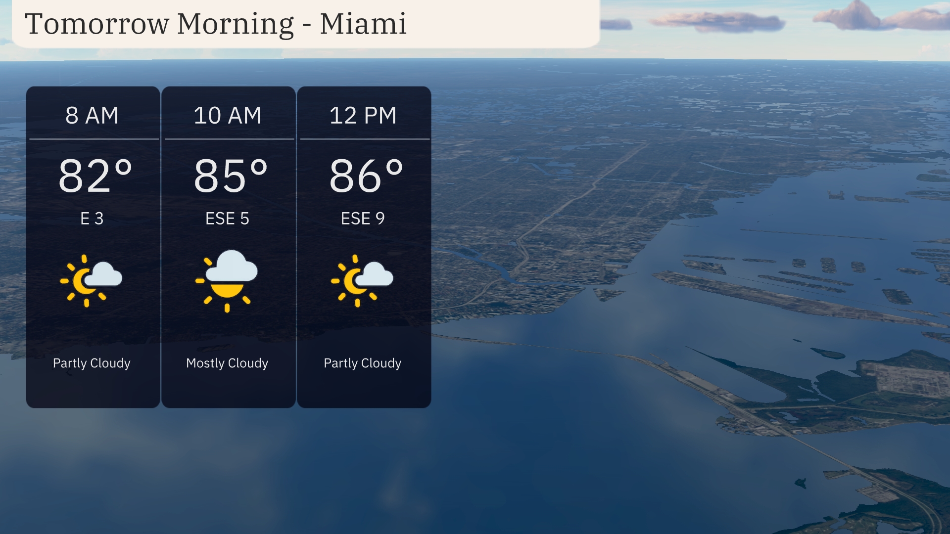
Temperatures in Miami tomorrow morning start at 82 degrees at 8 AM with partly cloudy skies. By 10 AM, you’ll see mostly cloudy conditions as temperatures rise to 85 degrees, with an east-southeast breeze at 5 miles per hour. As the morning progresses to noon, expect partly cloudy skies to return with temperatures reaching 86 degrees and an east-southeast wind blowing at 9 miles per hour.
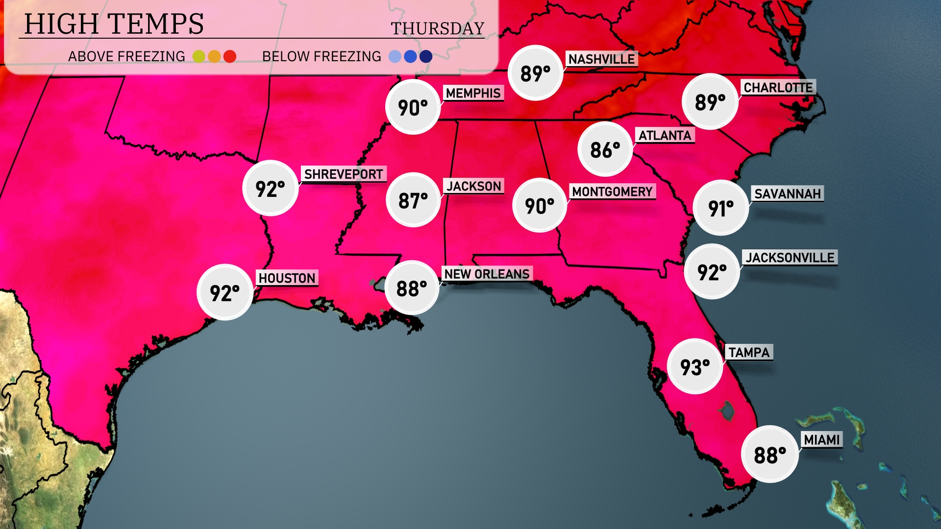
Tomorrow, high temperatures will reach a sizzling 93 degrees in Tampa, while Miami sits at a warm 88 degrees. Houston and Shreveport will both hit 92 degrees, showing above-average readings for this time of year. In Atlanta, expect a high of 90 degrees, as the humidity continues to rise, contributing to a muggy atmosphere. Savannah will also experience a hot day at 91 degrees, with similar conditions extending through much of the Southeast.
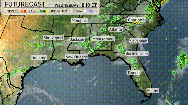
For the Southeast tomorrow, thunderstorms associated with a frontal boundary will dominate from New Orleans to Atlanta. Expect showers and potentially severe storms from the early morning hours, with the heaviest rain likely to cause isolated flooding, especially in low-lying areas. Temperatures across the region will remain warm, reaching the mid-80s°F after the frontal passage. Meanwhile, coastal areas from Jacksonville to Miami will continue to see scattered showers, contributing to humid conditions throughout the day. Stay alert for any severe weather warnings, particularly in areas with ongoing thunderstorms.
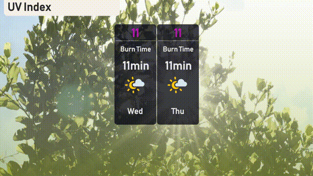
The UV index in Miami is extreme, reaching 11 for both Wednesday and Thursday. This indicates a very high risk of harm from unprotected sun exposure and a burn time of just 11 minutes. Ensure you use high-SPF sunscreen, seek shade, and wear protective clothing if you’re outdoors!
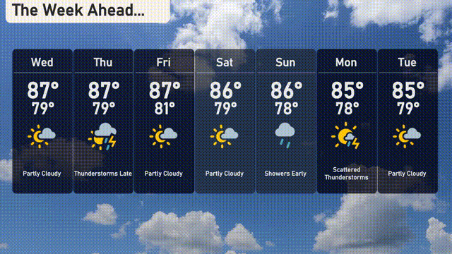
Wednesday: Partly cloudy with temperatures reaching up to 87 degrees and a low near 79 degrees.
Thursday: Watch for late thunderstorms with a high of 87 degrees and a low of 79 degrees.
Friday: Partly cloudy skies, high of 87 degrees and cooling to 81 degrees at night.
Saturday: Another partly cloudy day, with temperatures peaking at 86 degrees and dropping to 79 degrees overnight.
Sunday: Expect early showers with highs around 86 degrees and lows near 78 degrees.
Monday: Scattered thunderstorms are possible with a daytime high of 85 degrees and a low of 78 degrees.
Tuesday: We wrap up the week with partly cloudy conditions, a high of 85 degrees, and a low of 79 degrees.
Have a great week, and stay cool in Miami!