Midwest Mornings: Navigating the Ever-Changing Skies of Chicago
By
Amy Freeze
Dive into a comprehensive weather update with meteorologist Amy Freeze, covering the spectrum of conditions across the Midwest, from sunny days to scattered showers.
Catch the latest Midwest weather insights from Amy Freeze! From chilly mornings in Chicago to warm afternoons across the region, get all your updates in one place.
Meteorologist Amy Freeze brings you the latest on the changing weather conditions in Chicago and the Midwest. From early morning forecasts of partly cloudy skies to full daytime updates with scattered showers and mild temperatures, Amy covers everything you need to plan your day and stay prepared for any weather event. Learn about the upcoming weather trends and what to expect in your local area. Always stay updated and ready!
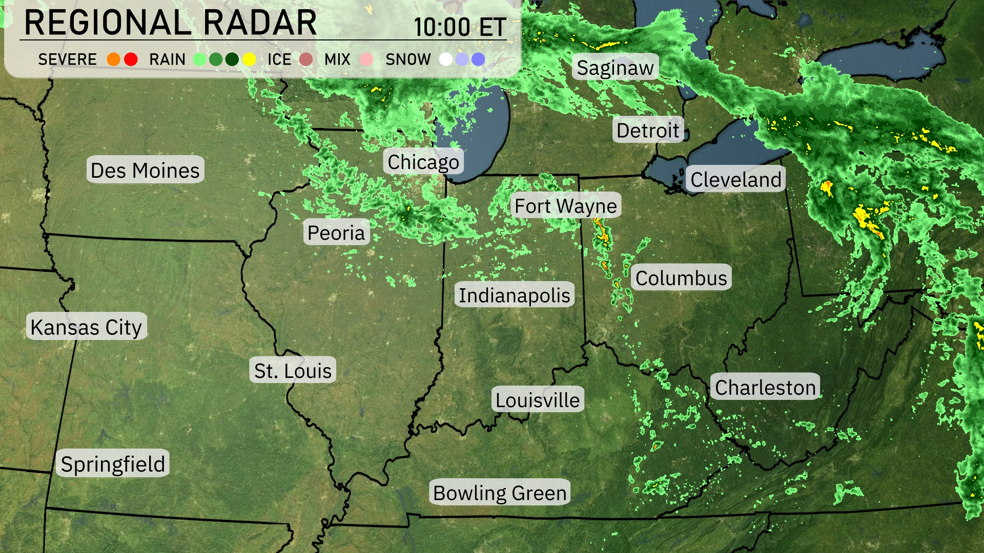
The Midwest is experiencing a spectrum of weather conditions. Showers are scattered across areas from Peoria to Chicago, bringing moderate rain to these locations. Moving eastward, Fort Wayne is experiencing a concentrated band of rain stretching towards Columbus where rain intensifies. Saginaw and Detroit are seeing light precipitation, contributing to the soggy conditions in the area. Louisville and Bowling Green remain clear, enjoying a break from any active weather.
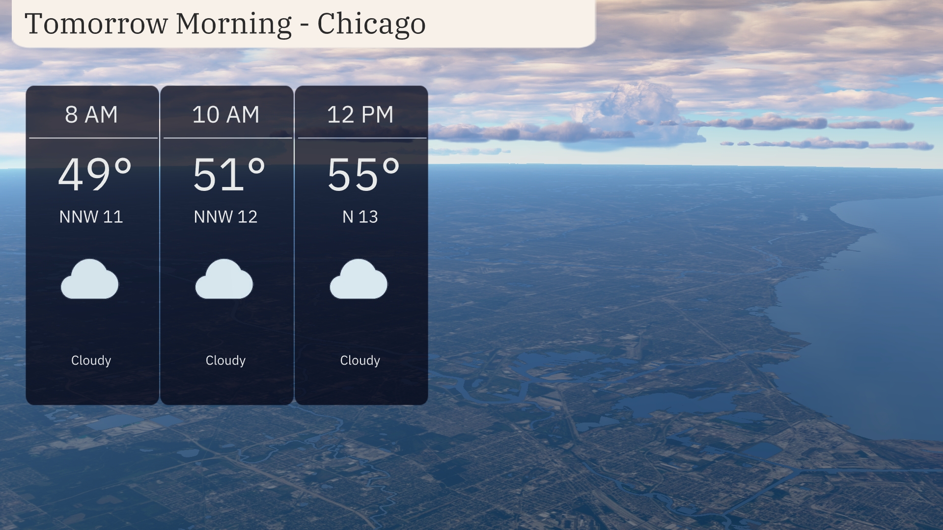
Expect a cloudy morning in Chicago tomorrow, starting with temperatures around 49 degrees at 8 AM with a north-northwest wind at 11 miles per hour. By 10 AM, temperatures will rise slightly to 51 degrees with winds from the north-northwest at 12 miles per hour. As we head towards midday, temperatures will reach 55 degrees, with winds shifting to the north at 13 miles per hour.
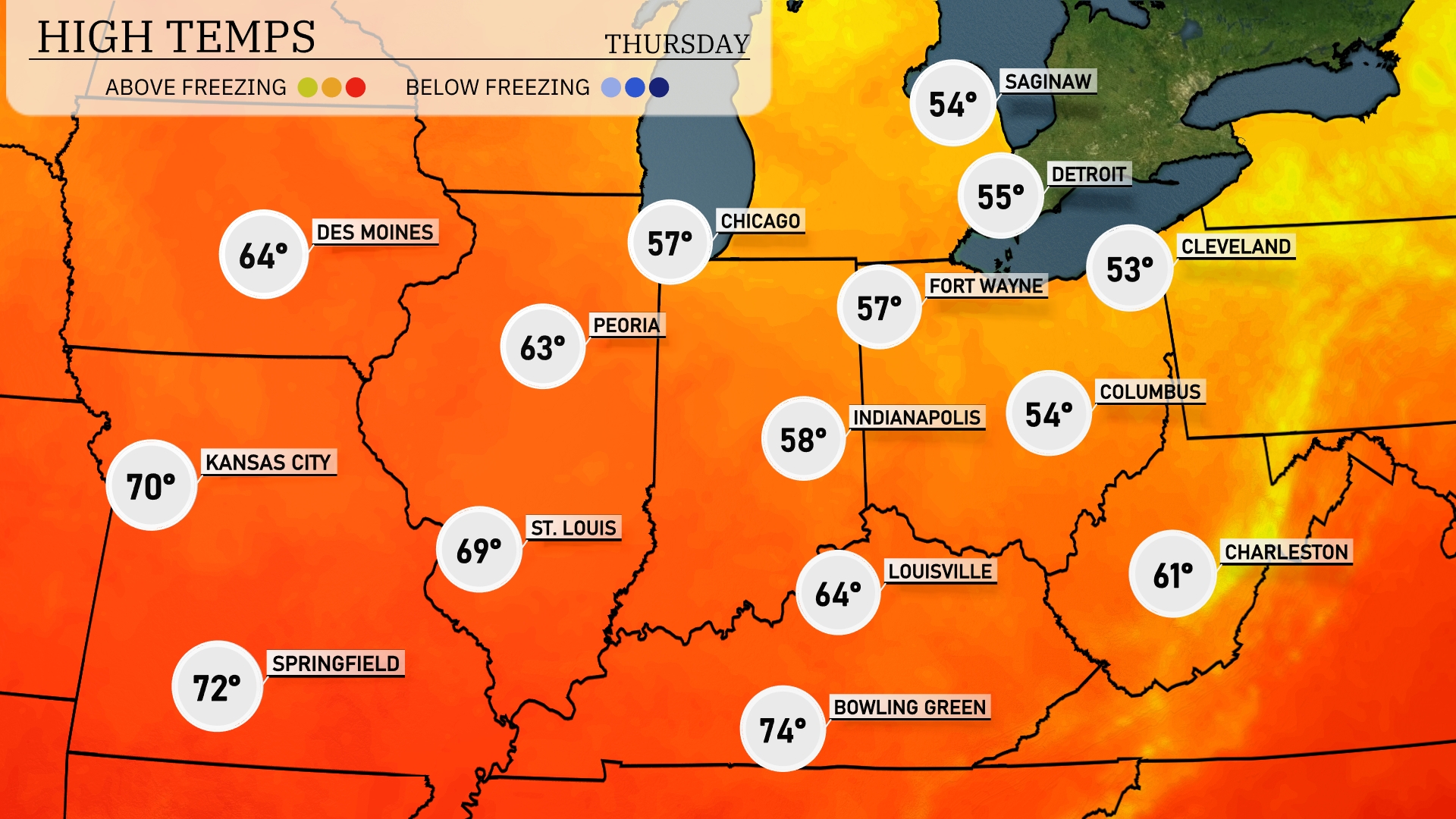
Tomorrow’s high temperatures in the Midwest are leaning warm, with Springfield reaching 72 degrees and Kansas City hitting 70. Peoria is expected to see a high of 63, while Chicago will be cooler at 57 degrees. Indianapolis is forecasted at 58, slightly below average for this time of year. Bowling Green will be the warmest spot in the region, climbing to 74 degrees.
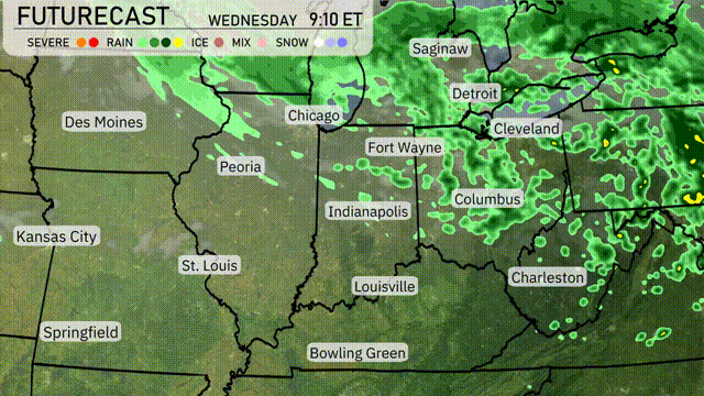
A weather system will bring rain showers across the Midwest tomorrow, with a particular focus from Chicago to Cleveland. Expect rain to begin early in the day and continue through the afternoon, potentially impacting travel and local activities. The temperatures will remain relatively mild across the region, with no drastic fluctuations expected. Isolated storms could develop, providing brief heavy rain and gusty winds, but severe weather is not currently anticipated.
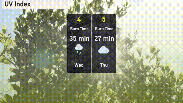
The UV index for Chicago is forecasted to be moderate on Wednesday with a value of 4, leading to a burn time of about 35 minutes if exposed to direct sunlight. By Thursday, expect an increased UV index of 5, where sunburn may occur in approximately 27 minutes. Keep a close watch on the sky for possible storm activity, particularly on Wednesday, which could temporarily lower UV exposure.
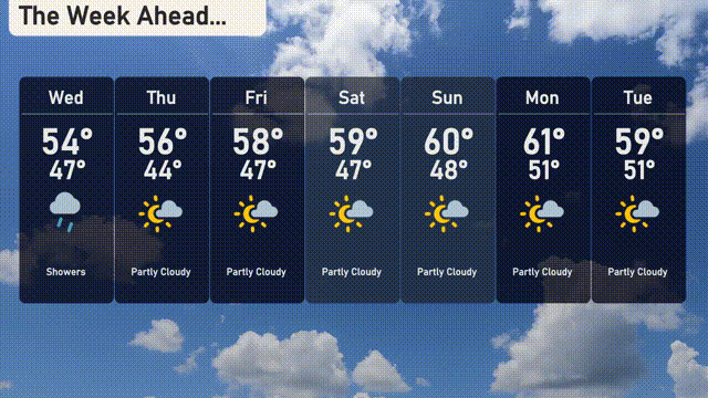
Wednesday: Showers and a high of 54 degrees, cooling down to 47 at night.
Thursday: Partly cloudy skies with temperatures reaching 56 degrees and a low of 44.
Friday: Mostly sunny with a high of 58 degrees, dipping to 47 in the evening.
Saturday: Partly cloudy conditions as the temperature hits 59 degrees, and a low of 47.
Sunday: Another partly cloudy day, with a high of 60 degrees and nighttime temperatures around 48.
Monday: Partly cloudy with a pleasant high of 61 degrees and a low of 51.
Tuesday: Expect partly cloudy skies and a high of 59 degrees, with the temperature remaining steady at 51 overnight.