Chicago braces for a series of thunderstorms as the Midwest faces fluctuating weather patterns. Discover what's next for your area with our comprehensive forecast.
Explore how storms and warmer days are shaping up in Chicago and beyond. From tonight’s cool down to tomorrow’s temperature climb, get all your weather updates here!
As thunderstorms roll across the Midwest, Chicago holds steady with cool mornings and warm afternoons. Learn about the severe weather heading towards Columbus and how storms are shaping the weather in surrounding states like Indianapolis and Kansas City. Tonight’s forecast promises cooler temperatures leading into a warmer tomorrow. Stay safe with UV safety tips as the index hits high in Chicago.
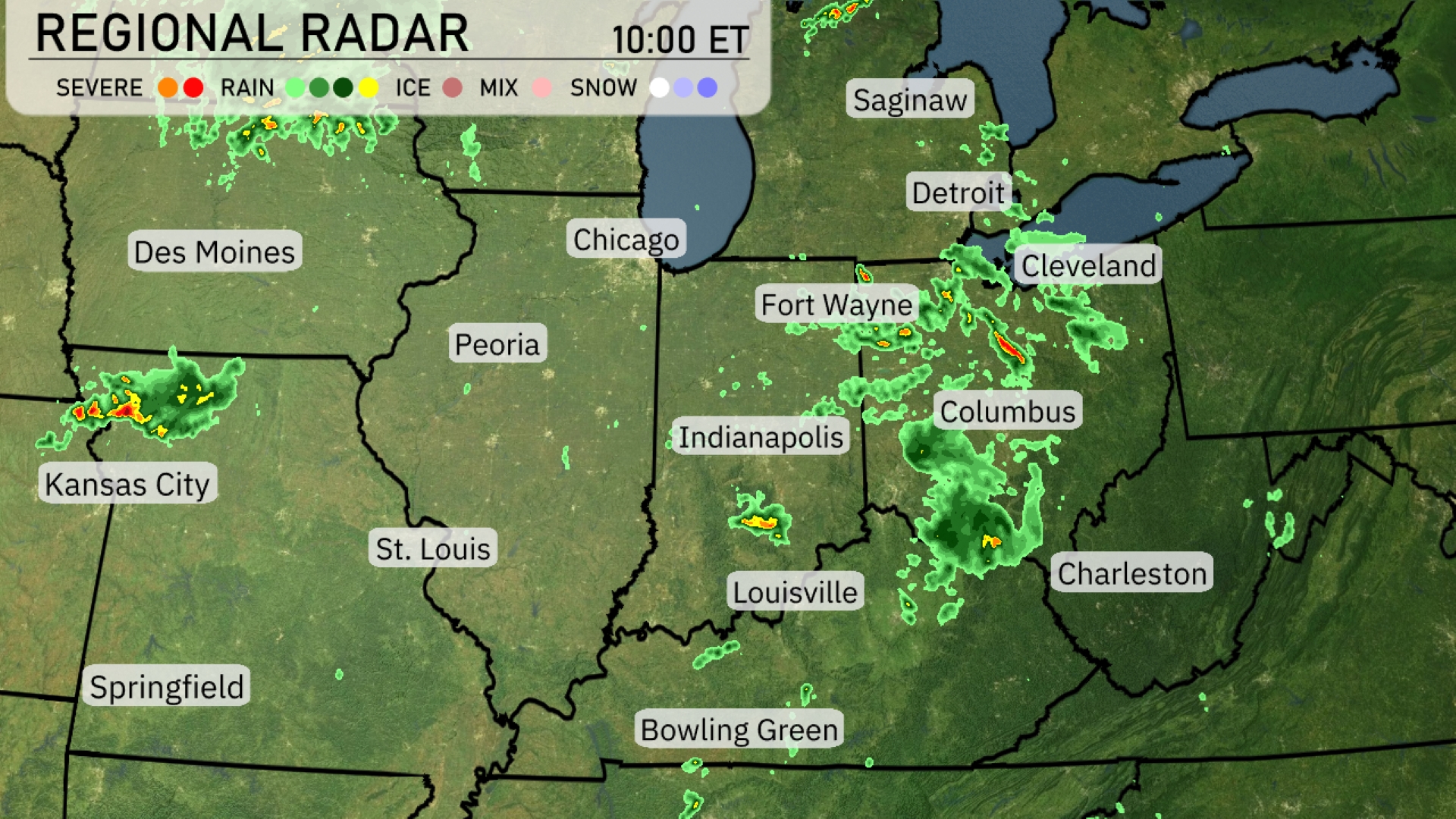
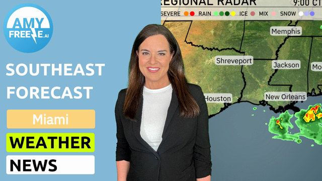
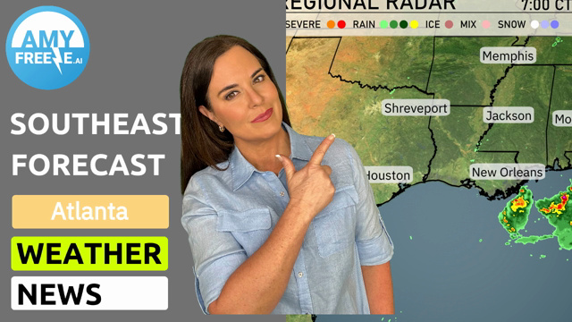
A swath of thunderstorms is sweeping across the Midwest, with notable activity in Columbus where severe weather flags are prominent. Rain showers extend through Indianapolis and Fort Wayne, hinting at continued moisture moving eastward. Showers are forming just outside of Des Moines, heading southeast towards Kansas City. Meanwhile, St. Louis and Louisville are enjoying relatively clear skies, providing a break from the active weather surroundings.
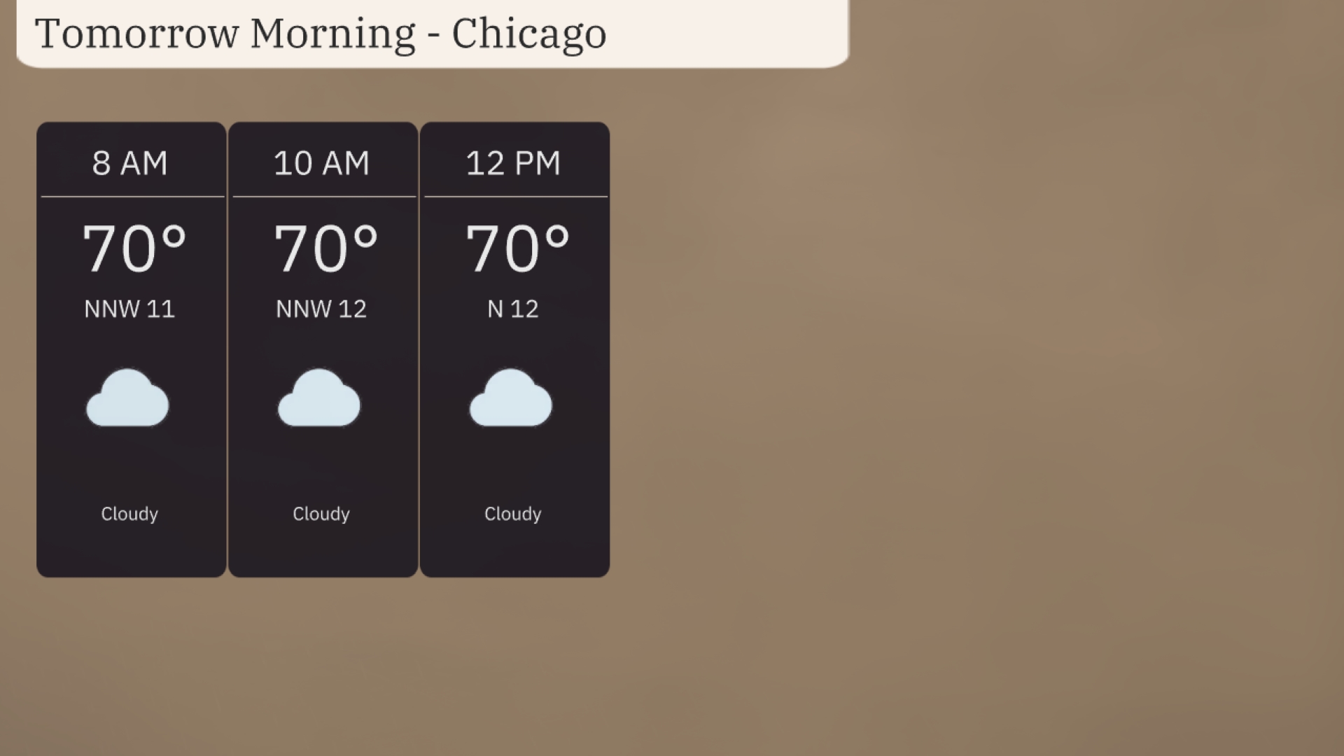
Tomorrow morning in Chicago, temperatures hold steady around 70 degrees with winds shifting slightly from the north-northwest at 11-12 miles per hour. Skies will remain cloudy throughout the morning hours. The wind shift is subtle, with a steady breeze from the north by noon. Prepare for a typically overcast morning, perfect for a light jacket as the breeze keeps it cool.
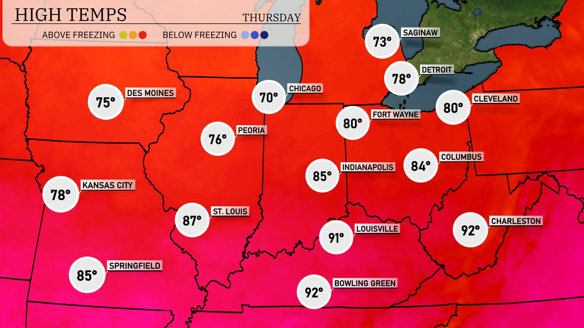
Tomorrow in the Midwest, we’re anticipating some warmer temperatures as summer heat takes hold. Chicago will see a high of 70 degrees, while Des Moines will reach 75. Kansas City is set to enjoy a balmy 78 degrees, and further south, St. Louis will hit 87 degrees. In Indiana, Indianapolis will warm up to 85 degrees, with neighboring Louisville climbing to a steamy 91.
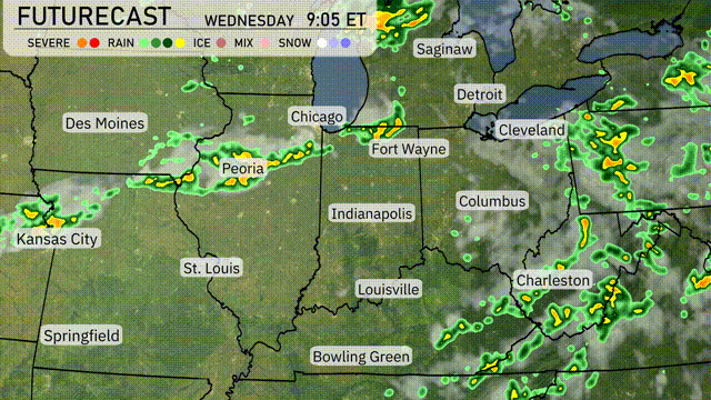
A frontal system will push through the Midwest late tonight, with showers and scattered thunderstorms developing from Kansas City up through Chicago. Expect increased cloud cover and rain chances from Des Moines to Peoria, potentially leading to localized flooding. By tomorrow, storms will extend eastward impacting cities like Fort Wayne and Cleveland, bringing a risk of damaging winds. Cooler, drier air follows the front, dropping temperatures by 5 to 10 degrees across the region.
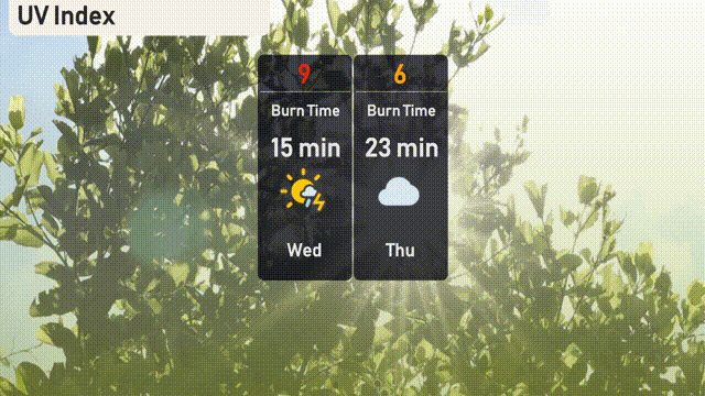
The UV index in Chicago today is high at 9, with a burn time of just 15 minutes, so make sure to apply sunscreen and seek shade if outdoors. Tomorrow, cloud cover will bring the index down to 6, resulting in a longer burn time of 23 minutes.
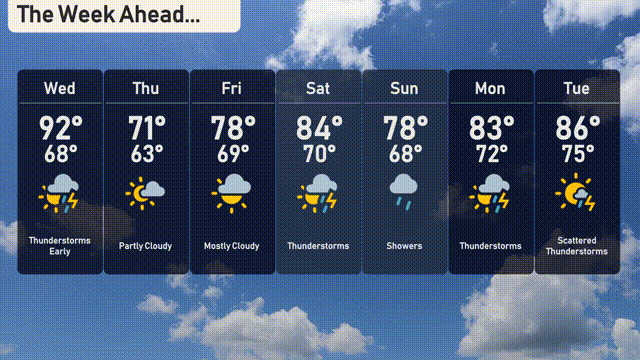
For the 7-day forecast in Chicago:
Wednesday: Thunderstorms early with a high of 92 degrees and a low of 68 degrees.
Thursday: Partly cloudy conditions expected, cooling to a high of 71 degrees and a nighttime low of 63 degrees.
Friday: Mostly cloudy skies, temperatures peaking at 78 degrees during the day and cooling down to 69 degrees at night.
Saturday: Warming up with a high of 84 degrees and a low of 70 degrees under partly cloudy conditions.
Sunday: Showers return, with temperatures reaching a high of 78 degrees and a low of 68 degrees.
Monday: Thunderstorms expected with temperatures climbing to a high of 83 degrees and a low of 72 degrees.
Tuesday: Scattered thunderstorms throughout the day, with a high of 86 degrees and a low of 75 degrees.