From Rain to Snow: Navigating Midwest’s Unpredictable April Weather with Amy Freeze
By
Amy Freeze
Explore the intricate dance of weather across the Midwest with Amy Freeze. From light drizzles in Ohio to snow showers in Chicago, learn what to expect and how to prepare.
Detailed weather updates for Midwest cities, tracking a dynamic change from rain to snow as you plan your week.
Meteorologist Amy Freeze provides an in-depth look at the shifting weather patterns affecting the Midwest. From temperature fluctuations and upcoming rain to unexpected snowfall, here’s your detailed guide to staying prepared and keeping warm.
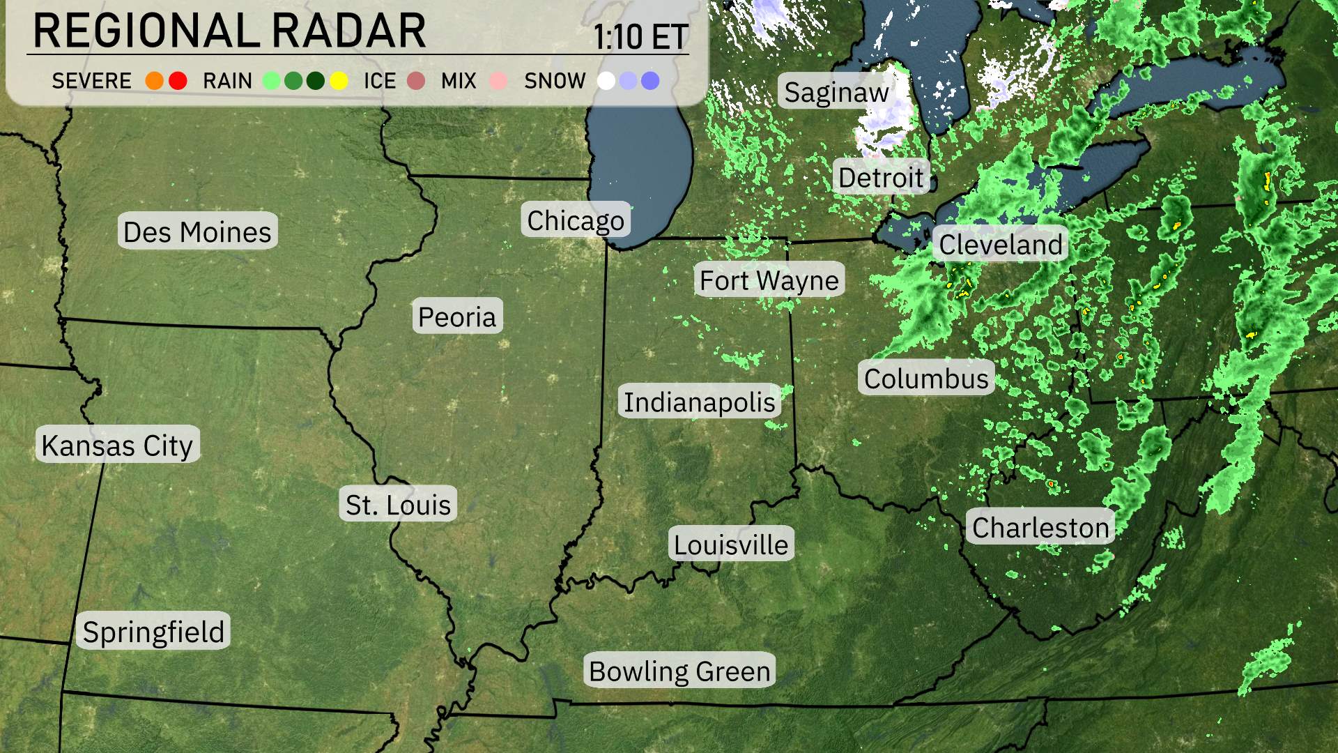
The radar indicates rain sweeping across the Midwest region, concentrated primarily over Michigan and Ohio. Specifically, Cleveland is blanketed by rain with precipitation extending into Fort Wayne. Meanwhile, Columbus is seeing steady rainfall, moving toward Charleston as the day progresses. Areas like Indianapolis and Louisville are currently overcast but dry, with the rain track edging closer. Places such as Des Moines and Peoria remain clear, enjoying a respite from the cloud cover.
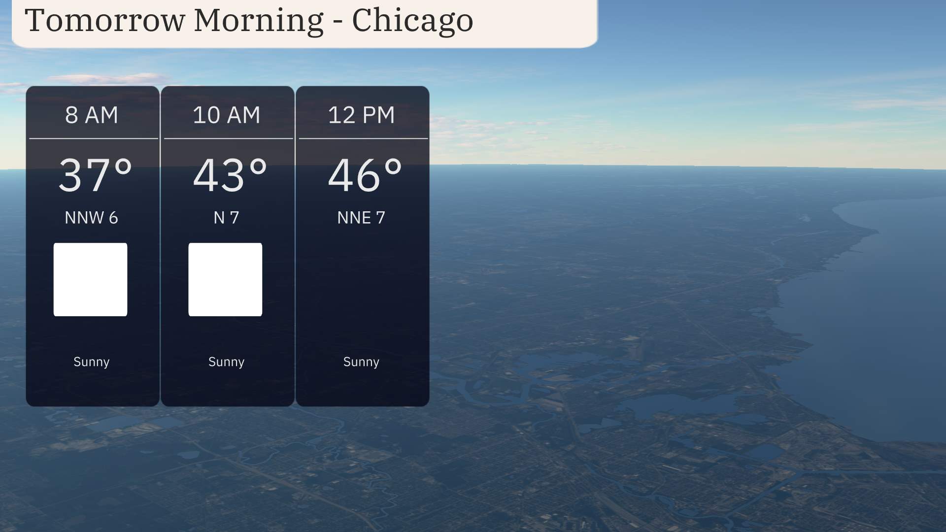
Tomorrow morning in Chicago, it starts off chilly with temperatures at 37 degrees at 8 AM. Expect sunny skies with temperatures rising to 43 degrees by 10 AM. Winds are coming from the north-northwest at 6 to 7 miles per hour, adding a crispness to the air.
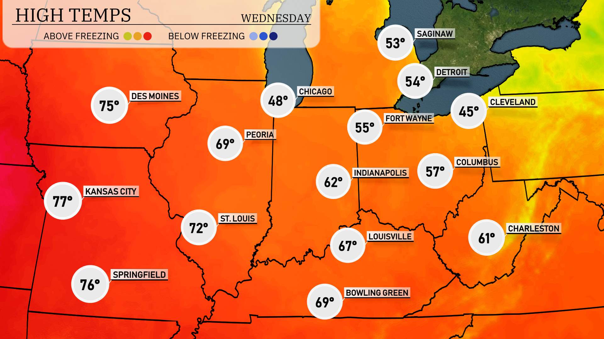
Tomorrow, the Midwest will see above-average high temperatures as warmer air moves into the region. Kansas City leads the pack with a high of 77 degrees, closely followed by Springfield at 76. St. Louis is expecting a pleasant 72 degrees, while Peoria and Bowling Green both reach the mid-60s, at 69 degrees. Indianapolis will see a modest 62 degrees, but Chicago remains cooler at 48 degrees, reflecting a lingering chill.
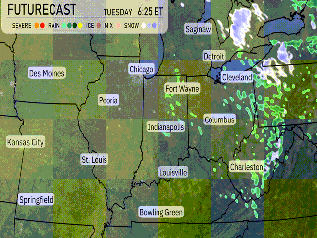
Across the Midwest, anticipate a mix of rain showers transitioning to snow by evening, primarily impacting areas from Chicago to Fort Wayne. Areas like Indianapolis and Louisville will see rain throughout the day with a chance of thunder. Expect a gradual drop in temperatures with cooler air following a frontal passage by nightfall. Watch for potential slick conditions in regions experiencing snow, particularly around Cleveland and Detroit.
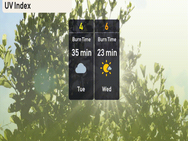
The UV index in Chicago is moderate today, with a level of 4, suggesting a burn time of approximately 35 minutes in direct sunlight. On Wednesday, expect the UV index to increase to 6, with potential sunburn in about 23 minutes. Make sure to wear sunscreen and protective clothing, especially if you’re outside during midday.
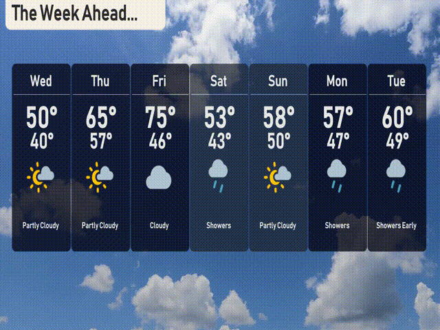
For the 7-day forecast in Chicago:
Wednesday: Look for partly cloudy skies with a high of 50 degrees and a low of 40.
Thursday: Warmer with partly cloudy conditions, reaching a high of 65 degrees and a low of 57.
Friday: Expect overcast skies with temperatures peaking at 75 degrees and dipping to 46 at night.
Saturday: Showers likely throughout the day, with a high of 53 degrees and a nighttime low of 43.
Sunday: Partly cloudy skies return, and the high will be near 58 degrees with a low of 50.
Monday: Cooler weather with partly cloudy conditions, a daytime high of 57 degrees, and a low of 47.
Tuesday: Expect showers early in the day, with temperatures around 60 degrees for the high and 49 degrees for the low.