Midwest Weather Mosaic: Clear Skies and Storm Alerts in Chicago
By
Amy Freeze
Meteorologist Amy Freeze provides a comprehensive look at this week's fluctuating weather patterns across Chicago and the Midwest, from crystal clear mornings to looming thunderstorms.
Amy Freeze forecasts an evolving weather scenario in Chicago—clear skies to severe storms. Stay updated on conditions and safety with her detailed daily insights.
In her latest overview, Meteorologist Amy Freeze offers insights into the complex weather dynamics affecting Chicago and the Midwest, featuring clear skies, severe storms, and everything in between. From daily temperature fluctuations to severe weather warnings, this coverage provides all you need to stay prepared. Follow Amy’s expert advice and remarkable updates to navigate through the week’s diverse weather conditions safely.
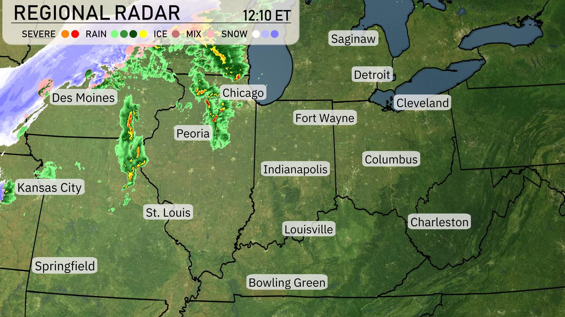
A dynamic weather event is unfolding in the Midwest as the regional radar indicates significant conditions across the area. Starting in the northwest, Des Moines is under the influence of a severe snow system extending across the northern region, mixing with ice in areas further north. As we move southeast, a line of severe thunderstorms is making its presence known, impacting regions like Peoria and stretching towards St. Louis, signaling strong activities with spotty severe conditions. In Chicago, rain showers are moving through, transitioning southeastward towards Fort Wayne and Indianapolis, bringing moderate rainfall. Meanwhile, cities such as Louisville and Bowling Green remain under clear conditions, providing a calm respite in contrast with the surrounding active weather systems.
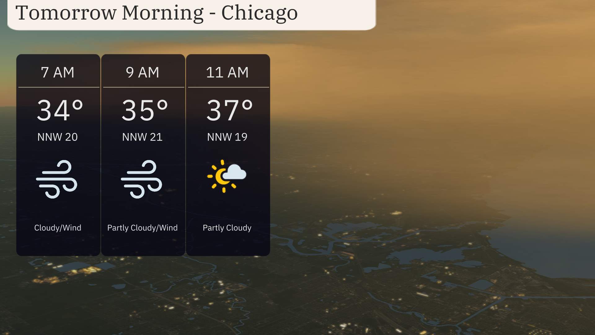
For tomorrow morning in Chicago, temperatures start at 34 degrees at 7 AM, rising to 37 degrees by 11 AM. Winds are from the north-northwest, gusting between 19 to 21 miles per hour. Expect cloudy conditions turning partly cloudy as the morning progresses.
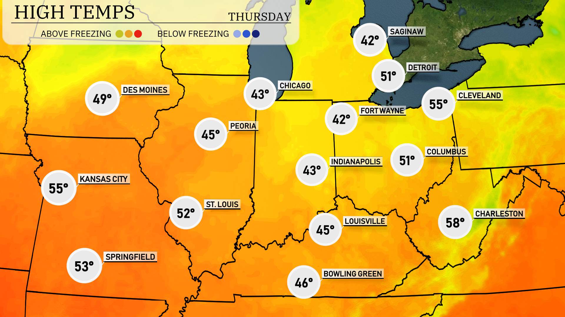
High temperatures for the Midwest on Wednesday are expected to be a mix of cool and mild readings, largely influenced by recent weather patterns.
In Chicago, afternoon highs will reach about 43 degrees, while Peoria is set for a slightly warmer 45 degrees. Moving over to Indianapolis, residents can anticipate a high of 43 degrees, similar to Fort Wayne’s expected 42 degrees.
Going south, Kansas City will see a milder day with temperatures climbing to about 55 degrees, while St. Louis is forecasted to hit 52 degrees. Springfield follows closely at 53 degrees, with Louisville forecasted for 45 degrees.
Overall, these temperatures are generally below average for this time of year and reflect a lingering influence of cooler air across the region.
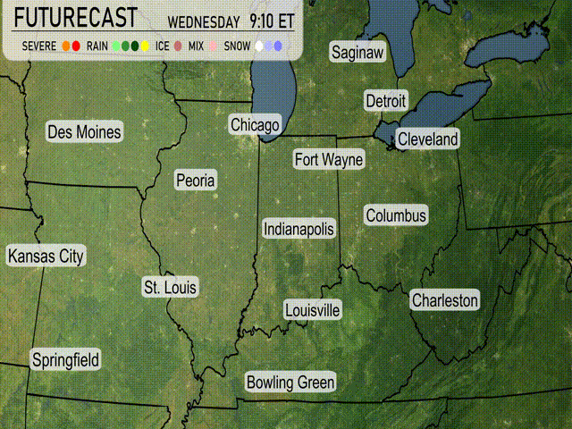
“A cold front slices through the Midwest by midday Wednesday, impacting cities like Chicago and St. Louis with potential heavy rainfall and strong thunderstorms. There’s a risk of severe weather, including damaging winds and isolated tornadoes, particularly during the afternoon hours. Expect rain to persist into Thursday morning across Indianapolis and Columbus, adding to already saturated grounds. As the cold front advances eastward, temperatures will drop significantly, falling into the lower 50s by Thursday morning, with a clearing trend and cooler, drier air filtering in by late Thursday afternoon.”
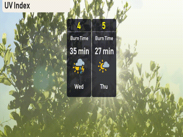
The UV index in Chicago for Wednesday is moderate at 4, with an estimated burn time of 35 minutes, though potential thunderstorms could reduce UV exposure. By Thursday, the index increases to 5, with a burn time of approximately 27 minutes. Consider sun protection during your outdoor activities.
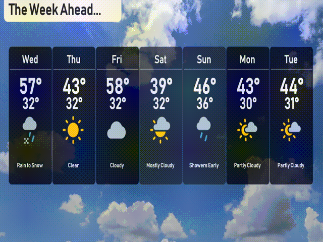
For the 7-day forecast in Chicago:
Wednesday: Rain transitioning to snow with a high of 57 degrees and a low of 32 degrees.
Thursday: Clear skies with a high of 43 degrees and a low of 32 degrees.
Friday: Cloudy conditions continue, reaching a high of 58 degrees and a low at 32 degrees.
Saturday: Mostly cloudy, cooler with a daytime high of 39 degrees and a low of 32 degrees.
Sunday: Early showers with mostly cloudy skies, temperatures peaking at 46 degrees and dipping to 36 degrees.
Monday: Partly cloudy, hitting a high of 43 degrees and a low of 30 degrees.
Tuesday: More clouds with a high of 44 degrees and a low of 31 degrees.
Hope that helps! Stay safe and enjoy the week ahead!