Midwest Mosaic: A Tapestry of Weather from Thunder to Sun
By
Amy Freeze
Discover the versatile weather spectrum sweeping through the Midwest, from sunny Chicago afternoons to stormy St. Louis mornings, with Meteorologist Amy Freeze's expert insights.
Meteorologist Amy Freeze guides you through a whirlwind of weather conditions across the Midwest. Find out what today’s UV index means for you and get ready for tomorrow’s weather shifts!
Welcome to your in-depth look at the Midwest’s weather forecast with Amy Freeze. This week, Chicago and its neighboring cities experience a range of conditions from sporadic thunderstorms to mild sunny days. Dive into local forecasts for notable variations in temperatures and storm activities, and uncover why UV precautions are a must today. Plus, get a head’s up on the wave of weather changes expected tomorrow – all detailed in our extended daily and weekly projections.
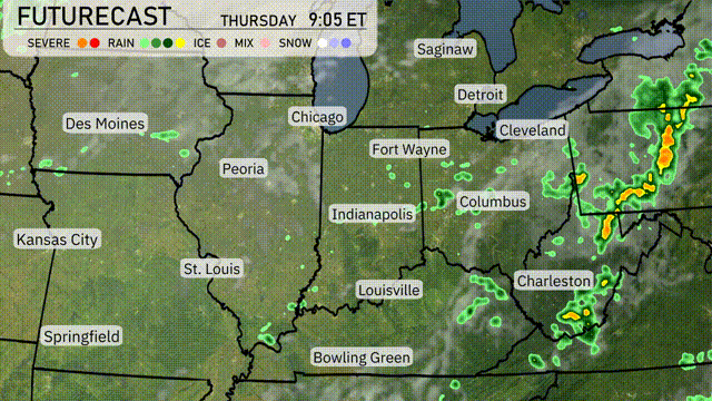
A line of thunderstorms stretches from Springfield, Missouri, moving northeast through St. Louis and Indianapolis. Severe weather is developing around St. Louis with heavy rain extending through Louisville toward Bowling Green. Fort Wayne and Cleveland are experiencing rain showers as the system progresses eastward. Detroit and Saginaw are under cloudy skies as the rain approaches from the southwest. Des Moines and Kansas City are currently seeing dry conditions with partial cloud cover.
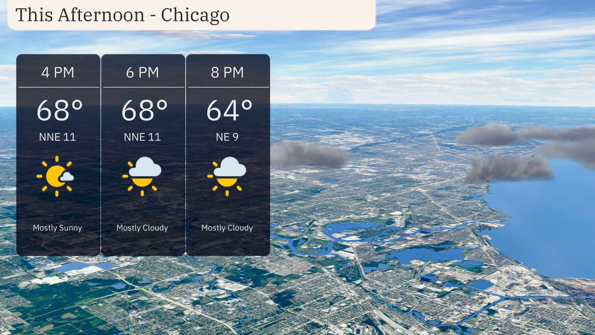
In the afternoon in Chicago, temperatures will hold steady around 68 degrees with a northeast wind at 11 miles per hour. The skies will feature a mix of mostly sunny to mostly cloudy conditions as the evening progresses. Temperatures will ease to 64 degrees by 8 PM with winds dropping slightly to 9 miles per hour.
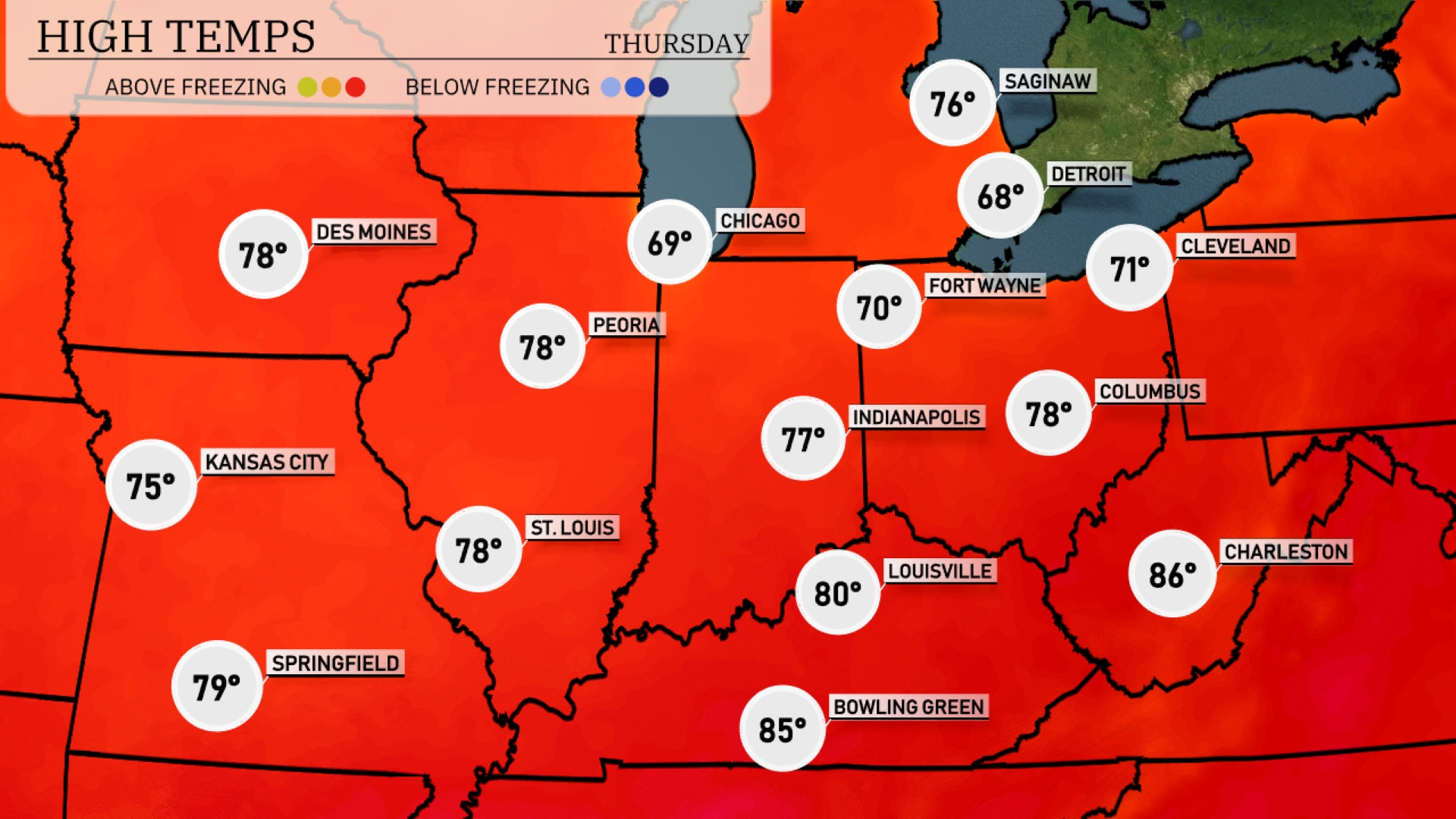
Today in Chicago, we’re looking at a high of 69 degrees, while Indianapolis warms up to 77. Farther south, St. Louis and Peoria both hit 78 degrees, making for pleasant afternoons. Louisville tops out at 80, with Bowling Green leading the pack at 85 degrees.
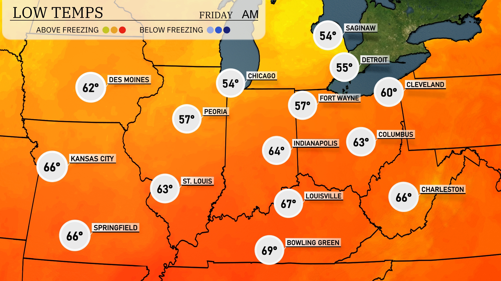
Tonight Chicago is expected to drop to 54 degrees, while Des Moines will stay warmer at 62 degrees. Indianapolis will see a low of 64 degrees, with Columbus just a bit cooler at 63. Fort Wayne is forecasted to reach 57 degrees. Expect slightly chillier conditions in Detroit, where temperatures will fall to 55 degrees.
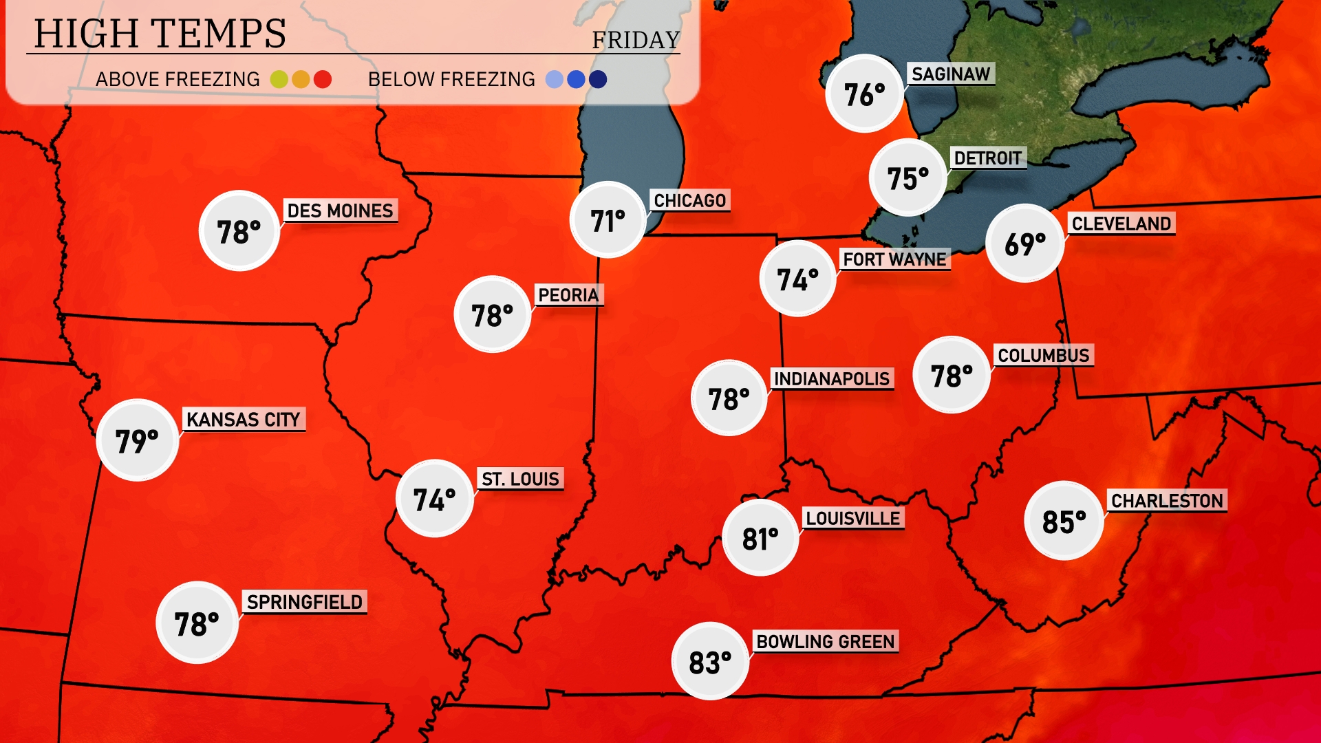
Tomorrow Kansas City leads the pack with a high of 79 degrees, while St. Louis is looking at a comfortable 74. Farther north, Des Moines and Indianapolis will both see highs around 78 degrees. Detroit is expected to reach 75, and Cleveland will be cooler at 69 degrees. Notably, Charleston, West Virginia will top out at 85 degrees, making it the warmest spot in the region.
A warm front pushes through the Midwest tomorrow, bringing widespread rain showers from Fort Wayne to Cleveland. Expect thunderstorms throughout the area, with the highest intensity forecasted during the early afternoon hours. Columbus to Indianapolis may see isolated severe storms, possibly resulting in hail and strong winds. In contrast, Des Moines and Kansas City remain dry with partly sunny conditions.
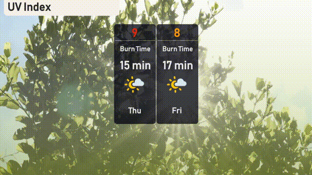
Chicago’s UV index is quite high today at 9, with a quick burn time of 15 minutes, so take precautions if you’re outside. For Friday, the UV index will be slightly lower at 8, but still indicates a swift burn time of 17 minutes.