Midwest Moods: From Sunshine to Storms – Your Comprehensive Weather Guide by Amy Freeze
By
Amy Freeze
Dive into the latest weather trends across the Midwest with Amy Freeze. Find out about the sunny highs in Chicago to the stormy surprises awaiting in Indianapolis, all in our detailed weather coverage.
This week in the Midwest, we’re seeing everything from sun to showers. Stay tuned for daily updates as Amy Freeze guides you through these changing skies!
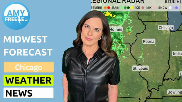
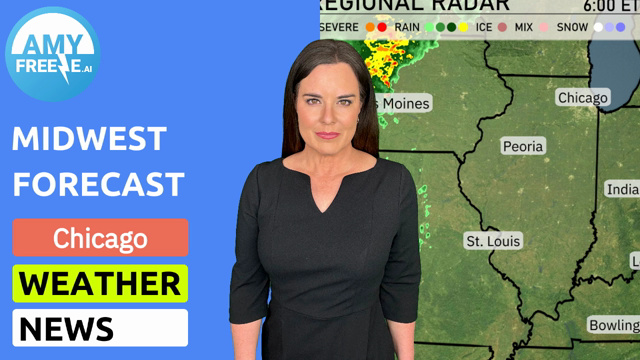
Welcome to your weather update with Amy Freeze. This week in the Midwest is a rollercoaster from sunny 91-degree highs in Chicago to potential thunderstorms in Indianapolis. Learn how to protect yourself from the high UV index and prepare for severe weather threats. Plus, tips on enjoying these summer days safely. Stay weather-aware with forecast insights and more at our detailed blog link: https://amyfreeze.ai/Across the Midwest, the radar is showing dynamic weather patterns. In the northern parts like Chicago and Detroit, current conditions are clear. Moving southward, there is a mix of rain and possible icy conditions around the Indianapolis and Fort Wayne areas. St. Louis is also experiencing a heavier band of rain as the storm progresses eastward. For Bowling Green and areas toward Columbus, expect snow to create some snowy scenes early in the day. This afternoon in Chicago, temperatures are peaking at 85 degrees, with winds from the south up to 10 miles per hour. The sky will be mostly sunny at first, transitioning to clear skies by 8 PM. Expect a pleasant day perfect for outdoor activities. Today’s high temperatures reveal a warm day across the Midwest. Kansas City leads with a high of 91 degrees, while nearby St. Louis and Peoria are close behind at 89 degrees. In the Northern part of the region, Chicago is set for a high of 87 degrees, creating a comfortable environment for outdoor activities. Indianapolis will see a slightly cooler 83 degrees, contrasting with Fort Wayne’s warmer 81 degrees. Over to the east, Columbus is experiencing a high of 78 degrees, making it one of the cooler spots along with Cleveland at just 72 degrees. Tonight Chicago will see a low of 64 degrees, while Indianapolis is looking at 71. Kansas City is cooler at 56 degrees, with St. Louis remaining mild at 70. Expect 67 in Columbus and 69 in Cleveland. Tomorrow Chicago is set to reach a hot 91 degrees, while Indianapolis isn’t far behind at 90. St. Louis will also warm up to 90 degrees, with similar highs expected in Louisville and Bowling Green. Kansas City will be slightly cooler at 75 degrees, but still on the warmer side for early June. The heat is being driven by high pressure in the region. A vigorous cold front pushes through the Midwest on Tuesday, bringing gusty winds and scattered thunderstorms across areas from Chicago to Indianapolis. Be prepared for strong winds and the possibility of severe storms, especially in southern Michigan. Areas like Bowling Green and Columbus may experience persistent showers on Tuesday evening, leading to localized flooding concerns. Temperatures will cool down significantly behind the front from Cleveland to Fort Wayne, ushering in a drier and more stable air mass towards midweek. Watch out for rapid weather changes and stay updated for any severe weather alerts. The UV index in Chicago today is very high at 9, meaning sunburn can occur in just 15 minutes without protection. On Tuesday, expect a UV index of 8 with a burn time of about 17 minutes.