From Chilly Winds to Sunny Skies: Your Comprehensive Midwest Weather Update
By
Amy Freeze
Join Amy Freeze as she navigates the intriguing shifts in Midwest weather, from cool rains to warmer, clearer days ahead. Get all the details on what to expect right outside your front door in our latest blog post.
A dynamic weather pattern is set to move through the Midwest, bringing a mix of conditions from showers to clear skies. Check out our latest blog post to learn more about what Amy Freeze predicts for the coming days.
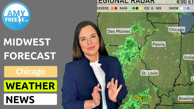
As a cold front moves east through the Midwest, weather dynamics are rapidly changing. From Chicago to Cleveland, rain and snow affect travel and outdoor plans, while cities like Des Moines enjoy dry skies. Dive deeper with Amy Freeze into how these conditions develop and what they mean for your week ahead in our comprehensive blog post. Stay ahead of the weather with expert insights and tips!
A line of rain showers is sweeping across the Midwest, stretching from Chicago all the way to Cleveland, with heavy rain particularly affecting Fort Wayne and Columbus. Saginaw is experiencing some lighter rain. Snow is visible in areas slightly northeast around Lake Erie. Indianapolis is currently under cloudy skies as the system moves eastward. Elsewhere, cities like Des Moines and St. Louis remain in the clear, enjoying dry conditions.
For this evening in Chicago, expect temperatures to gradually decrease from 63 degrees at 9 PM to 58 degrees by 1 AM. The skies will transition from partly cloudy to clear as the evening progresses. Winds will be calm, shifting from an easterly direction at 3 mph early in the evening.
Tonight in the Midwest, expect chilly conditions as a cold front moves through. Chicago will drop to 47 degrees, while Fort Wayne cooler at 49 degrees. Indianapolis is looking at a low of 56 degrees, and further west, St. Louis will see a mild 57 degrees. Meanwhile, Kansas City stands at a low of 56 degrees. Notably, Saginaw will be the coldest at 41 degrees, marking a significant drop in temperatures across the region.
Tomorrow, temperatures in the Midwest will generally be above average as warmer air moves in. Des Moines is set to reach a high of 79 degrees, while Peoria will see a warm 80. In Chicago, expect a cooler but comfortable 67 degrees. Kansas City will hit a high of 67 degrees, and Indianapolis will warm up to 79.
A weather system is moving through the Midwest, starting with light rain across areas like Detroit and Cleveland, which will clear by midday. By tomorrow, expect a mix of sun and clouds from Chicago to Indianapolis, with daytime highs reaching the low 70s. There’s a risk for thunderstorms in the late afternoon, especially from Bowling Green to Louisville, due to an advancing cold front. These storms may bring gusty winds and brief downpours, so keep an umbrella handy. Overnight, cooler air settles in, bringing temperatures down to the low 50s in regions like Springfield and St. Louis.
The UV index in Chicago on Tuesday is expected to reach a high of 7, which presents a high risk of harm from unprotected sun exposure with a burn time of about 20 minutes. As we move into Wednesday, the index slightly decreases to 6, indicating a moderate risk with a burn time of approximately 23 minutes.
For the 7-day forecast in Chicago:
Tuesday: A pleasant day ahead with partly cloudy skies, highs reaching 72 degrees, and lows of 54 degrees.
Wednesday: Mostly cloudy, cooler weather arriving with a high near 64 degrees and a low of 47.
Thursday: Clear skies with temperatures dipping to a high of 55 degrees, and an overnight low of 43 degrees.
Friday: Mostly clear throughout the day with a warming trend, high temperatures hitting 61 degrees and a low of 45.
Saturday: Sunnier skies with temperatures rising further, expect a high of 69 degrees and a low of 48.
Sunday: Clear and lovely with a daytime high of 71 degrees and a nighttime low of 55.
Monday: Partly cloudy conditions as temperatures climb to 76 degrees, with a comfortable low of 59.
Enjoy the weather, Chicago!