From Drizzles to Breezes: Tracking This Week’s Midwest Weather with Amy Freeze
By
Amy Freeze
The Midwest is experiencing a mixed bag of weather this week. Meteorologist Amy Freeze guides us through the varying conditions, from chilly lows in Des Moines to balmy highs in Charleston.
Dive into this week’s detailed Midwest weather forecast with meteorologist Amy Freeze. Expect a range from frosty lows to sunny highs across the region. Stay informed and prepared!
Welcome to our detailed overview of this week’s weather in the Midwest, brought to you by renowned meteorologist Amy Freeze. As cold fronts sweep through, causing temperature dips and gusty winds, the Midwest prepares for a mix of conditions. From night temperatures dropping into the 20s to sunny day highs reaching the 80s, each city in the region faces unique weather. This blog delves into daily specifics, safety tips for the impending storms, and how you can best prepare for each day. Keep this guide handy to navigate your week with ease!
On the Regional Radar this morning, we’ve got some weather activity to talk about in the Midwest! Up north, near Saginaw, a swath of snow is keeping things chilly and creating slick travel conditions. Detroit is no stranger to these snowy patches today, as they extend into the area. Cleveland is also seeing snow flurries that are expected to continue as the system moves westward. Moving south, locations like Fort Wayne and Indianapolis are experiencing overcast conditions with snow expected shortly. In Chicago and Peoria, it’s damp and drizzly with rain showers moving across the region. Meanwhile, folks in St. Louis and Springfield are enjoying dry conditions—great news for any afternoon plans! Farther west, Des Moines and Kansas City stay dry and calm for now.
For this evening in Chicago, temperatures start at 61 degrees at 8 PM, dipping to 59 degrees by 10 PM and settling at 58 degrees by midnight. Expect mostly cloudy skies initially, transitioning to partly cloudy later, and then to cloudy conditions. Winds will maintain a south-southeast to south direction, with speeds gradually increasing from 8 to 10 miles per hour through the evening hours.
Now for the low temperatures across the Midwest. Tonight, expect a frosty start with temperatures dipping into the 20s in several areas. Des Moines will see a chilly low of 26 degrees. Kansas City is forecasted to hit 30 degrees, while Springfield will settle at 31. Peoria will hit the freezing mark at 32 degrees. St. Louis will be slightly warmer, ending the night at 35 degrees. Indianapolis should see a low of 39, while Louisville sits at 42 degrees. Fort Wayne is expected to cool down to 38 degrees. Expect notably cooler air sweeping in overnight, so bundle up if you’re heading out!
High temperatures for tomorrow across the Midwest show a range of readings, with some areas experiencing slightly above-average temperatures.
Chicago reaches a high of 60 degrees, while Peoria will enjoy 69 degrees. In St. Louis, temperatures climb to a warm 72. Indianapolis is expected to hit 67 degrees, and over in Cleveland, look for a high of 71 degrees. More significant warmth can be found further south, as Charleston anticipates a very warm 85 degrees.
These temperatures are influenced by a warm air mass moving into the region, resulting in a pleasant day for many. However, the northern tier, including Des Moines, will face cooler conditions, struggling to reach just 47 degrees. Overall, a contrast is evident, with areas to the north feeling the effects of lingering cold while southern locations bask in above-average warmth.
“A cold front is sweeping through the Midwest, bringing temperature drops and gusty winds. Expect showers and isolated thunderstorms, primarily impacting areas from St. Louis to Indianapolis. As the front progresses, cooler air settles in with a noticeable drop by Wednesday night. Prepare for potential localized flooding, particularly around low-lying areas in Springfield and Des Moines. Chicago and Detroit will experience breezy conditions with scattered showers, clearing by midweek. Keep an eye out for severe weather alerts, especially across southern Illinois and Indiana, where storm intensity may heighten.”
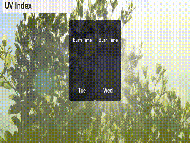
The UV index in Chicago is low and will not be significant today or tomorrow due to the storm system blocking harmful rays.
For the 7 Day Outlook in Chicago:
Wednesday: Mostly cloudy with a high of 62 degrees, and a nighttime low of 33.
Thursday: Expect rain transitioning to snow as temperatures peak at 44 degrees and drop to 32 overnight.
Friday: Enjoy a mostly clear day with a high of 57 degrees, cooling to 33 at night.
Saturday: Showers expected early, with a high reaching 40 degrees and a low of 33.
Sunday: Partly cloudy conditions, warming up to 47 degrees and dropping to 36 after dark.
Monday: The day begins with rain changing to snow, with a high of 43 degrees and a low of 33.
Tuesday: Partly cloudy skies return, with a daytime high of 46 degrees and a low of 33.