Midwest Weather Warnings: Storms Approaching Chicago
By
Amy Freeze
Stay updated with the latest weather patterns affecting Chicago and the wider Midwest region. From sunny spells to storm warnings, we’ve got you covered.
Explore our latest blog on the evolving weather conditions in Chicago and the Midwest. Expect a mix of sunny intervals and possible thunderstorms as we head into the week.
This comprehensive guide provides detailed insights into the current weather conditions sweeping across Chicago and the Midwest. From temperature variations to looming storms, understand how these changes can impact your week and how to best prepare for them.
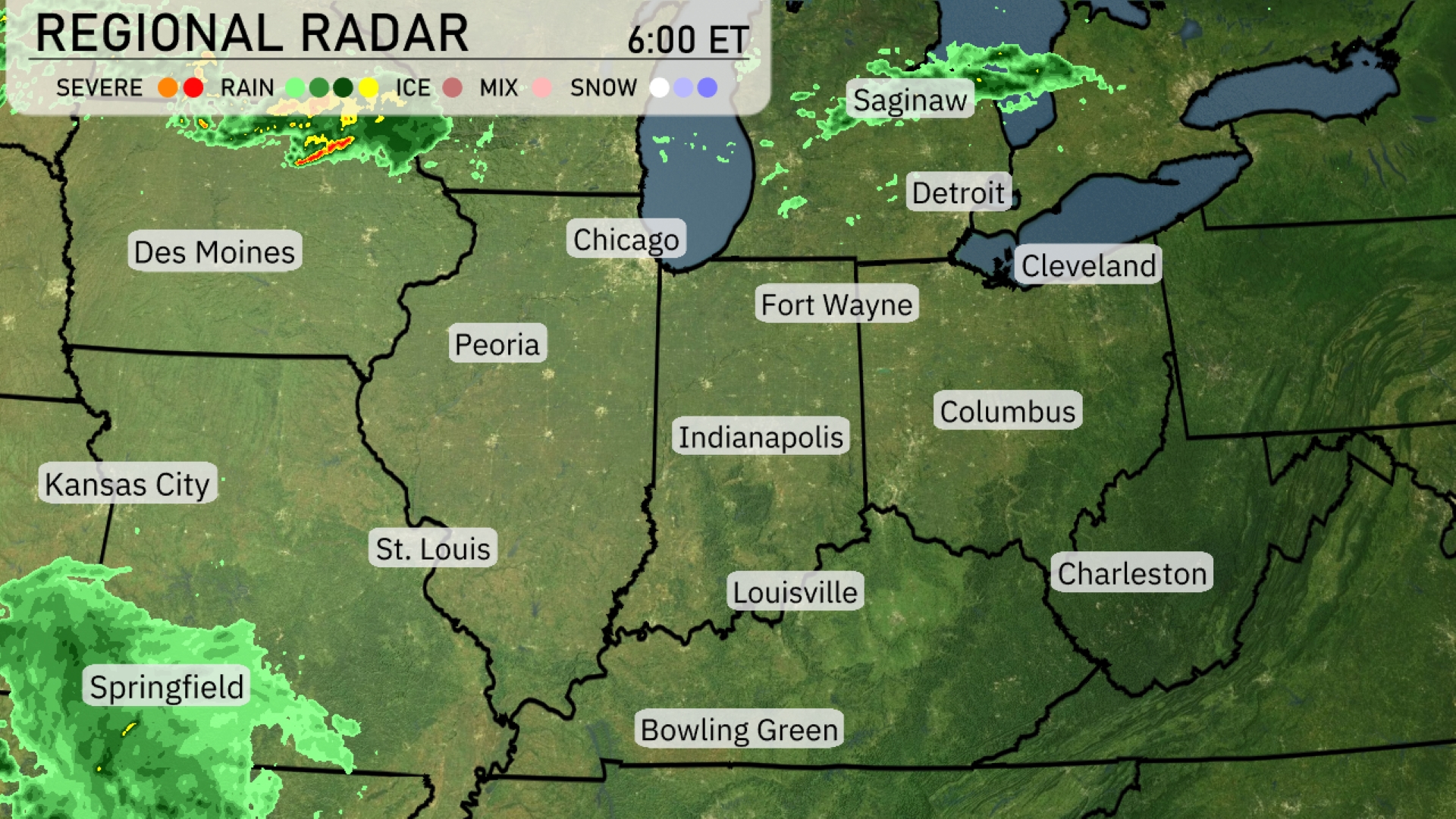
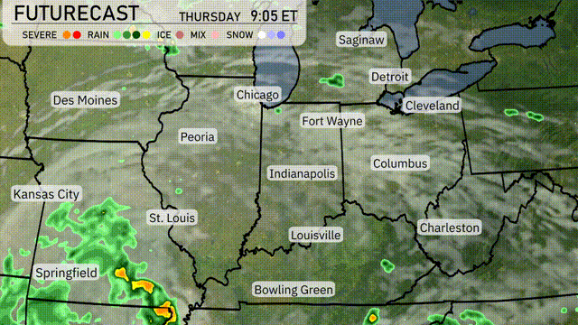
On the Regional Radar, the Midwest is experiencing scattered weather conditions. A cluster of severe storms is situated in northwest Iowa, moving toward Des Moines. Rain and thunderstorms are pushing southeast towards Chicago and its surrounding areas. A separate area of rain showers is drifting toward Springfield providing some moisture to the region.
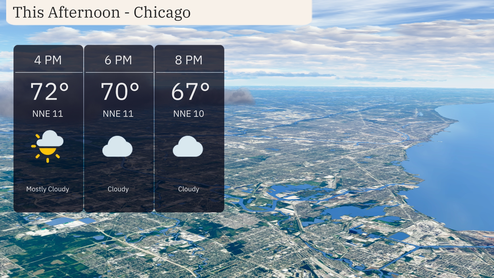
Expect a mostly cloudy afternoon in Chicago with temperatures starting at 72 degrees at 4 PM, gradually cooling to 67 degrees by 8 PM. Winds will be coming from the north-northeast at around 11 miles per hour, easing slightly to 10 miles per hour later.
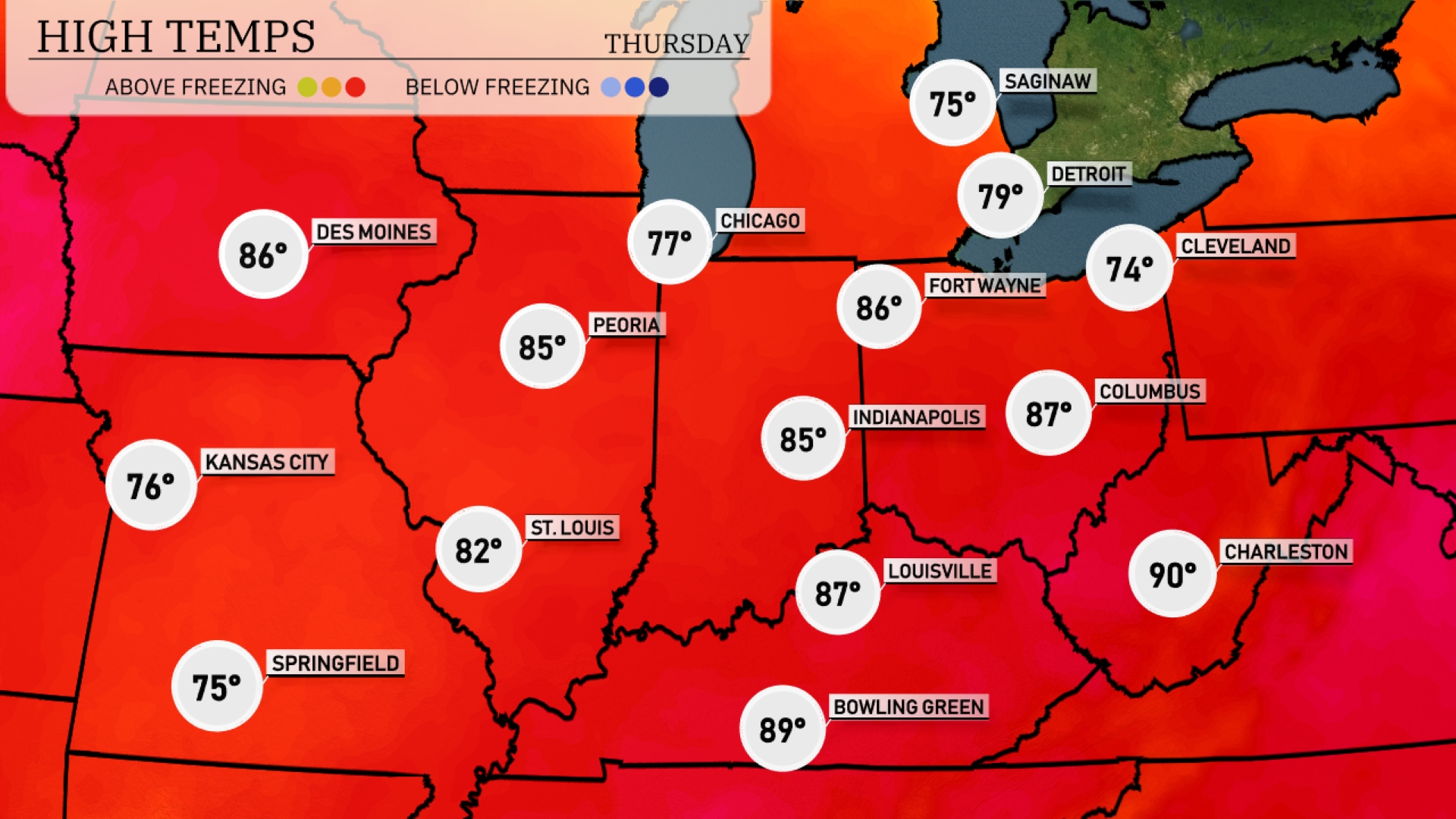
In the Midwest today, we’re seeing warm temperatures across the board. Chicago is enjoying a pleasant high of 77 degrees, while further south in Indianapolis, temperatures climb to 85. Peoria will hit 85 as well, and Louisville is warming up to 87. Just to the east, Columbus reaches 87 degrees, but it’s a bit cooler in Cleveland with a high of 74. Bowling Green hits an impressive 89 degrees, showcasing the warmth in the southern parts of the region.
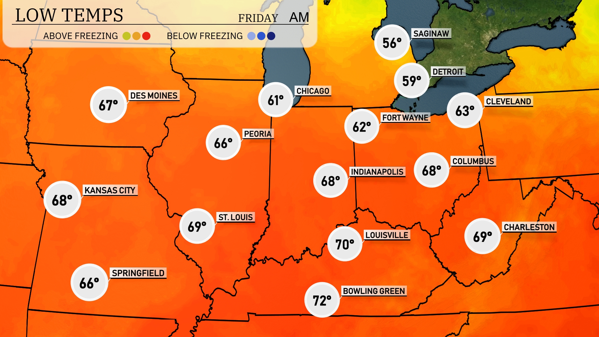
Tonight, low temperatures across the Midwest are expected to vary widely. Chicago will dip to 61 degrees, while Des Moines holds steady at 67. Indianapolis and Columbus are forecasted to see lows of 68 degrees, with St. Louis slightly cooler at 69. Fort Wayne will be among the cooler spots, dropping to 62 degrees.
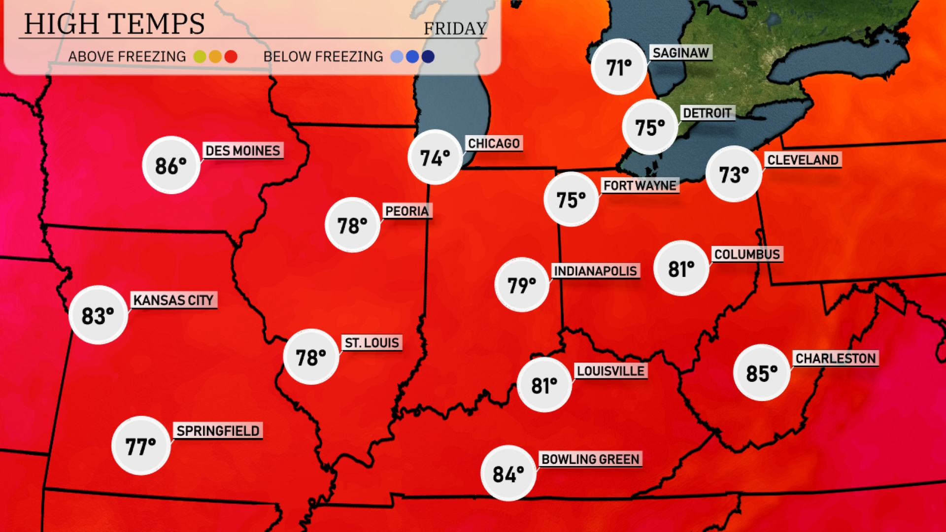
Tomorrow in Des Moines expect a very warm high of 86 degrees. Kansas City will see temperatures reach 83, while St. Louis is not far behind at 78 degrees. Indianapolis and Louisville will experience pleasant highs of 79 and 81 degrees, respectively. Cleveland will be cooler at 73, continuing a trend of below-average temperatures for the Great Lakes region.
A frontal system is moving into the Midwest, bringing rain and a chance of thunderstorms starting Thursday morning, particularly affecting areas from Kansas City to Indianapolis. Watch for heavier downpours along the I-70 corridor in the afternoon, possibly leading to localized flooding. Temperatures will remain warm ahead of the front, but expect a cooler shift by Friday with clearing skies. In the northern stretches, such as Chicago and Detroit, showers are more scattered, with less severe weather activity anticipated.
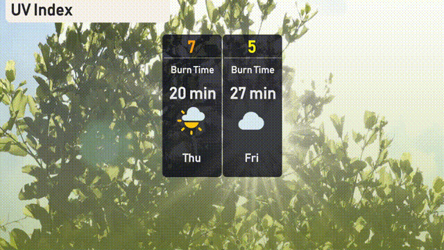
Today in Chicago, the UV index is high at 7, so be cautious as sunburn can occur in about 20 minutes if you’re outside. By Friday, the index lowers to 5, offering a bit more protection but still requiring attention, with a potential burn time of 27 minutes