Midwest Weather Watch: A Mixed Bag of Sun, Clouds, and Storms
By
Amy Freeze
Discover the dynamics of Midwest weather, from sunny Chicago mornings to stormy skies across the region.
This June 6, dive into an informative overview of what to expect weather-wise across Chicago and the Midwest—your comprehensive guide to staying prepared and informed.
Greetings, weather enthusiasts! Today’s Midwest forecast spans everything from Chicago’s partly cloudy skies to severe storms targeting St. Louis. Chicago enjoys a mild start with temperatures in the pleasant highs, but keep an umbrella handy, as rain is set to cover regions from Detroit to Charleston. Stay updated on storm progress and temperature fluctuations as we provide continual insights right here.
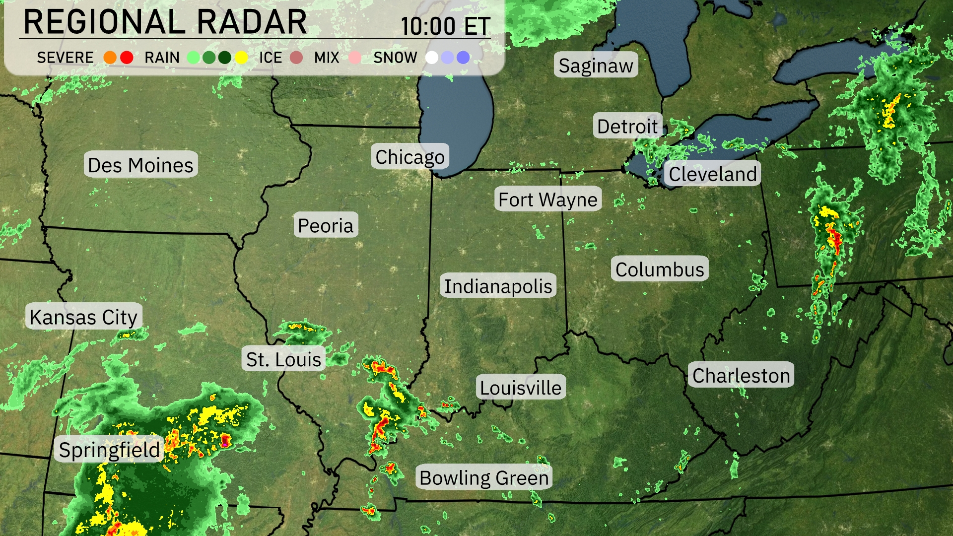
Across the Midwest, a notable cluster of precipitation can be seen moving towards St. Louis, marked by severe storms bringing heavy rain. Springfield is also experiencing persistent rainfall, contributing to the wet conditions in the region. To the northeast, light rain is brushing the areas around Detroit and Cleveland as showers extend southward towards Charleston. Chicago and Indianapolis remain under clear skies as of now, providing a break from the storm activity.
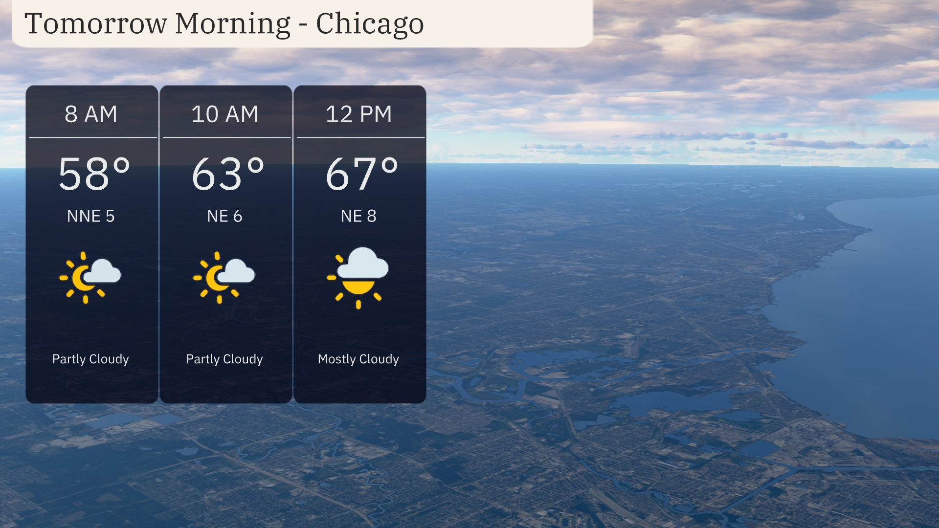
A partly cloudy start to the morning in Chicago with temperatures around 58 degrees at 8 AM, experiencing a gentle NNE breeze at 5 miles per hour. Moving toward 10 AM, the temperature rises to 63 degrees with continued partly cloudy skies and a NNE breeze at 6 miles per hour. By 12 PM, expect mostly cloudy skies with temperatures reaching 67 degrees and winds picking up slightly to NNE 8 miles per hour.
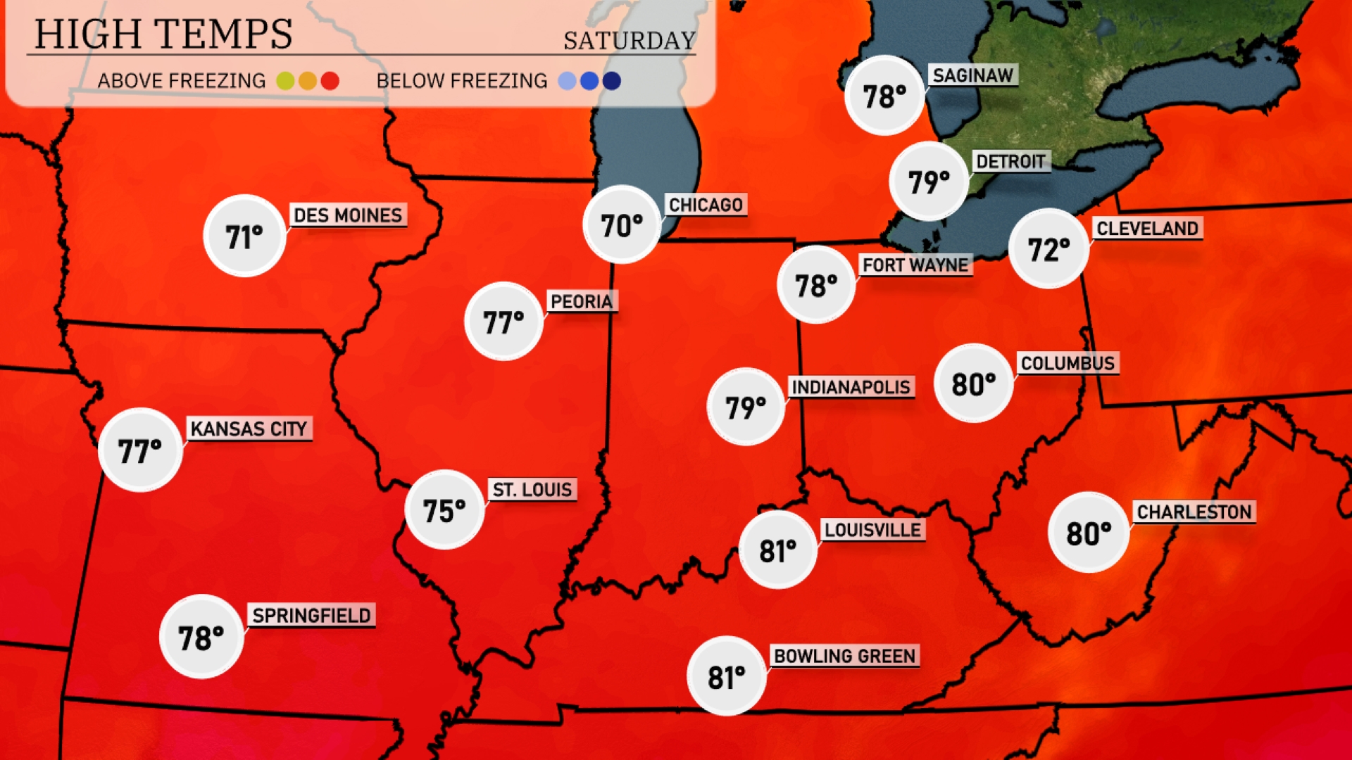
Tomorrow, expect a warm day across the Midwest. Chicago will reach a high of 70 degrees, while Des Moines warms to 71. St. Louis is looking at a pleasant 75 degrees, with Kansas City slightly warmer at 77. Indianapolis will see a notable high of 79 degrees, and both Louisville and Bowling Green may hit 81 degrees
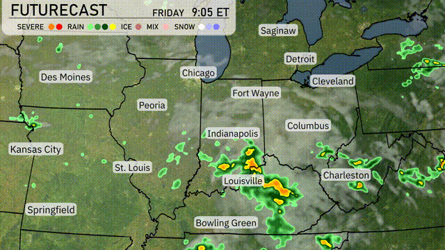
Showers and thunderstorms are expected to sweep across the Midwest starting Friday morning. Areas from Indianapolis to Louisville may experience heavy rainfall and isolated severe storms, with a focus on afternoon and evening hours. There is potential for localized flooding due to the intensity of storms in Louisville and Indy. Temperatures will remain warm, but cooler air is on the heels of a trailing cold front moving in from the west. The front is expected to clear by Saturday, bringing drier and slightly cooler conditions.
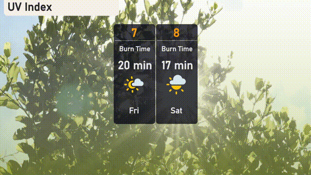
Chicago can expect a high UV index of 7 on Friday, creating a burn time of about 20 minutes in the sun. As we move into Saturday, the UV index climbs to 8, with an even quicker burn time of 17 minutes.
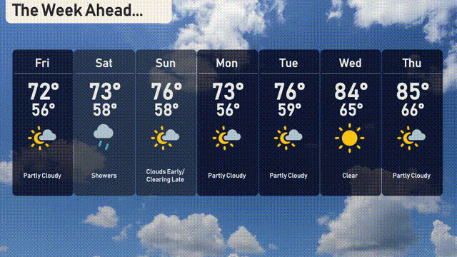
Friday: Partly cloudy with a high of 72 degrees and a low of 56 degrees.
Saturday: Expect showers with temperatures reaching 73 degrees and dipping to 58 degrees.
Sunday: Clouds early with clearing late, highs around 76 degrees and lows at 58 degrees.
Monday: Partly cloudy skies, a high of 73 degrees, and a low of 56 degrees.
Tuesday: Mostly sunny, warming up to 76 degrees during the day and cooling off to 59 degrees at night.
Wednesday: A clear day with temperatures peaking at 84 degrees and a low of 65 degrees.
Thursday: Partly cloudy with a high of 85 degrees and a low of 66 degrees.