Week Ahead in Weather: Warm Days and Stormy Nights in the Midwest
By
Amy Freeze
Your complete guide to this week's weather across the Midwest, featuring temperature trends and severe storm alerts. Stay informed and prepared!
Dive into the latest weather trends with a detailed look at temperatures, severe weather alerts, and safety tips for the upcoming week across Chicago and the Midwest.
Welcome to your detailed Midwest weather guide! This week in Chicago, anticipate a mix of partly cloudy skies and potential severe weather, including thunderstorm alerts. We’re tracking temperatures that range from pleasant highs in the mid-to-upper 80s to stormy evenings that could escalate into severe weather conditions by the weekend. Don’t miss out on our daily weather insights and prepare effectively for every sun, cloud, and raindrop!
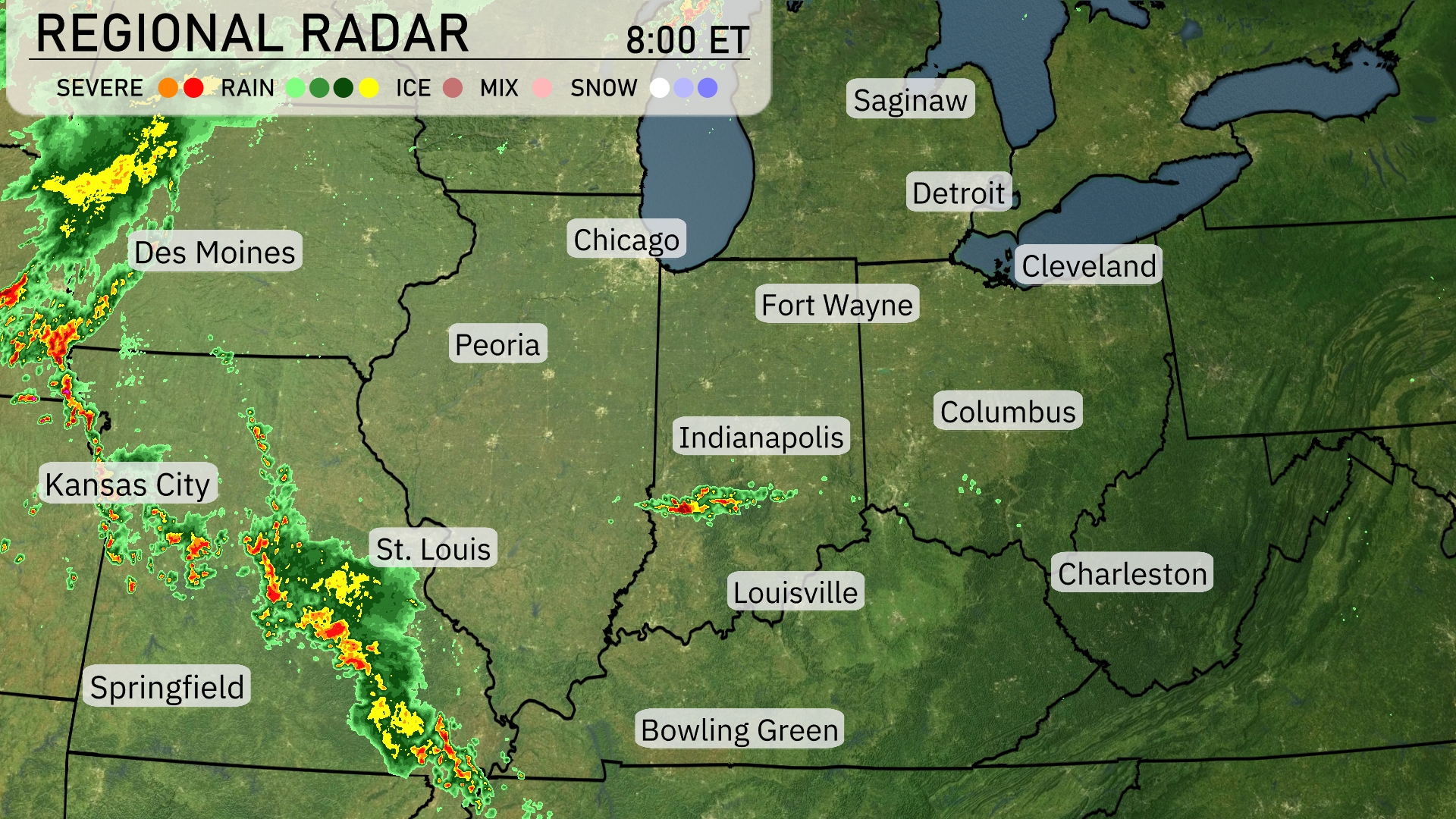
A line of storms is advancing across the Midwest, with intense weather currently affecting areas from St. Louis to Springfield. Kansas City and Des Moines are seeing rain mixed with severe weather conditions. Indianapolis and Louisville are under scattered light showers. It’s clear from Chicago extending to Cleveland and Detroit, offering calm weather conditions this morning.
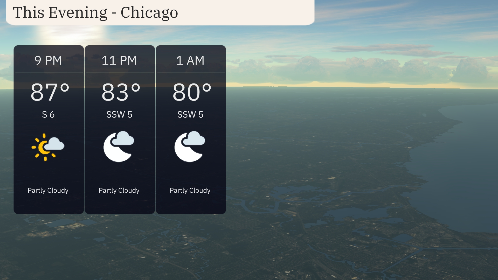
For this evening in Chicago, expect partly cloudy skies with temperatures decreasing from 87 degrees at 9 PM to 80 degrees by 1 AM. Winds will be gentle, blowing from the south to southwest at 5 to 6 miles per hour. Overall, a pleasant night with mild conditions is expected.
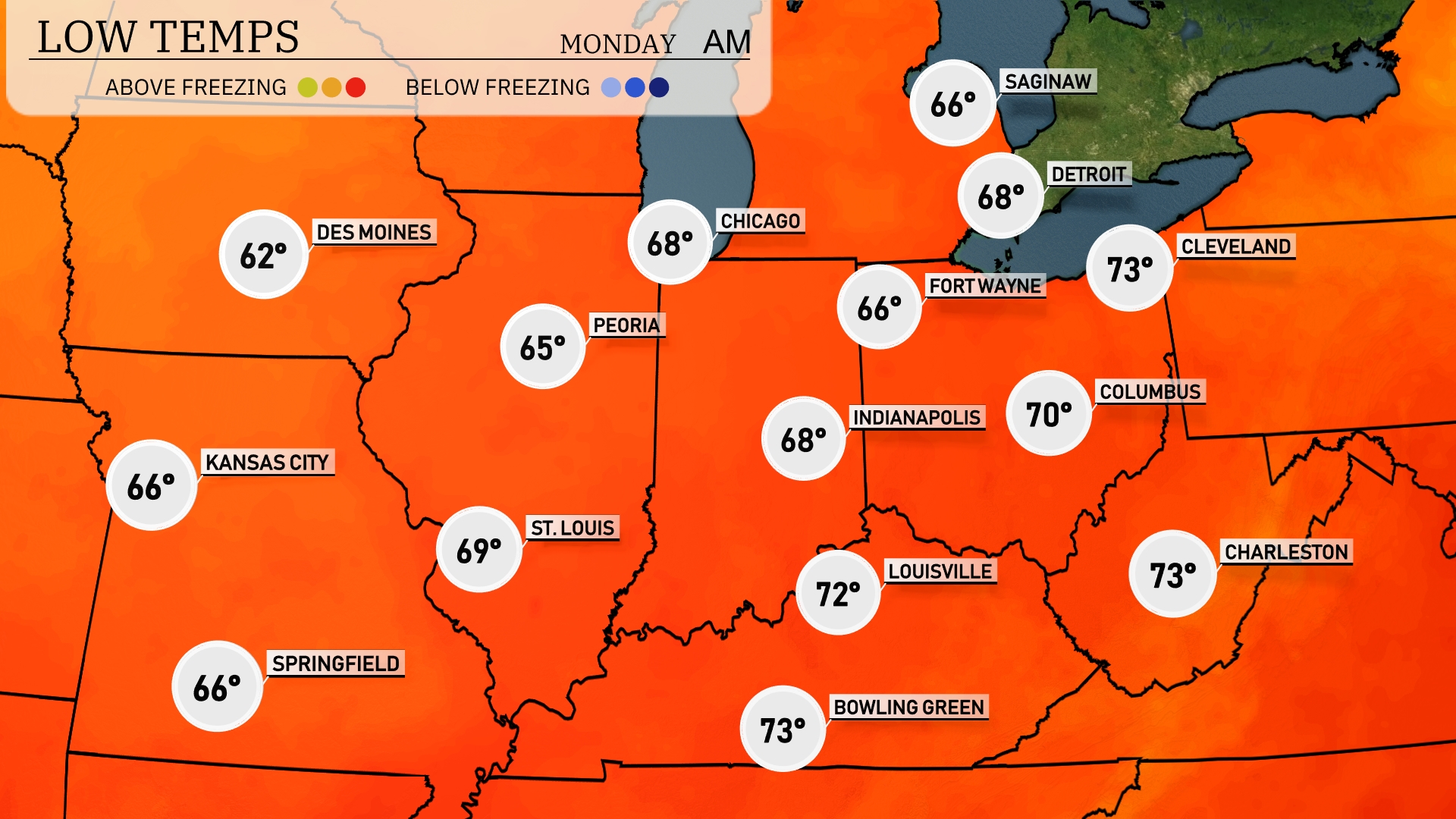
Tonight, temperatures in the Midwest will drop significantly, with Chicago expected to see a low of 68 degrees. St. Louis will cool down to 69 degrees, while Indianapolis will rest at 68. In contrast, further south, Louisville will have a milder low of 72 degrees. Expect a slight chill in the air as these cool temperatures settle in.
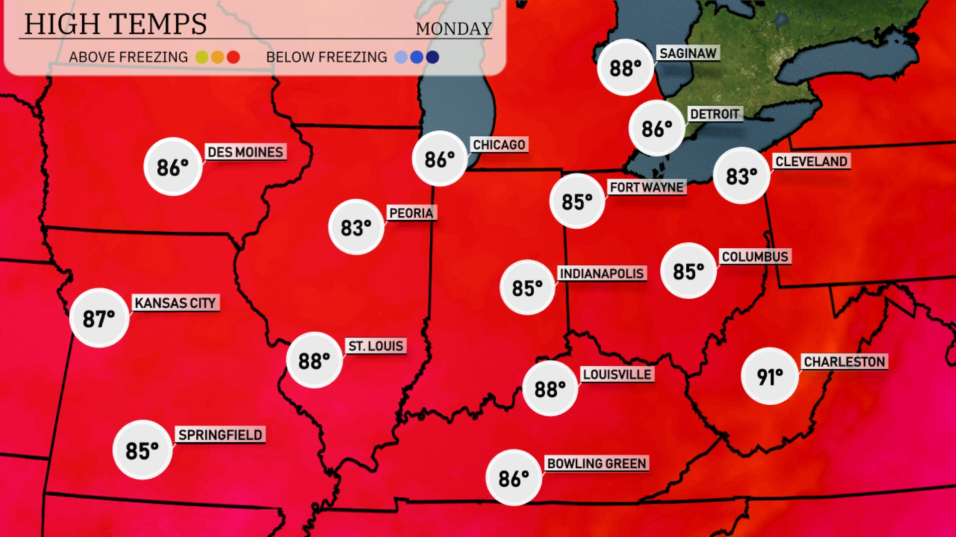
Tomorrow, the Midwest will see warm temperatures with highs expected to reach 88 degrees in St. Louis and Louisville. Kansas City will follow closely with a high of 87 degrees, while Peoria and Indianapolis will enjoy cooler but still pleasant highs of 83 and 85 degrees, respectively. Fort Wayne and Cleveland will see similar temperatures, with highs around 85 and 83 degrees. Overall, temperatures are trending above average for this time of year, driven by a warm air mass moving through the region.
For the Midwest, expect a strong line of thunderstorms to move through from Des Moines to Fort Wayne by Sunday evening, with potential for damaging winds and heavy rainfall. The risk of severe weather is particularly heightened around Chicago and Indianapolis. Thunderstorms will gradually shift southeast by Monday morning, impacting Louisville and Bowling Green. Following the storm system, cooler and drier conditions settle in, leading to a mild start to the week. Keep alert for severe weather alerts and be cautious of any rapid rainfall that could lead to localized flooding.
The UV index in Chicago will be high on Sunday with a rating of 9, indicating a burn time of approximately 15 minutes under direct sunlight. On Monday, expect a slightly lower UV index of 7, with a burn time of about 20 minutes. Be sure to take extra precautions when outdoors, including applying sunscreen and wearing protective clothing.
For the 7-day forecast in Chicago:
Sunday: Partly cloudy skies with a high of 93 degrees and a low of 75 degrees.
Monday: Expect partly cloudy conditions, cooling slightly with a high of 86 degrees and a low of 68 degrees.
Tuesday: Enjoy clear skies as temperatures reach up to 87 degrees and dip to 69 degrees overnight.
Wednesday: Partly cloudy weather continues with a warm high of 89 degrees and a low of 70 degrees.
Thursday: Partly cloudy again, bringing temperatures around 88 degrees for a high and 72 degrees for a low.
Friday: The sun peeks out, partly cloudy with a high of 92 degrees and a nighttime low of 76 degrees.
Saturday: Scattered thunderstorms are possible, with temperatures climbing to 94 degrees and a low of 75 degrees.
Stay safe and enjoy the weather ahead!