New York Weather Whirl: Spring Arrives with Clouds and Showers
By
Amy Freeze
Meteorologist Amy Freeze guides you through a detailed forecast as the Northeast ushers in Spring with a mix of mild and chilly temperatures. Find out what the weather holds this week in NYC!
Dive into the start of Spring with Meteorologist Amy Freeze as she details the coming weather changes across NYC and the Northeast. From occasional rain to the varying temperatures, get prepared with Amy’s insightful forecast!
Welcome to Spring in New York City! Amy Freeze is here with the latest weather updates on this pivotal first day of the season. The Northeast sees a variety of weather conditions today, from cloudy skies in NYC to rain showers moving through from Buffalo to Syracuse. Expect temperatures to take a mild dip through the evening, leading into a cooler weekend. In our comprehensive blog post, Amy Freeze explains the detailed weather patterns, giving you all the necessary forecasts to plan your week effectively. Don’t miss out on this essential read for all NYC and Northeast inhabitants as Spring begins to unfold!
Across the Northeast, today’s radar indicates that showers are advancing eastward from the Great Lakes region. Buffalo is currently under a line of rain showers, which extends east into the southwestern part of New York. As we move farther east, cities like Syracuse are set for wetter conditions, with clouds increasing ahead of the front. Albany and the upper Hudson Valley remain mostly dry for now, but you should keep an umbrella handy as precipitation edges closer. In New York City, skies are partly cloudy with no immediate showers, allowing for a clear afternoon commute. Down in Philadelphia and Washington, D.C., skies remain clear, providing a rather mild start to the day. Up north in Portland and Boston, conditions are relatively calm, with skies showing minimal cloud cover and opportunities for some sunshine.
Afternoon in New York City brings cloud cover with temperatures around 54 degrees by 3 PM. Winds are from the southeast at 10 miles per hour. As we move into the late afternoon, temperatures dip to 52 degrees accompanied by foggy conditions around 5 PM. By 7 PM, expect a further drop to 49 degrees with showers likely and gentler southeast winds at 6 miles per hour.
Let’s take a look at today’s high temperatures across the Northeast. It’s a mix of mild and warm conditions. Pittsburgh reaches a high of 66 degrees, while Philadelphia matches that with 66 as well. Scranton sees a nice day at 64 degrees, but New York is a bit cooler with a high of just 55 degrees. Further north, Albany is slightly warmer at 63 degrees, while Syracuse enjoys a high of 65. Boston remains on the chilly side with a high of only 54 degrees, and Portland is even cooler at 44 degrees. Overall, we’re seeing some pleasant temperatures, but the coastal areas are experiencing a notable chill compared to the inland cities.
Now for the low temperatures in the Northeast. Expect a cold night ahead, with Albany dropping to 30 degrees. Scranton will see a low of 35, while Philadelphia dips down to 37. New York City is set to cool to 39 degrees, and Boston will be chilly at 35. Meanwhile, Buffalo will have a low of 37, and Syracuse will hit 36. Notably, Burlington is forecasted to be the coldest in the region at 31 degrees, with Portland just above at 32. Overall, be prepared for a brisk and frosty start tomorrow.
High temperatures for the Northeast region tomorrow are expected to be slightly below average as a cold front moves through. Boston will see a high of 47 degrees. Providence is looking at temperatures reaching 46 degrees. New York City will manage to warm up to 54 degrees.
Philadelphia is expected to hit 55 degrees, experiencing the warmest conditions in the region.
Pittsburgh will see a high of 55 degrees as well.
Buffalo remains cooler at 41 degrees.
Overall, while some areas will feel a chill, expect partly cloudy skies and a continuation of seasonal temperatures in the Northeast.
“A cold front advances across the Northeast impacting cities from Washington, D.C. to Boston. An embedded line of thunderstorms with heavy rain and strong winds will be a concern through Thursday afternoon. Philadelphia and New York City should anticipate potential severe weather, including gusty winds and heavy downpours. By evening, conditions shift toward New England, bringing substantial precipitation to Portland and Boston. Be mindful of localized flooding with more than an inch of rain expected. Temperature fluctuations may lead to cooler air behind the front, bringing a more mild weekend ahead.”
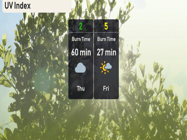
Today in NYC, the UV index is low at 2, meaning sun protection isn’t a big concern today due to cloud cover reducing UV exposure. On Friday, expect a higher UV index of 5, with potential burn time in about 27 minutes, so consider sunscreen and a hat if you’ll be outdoors.