Navigating Through Smoke: NYC’s Air Quality Alert and a Week of Weather Waves
By
Amy Freeze
Explore how NYC's air quality is affected by Canadian wildfires and what this means for your week ahead in terms of weather changes. Get the latest forecasts and safety tips.
From smoky skies to sunny days, NYC experiences a diverse week of weather. Tune in for the latest air quality alerts and what the forecast holds.
This week in New York City begins under a blanket of smoke from distant Canadian wildfires, impacting air quality significantly. As the week progresses, we see a mix of temperatures climbing well above the seasonal average, with a high-pressure system contributing to mostly sunny skies. By midweek, however, a cold front will bring cloudy conditions and potential thunderstorms, drastically altering the clear start. End the week with lower temperatures and clearer skies as we break down each day’s forecast in detail.
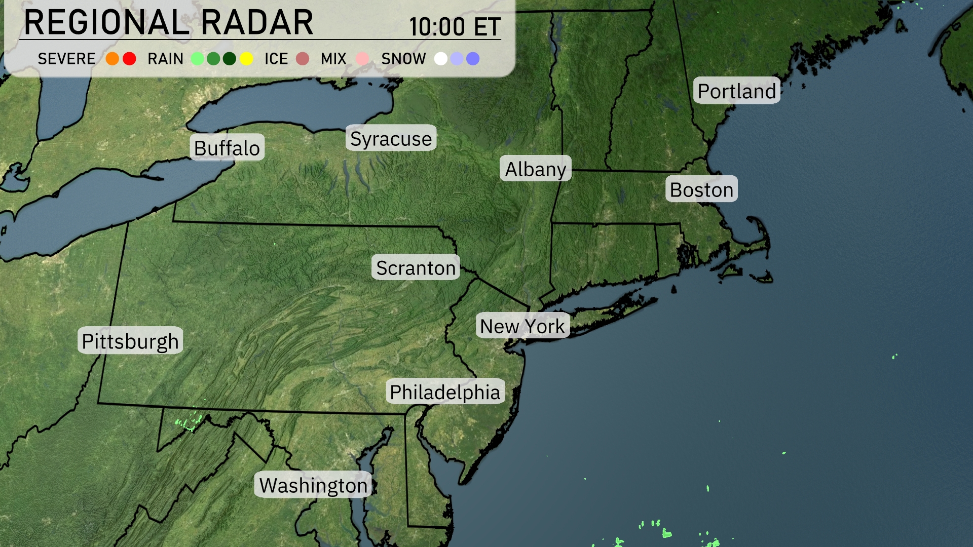
The Northeast radar shows rain free conditions for much of the region, including New York City, Scranton, and Syracuse. Boston and Portland are also experiencing calm weather without any signs of rain or storms at this moment. Some light showers appear to be developing off the coast, suggesting a possible shift in conditions later. Buffalo, Albany, and Philadelphia can enjoy a quiet weather day with skies remaining cloud-free.
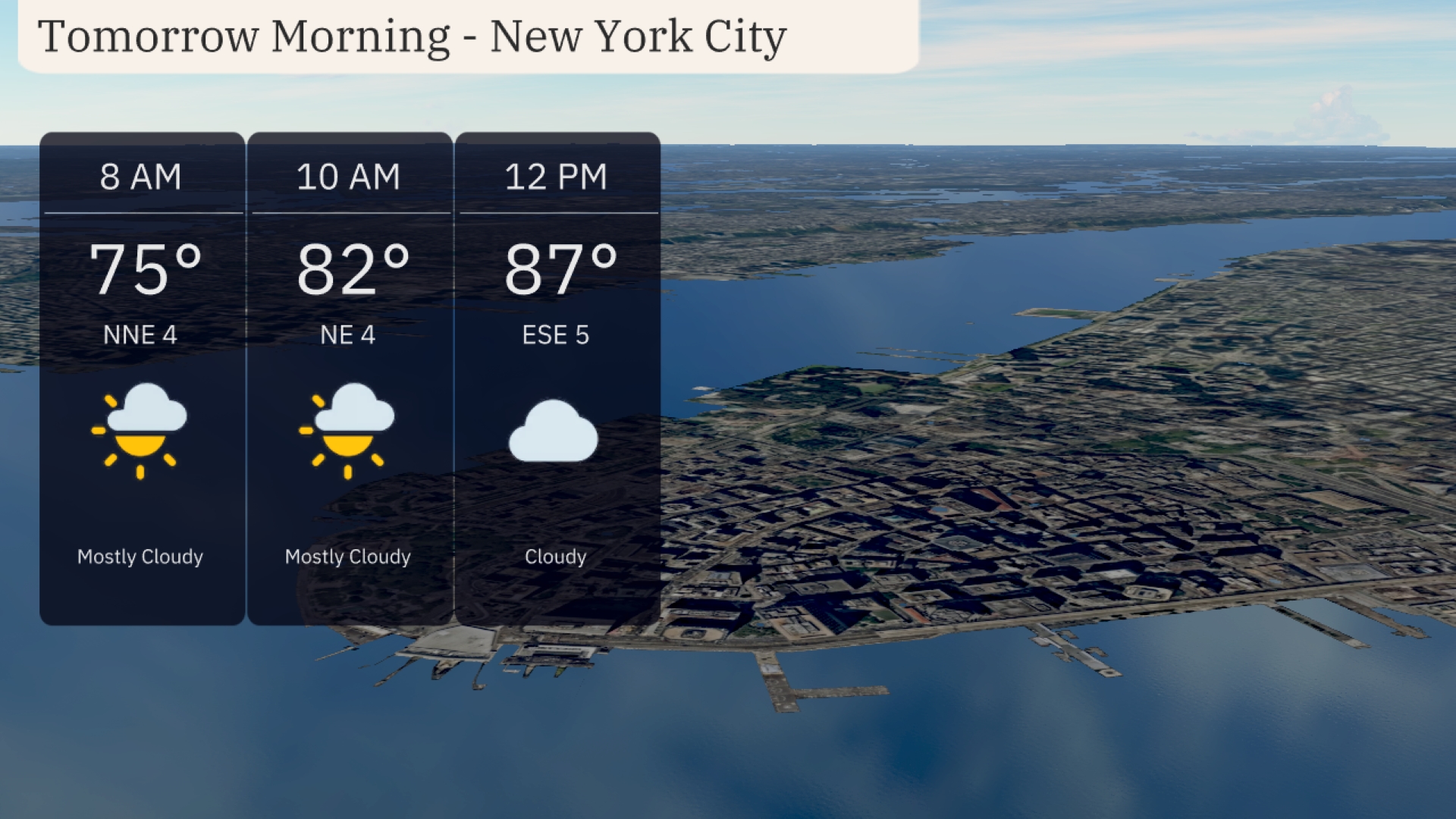
In New York City tomorrow morning the smoke from the Canadian wildfires should start to lift. Temperatures start at 75 degrees at 8 AM, climbing to 82 degrees by 10 AM. Expect mostly cloudy skies with light winds from the northeast. By noon, temperatures reach 87 degrees with winds shifting to the east-southeast under cloudy conditions. Prepare for a warm and overcast morning as you head out.
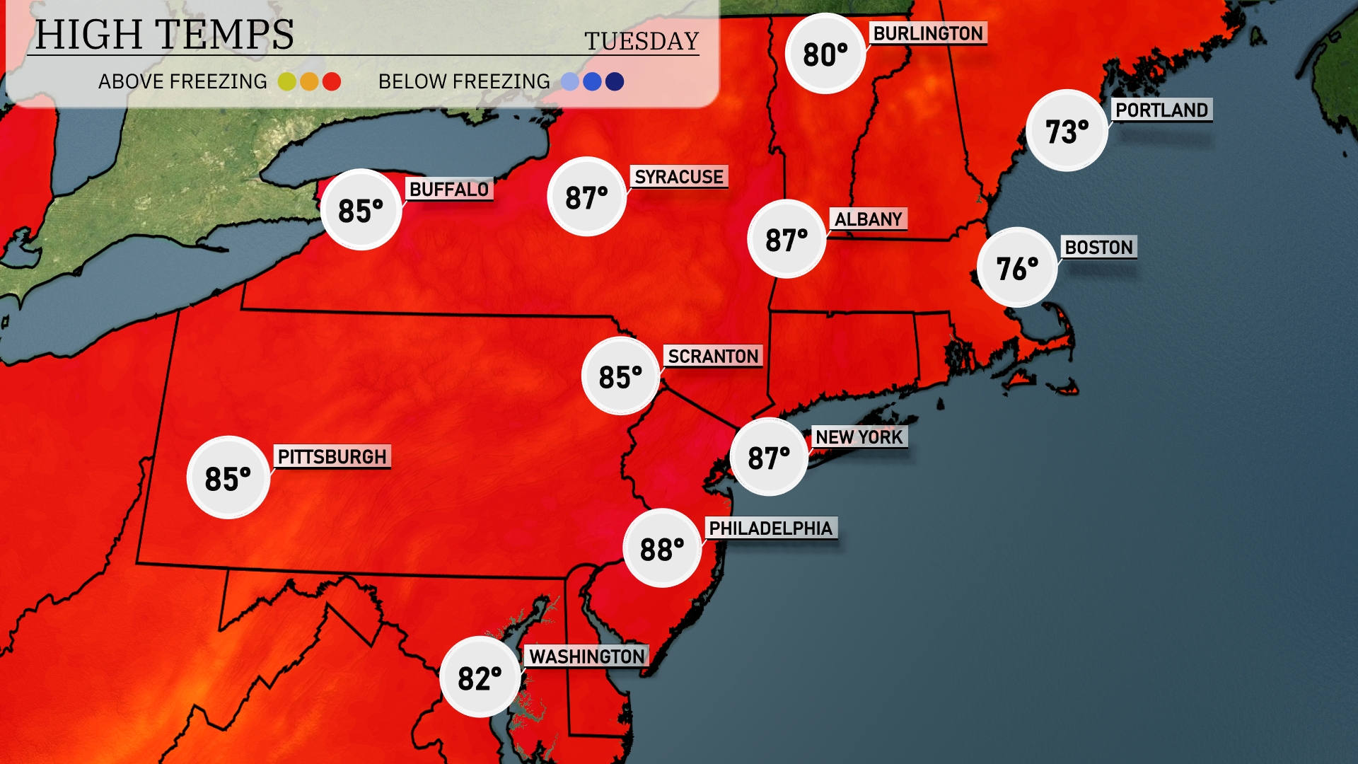
Tomorrow in the Northeast, temperatures will soar well above average. New York City expects a high of 87 degrees, while Philadelphia will reach a warm 88 degrees. Syracuse and Albany will also see highs of 87 degrees, with Buffalo slightly cooler at 85. Boston is looking at a pleasant day with a high of 76 degrees, while Portland will be the coolest spot at 73. This warm spell is influenced by a high-pressure system, keeping conditions mostly clear and sunny.
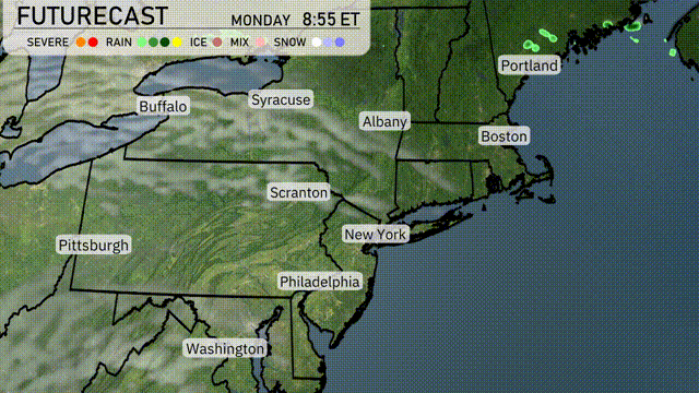
A cold front will sweep into the Northeast tomorrow, bringing cloudy weather starting in the afternoon and some rain. Expect scattered thunderstorms from Syracuse to Boston, with the potential for brief heavy rainfall and gusty winds. Buffalo might experience early morning showers, transitioning to clearer skies by evening. Temperatures will drop significantly as the front passes, offering cooler conditions for areas from New York City to Albany by Wednesday morning.
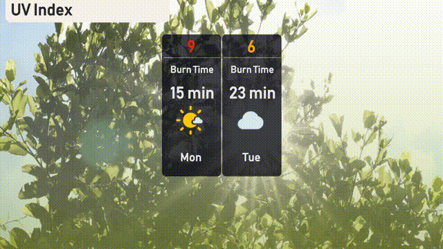
The UV index in NYC today, Monday, is 9, indicating a very high level of sun exposure, with a burn time of about 15 minutes in direct sunlight. For Tuesday, clouds will lower the UV index to 6, with a burn time of 23 minutes.
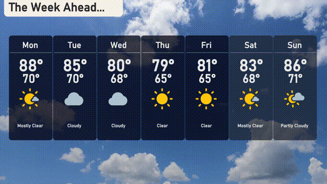
For the 7-day forecast in New York City:
Monday: Smokey skies from the wildfires. Expect a high of 88 degrees and a low of 70 degrees.
Tuesday: Expect cloudy conditions, with temperatures reaching 85 degrees and dropping to 70 degrees overnight.
Wednesday: Under cloudy skies, the day will warm up to 80 degrees, with a nighttime low of 68 degrees.
Thursday: Clear skies dominate with a high temperature of 79 degrees and a low of 65.
Friday: Clear weather continues, reaching up to 81 degrees during the day and down to 65 degrees at night.
Saturday: Mostly sunny with comfortable temperatures peaking at 83 degrees and a low of 68 degrees.
Sunday: Partly cloudy with a daytime high of 86 degrees and a nighttime low of 71 degrees.