NYC Morning Weather: Mix of Sunshine and Approaching Showers
By
Amy Freeze
Explore what the weather holds for New York City and the Northeast on the morning of September 28, 2025, with insights on a looming cold front and its impacts.
NYC welcomes you to a beautiful morning with a mix of sun and clouds on September 28. But, keep your umbrellas handy as heavy rain could hit by evening!
On the morning of September 28, 2025, New York City will see temperatures around 71-75℉ with a pleasant mix of sunshine and clouds. The Northeast enjoys a similar tranquil weather pattern, but there’s a twist: a brewing storm off the coast is expected to hit by evening, bringing potential heavy rain and thunderstorms. Stay tuned to Amy Freeze’s weather updates for safe and informed decisions.
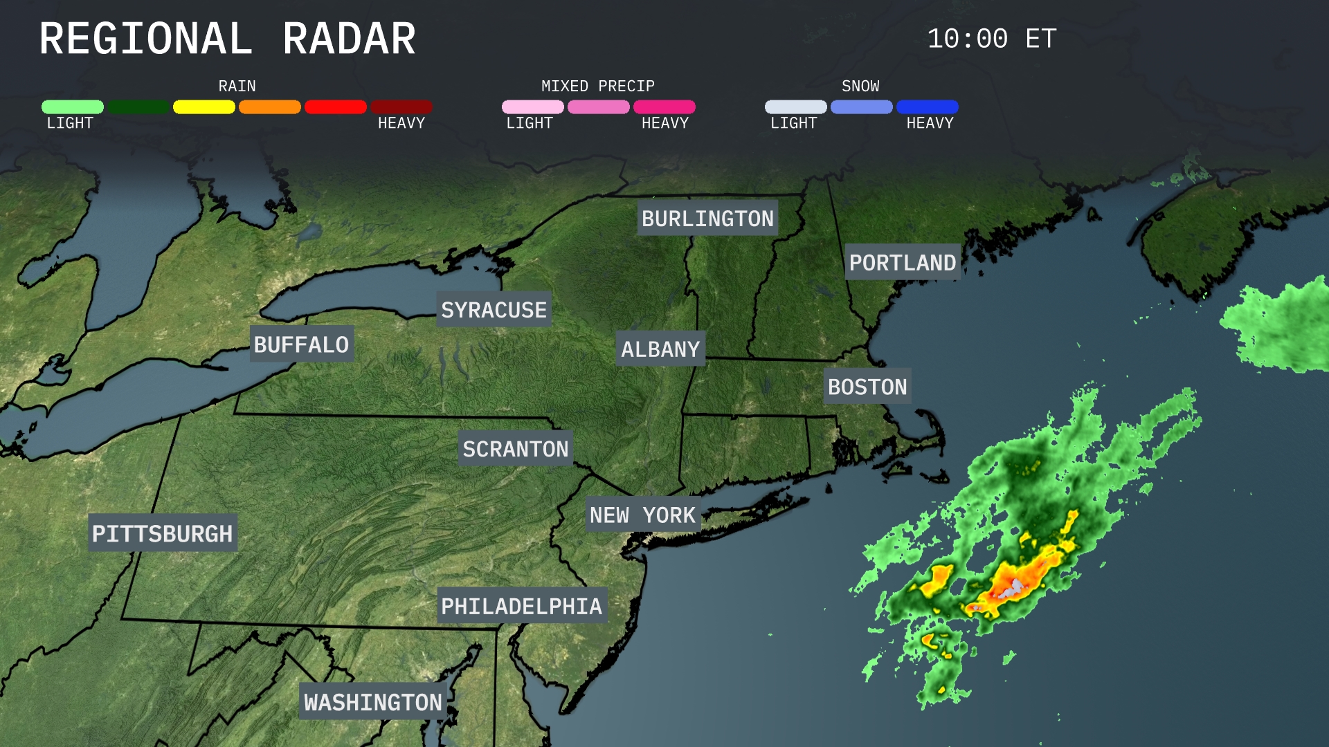
A clear picture dominates the Northeast region with Boston, Albany, and Buffalo experiencing tranquil weather. However, just off the coast of New York City, a mass of heavy rain is brewing, moving northeast towards Boston and Portsmouth. Syracuse and Burlington remain cloud-free, while light showers are expected to veer off into Portsmouth. In Pittsburgh and Philadelphia, the day is starting with clear skies.
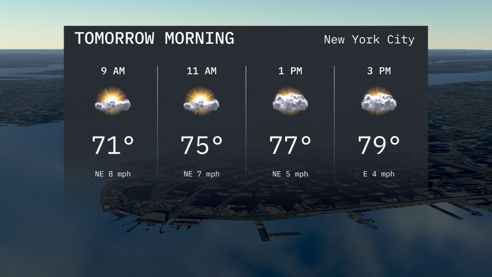
Tomorrow morning in New York City, temperatures are starting around 71 degrees at 9 AM, warming up to 75 degrees by 11 AM. Skies will have a mix of sun and clouds, providing some pleasant sunshine. Winds from the northeast will be light, around 7 to 8 miles per hour, making it comfortable for a morning stroll.
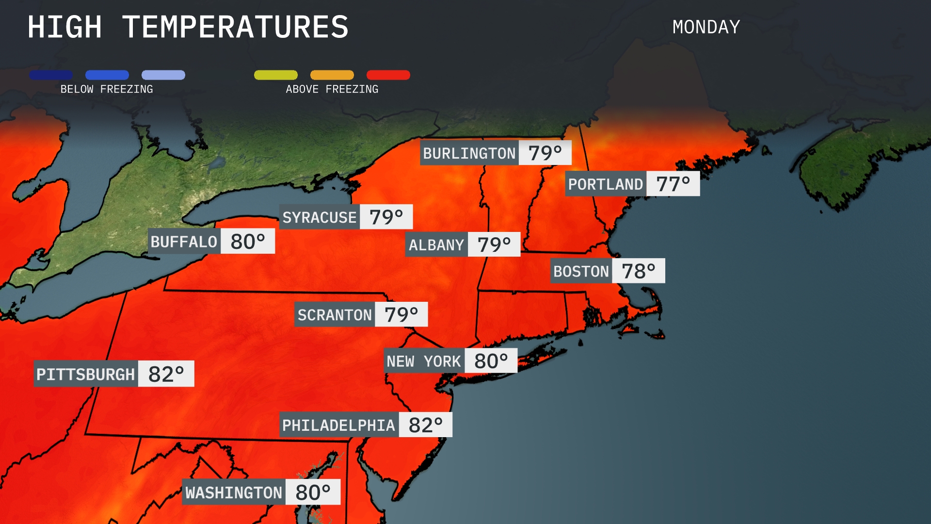
Tomorrow in the Northeast, expect mild temperatures with highs reaching 82 degrees in Pittsburgh and Philadelphia. New York City will see a comfortable 80 degrees, while Albany and Scranton are forecasted to hit 79. Burlington, Vermont will be close behind at 79 degrees, and Boston is looking at a high of 78. Notably, these temperatures are above average for this time of year, influenced by a warm front bringing unseasonably warm air into the region.
A cold front is set to move through the Northeast, bringing heavy rainfall and potential thunderstorms from New York City to Boston tomorrow evening. Rainfall totals could exceed an inch, creating a risk for localized flooding. As the front advances, expect gusty winds and cooler temperatures, with daytime highs dropping to the low 60s in Syracuse and Albany. In the early morning, scattered showers are possible in Burlington and Portland, clearing out by midday. By Friday, high pressure builds in, offering sunny skies and dry conditions for the weekend.
The UV index in New York City today is 8, with a burn time of approximately 27 minutes. For tomorrow, expect a UV index of 6, lengthening the burn time to about 35 minutes. Remember to protect your skin with sunscreen and wear a hat when you’re out in the sun!
For the 7-day outlook in New York City:
Monday: A warm day with mostly sunny skies. Expect a high of 80 degrees with a low of 67 degrees.
Tuesday: Partly cloudy with temperatures rising to 82 degrees. Overnight, temperatures will drop to 59 degrees.
Wednesday: Cooler and partly sunny, with a high of 72 degrees and a low of 54 degrees.
Thursday: Expect mostly cloudy skies and a high of 67 degrees. The low will settle around 54 degrees, still with no rain forecasted.
Friday: Clouds continue with partial clearing, reaching a high of 73 degrees and a low of 56 degrees.
Saturday: Mostly sunny and warming, topping out at 79 degrees with a crisp low of 59 degrees.
Sunday: Partly cloudy to end the week with a high of 80 degrees and a low of 61 degrees.