NYC’s Week Ahead: Weather Forecasts and Alerts for the Northeast
By
Amy Freeze
Explore comprehensive weather updates for NYC and neighboring Northeast regions, from today's conditions to a detailed 7-day outlook. Learn how a looming band of thunderstorms could impact your plans.
This week in NYC and the Northeast brings everything from partly cloudy skies and isolated thunderstorms to major shifts including severe weather potential. Stay updated and prepared!
This hour-by-hour breakdown covers not only the present conditions across New York City but also detailed predictions through the Northeast. From today’s mild temperatures to an incoming cold front, every element is addressed to ensure your utmost preparation. Plus, anticipate what the high UV index means for your outdoor plans.
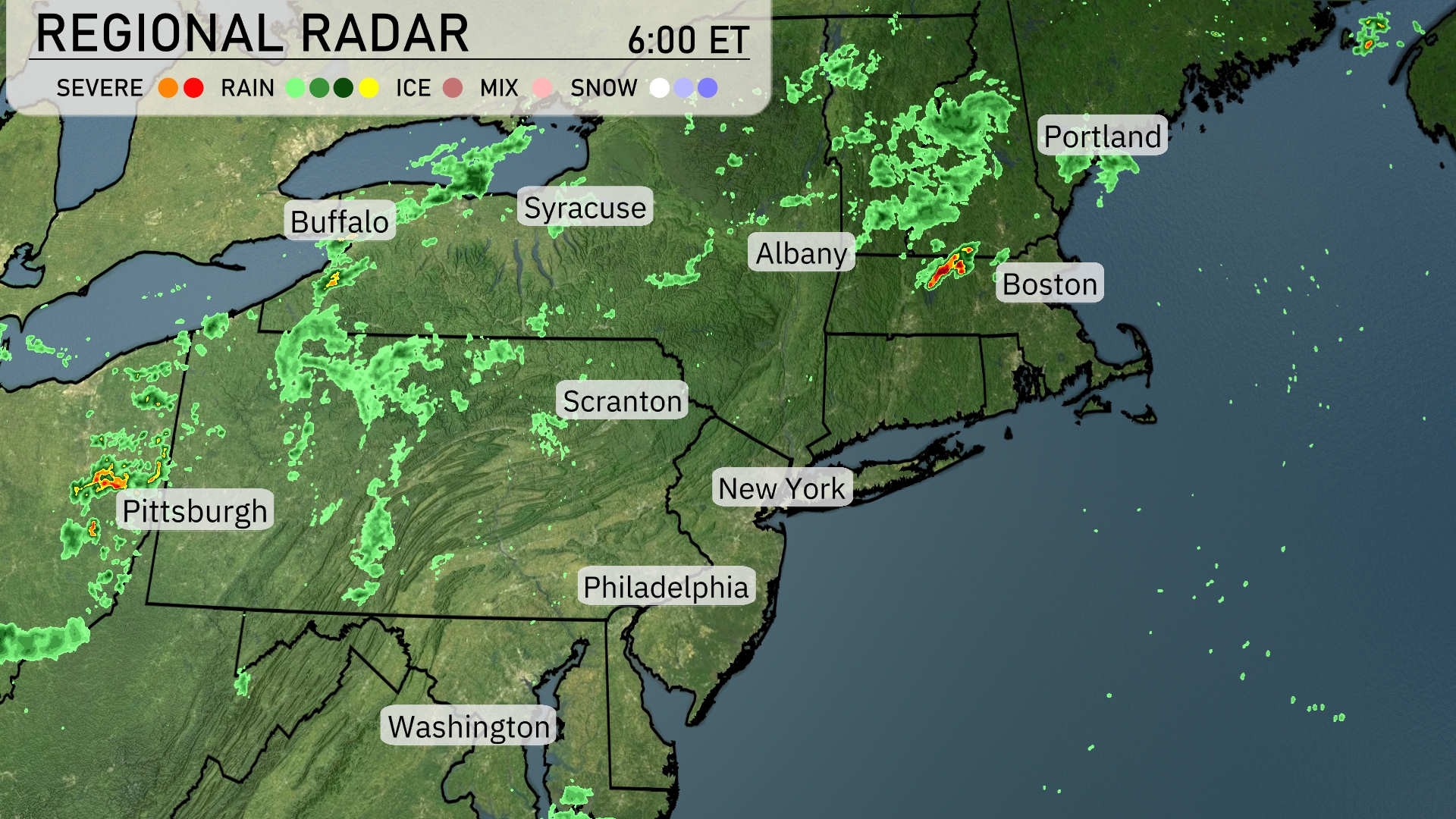
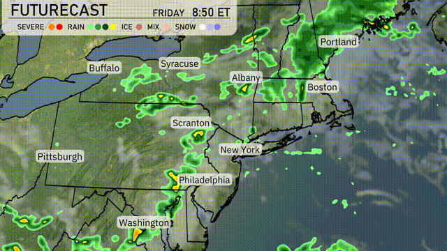
A cluster of showers and storms is moving through the Northeast, affecting areas from Syracuse to Albany. The heaviest rain is currently impacting Boston, with showers extending southwest towards Scranton. Pittsburgh and Buffalo are experiencing scattered rain showers, while the skies over New York City and Philadelphia remain mostly clear at this time. Farther south, Washington is also seeing dry conditions.
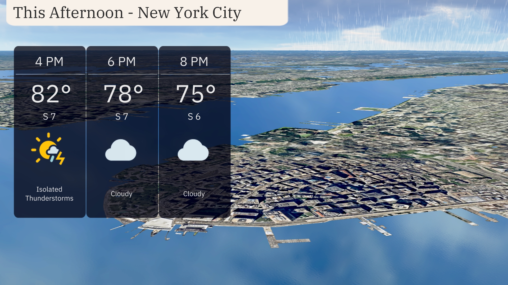
Afternoon in New York City brings temperatures around 82 degrees, with isolated thunderstorms possible. Winds are coming from the south at 7 mph, adding a touch of warmth to the atmosphere. By 6 PM, temperatures dip slightly to 78 degrees under cloudy skies, transitioning to 75 degrees at 8 PM. The cloud cover persists into the evening, with winds at 6 mph, maintaining a calm pattern.
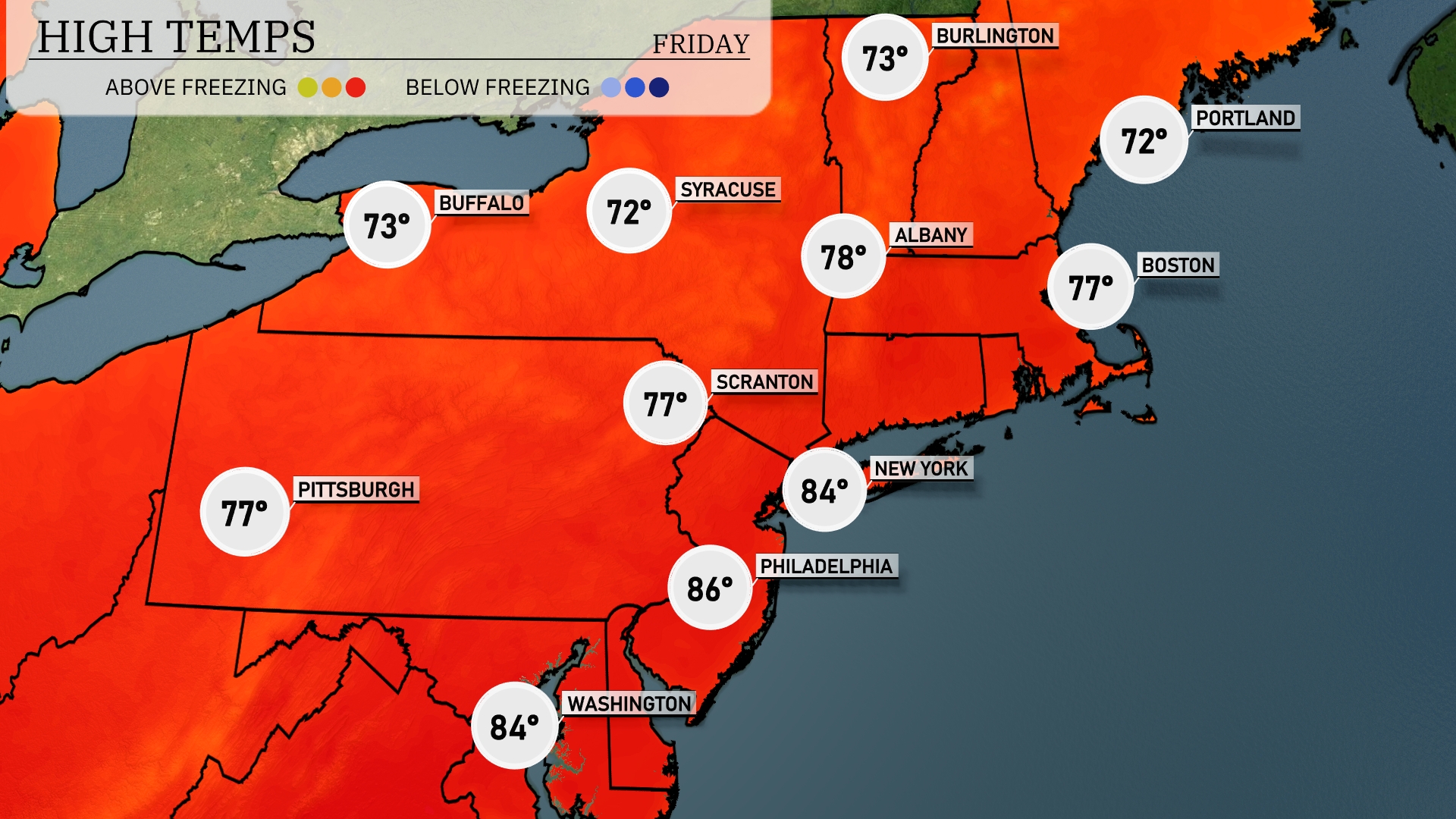
This afternoon is shaping up to be warm across the Northeast. Philadelphia will feel the heat with a high of 86 degrees. Boston reaches 77 degrees, and Scranton settles at 77 as well. Buffalo experiences a cooler day with a high of 73 degrees, and Syracuse nudges just below that at 72 degrees.
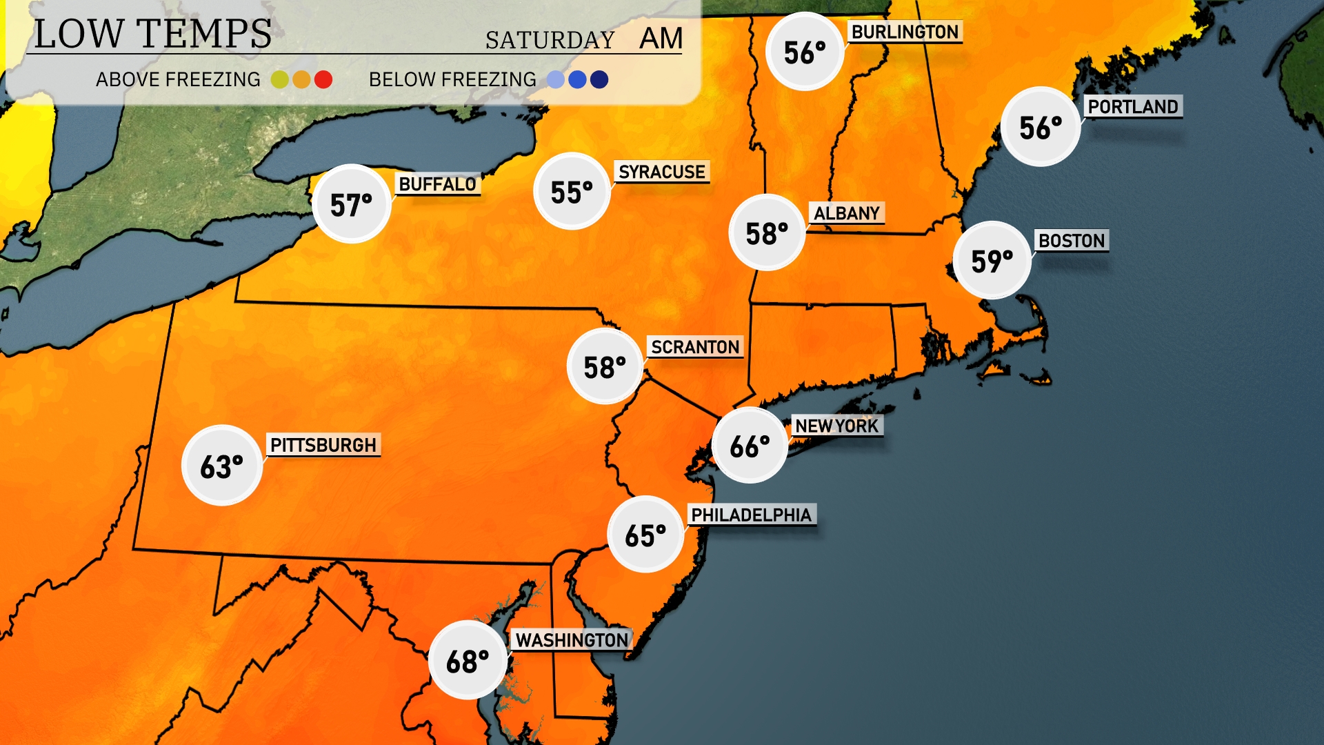
Tonight Buffalo will drop to a chilly 57 degrees, while Syracuse is expected to reach 55. Scranton and Albany will see lows of 58 degrees, and Boston is forecasting a low of 59.
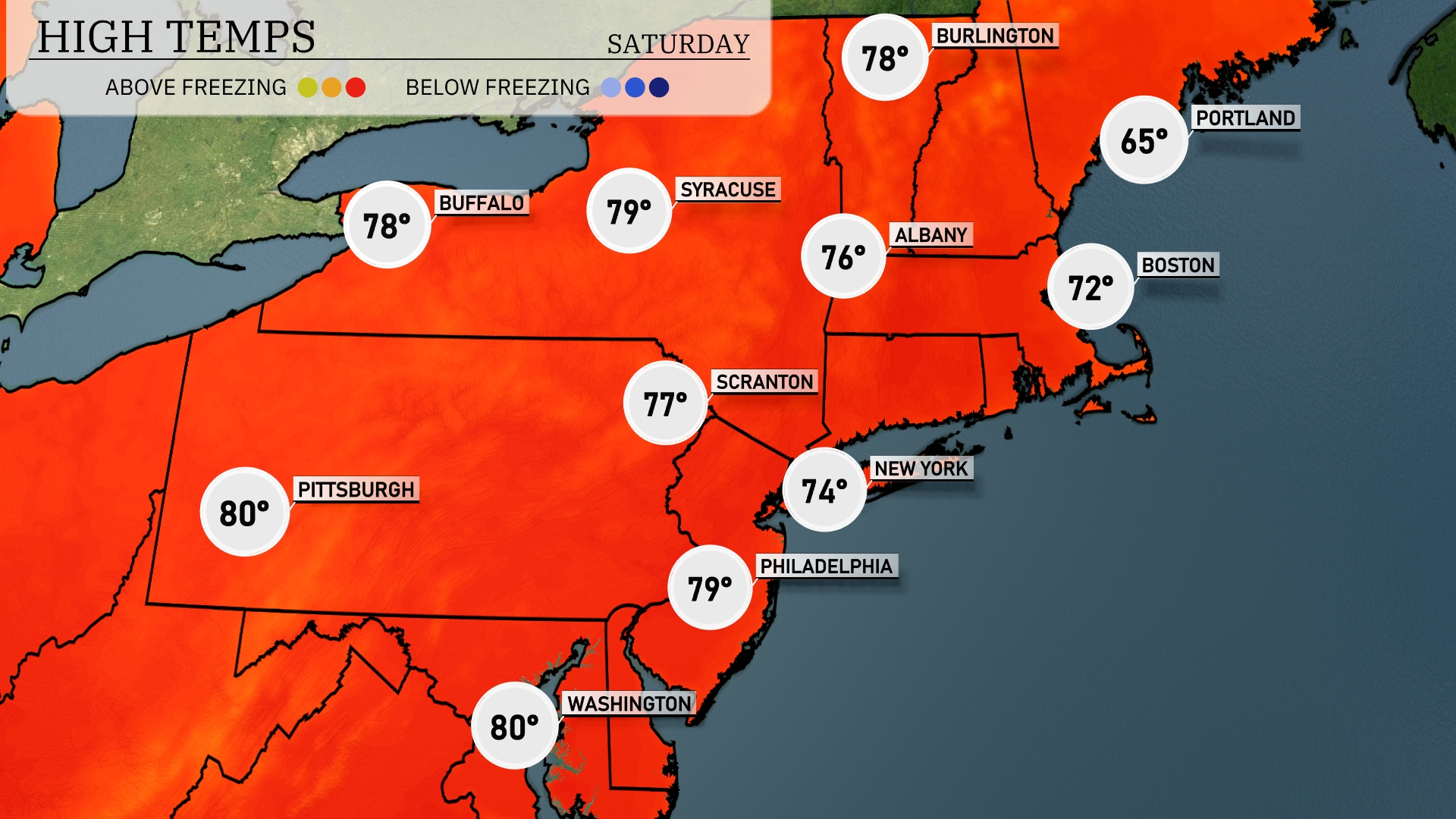
Tomorrow, expect a warm day across the Northeast, with Pittsburgh reaching a high of 80 degrees. Philadelphia will also warm up to 79 degrees, while Scranton will see a high of 77. New York City isn’t far behind at 74 degrees, and Albany will hit 76. Meanwhile, Boston will be a bit cooler at 72 degrees, with Portland only reaching 65.
A band of thunderstorms is projected to sweep across the Northeast, reaching New York City and Philadelphia by tomorrow afternoon. These storms may bring heavy rainfall and gusty winds, so it’s essential to be prepared for possible localized flooding. A cold front pushes through late in the day, dropping temperatures significantly, providing a refreshing change after the storms pass. By tomorrow night, the front will clear the region, with temperatures cooling and skies clearing. Keep an eye on potential severe weather alerts, especially for areas from Albany to Portland.
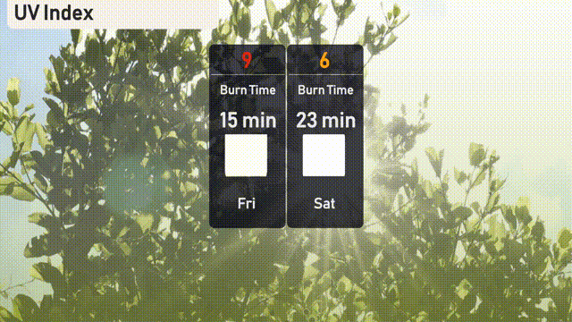
The UV index in New York City will be very high at 9 on Friday, with a burn time of about 15 minutes in direct sunlight. On Saturday, the index is forecasted to be moderate at 6, with a burn time around 23 minutes.