Navigating Through Northeast’s Skies: An Evening Forecast Breakdown
By
Amy Freeze
Join Meteorologist Amy Freeze as she details this evening's weather in NYC and a sneak peek into what the Northeast holds for the upcoming week.
From partly cloudy to stormy skies, see what’s in store for NYC and the Northeast. Amy Freeze gives you all the details from calm nights to approaching storms.
Hello New York and all our Northeastern neighbors! It’s Meteorologist Amy Freeze here with your full regional weather update. Tonight’s forecast includes gentle skies over NYC, though stay alert for a major turn tomorrow with a cold front and heavy rains. Our 7-day outlook details temperature shifts and storm predictions. Stay weather-wise with us, and don’t get caught unprepared!
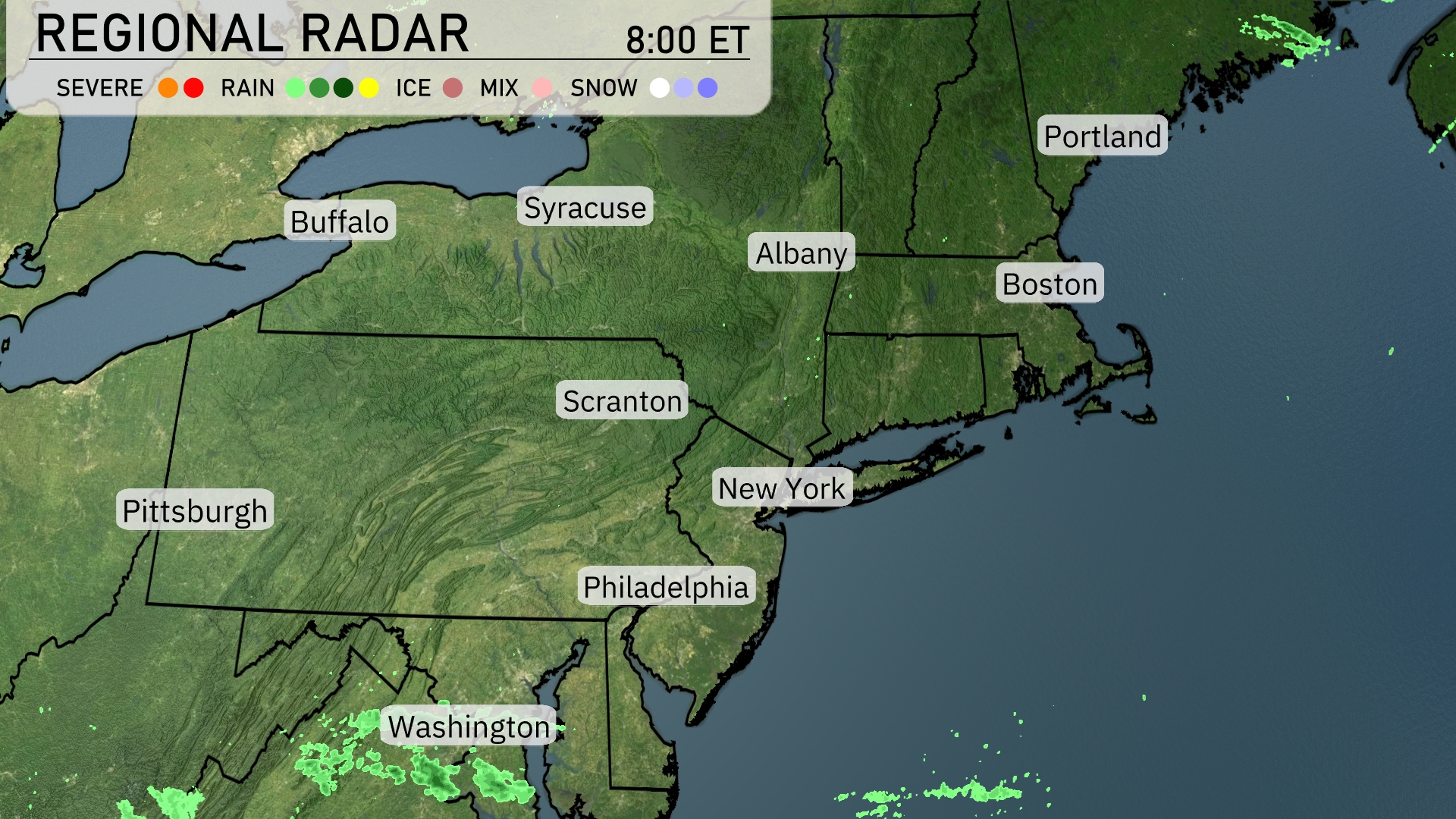
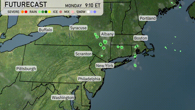
On the Regional Radar, the Northeast is experiencing mostly calm weather. Major cities, including New York, Philadelphia, and Boston, remain dry and cloudy-free for the moment. Areas such as Pittsburgh and Syracuse are not experiencing any significant weather disturbances. Meanwhile, areas near Portland are clear, with no immediate precipitation or cloud cover expected.
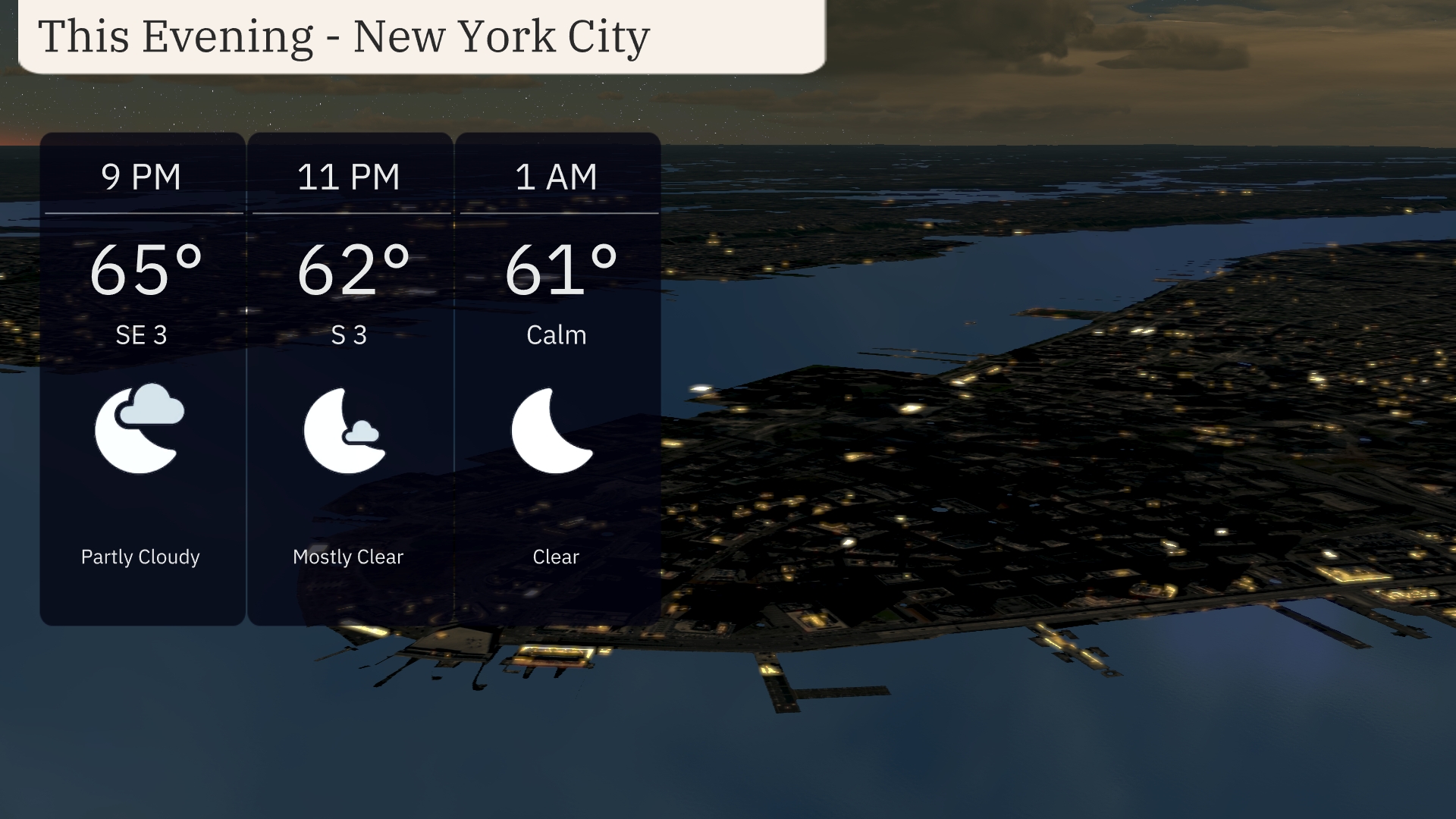
In New York City this evening, temperatures will gradually decline from 65 degrees at 9 PM to 61 degrees by 1 AM. Expect partly cloudy skies transitioning to mostly clear conditions as the night progresses. Winds will be light, shifting from a southeast breeze at 9 PM to calm by 1 AM. Enjoy the tranquil night!
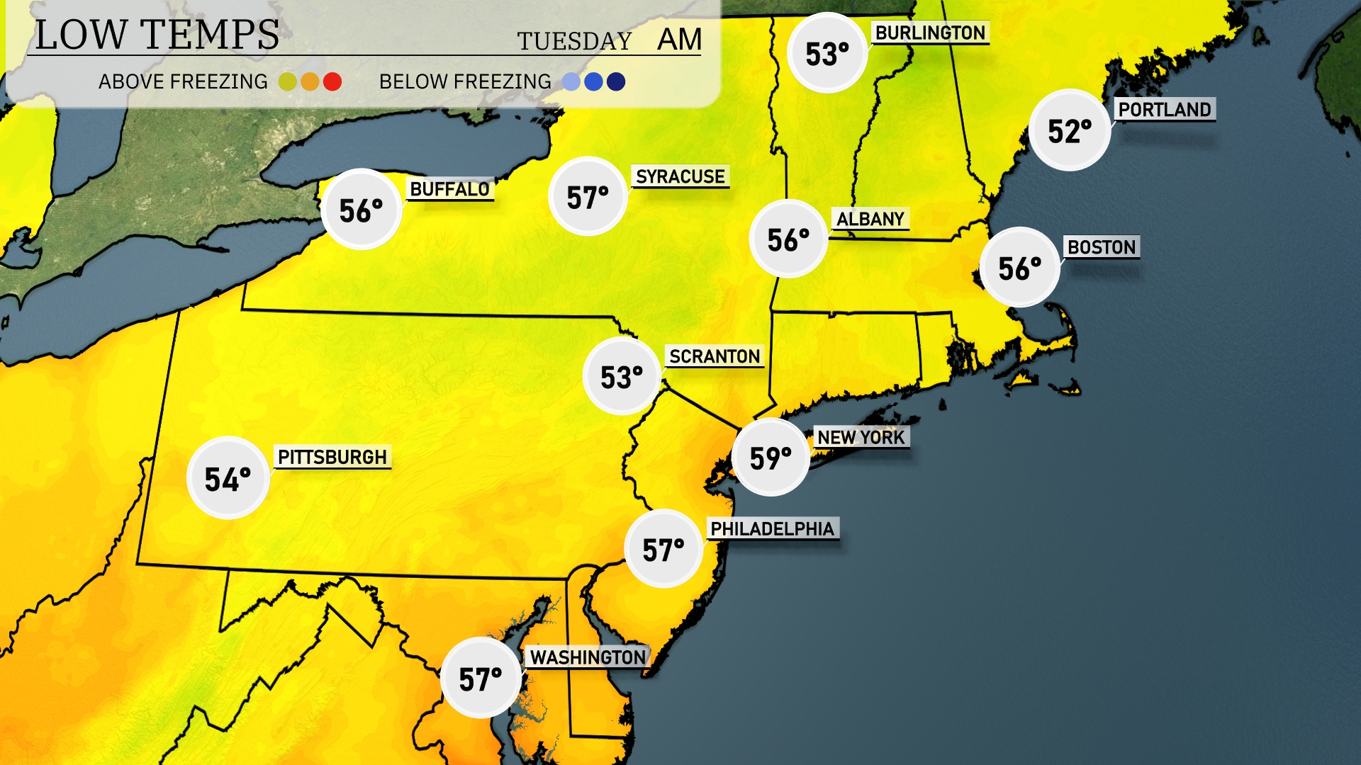
Tonight in the Northeast, expect a brisk evening with temperatures dipping down to 52 degrees in Portland and 56 degrees in Boston. New York City will see a low of 59, while Philadelphia cools to 57. Scranton will experience a cooler night at 53 degrees. Pittsburgh will have a low of 54, bringing in a refreshing chill across the region.
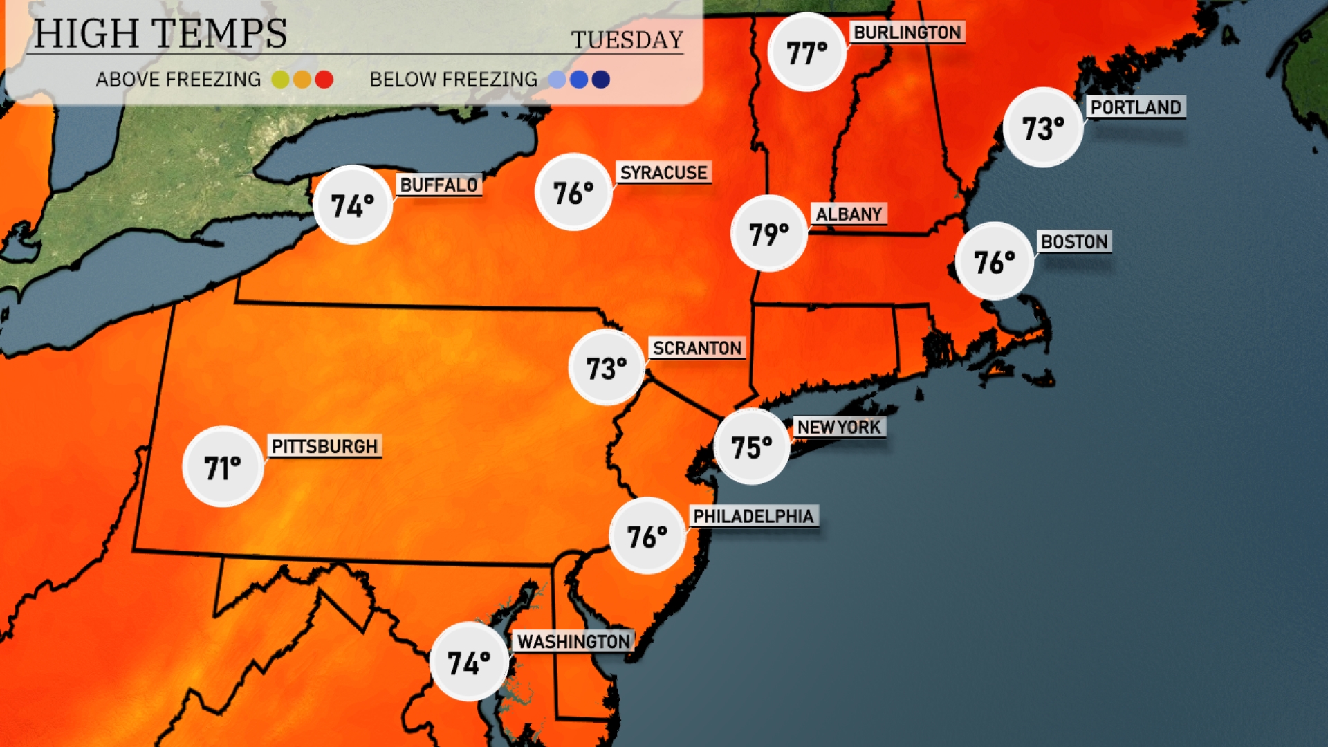
High temperatures in the Northeast are expected to be pleasantly warm for tomorrow. New York will reach a high of 75 degrees, while Philadelphia warms up to 76. Boston should see temperatures around 76 as well, with Albany slightly warmer at 79 degrees. Areas like Scranton will experience highs of 73, and Pittsburgh will get up to 71.
A cold front sweeps through the Northeast, bringing significant rainfall across the area starting tomorrow morning. Strong storms with gusty winds are likely, especially in the afternoon, impacting areas from Albany to Boston. Philadelphia and New York City remain under heavy downpour watches with possible localized flooding. Temperatures drop several degrees behind the front, offering cooler and breezy conditions. Prepare for challenging travel due to reduced visibility and wet roads.
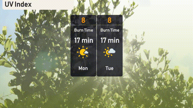
The UV index in New York City is high at 8 on both Monday and Tuesday. Expect a burn time of about 17 minutes in direct sunlight.
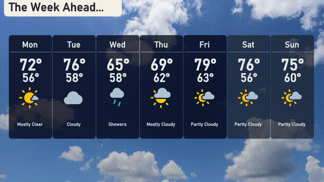
For the 7 Day Outlook in New York City:
Monday: Mostly clear skies with a high of 72 degrees and a low of 56.
Tuesday: Expect cloudy conditions with temperatures reaching a high of 76 degrees and a low of 58.
Wednesday: Showers are expected with a cooler high of 65 degrees and a low of 58.
Thursday: Mostly cloudy with a high warming up to 69 degrees and a low of 62.
Friday: Partly cloudy skies as the temperature rises to 79 degrees, with a low of 63.
Saturday: Partly cloudy conditions continue, with a high of 76 degrees and a low of 56.
Sunday: More partly cloudy weather, with temperatures peaking at 75 degrees and dipping to 60 at night.