Umbrella Days Ahead: Navigating NYC’s Showery Skies with Amy Freeze
By
Amy Freeze
Meteorologist Amy Freeze guides you through the rainy forecasts and what to expect in New York City and the surrounding Northeast as storm systems move through.
Meteorologist Amy Freeze delivers crucial updates on expected rain showers moving through NYC and the Northeast. Keep your umbrellas ready!
Hello NYC and Northeast dwellers! 🌧️ Meteorologist Amy Freeze here with a full breakdown of this week’s weather. We’re seeing a mix of rain across the region, from heavy in Pittsburgh to light, sporadic showers in Philadelphia. NYC, prepare for a wet afternoon with temperatures chilling down into the low fifties by tonight. Don’t forget, a low-pressure system could bring thunderstorms tomorrow! Stay updated and prepared. Full details at: https://amyfreeze.ai/
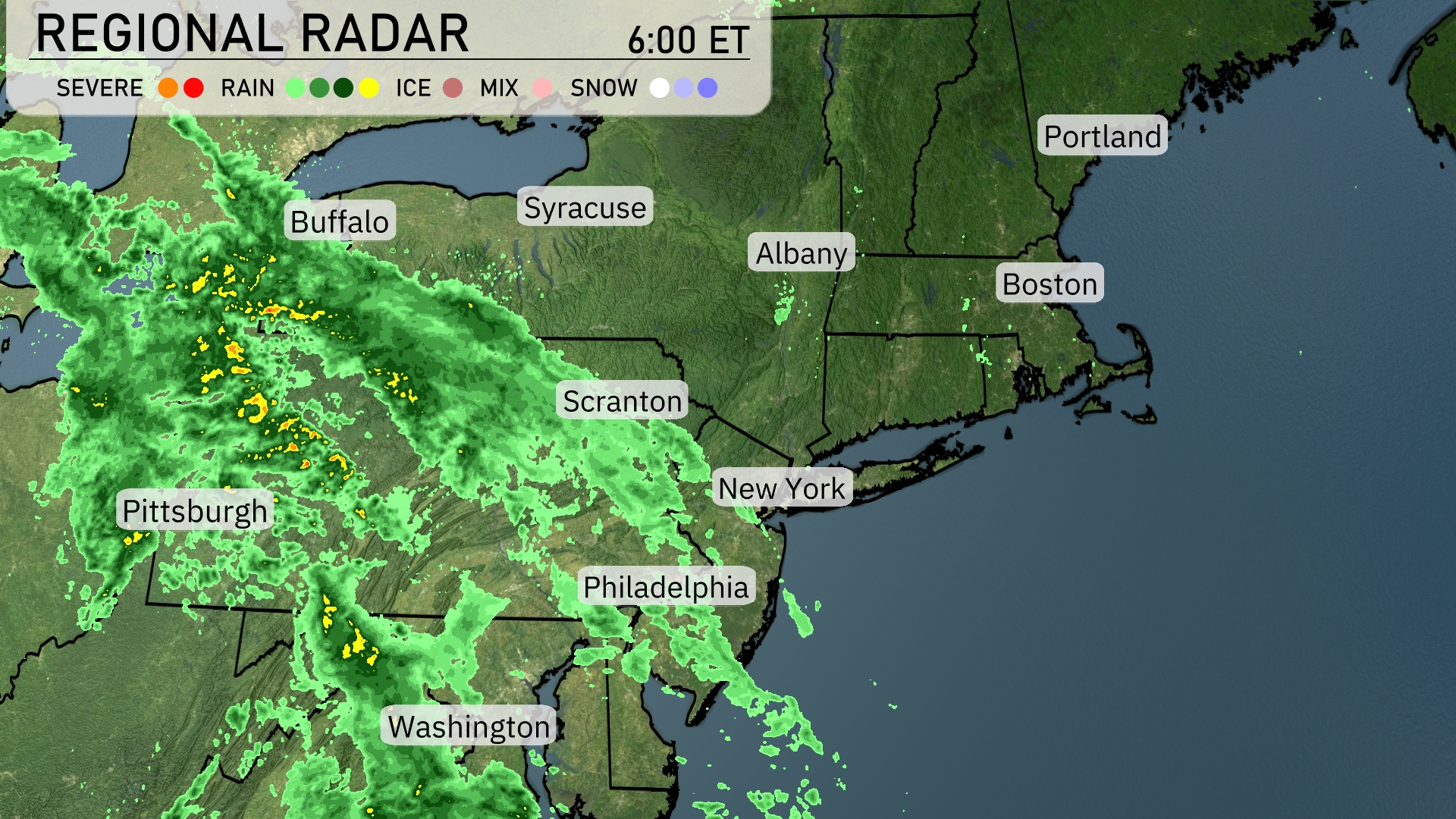
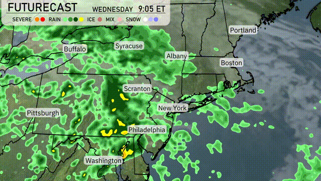
On the Regional Radar, rain is sweeping across the Northeast, moving eastward from Pittsburgh, where it is currently heaviest. This rain extends through Buffalo and Scranton, and is approaching New York City with steady showers. Philadelphia is experiencing intermittent rain as the system progresses. Farther northeast, cities such as Albany and Boston are still dry but should prepare for incoming precipitation. Washington D.C., however, may catch a break as the bulk of the rain remains to the north.
Expect a wet afternoon in New York City with showers transitioning to light rain by evening. Temperatures will hover around 55 degrees at 4 PM, dipping slightly to 54 degrees by 6 PM. Winds will be easterly at 15 miles per hour, easing to 12 miles per hour later. By 8 PM, temperatures will settle at 53 degrees under overcast skies with continued light rain.
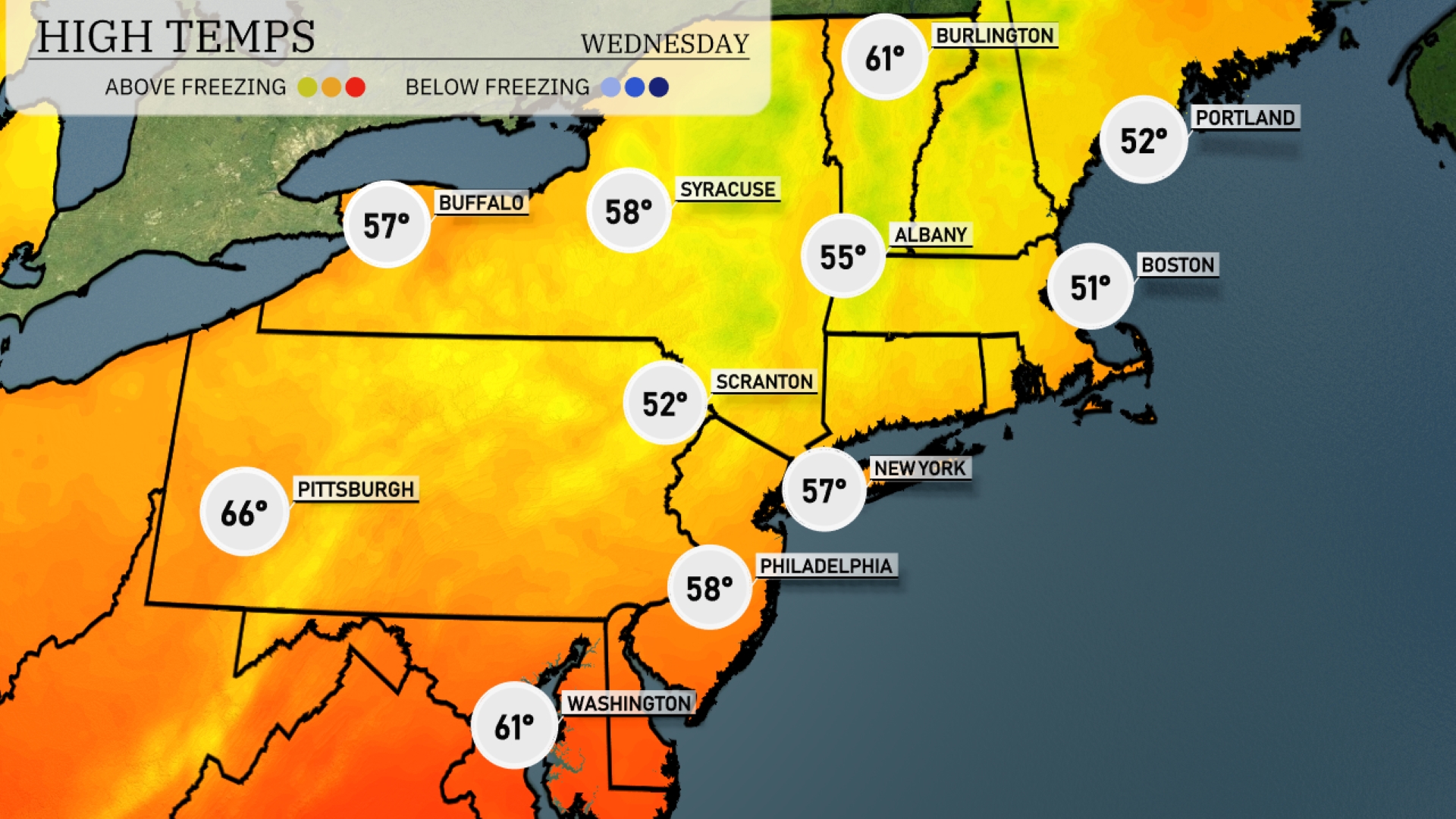
Today’s regional high temperatures in the Northeast show a cool trend across the area. In New York City, expect a high of 57 degrees, while Philadelphia will see a slightly warmer 58 degrees. Farther north, Syracuse reaches a high of 58 degrees, but Buffalo is cooler at just 57. Albany trails behind at 55 degrees, and over in Boston, temperatures are notably low at 51 degrees. Pittsburgh offers a contrast with a more pleasant high of 66 degrees.
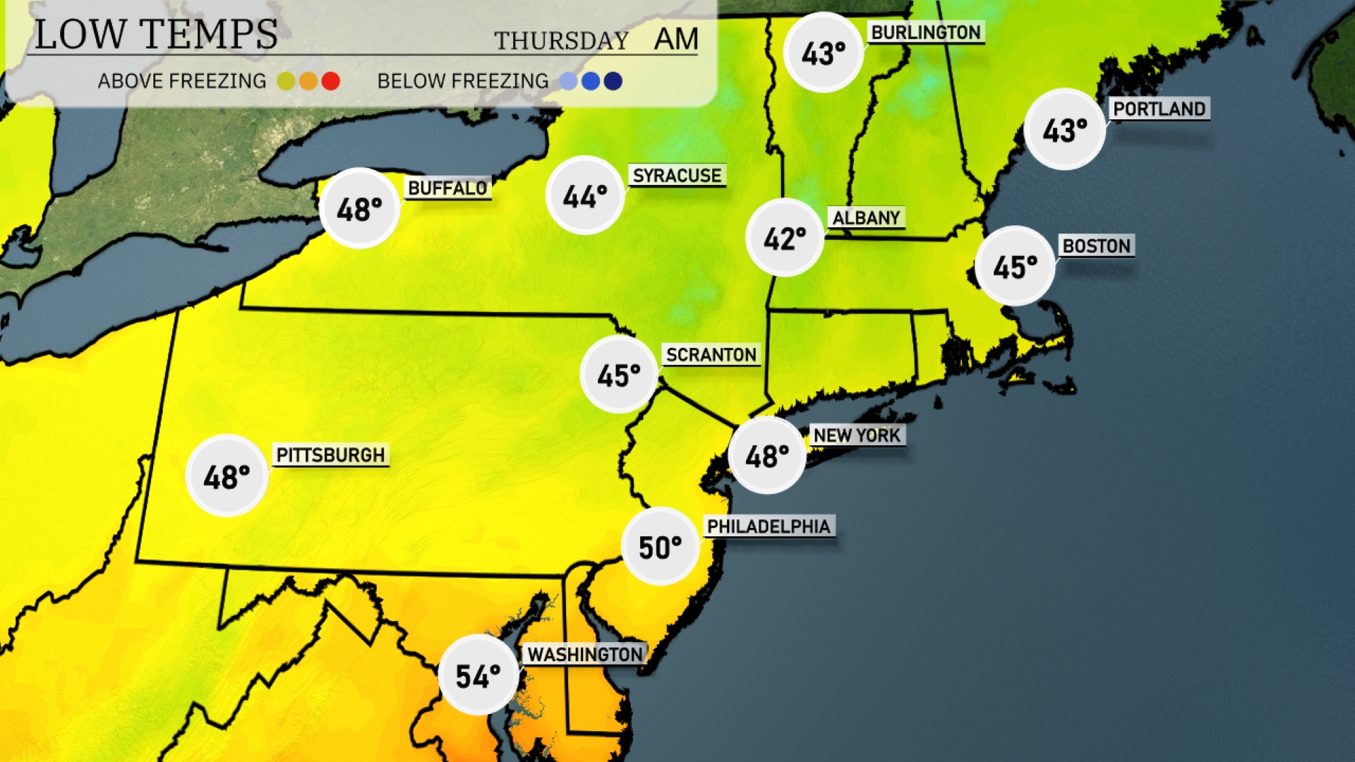
Tonight in the Northeast, temperatures will dip significantly as a cold front moves through. Albany will see a low of 42 degrees, while Syracuse will be a bit cooler at 44. Scranton expects a low of 45, and both New York City and Boston will settle at 48. Pittsburgh will be slightly warmer at 48, but expect noticeable chill in the area.
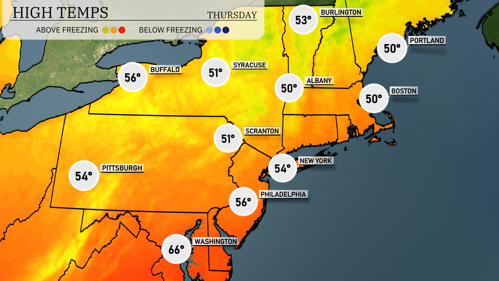
For high temperatures tomorrow in the Northeast, we’re looking at above-average warmth across the region. New York City will reach around 54 degrees, while Philadelphia can expect a high of 56. Farther north, Albany is forecasted to see a high of 50 degrees, and Scranton will also hit 51 degrees. Buffalo’s high will be slightly cooler at 56 degrees, but overall, temperatures are milder compared to seasonal norms.
A low-pressure system brings widespread rain across the Northeast tomorrow, with moderate to heavy showers expected from Pittsburgh through New York City. Watch for afternoon thunderstorms, especially near Philadelphia and Scranton, which could bring gusty winds. Temperatures linger in the lower to mid-60s as the system moves eastward. As it progresses, minor flooding is possible in urban areas, so stay vigilant. By Wednesday evening, expect clearing skies starting from the west, leading to cooler and drier conditions overnight.
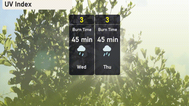
The UV index in New York City is low at 3 for both Wednesday and Thursday, largely due to cloud cover and potential rain.