NYC’s Summer Weather Rollercoaster: From Scorcher Days to Thunderous Nights
By
Amy Freeze
Explore the dynamic weather patterns over NYC and the Northeast as summer heat waves blend with incoming thunderstorms.
Get the scoop on NYC’s ever-changing summer weather! From sunny skies to storm warnings, know what each day holds in store and how to enjoy the season safely.
Join us as we navigate through New York City’s diverse weather patterns this summer. Begin with partly cloudy skies and transition to more ominous weather with thunderstorms on the horizon. Explore daily highs and lows, and prepare for varying conditions whether you’re planning outdoor activities or figuring out what to wear. Detailed forecasts, tips for staying cool, and how to remain weather-aware are all part of this comprehensive guide. Read more at https://amyfreeze.ai/
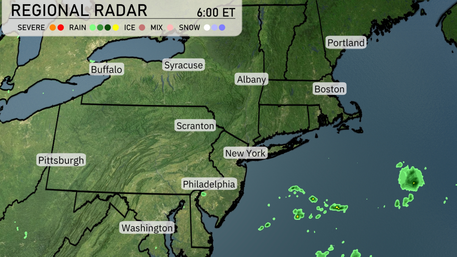
A calm start across much of the Northeast regional radar today as clear skies are seen in major cities like New York and Boston. Some patchy clouds are starting to move into areas around Scranton and Albany. Off the coast near New Jersey, isolated rain showers are visible, but they are expected to stay offshore. Keep an eye on conditions near Buffalo, as clouds begin to gather there.
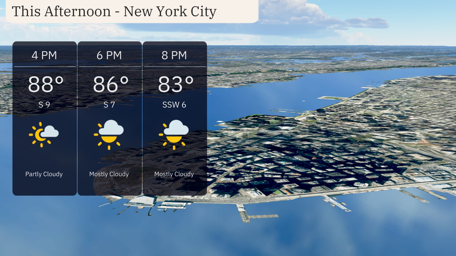
Afternoon temperatures in New York City will begin at a warm 88 degrees, dropping slightly to 86 degrees by 6 PM. Expect partly cloudy skies transitioning to mostly cloudy by late afternoon. Winds will be gentle, starting from the south at 9 mph and then shifting to the south-southwest at 6 mph. It’s a great day to enjoy outdoor activities, just keep an eye on those clouds.
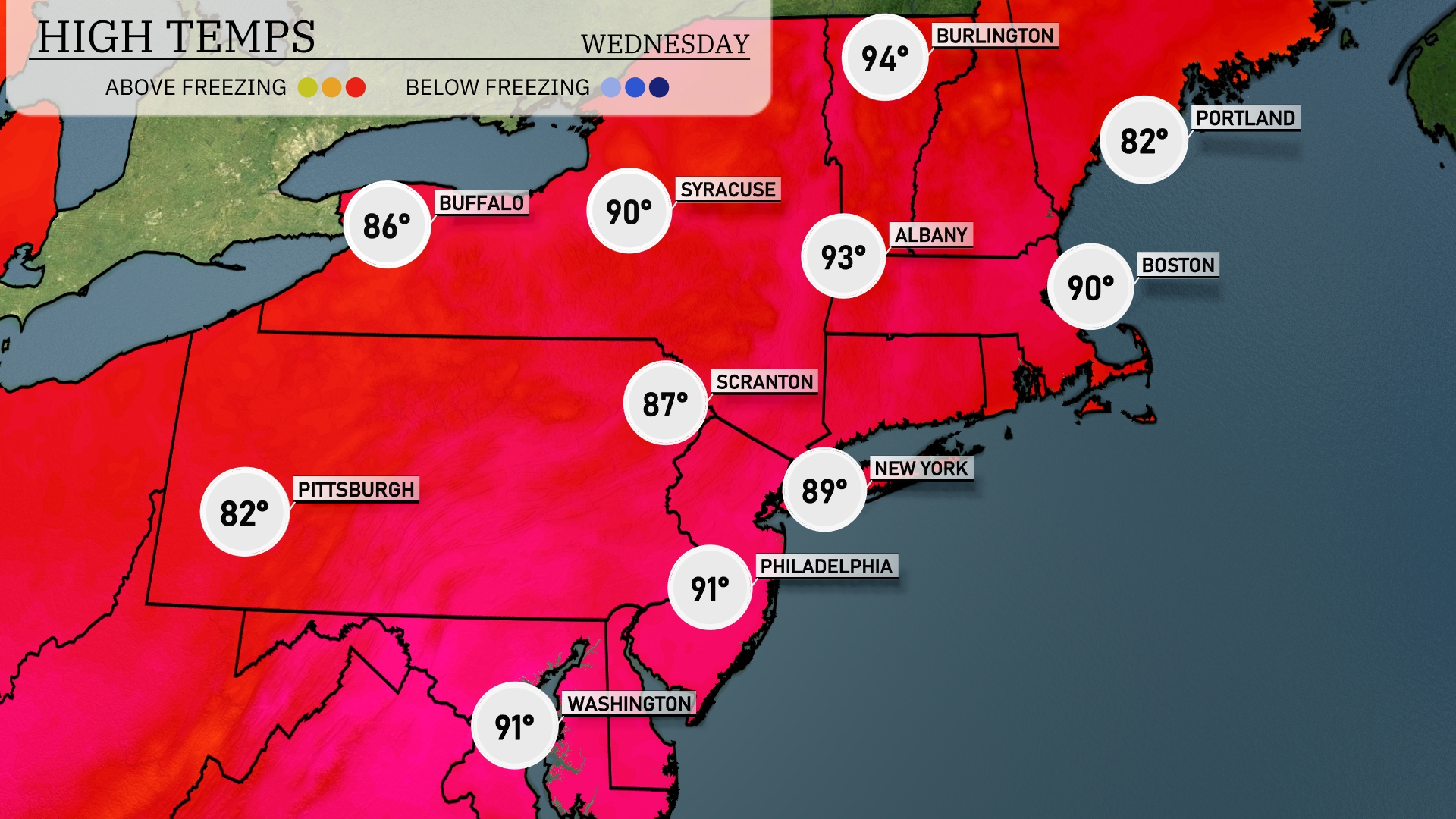
Today’s high temperatures in the Northeast are showing summer’s full heat. New York City will reach a warm 89 degrees, while Boston is not far behind it at 90 degrees. Folks in Philadelphia are looking at a scorching 91, making it one of the hottest spots today. Further north, Syracuse is also warm, hitting a high of 90 degrees, while Buffalo remains slightly cooler at 86 degrees. The coastal areas in Portland will see a more moderate high of 82 degrees, creating a noticeable temperature contrast across the region.
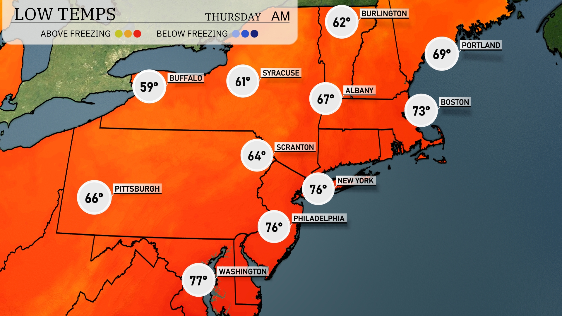
Tonight, temperatures in the Northeast will dip to 59 degrees in Buffalo and 61 in Syracuse. Scranton will experience a low of 64, while New York City remains warmer at 76. Philadelphia also matches New York with a balmy 76 degrees, and Boston will cool down to 73. Expect slightly lower temperatures in Portland at 69, signaling a cooler night across the region.
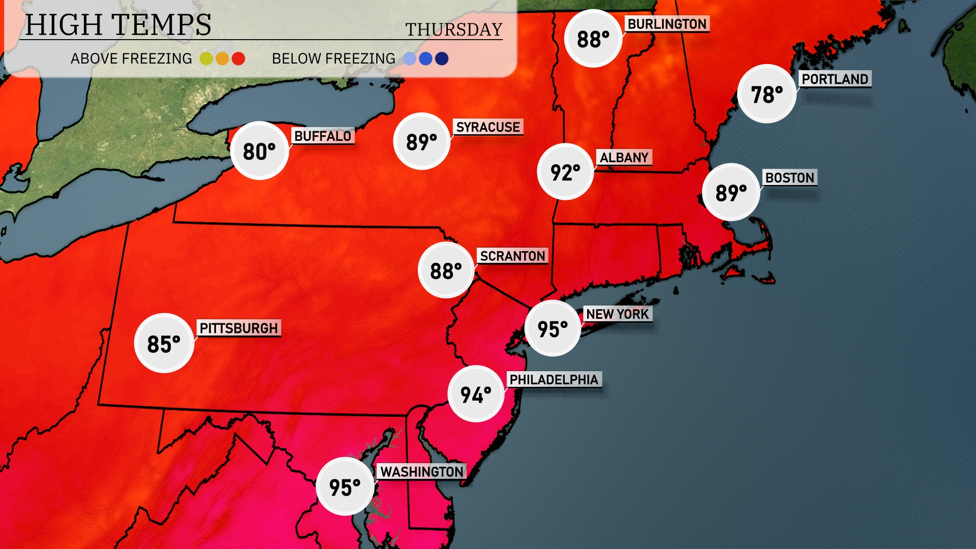
Tomorrow in the Northeast, expect sweltering temperatures with New York City reaching a high of 95 degrees. Philadelphia is also feeling the heat, with highs hitting 94 degrees. Syracuse and Scranton will be warm, with highs of 89 and 88 degrees, respectively. Boston’s temperature is expected to climb to 89, while Buffalo will see a cooler day at 80 degrees.
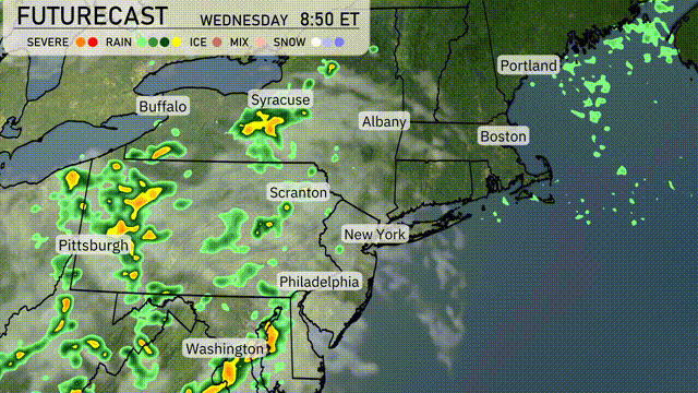
For tomorrow in the Northeast, a line of thunderstorms will extend from New York to Washington, D.C., with heavy rainfall likely during morning hours. In Syracuse and Scranton, expect scattered showers throughout the day, which could bring potential localized flooding. Thunderstorms could reach severe levels in some areas, so remain weather aware. Temperatures will hover in the mid-70s for most of the region. As the system moves east, clearer skies should emerge by evening, paving the way for a modest warming trend.
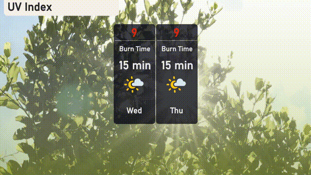
New York City will experience a very high UV index of 9 both today and tomorrow, with a burn time of approximately 15 minutes in direct sunlight.