NYC Forecast: Bright Mornings with a Chance of Evening Showers – Your Comprehensive Guide
By
Amy Freeze
Experience the dynamic weather of NYC from sunny skies to rainy nights! Check tomorrow's forecast and how it affects your week.
This morning in NYC promises sunny skies and warm temps, with a high of 82°F by noon. Learn how the evening’s thunderstorms might impact your plans!
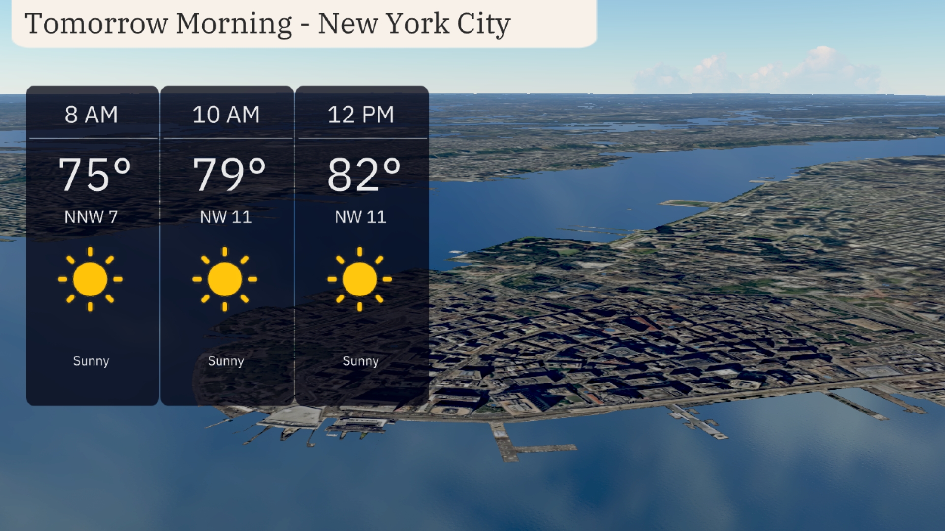
Welcome to your detailed NYC weather update! Tomorrow morning will start sunny with temperatures climbing, perfect for a walk or a coffee outdoors. However, a band of severe weather offshore indicates potential thunderstorms moving away from the coast. A cold front later might bring scattered showers and gusty winds, especially from Sunday evening into Monday. Detailed forecasts await at our blog: https://amyfreeze.ai/
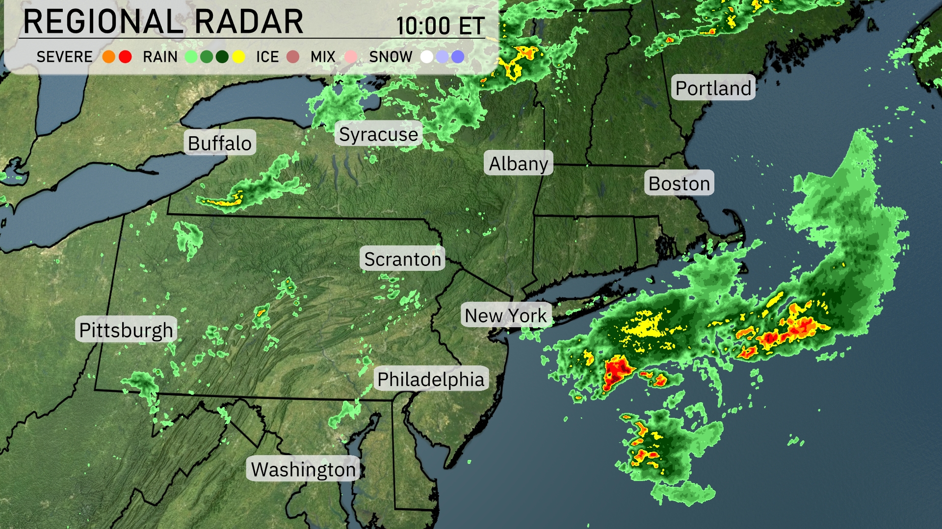
The Northeast is seeing a variety of weather conditions, with rain showers predominantly affecting the region. Around New York City, a band of severe weather is visible offshore, indicating the presence of thunderstorms moving away from the coast. Areas near Albany and Syracuse are experiencing scattered rain showers, though they remain less intense. In Pittsburgh, a more moderate rain is observed, and cloud cover extends through the region providing a blanket across Boston and Portland, Maine.
For tomorrow morning in New York City, plan for a sunny start with temperatures climbing from 75 degrees at 8 AM to 82 degrees by noon. Winds will be coming from the northwest at speeds between 7 and 11 miles per hour. A bright and brilliant day is on tap, perfect for a morning walk or outdoor coffee.
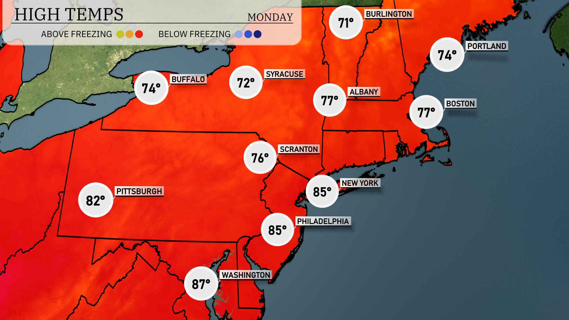
Tomorrow in the Northeast, temperatures are on the rise with New York City expecting a high of 85 degrees, while Philadelphia also reaches 85. Scranton will see a warm afternoon at 76 degrees. Boston and Albany are in the mid-70s, forecasted for 77 and 74 degrees, respectively.
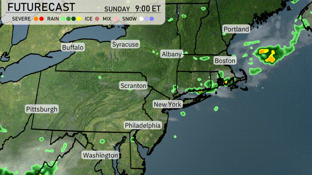
A cold front moving through the Northeast will bring scattered showers and thunderstorms, particularly impacting areas from New York City to Boston late Sunday evening. Expect periods of heavy rain with potential localized flooding, especially in urban areas. Temperatures will remain warm ahead of the front, hovering in the low 80s but will drop into the 70s as cooler air filters in post-front. The risk for severe weather is low, but gusty winds may accompany stronger storms. By Monday, drier conditions will prevail as the front exits, with a pleasant setup for the early part of the workweek.
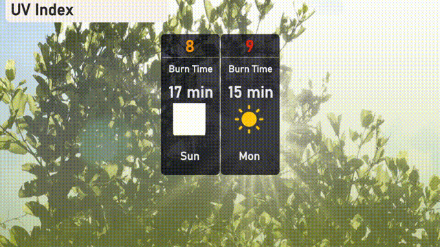
The UV index in New York City is high, with values of 8 on Sunday and 9 on Monday. Be cautious if heading outdoors as Sunday presents a burn time of just 17 minutes, while Monday’s burn time is even shorter at 15 minutes.
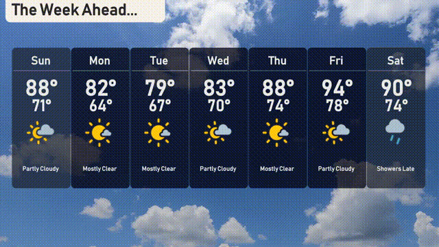
Sunday: Partly cloudy with a high of 88 degrees and a low of 71 degrees.
Monday: Mostly clear skies, with the temperature reaching 82 degrees and cooling down to 64 degrees overnight.
Tuesday: Another mostly clear day, warming up to 79 degrees during the day, with a nighttime low of 67 degrees.
Wednesday: Expect partly cloudy conditions, with temperatures peaking at 83 degrees and a low of 70 degrees.
Thursday: Partly cloudy again, highs reaching 88 degrees with a low of 74 degrees in the evening.
Friday: Mostly clear with the warmest temperatures of the week, a high of 94 degrees and a low of 78 degrees.
Saturday: Showers are expected late in the day, with a high of 90 degrees and a low of 74 degrees.
Stay safe and enjoy the week ahead!