Navigating NYC’s Weather Wonders: From Sunny Spells to Storm Alerts
By
Amy Freeze
Explore what NYC’s eclectic weather has in store from sunshine to stormy forecasts. Get the details on how tomorrow's weather will impact the Big Apple!
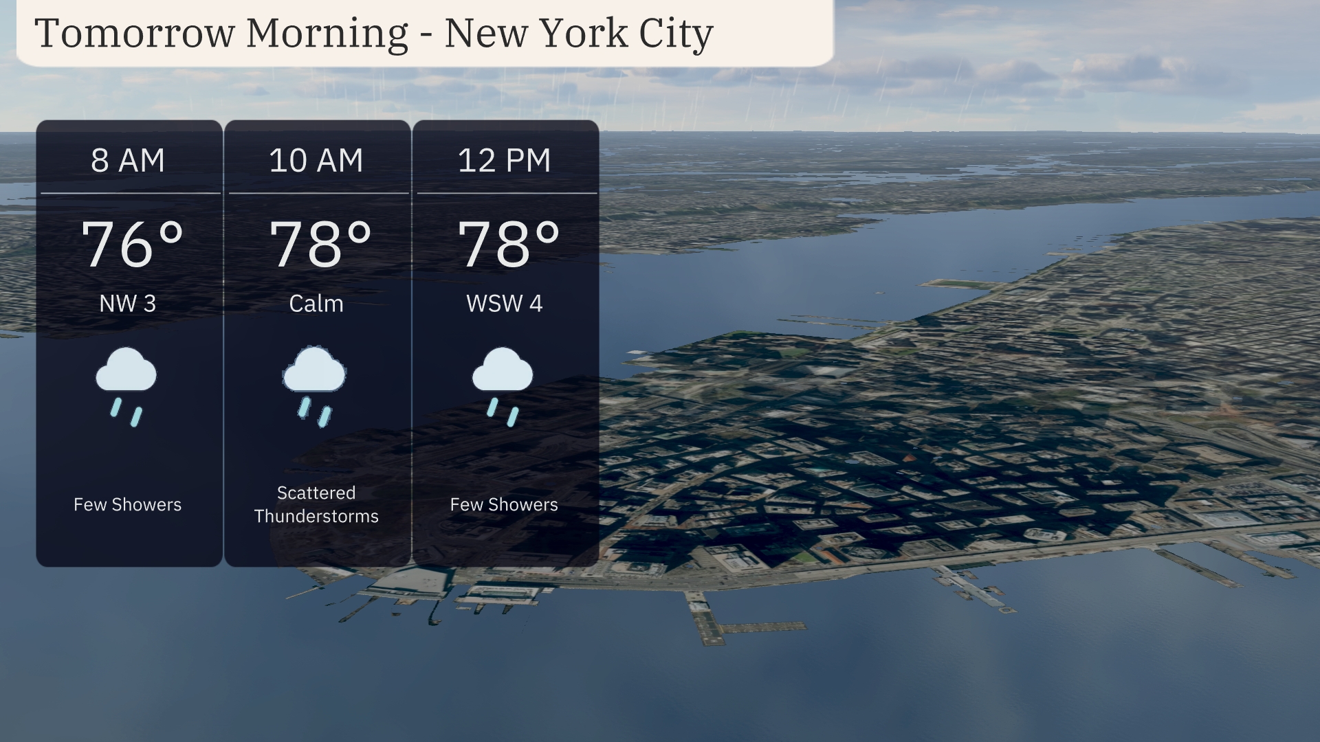
Tomorrow’s forecast for NYC starts with light showers, escalating to scattered thunderstorms by mid-morning. Temps reach a high of 83°F by afternoon.
This detailed guide covers NYC’s upcoming weather intricacies. From the unexpected warm spells hitting the city to imminent thunderstorms, discover how these conditions are set to unfold. Get insights into tomorrow morning’s expected conditions with light showers starting at 8 AM and temperatures steadily climbing. By noon, the mercury touches 78°F amid scattered showers and winds. Discover more on how to stay prepared and what to expect over the coming week with our full 7-day outlook.
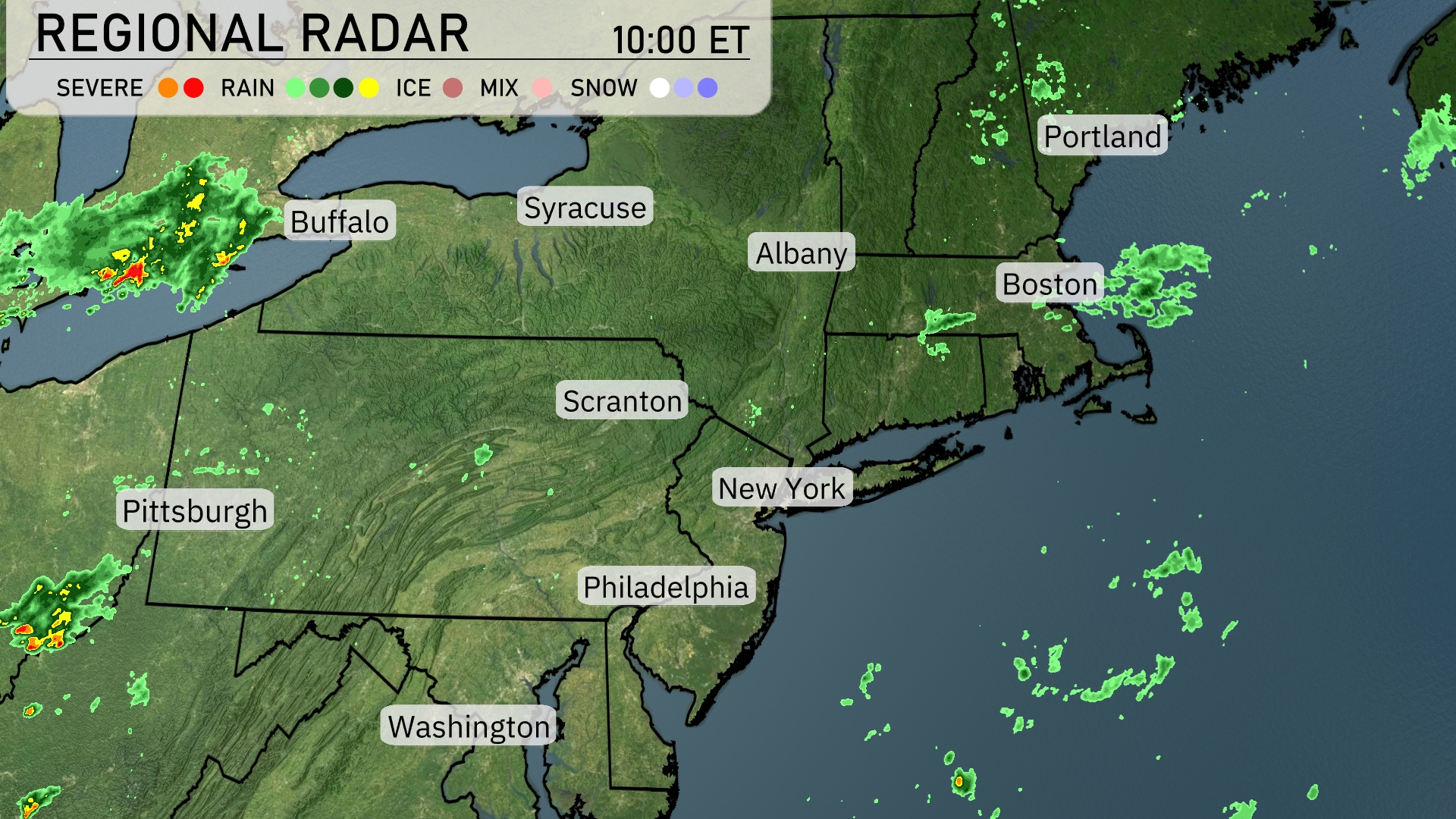
A storm system is developing west of Pennsylvania, bringing showers just north of Pittsburgh and moving into the area from the southwest. Scranton and nearby regions should anticipate cloud cover with light rain showers moving in from the west. Scattered rain showers are visible across the northeastern coastline, affecting Boston with mild rain. Clear skies prevail south of Syracuse toward New York City, but clouds are beginning to roll into Albany, indicating changing conditions ahead.
Tomorrow morning in New York City, temperatures will start at 76 degrees at 8 AM with light showers expected. By 10 AM, temperatures rise to 78 degrees with scattered thunderstorms developing, bringing a calm wind pattern. As we approach noon, temperatures hold steady at 78 degrees with a west-southwest wind at 4 mph and a few showers continuing.
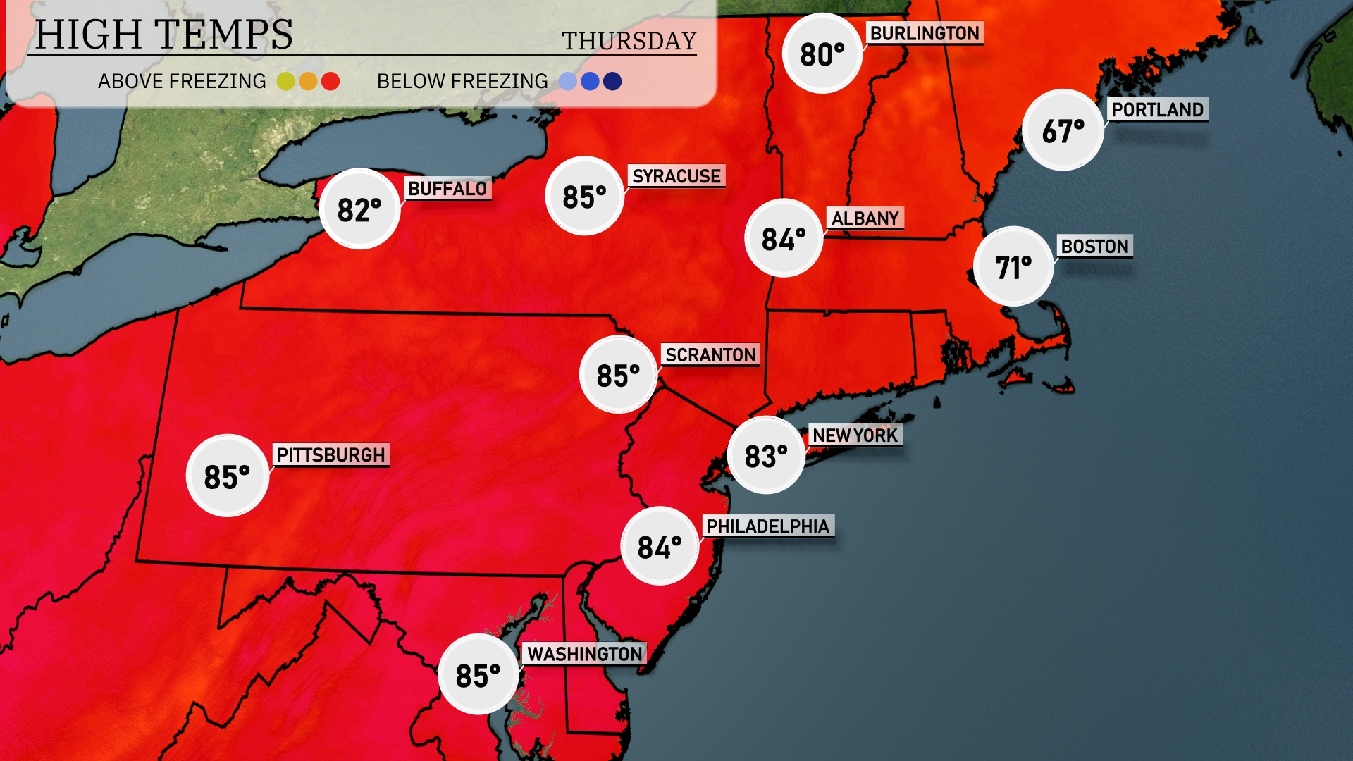
Tomorrow in the Northeast, temperatures will be on the warm side, with highs reaching 85 degrees in both Pittsburgh and Scranton. Syracuse and Washington will also see warm readings at 85 and 84 degrees, respectively. New York City is expected to hit 83, while Philadelphia will be slightly cooler at 84. Boston will experience a more moderate high of 71 degrees. Notably, these temperatures are well above average for this time of year, influenced by a warm air mass moving through the region.
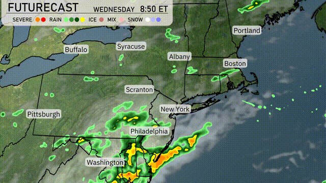
A weather system is set to bring rain and possible thunderstorms into the Northeast by tomorrow morning. Philadelphia and New York City can expect heavy rain, which could slow down the morning commute. By afternoon, the wet weather will move northeastward, impacting areas like Albany and Boston. While severe weather isn’t expected, localized flooding in low-lying areas could occur due to intense rainfall rates. Temperatures will remain mild, with a slight cool-down as the system exits Thursday.
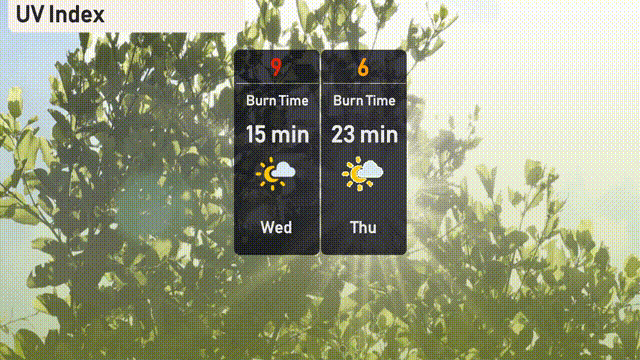
Today in NYC, the UV index is very high at 9, with a burn time of just 15 minutes—be sure to protect your skin if you’re outdoors. Tomorrow, the UV index drops to a moderate 6, with a burn time of 23 minutes, so continue to use sunscreen and seek shade during peak hours!
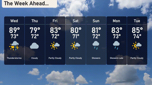
For the 7-day forecast in New York City:
Wednesday: Thunderstorms are on the horizon with a high of 89 degrees and a low of 73 degrees.
Thursday: Expect cloudy skies, cooling a bit to a high of 79 degrees and a low of 72 degrees.
Friday: The sun peeks through with partly cloudy conditions. Highs reach 83 degrees, with lows around 72.
Saturday: Mostly partly cloudy with temperatures rising to 80 degrees during the day and down to 71 at night.
Sunday: Showers will arrive later, with a high of 81 degrees and a nighttime low of 72.
Monday: More rain is expected with showers late in the day and highs of 83 degrees, cooling to 73 degrees.
Tuesday: Partly cloudy skies with highs reaching up to 85 degrees and a low of 74 degrees.