NYC Weather Report: Sunshine and Showers—April 29, 2025 Overview
By
Amy Freeze
Experience the dynamic weather patterns of NYC with Meteorologist Amy Freeze as she details an afternoon of partly cloudy skies and potential showers. Stay informed and prepared!
Join Meteorologist Amy Freeze for an insightful update on the weather in NYC and the Northeast for April 29, 2025. From clear skies to emerging showers, here’s everything to expect!
On April 29, 2025, Amy Freeze provides a detailed forecast for New York City and surrounding areas. Discover the transitions from partly cloudy to mostly cloudy skies, along with potential showers near Buffalo. Get the full weather rundown, from temperature fluctuations to an isolated thunderstorm threat, and plan your week ahead with the 7-day forecast. Visit the full post for more details: https://amyfreeze.ai/
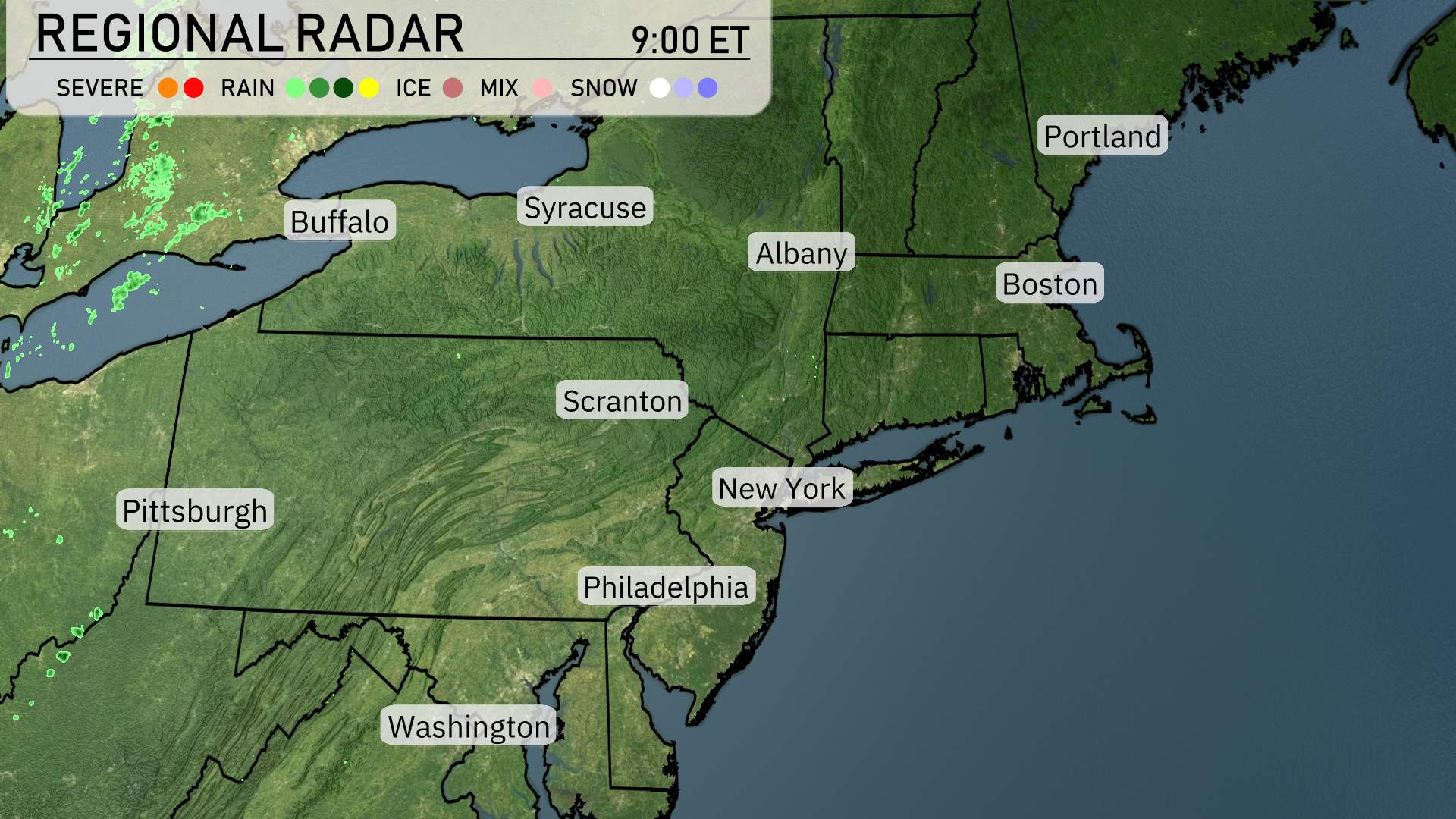
Over the Northeast, the regional radar reveals clear skies with no precipitation currently impacting major cities such as New York, Philadelphia, and Washington. The radar shows a tranquil weather pattern across Boston and Albany as well Tonight could be different. for now, clear skies extend across Syracuse and Scranton, providing a nice break from stormy weather. However, out to the west near Buffalo, some showers are beginning to develop, so a closer watch is advised for that area.
Temperatures in New York City during the afternoon will start at 77 degrees at 3 p.m., cooling down to 71 degrees by 7 p.m. Expect partly cloudy skies early on, transitioning to mostly cloudy later in the afternoon. Winds will be coming from the south-southwest at 11 miles per hour. An isolated thunderstorm late tonight is possible.
Today’s high temperatures are looking quite warm across the Northeast. New York City reaches near 80 degrees, while Philadelphia is slightly warmer at 82. Scranton makes a splash with a high of 84 degrees, and Syracuse matches that with an impressive 84 as well. To the north, Buffalo cools down slightly with a high of 71, while Albany settles at a pleasant 83 degrees. The coastal area around Boston will see a high of 79. An interesting temperature contrast emerges as we move toward Portland, where cooler air brings a high of just 69 degrees.
Tonight in the Northeast, expect some brisk temperatures as cold air settles in. Buffalo will drop to 42 degrees, while Syracuse cools down to 35. Albany will see a low of 38 degrees and Boston will be slightly milder at 44. Scranton will rest at 43 degrees, and New York City is forecasted to be 52 degrees. Burlington is expected to dip to 36, signaling a chilly night ahead across the region.
High temperatures for tomorrow in the Northeast will see a mix of mild conditions and some below-average readings. New York and Philadelphia will enjoy highs around 72 degrees and 77 degrees, respectively, while Boston reaches a comfortable 68 degrees. Syracuse and Buffalo will be cooler, with highs only hitting 52 degrees and 53 degrees, which is below typical for this time of year. Pittsburgh will warm up to 72 degrees supported by a building high-pressure system. Scranton is expected to see a high of 65 degrees remaining on the mild side as well.
A low-pressure system is moving across the Northeast tomorrow, bringing a chance of showers from Boston to Portland. Expect primarily rain, with no significant severe weather anticipated. Temperatures will hover in the upper 50s to lower 60s, marking slightly cooler conditions. Winds may pick up along the coast, leading to some breezy conditions. By evening, the system should push eastward, bringing clearing skies overnight.
The UV index in New York City will be a high of 7 today, meaning sunburn can occur in about 20 minutes without protection. Make sure to wear sunscreen, sunglasses, and protective clothing if you’ll be outside.