Explore the shifting skies of NYC from sunny clear days to unexpected rain showers. Detailed daily insights right here.
NYC and the Northeast brace for varied weather tonight! From partly cloudy skies to potential showers offshore, get all the details of what’s happening now.
This is your deep dive into the current weather over NYC and the broader Northeast region. The skies are mostly clear, but keep an umbrella handy as a small cluster of rain offshore might bring brief showers. Tonight, temps are gently dipping, making it perfect for an evening stroll. And don’t miss our 7-day forecast to plan your week ahead under these fluctuating skies. Full insights at https://amyfreeze.ai/
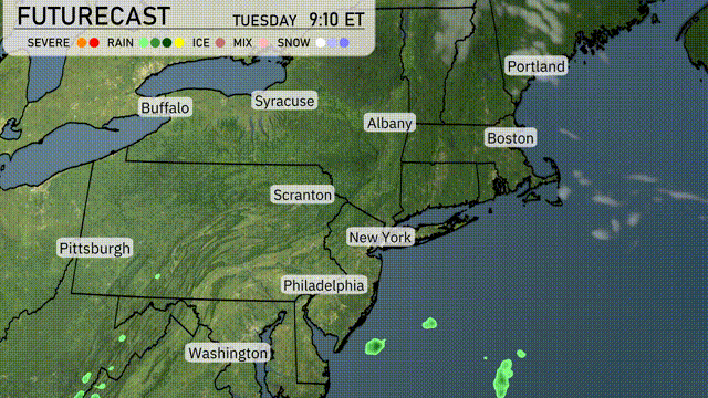
Over the Northeast, the regional radar indicates mostly clear conditions across much of the area. However, there is a small cluster of rain offshore from New York City, which could bring some brief showers to coastal locations if it shifts. Otherwise, major cities like Boston, Albany, and Buffalo are enjoying clear skies. Conditions are favorable for outdoor activities across the region today.
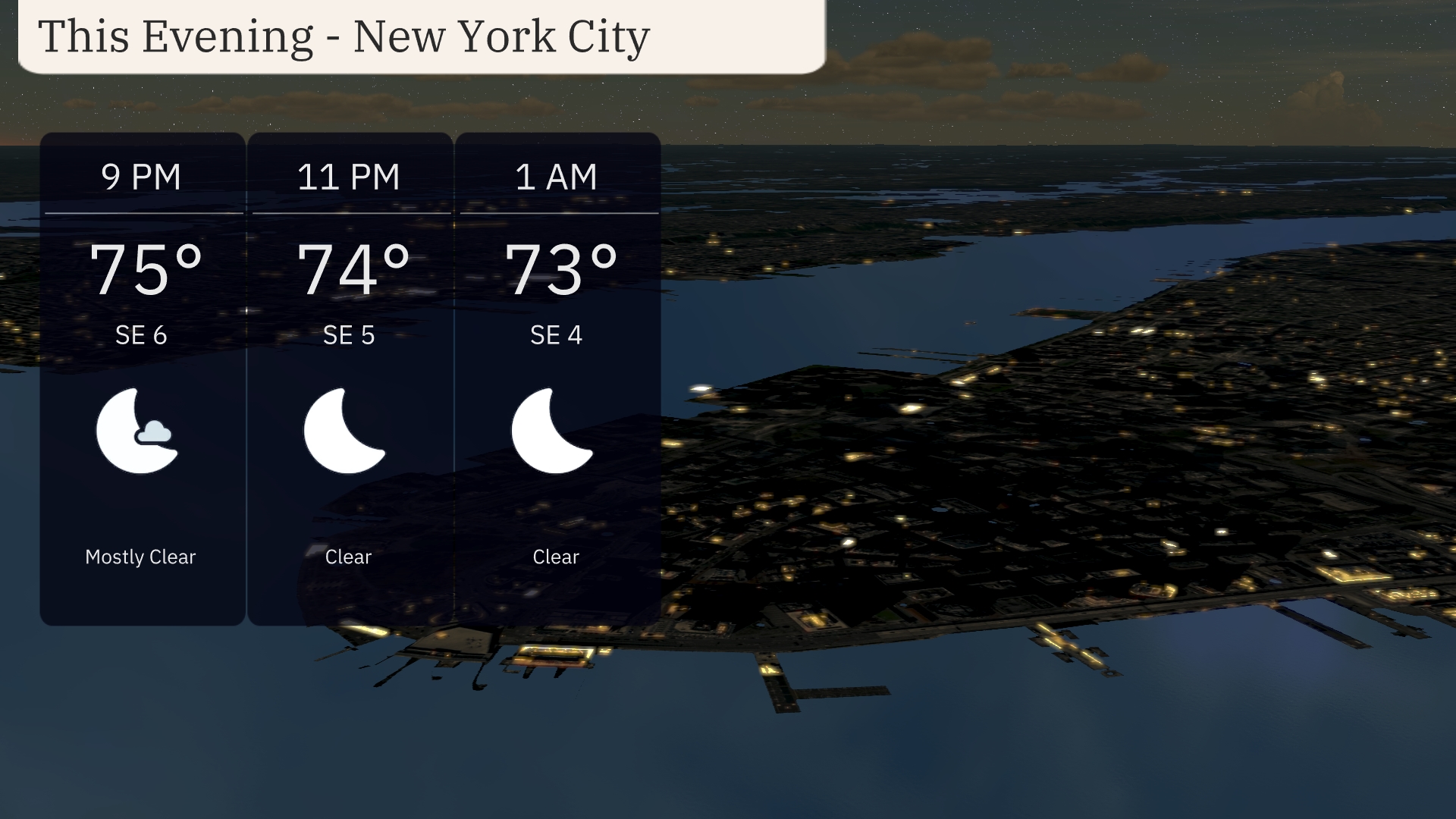
For this evening in New York City, temperatures gradually drop from 75 degrees at 9 PM to 73 degrees by 1 AM. Expect mostly clear skies early in the evening, transitioning to clear conditions through the night. Wind will be mild, coming from the southeast at 4-6 miles per hour. Enjoy the calm and pleasant evening atmosphere!
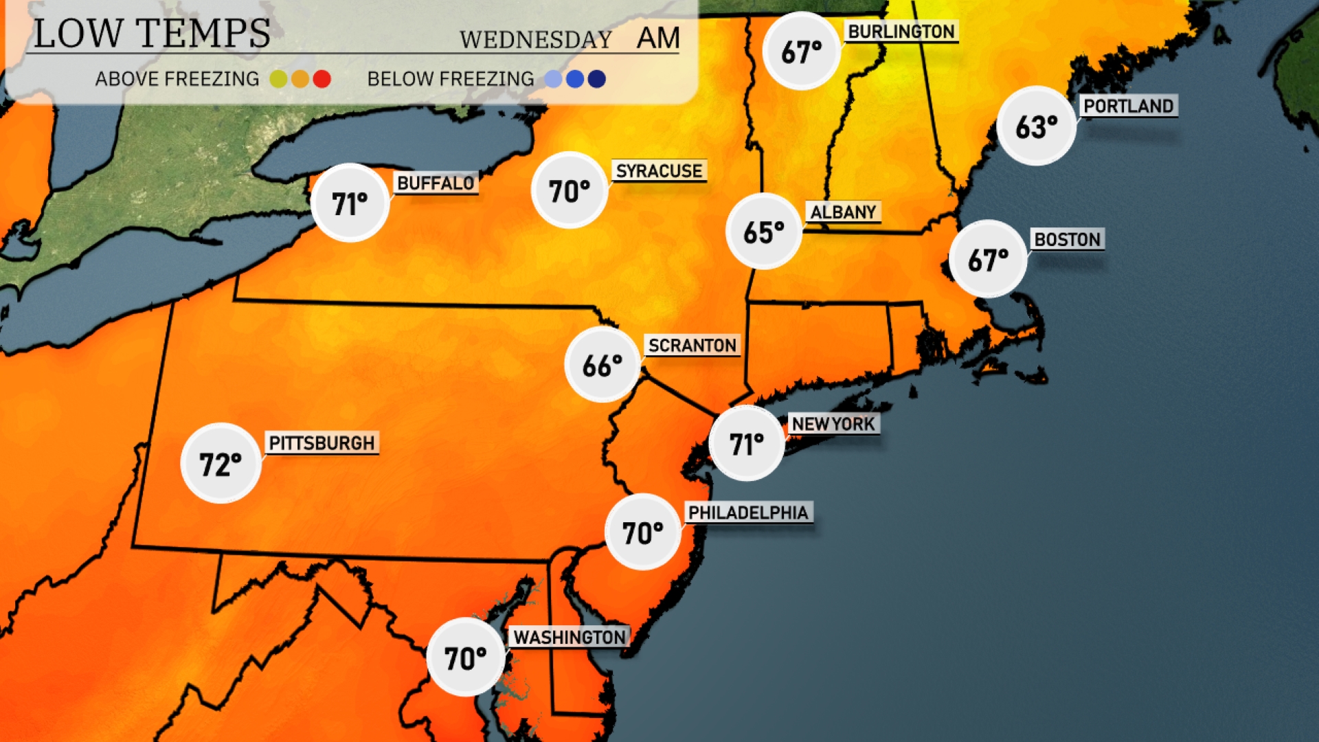
Tonight in the Northeast, low temperatures will vary significantly. Albany will dip to 65 degrees, while Boston can expect a cooler 67 degrees. Scranton is looking at a low of 66 degrees, and in Philadelphia, temperatures will settle at 70 degrees. Syracuse will hover around 70 degrees as well, maintaining a mild trend across the region.
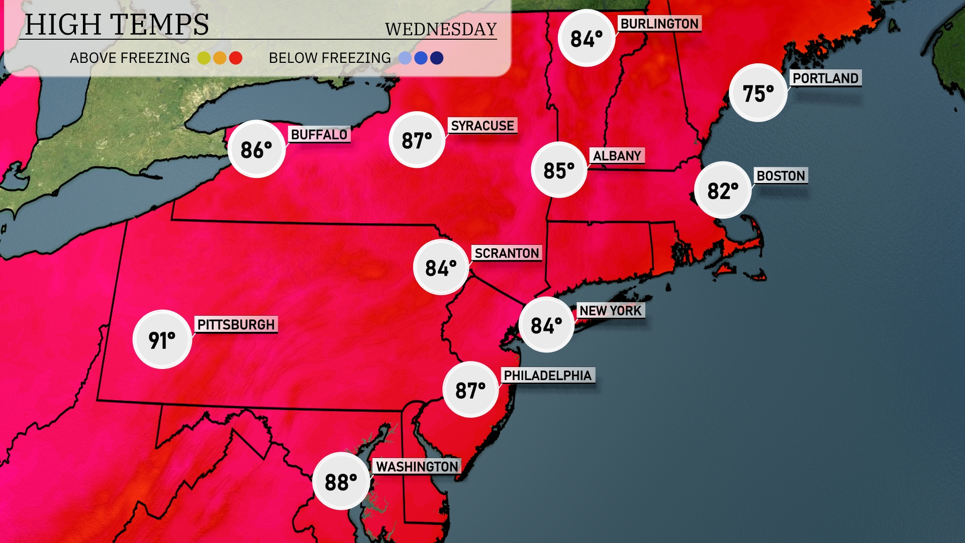
Tomorrow in the Northeast, we’re looking at some toasty highs. Pittsburgh will be a sizzling 91 degrees, while Philadelphia isn’t far behind at 87. In New York City and Scranton, highs will reach 84 degrees, and Albany will warm up to 85. Boston will see a slightly cooler temperature of 82 degrees, with Portland sitting at 75. These temperatures are well above average, influenced by a dominant high-pressure system bringing warm air into the region.
A weak cold front will push through the Northeast tomorrow, sparking scattered showers and a few thunderstorms from Philadelphia to Boston. Expect the heaviest rain during the late evening hours, with potential localized downpours that could lead to minor flooding in urban areas. Daytime temperatures will range from the mid-70s in Syracuse to the low 80s in New York City. By Wednesday morning, conditions will clear, leading to sunny skies and cooler temperatures across the region. Preparations should be made for slick roads due to rain-mixing periods, especially in early morning commutes.
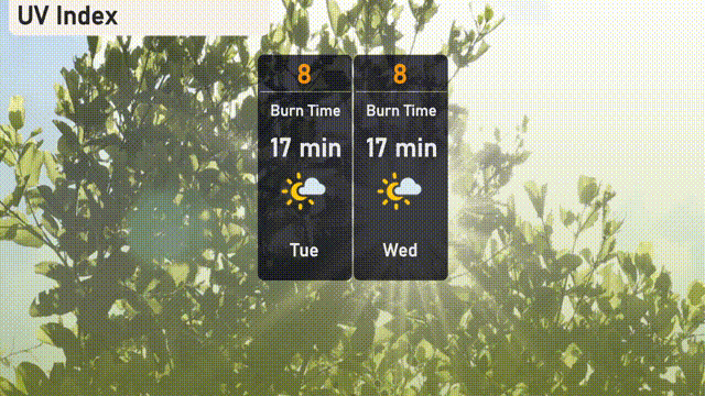
The UV index in New York City will be very high with a rating of 8 for both today and tomorrow, indicating a short burn time of about 17 minutes in direct sunlight. Remember to wear sunscreen, hats, and sunglasses if you’re heading outdoors!
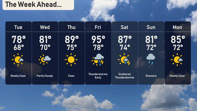
For the 7-day forecast in New York City:
Tuesday: Mostly clear skies with a high of 78 degrees and a low of 68 degrees.
Wednesday: Partly cloudy conditions, reaching up to 81 degrees, with a low of 70 degrees.
Thursday: Clear and warm, with highs around 89 degrees and lows at 75 degrees.
Friday: Thunderstorms early, bringing cooler weather with a high of 95 degrees and a low of 78 degrees.
Saturday: Scattered thunderstorms expected, temperatures peaking at 87 degrees and dropping to 74 degrees at night.
Sunday: Showers move in, with a high near 81 degrees and a low of 72 degrees.
Monday: Mostly clear once again with highs reaching 85 degrees, and lows around 72 degrees.