Partly Sunny, Partly Stormy: NYC’s Dynamic Weather Forecast for April 30, 2025
By
Amy Freeze
Dive into the detailed weather forecast for New York City as presented by Amy Freeze. From sunny mornings to rainy evenings, know what to expect and how to prepare for the week ahead.
Meteorologist Amy Freeze gives us the ins and outs of NYC’s weather on April 30, 2025. Discover what your day could look like with our detailed predictions!
Welcome to your detailed New York City weather outlook for April 30, 2025, with Amy Freeze. Tomorrow, you’ll find partly cloudy skies with temperatures climbing in the morning. As the day progresses, expect various changes, from mild conditions to unexpected showers. By evening, scatter showers might turn into thunderstorms, affecting several Northeast cities. End your day informed with this comprehensive guide to preparing for all weather possibilities right at your door.
The Northeast region is experiencing relatively clear and calm conditions. However, light rain is approaching from the west, just beyond the Pennsylvania state line, with some showers gradually moving towards cities like Scranton and Buffalo. Syracuse remains cloud-free at the moment, while a mix of clouds begins to gather over New York City. To the north, Albany and Boston are under partly cloudy skies, providing some breaks of sunshine. Washington, D.C., remains dry
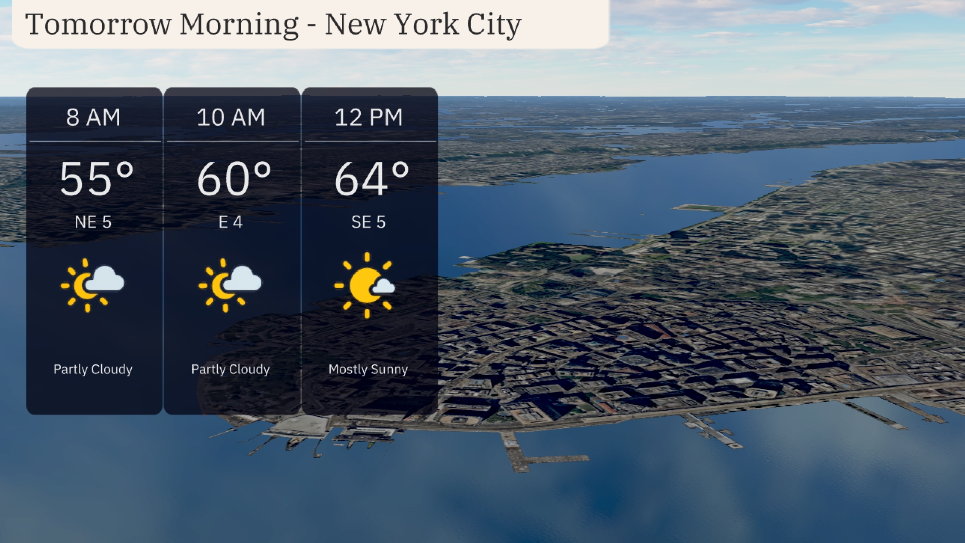
Expect a partly cloudy start in New York City tomorrow morning, with temperatures rising from 55 degrees at 8 AM to 60 degrees by 10 AM. The wind will be light, starting from the northeast at 5 mph and shifting to the east. By midday, temperatures will reach 64 degrees with mostly sunny skies and a gentle southeast breeze at 5 mph.
Tomorrow, the Northeast will experience above-average temperatures with several cities enjoying a warm day. Philadelphia leads the way with a high of 77 degrees, while Pittsburgh reaches 81 degrees. New York City will see a comfortable 65 degrees, and Albany is expected to hit 72 degrees. In contrast, Boston will be cooler at 62 degrees, and Portland lags behind at 55 degrees.
Rainy conditions will develop by evening from Pittsburgh to Scranton, with scattered showers spreading eastward through the overnight hours. Thunderstorms could bring gusty winds and brief downpours, particularly from Buffalo to Albany. Expect rain to reach New York City and Boston by morning, impacting the commute. Temperatures will remain steady in the mid-60s to low 70s.
The UV index in New York City will be notably high over the next two days. On Wednesday, expect a UV index of 7, where a burn can occur within 20 minutes of sun exposure. Thursday sees the index rise to 8, bringing even stronger sun with a burn time of just 17 minutes.
For the 7-day forecast in New York City:
Thursday: Partly cloudy skies with a high of 68 degrees and a low of 56.
Friday: Expect cloudy conditions with highs around 78 degrees and a low of 63.
Saturday: Thunderstorms roll in, bringing a high of 79 degrees and an overnight low of 62.
Sunday: Showers continue with temperatures peaking at 68 degrees, dropping to 57 degrees at night.
Monday: More showers are expected, with a high of 62 degrees and a low of 58.
Tuesday: The rainy pattern persists with showers, reaching a high of 65 degrees and dipping to 59 at night.
Wednesday: Rounding out the week with more showers, the high will be 68 degrees and the low 59.