New York’s Mid-Summer Moods: Sizzling Days to Stormy Nights
By
Amy Freeze
Experience the dynamic summer weather of NYC from hot sunny days to evening thunderstorms. Plan your week with our detailed forecast.
Discover the fluctuating summer climate in NYC! From daytime highs of 92°F to nighttime thunderstorms, get the full weather rundown.
This is your ultimate guide to navigating NYC’s unpredictable summer weather. From partly cloudy skies and a scorcher at 92°F on Tuesday afternoon to thunderstorms cooling down to 79°F by night, our detailed breakdown helps you plan your activities. Stay weather-aware with updates on the Northeast’s shifting conditions, urban flooding risks, and UV index warnings. Enrich your summer plans by staying informed about what’s happening right outside your front door!
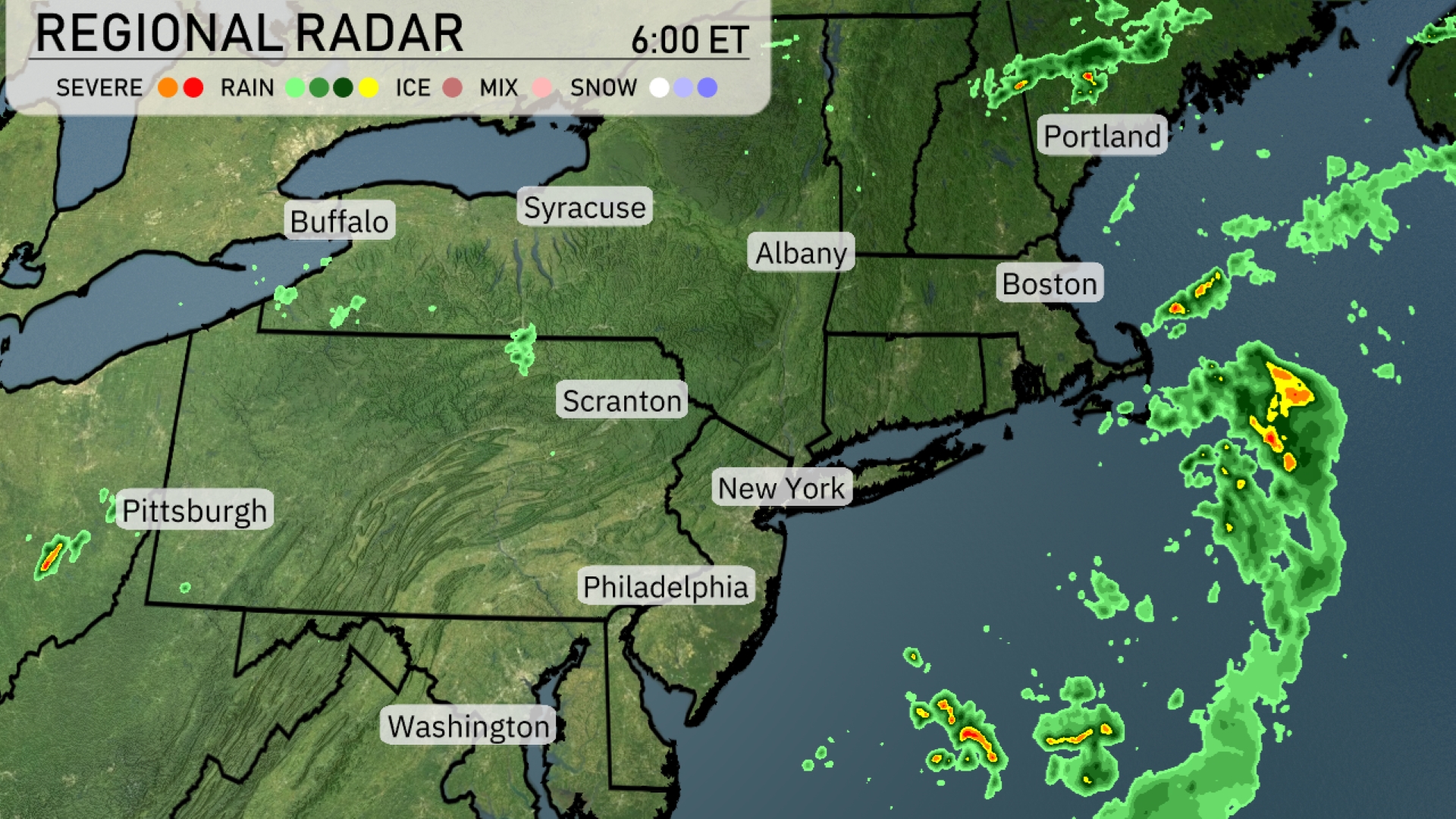
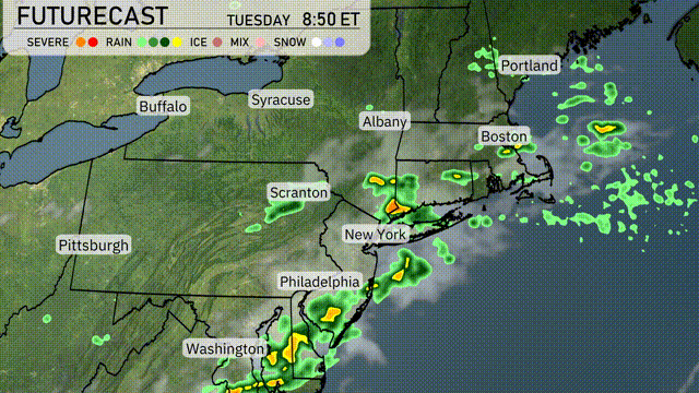
The Northeast region is experiencing mostly clear skies with a few pockets of activity. Showers are approaching Pittsburgh, indicating potential rain for the area. Portland and coastal parts of Maine might see some scattered thunderstorms just off the coast, moving eastward. New York City and Boston remain dry, with clear conditions dominating the region.
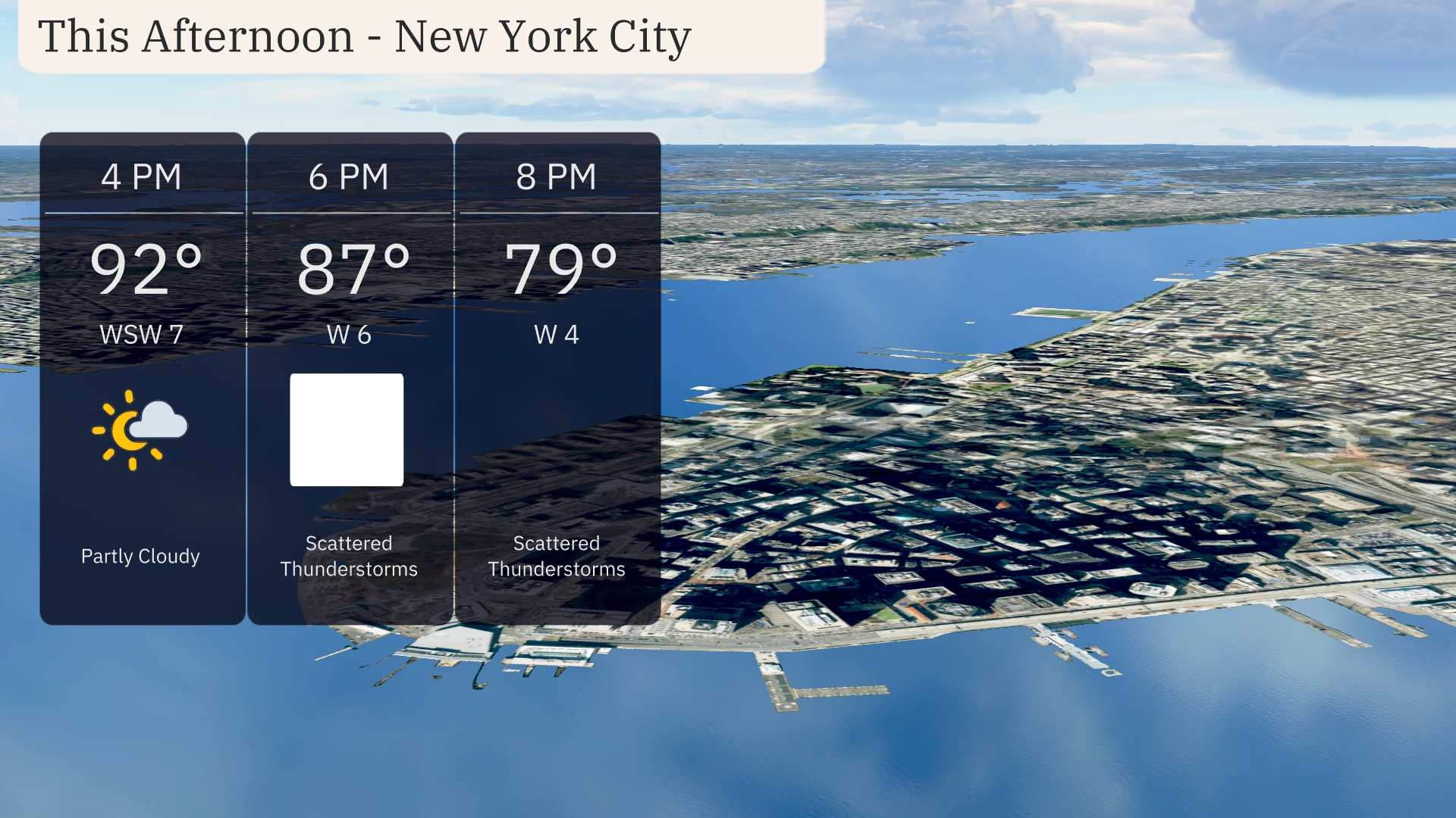
This afternoon in New York City, temperatures will peak at a warm 92 degrees. Expect partly cloudy skies, with winds coming from the WSW at 7 miles per hour. Heading into the early evening, scattered thunderstorms are likely, with temperatures dropping to 87 degrees and winds shifting to 6 miles per hour. By 8 PM, expect continued thunderstorms and temperatures further cooling to 79 degrees with winds from the west at 4 miles per hour.
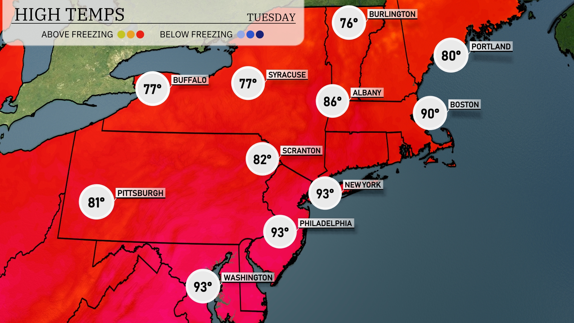
In the Northeast today, we’re seeing some significant temperature variations. New York City is heating up to a sizzling 93 degrees, while Albany reaches 86 degrees. Scranton will be slightly cooler with a high of 82 degrees. Upstate, both Buffalo and Syracuse are expected to see highs around 77. Meanwhile, coastal areas like Boston hit 90 degrees, creating a warm contrast with Portland’s pleasant 80 degrees.
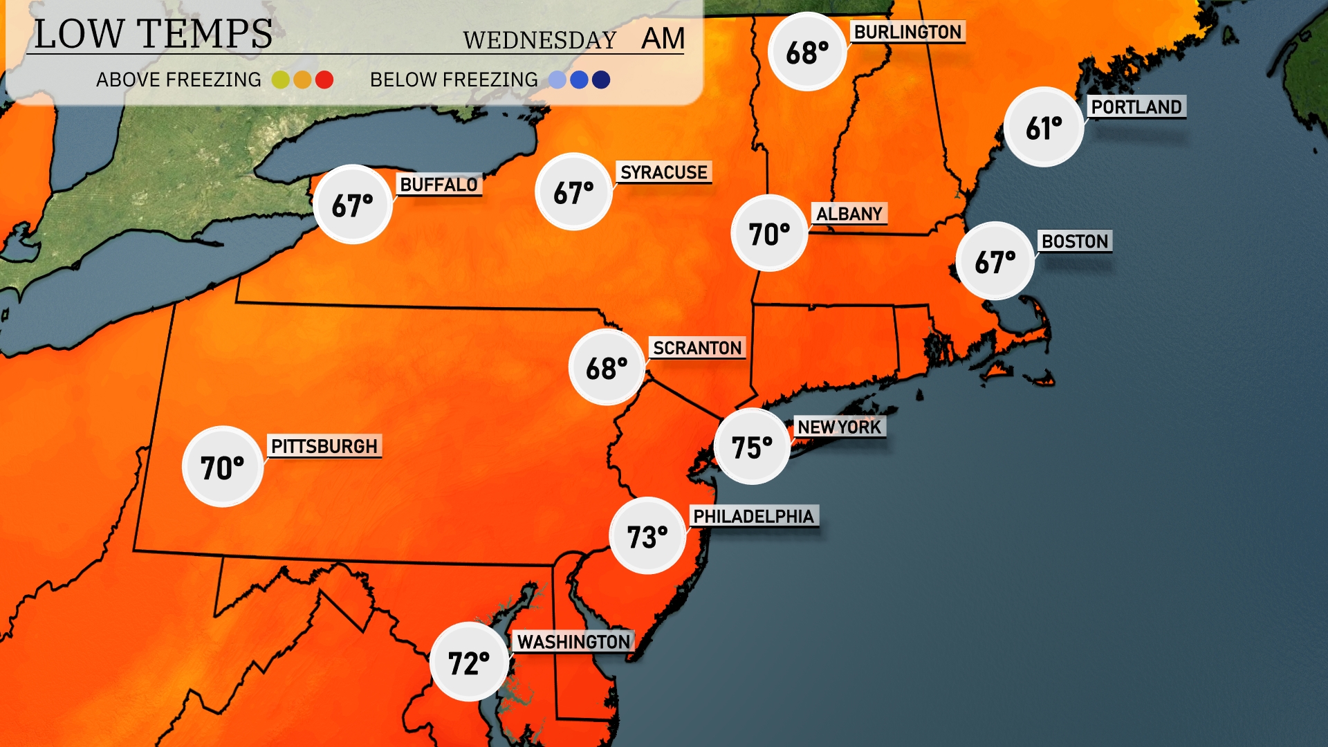
Tonight, temperatures will drop to 61 degrees in Portland. Boston is expected to hit 67 degrees, while Albany will also see a low of 70 degrees. Scranton will cool down to around 68 degrees, and Syracuse will drop to 67. Expect a slightly warmer trend for New York City at 75 degrees.
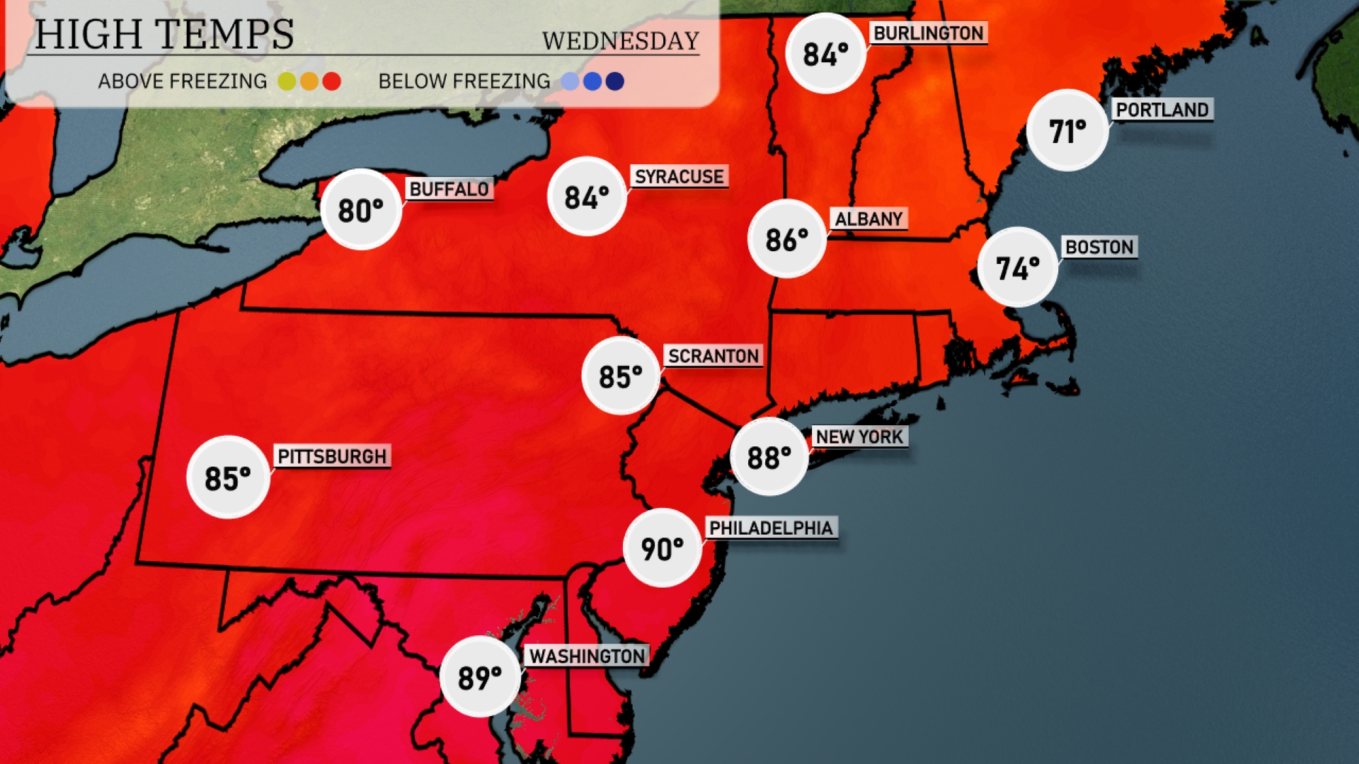
Tomorrow in Philadelphia, expect a sizzling high of 90 degrees, making it one of the warmest spots in the Northeast. New York City will follow closely with a high of 88 degrees, while Scranton and Pittsburgh will reach 85. Albany is set for a hot 86 degrees, and Syracuse will warm up to 84 degrees.
A cold front is sweeping through the Northeast, bringing scattered showers and thunderstorms to Washington, D.C., Philadelphia, and as far north as New York City through Tuesday evening. Expect a few of these storms to pack heavy rains and gusty winds. By Wednesday morning, areas like Albany and Scranton could experience isolated storms as the front moves eastward. While severe weather is not the main concern, keep an eye out for minor urban flooding in low-lying areas due to brief, heavy downpours. Temperatures will trend slightly cooler following the front’s passage, with clearing conditions expected by late Wednesday into Thursday.
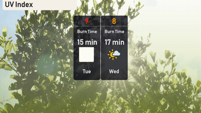
The UV index in New York City is set to be very high on Tuesday with a value of 9, bringing a fast burn time of about 15 minutes in direct sunlight. Wednesday sees a slight decrease with a UV index of 8, which still poses a risk with a burn time around 17 minutes.