New York City Weather Forecast for 09/22/2025: A Mix of Clouds, Sun, and Gentle Breezes
By
Amy Freeze
Expect a blend of partly cloudy skies and warm temperatures in New York City tomorrow morning. Full details on this week's weather trends from sunny highs to rainy lows.
Catch the latest in NYC weather for 09/22 with our detailed forecast. From morning breezes at 69°F to a cozy 75°F by noon, see what the weather holds!
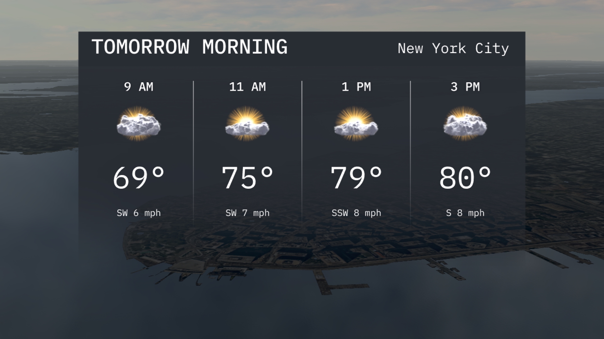
Dive into our detailed weather forecast for New York City this Tuesday morning. Starting at a cool 69°F, the city will experience partly cloudy skies with a gentle southwest breeze, warming up to 75°F by mid-morning. The week continues with fluctuating temperatures and conditions, from sunny days to potential showers. Get all the insights and be prepared for each day’s weather. Visit our full article at https://amyfreeze.ai/
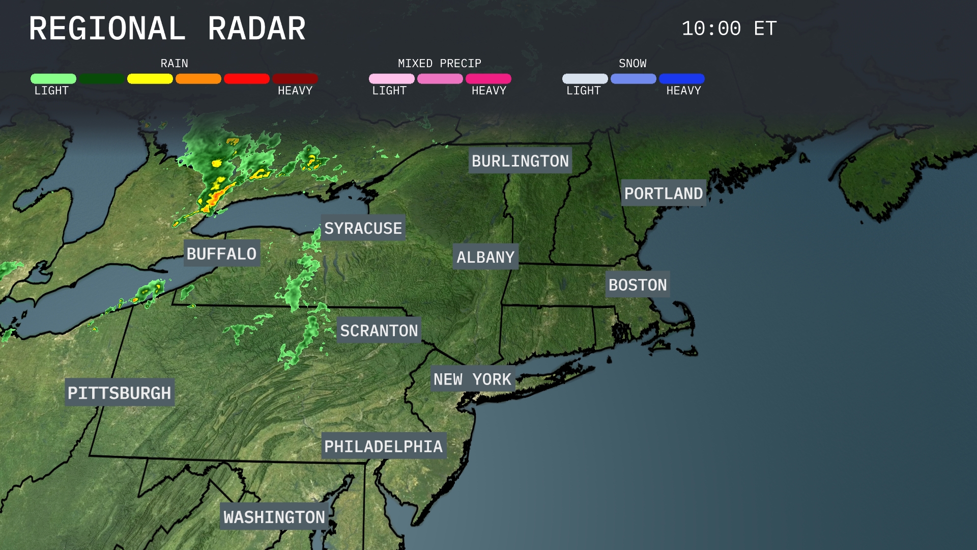
The Northeast region is seeing a band of rain showers stretching from Buffalo to Syracuse, moving through the state of New York. Light rain is extending into areas near Scranton, Pennsylvania. Meanwhile, cities such as Albany, Boston, and Portland are experiencing clear conditions, while Burlington remains free from precipitation. Washington, Philadelphia, and New York are also enjoying dry weather for now as there is no significant cloud cover or rain activity in those areas.
Tomorrow morning in New York City, expect partly cloudy skies with temperatures starting at 69 degrees by 9 AM. Winds will be coming from the southwest at 6 miles per hour, providing a gentle breeze. By 11 AM, the temperature will rise to 75 degrees with winds increasing slightly to 7 miles per hour.
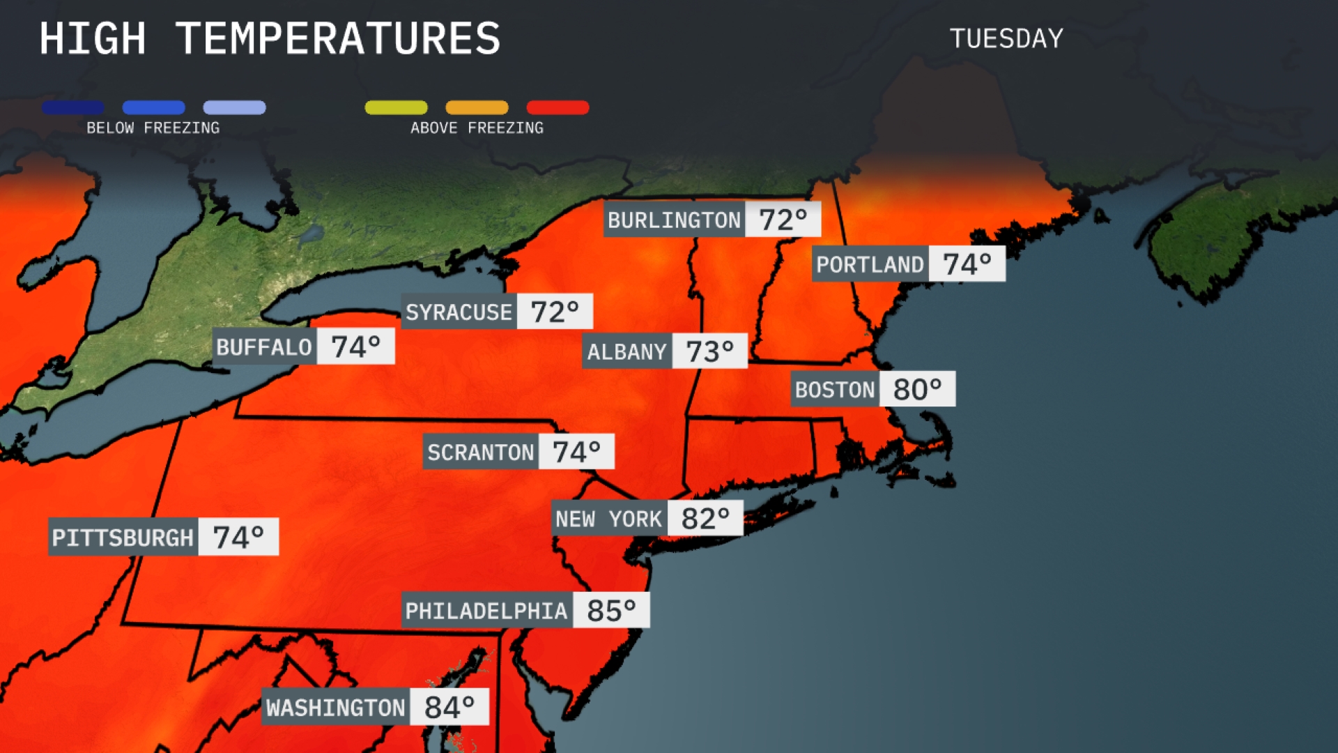
Tomorrow in the Northeast, we’re expecting unseasonably warm temperatures. New York City will see a high of 82 degrees, while Philadelphia may reach up to 85 degrees. Boston is not far behind at 80 degrees, indicating a warm day across the region. Scranton and Buffalo will both experience highs of 74 degrees, and Syracuse can expect 72 degrees.
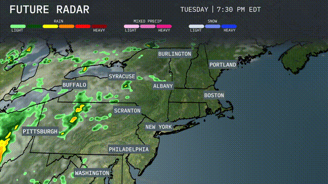
A developing low-pressure system brings rain and moderate to heavy thunderstorms across the Northeast, starting from the Great Lakes and progressing eastward by late afternoon. Buffalo and Syracuse can expect showers by morning, with potential for localized flooding in areas of heavier precipitation. By evening, rain spreads into Albany and Scranton, advancing towards New York City overnight. Expect strong winds in coastal areas, particularly along the New England coast, as this system advances.
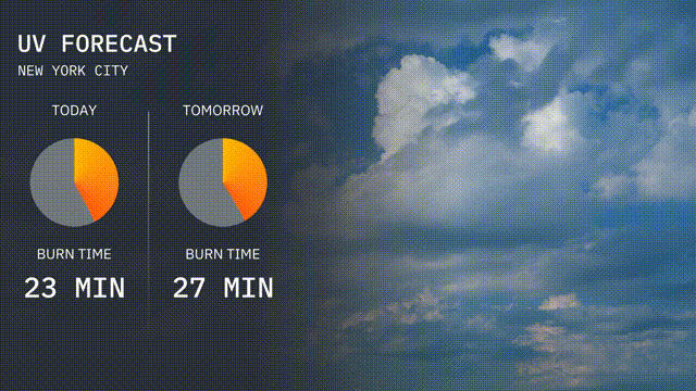
The UV index in New York City today is moderate at 5, with a burn time of 23 minutes in direct sunlight. Tomorrow, expect a slight increase in the UV index to 6, as the burn time extends to 27 minutes.
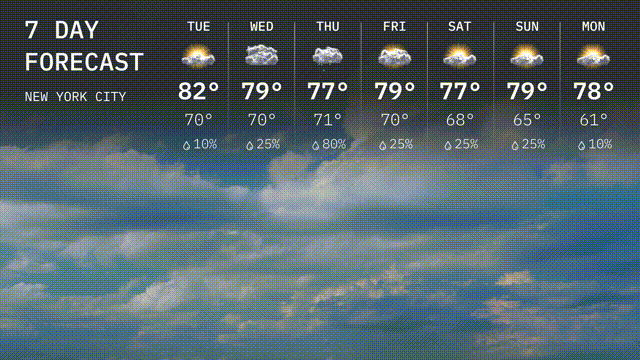
For the 7-day forecast in New York City:
Tuesday: Mostly sunny with a high of 82 degrees and a low of 70.
Wednesday: Clouds roll in with temperatures reaching 77 degrees during the day and a nighttime low of 70 degrees.
Thursday: Rainy conditions dominate with a high of 77 degrees and a low of 71.
Friday: The rain clears, leaving partly cloudy skies and a high of 79 degrees. Nighttime temperatures will drop to 70 degrees.
Saturday: Partly sunny, expect a high of 79 degrees and a drop to 68 degrees overnight.
Sunday: More sun peeks through the clouds, with a high of 77 degrees and a low of 65.
Monday: It brightens up slightly with mostly sunny skies and a high of 78 degrees, cooling to 61 degrees at night.