Storms Sweep Through NYC: A Detailed Look at This Week’s Weather Forecast
By
Amy Freeze
Meteorologist Amy Freeze provides an in-depth look at the stormy conditions expected in New York City, along with a sneak peek into temperature fluctuations through the week.
As storms roll into NYC, discover how the weather will fluctuate from refreshing cool evenings to lively warm afternoons.
Metereologist Amy Freeze dives into the detailed forecast for New York City. From thunderstorms impacting your morning commute to fluctuating temperatures adding a chill to your evenings, learn how this week’s weather will affect your daily plans. Expect detailed descriptions of temperature highs and lows and practical advice to stay comfortable and safe.
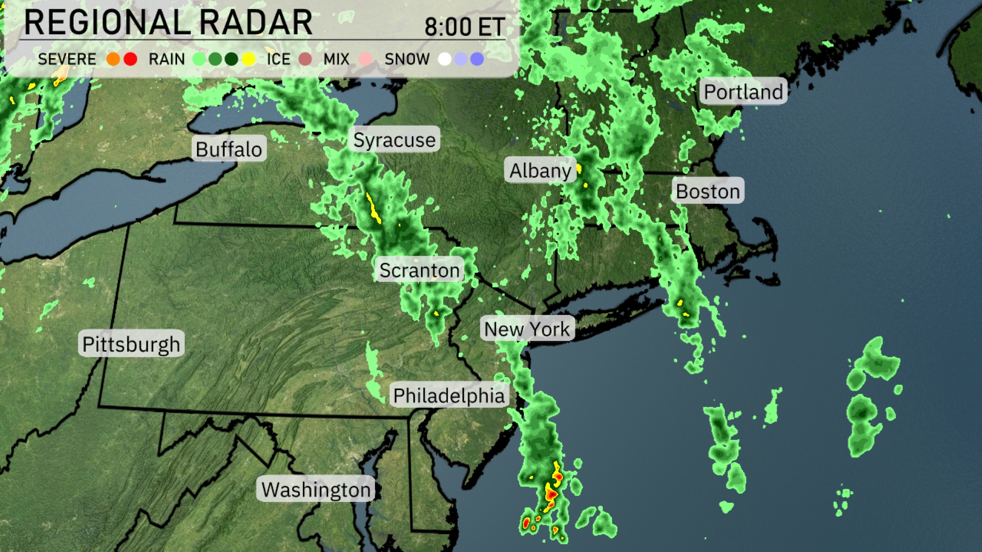
Rain and thunderstorms are sweeping through the Northeast, moving from Pittsburgh to New York City, impacting much of the region. Heavier rain is concentrated around New York, with clouds extending towards Boston and Portland. Albany is experiencing some cloud cover with rain showers approaching. In the Scranton area, expect intermittent rain with more rain showers advancing. Philadelphia is currently under lighter rain, with the potential for heavier rainfall as the system moves in.
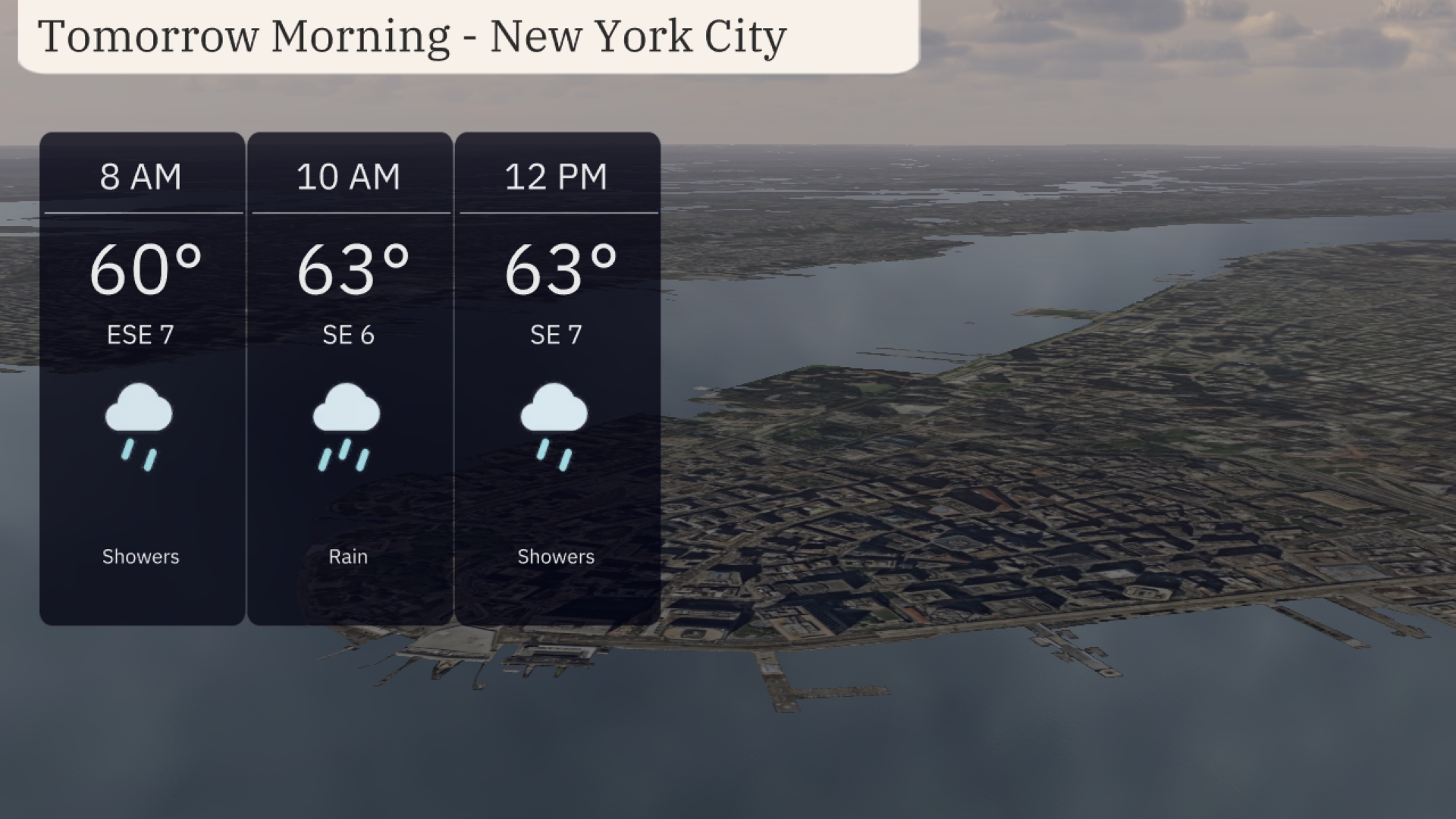
In New York City tomorrow morning, temperatures will start at 60 degrees by 8 AM, rising to 63 degrees by 10 AM. Expect showers throughout the morning, transitioning to rain by 10 AM, with a light southeast wind between 6 to 7 miles per hour. Around noon, the showers will continue, maintaining the temperature at 63 degrees, with the wind from the southeast at 7 miles per hour.
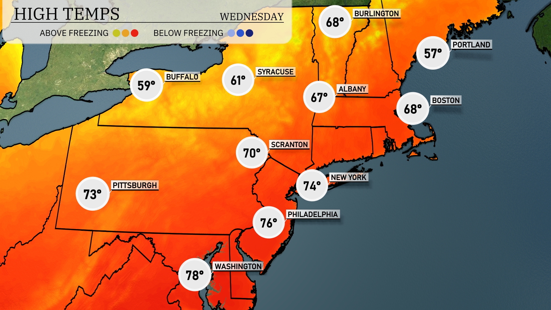
Tomorrow, the Northeast is set to experience warm temperatures, reaching above-average readings across the region. New York City will enjoy a high of 74 degrees, while Philadelphia warms up to 76. Scranton, PA, is looking at a pleasant 70 degrees, and Pittsburgh will hit 73. The cooler spots include Albany with a high of 67 and Buffalo peaking at 59 degrees.
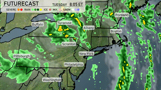
Expect an active weather day across the Northeast tomorrow. A band of showers and thunderstorms will pass through the region, with heavy downpours likely from Syracuse to Albany, impacting morning commutes. As the system moves eastward, areas from Scranton to New York City will experience persistent rain, potentially causing localized flooding in low-lying areas. Temperatures will remain moderate with a cooling trend as the front passes through. The day will end with clearing skies moving into the Philadelphia and Washington regions, suggesting dry and cooler conditions by the evening.
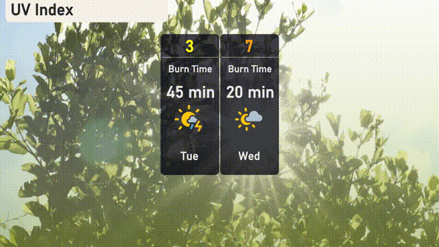
The UV index in New York City is expected to be low on Tuesday with a value of 3, significantly reduced by cloud cover and potential storms. No burn time is necessary to mention due to the low UV exposure. On Wednesday, the UV index rises to a high of 7, presenting a quicker burn time of about 20 minutes in direct sunlight.
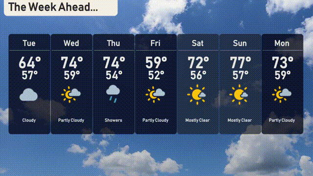
Tuesday: Cloudy skies with a high of 64 degrees and a low of 57 degrees.
Wednesday: Partly cloudy and warming up with a high of 74 degrees and a low of 59 degrees.
Thursday: Showers expected, with temperatures reaching a high of 74 degrees and a low of 54 degrees.
Friday: Partly cloudy conditions, cooling down to a high of 59 degrees and a low of 52 degrees.
Saturday: Mostly clear and warmer, with a high of 72 degrees and a low of 56 degrees.
Sunday: Mostly clear skies continue, with the high climbing to 77 degrees and a low of 57 degrees.
Monday: Partly cloudy to start the new week, with a high of 73 degrees and a low of 59 degrees.