Navigating NYC’s Skies: A Week of Sun, Showers, and Surprises
By
Amy Freeze
From sunny afternoons to unexpected showers, NYC's weather this week keeps us on our toes. Dive into our detailed forecast for what to expect each day!
This week in NYC, the weather has its ups and downs. From clear, sunny skies to chilling showers and a cooling trend, check out what’s in store for the Big Apple.
As we navigate through another eventful week in New York City, Amy Freeze takes you day-by-day with precise forecasts. Partly cloudy today but don’t stash away that umbrella yet—anticipate a mix of rain and thunderstorms approaching. Read on for temperature details, UV index precautions, and our comprehensive 7-day forecast.
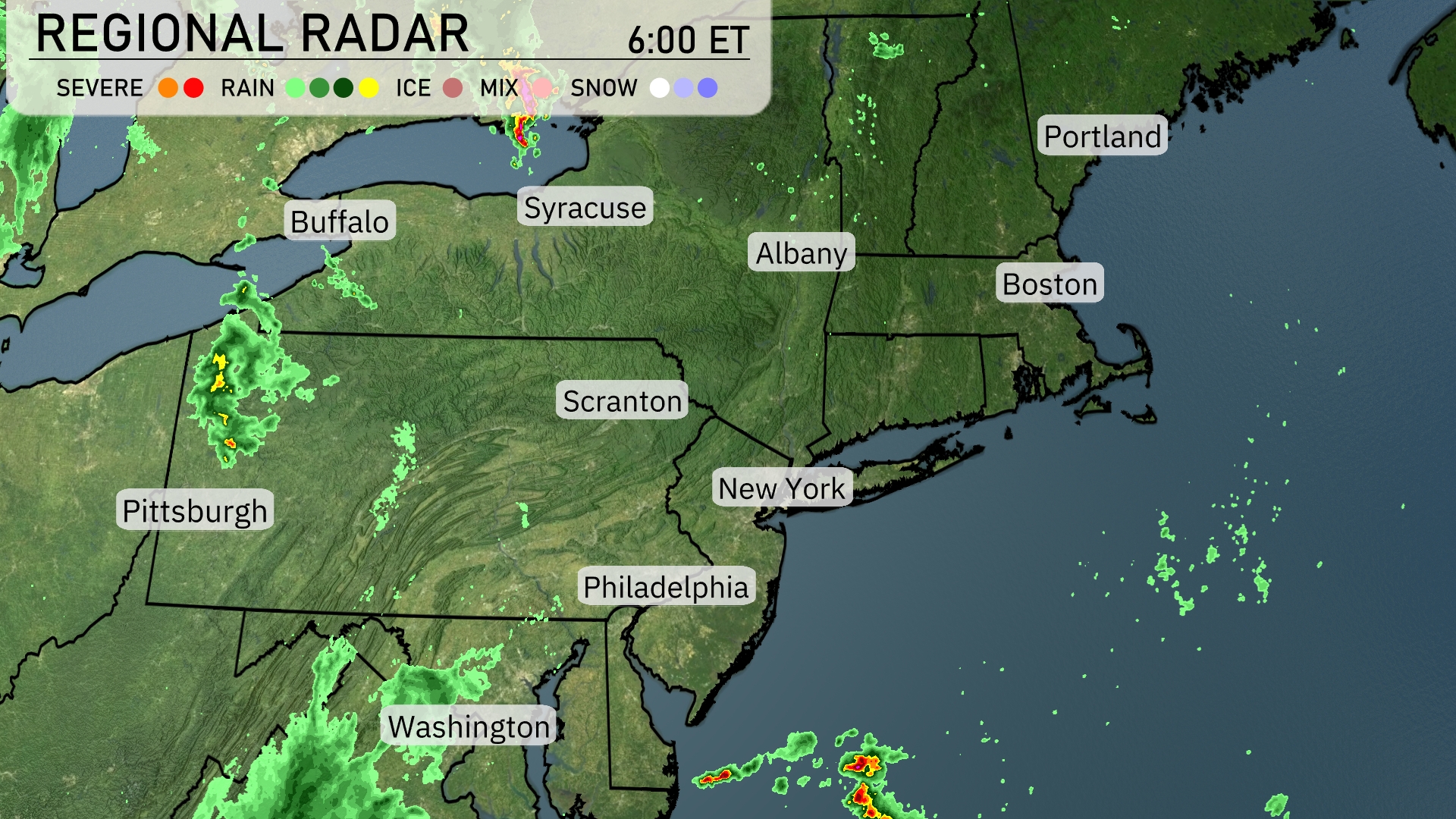
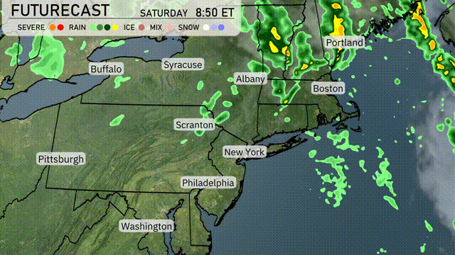
A mix of rain and severe weather is approaching Pittsburgh, moving eastward into western Pennsylvania. Scranton is experiencing scattered rain showers, extending towards the outskirts of New York City with some spotty precipitation. In Albany, expect emerging cloud cover, though conditions remain mostly dry for now. The Boston area enjoys clear skies, with only a few clouds drifting east towards Portland. Philadelphia and Washington are free from precipitation, maintaining a calm and dry start to the day.
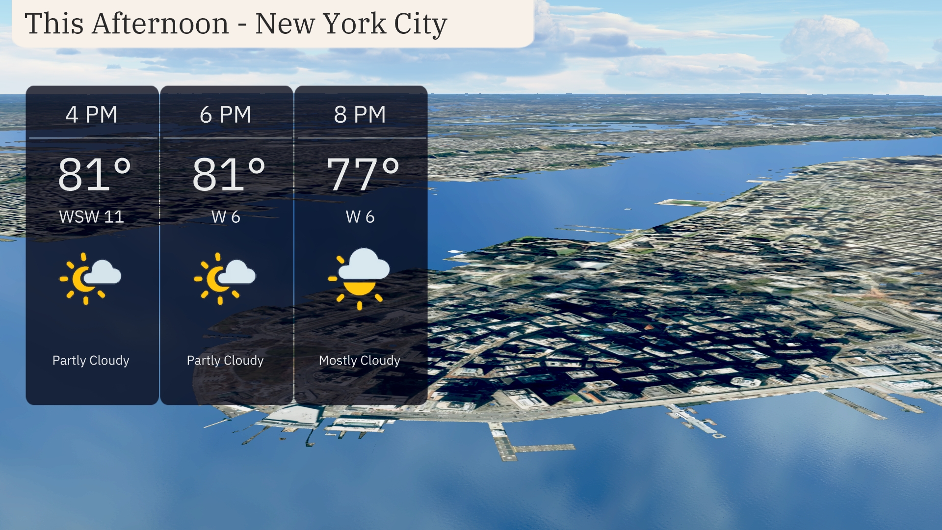
For the afternoon in New York City, expect partly cloudy skies with temperatures holding steady at 81 degrees. Winds will be from the west-southwest at around 11 mph, providing a gentle breeze. By 8 PM, clouds will increase, becoming mostly cloudy, while temperatures slightly drop to 77 degrees. Winds will calm to about 6 mph as the evening progresses.
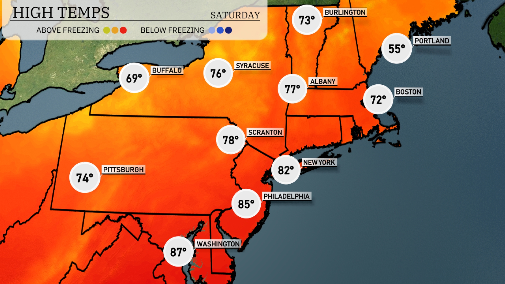
Today, the Northeast is experiencing a warm afternoon with high temperatures across the region. In New York City, expect a high of 82 degrees, while Philadelphia is feeling even warmer at 85. Scranton will reach 78, and Syracuse is close behind at 76 degrees. Boston, however, is a bit cooler with a high of 72, and further north in Portland, temperatures drop significantly to just 55 degrees. Buffalo is on the milder side too, reaching 69 degrees.
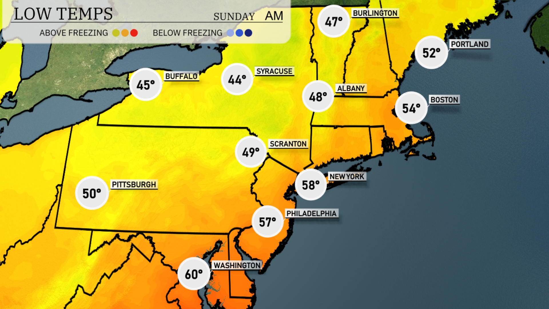
Tonight, the Northeast will experience some cooler temperatures as a cold front sweeps through the region. Boston is forecasted to drop to 54 degrees, while New York City will see a low of 58. Scranton will feel the chill at 49 degrees. Buffalo will cool down to around 45 degrees, and Syracuse will hit a low of 44. Expect temperatures in Pittsburgh to be slightly milder at 50 degrees, but still on the cooler side overall.
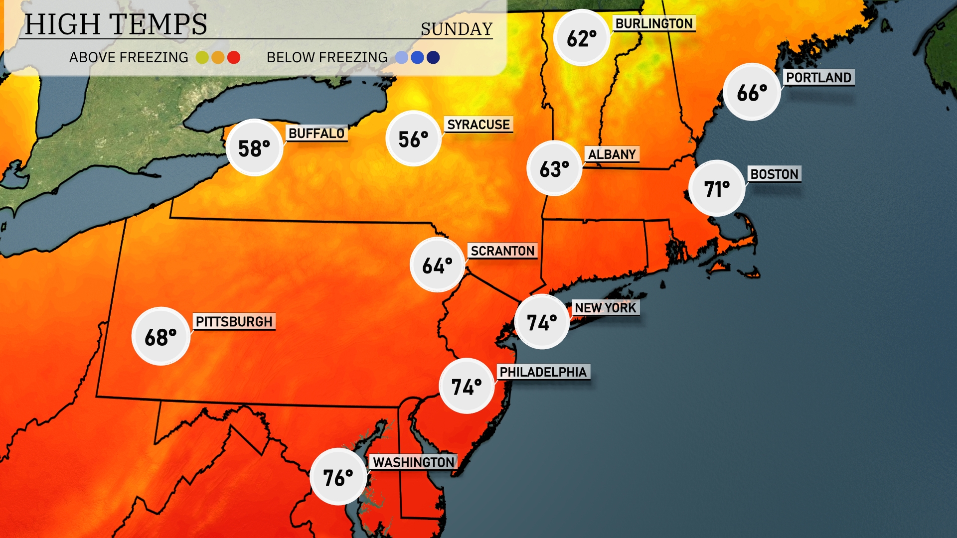
Tomorrow, the Northeast will experience a warm-up with highs reaching above average for many cities. New York will see a pleasant high of 74 degrees, while Philadelphia also hits 74. Washington, D.C., is expected to warm up to a balmy 76 degrees. Further north, Boston anticipates a high of 71 degrees, whereas Buffalo will lag behind at just 58 degrees, feeling the cooler effects of lingering cloud cover.
A cold front pushes through the Northeast tomorrow, bringing scattered rain showers from Boston to New York City. Expect showers to intensify by late afternoon, particularly around Albany and Scranton. Thunderstorms could develop in areas like Syracuse, enhancing the risk for heavy rain and gusty winds. Temperatures will dip slightly following this frontal passage, with a chillier air mass settling by evening.
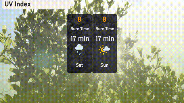
Today’s UV Index in NYC is high, at a level of 8. Expect a burn time of around 17 minutes if you’re outdoors, so make sure to apply sunscreen generously and wear hats or sunglasses.