Morning Clarity & Evening Showers: NYC’s Weather Outlook
By
Amy Freeze
New York City starts with clear skies but braces for evening showers and possible disruptions. Here’s everything you need to know to plan your day and stay dry!
In NYC tomorrow, enjoy a morning of clear skies and calm winds perfect for outdoor activities, but keep your umbrella close as showers and thunderstorms are expected by evening.
Welcome to your detailed NYC weather report! Tomorrow offers a refreshing start with temperatures at a comfortable mid-60s to low 70s and clear blue skies – perfect weather to enjoy your morning routine outdoors. However, the serenity will be short-lived as a low-pressure system ushers in showers by the afternoon, intensifying into potential thunderstorms later on. Engage with full week’s forecast, essential prep tips, and how this weather could affect your daily activities across the city, all here at https://amyfreeze.ai/
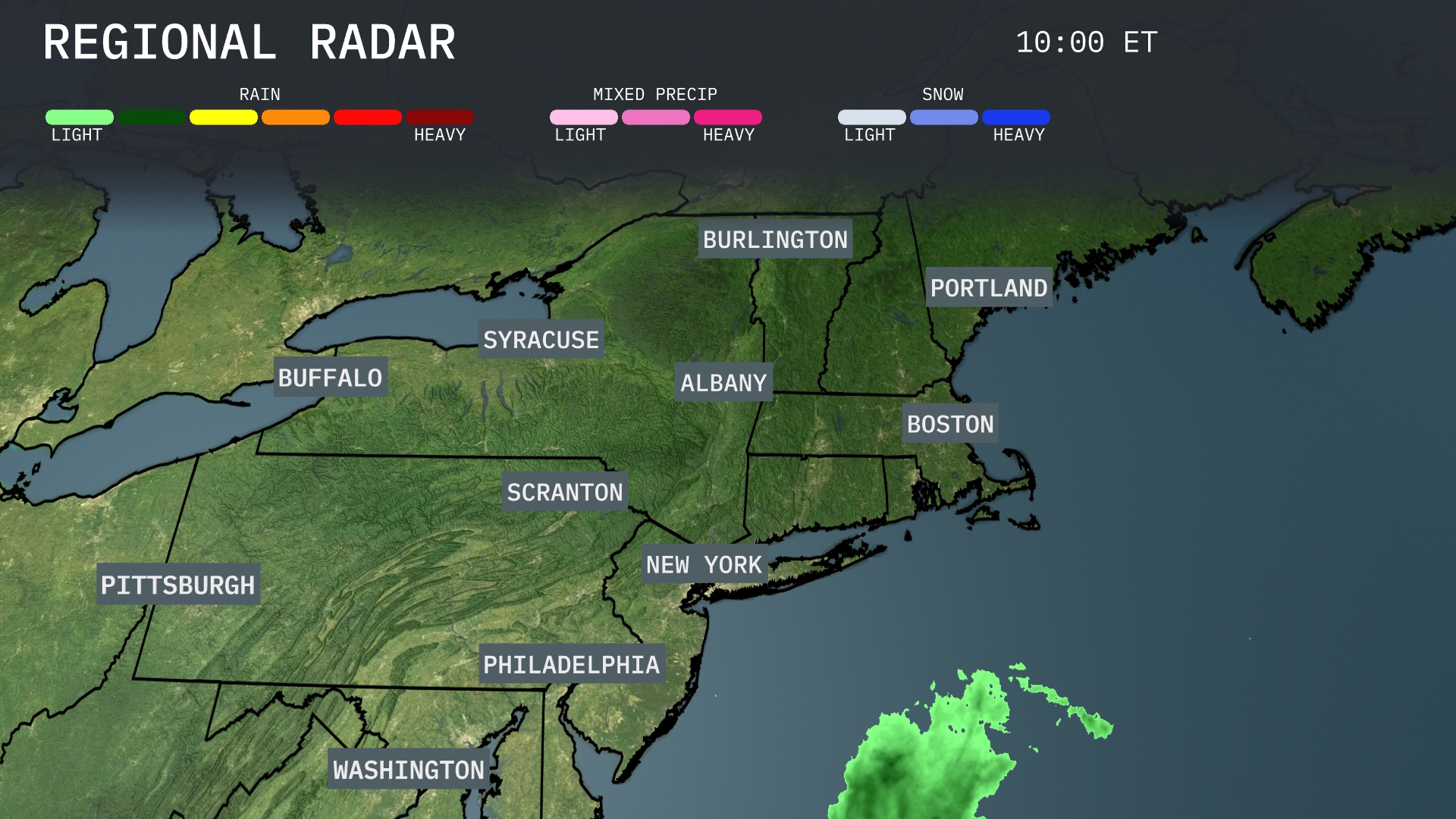
Showers are moving into the coastal areas of the Northeast, particularly impacting regions like Long Island and just south of New York City, with rain developing offshore. Elsewhere across the Northeast, cities such as Boston, Syracuse, and Burlington remain dry under clearer skies. The entire region from Albany to Pittsburgh is experiencing calm conditions. However, keep an umbrella handy if you’re near Philadelphia, as precipitation is edging closer.
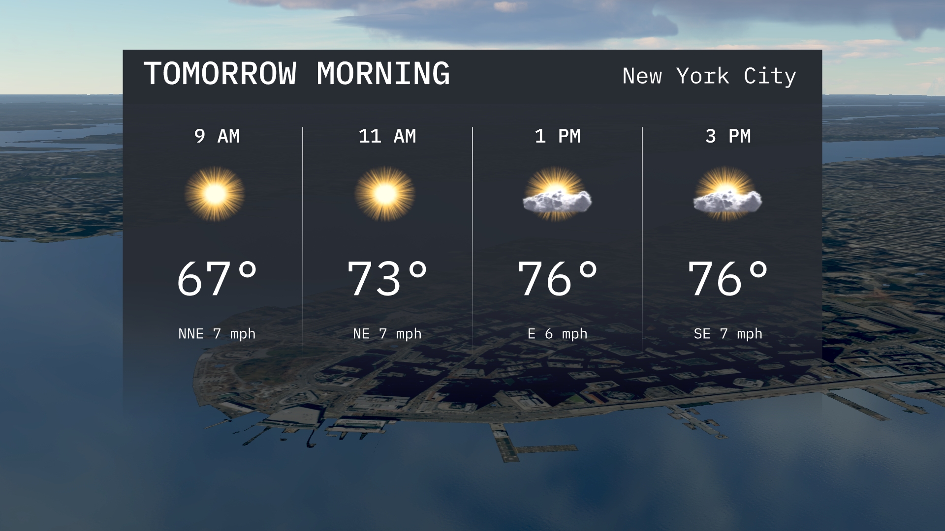
New York City will start tomorrow morning with clear skies. Temperatures will rise from 67 degrees at 9 AM to 73 degrees by 11 AM. Expect calm winds from the north-northeast, providing a pleasant morning for outdoor activities.
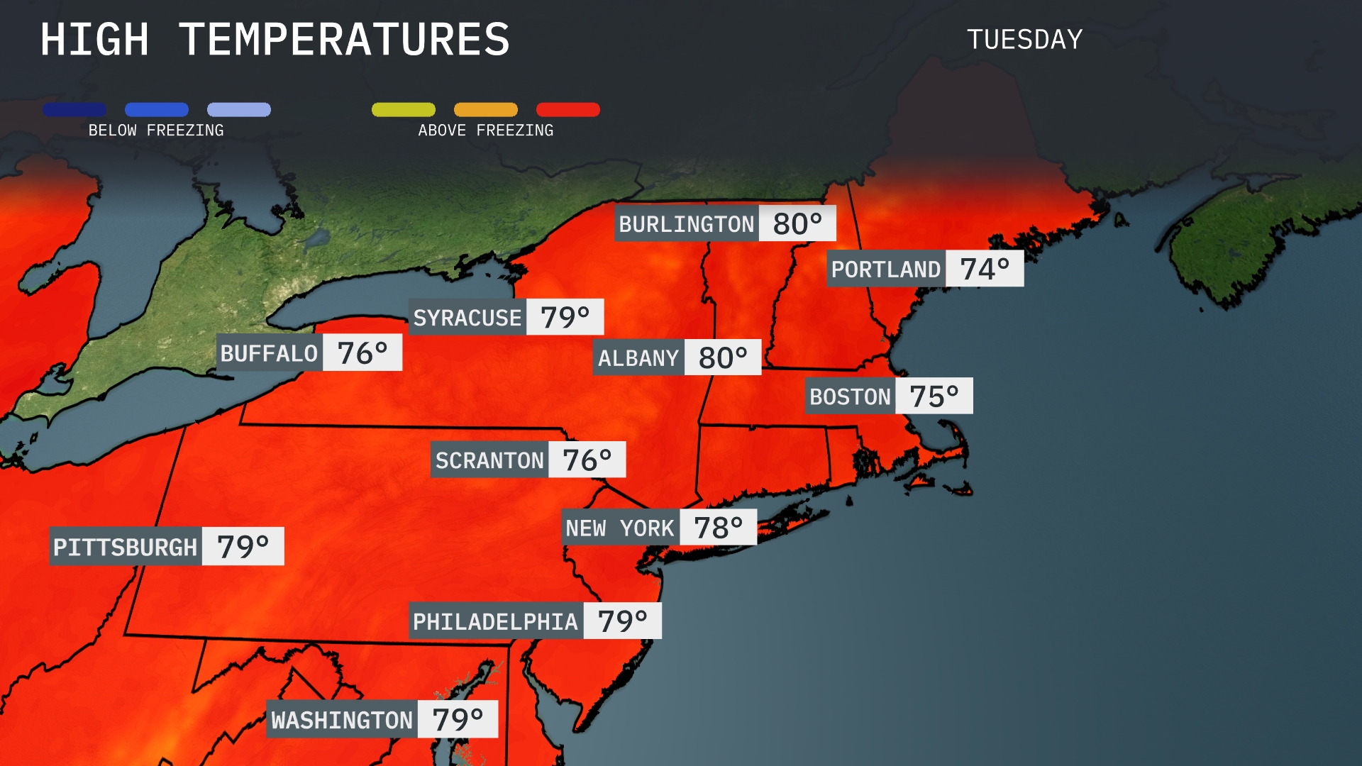
Tomorrow in the Northeast, Albany and Burlington will peak at 80 degrees, indicating warm weather above seasonal averages. Expect Boston to reach a high of 75 degrees, while Portland will see cooler temperatures at 74 degrees. Syracuse and Washington, D.C. will both hit 79 degrees, aligning closely with their typical September highs. Pittsburgh is also on the warmer side, with a high of 79 degrees, while Scranton will see 76 degrees. Overall, a warm spell influences the region, pushing temperatures above seasonal norms.
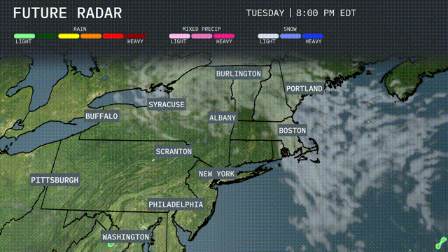
A low-pressure system is moving into the Northeast, bringing widespread rainfall and gusty winds by tomorrow afternoon. Areas from New York to Boston could see heavy showers, potentially leading to minor flooding in low-lying areas. Temperatures will hover around the mid-70s, slightly cooler with the arrival of a cold front later in the day. As this front moves through, expect thunderstorms primarily in the evening across inland sections like Albany and Scranton. Be prepared for disruptions in travel, especially during the evening commute.
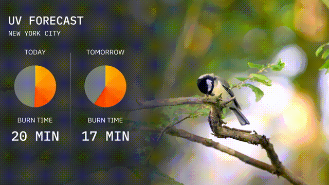
New York City’s UV index today is at 5, suggesting a moderate sun risk with a burn time of around 20 minutes. Tomorrow, it rises slightly with a UV index of 6, bringing a quicker burn time of about 17 minutes. Limit your time outdoors during peak hours and apply sunscreen to protect your skin!
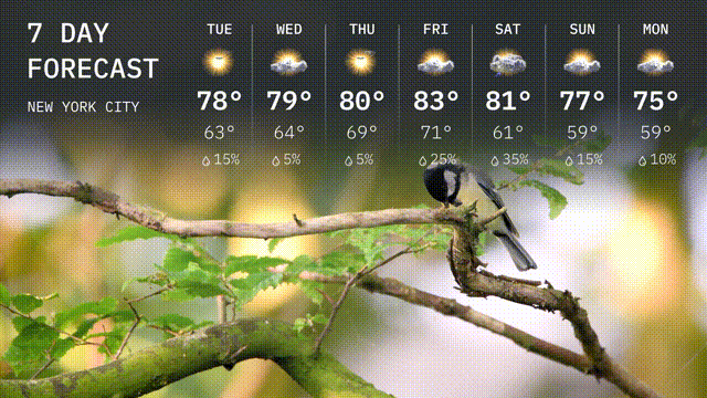
For the 7 Day Outlook in New York City:
Tuesday: Enjoy a sunny day with a high of 78 degrees and a comfortable low of 63 degrees.
Wednesday: Slightly warmer with mostly sunny skies, reaching a high of 79 degrees and dipping to 64 degrees overnight.
Thursday: Partly sunny skies with a high of 80 degrees and a low of 69 degrees.
Friday: A warm day with occasional showers, temperatures peaking at 83 degrees and dropping to 71 degrees at night.
Saturday: Expect showers with a high of 81 degrees and a nighttime low of 61 degrees.
Sunday: Showers continue, bringing highs around 77 degrees and lows near 59 degrees.
Monday: The week wraps up with more showers, a daytime high of 75 degrees and a low of 59 degrees.