Sunny Start, Rainy Afternoon: NYC’s Weather Outlook for April 14, 2025
By
Amy Freeze
Meteorologist Amy Freeze delivers the latest weather updates for New York City and the surrounding Northeast area. Expect a morning of clear skies, followed by showers and a comprehensive guide to plan your day.
Expect a bright morning followed by a shift to rain as the day progresses in NYC. Click for full details on how the weather could impact your day!
Good morning, NYC! Meteorologist Amy Freeze here with a detailed look at your weather for April 14, 2025. Starting off the day with clear skies and a comfortable 54°F, we head into a mild and partly cloudy afternoon. Around noon, the clouds thicken as temperatures peak at 64°F, with light winds keeping the air fresh. By late afternoon, watch out for showers as a rain band moves through the region, potentially leading to cooler temperatures and damp conditions. Keep an umbrella handy and stay tuned for real-time updates!
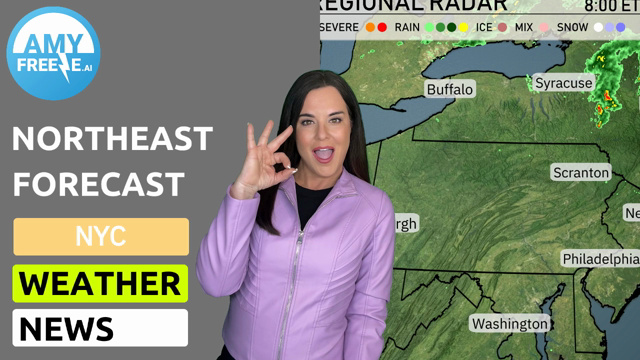
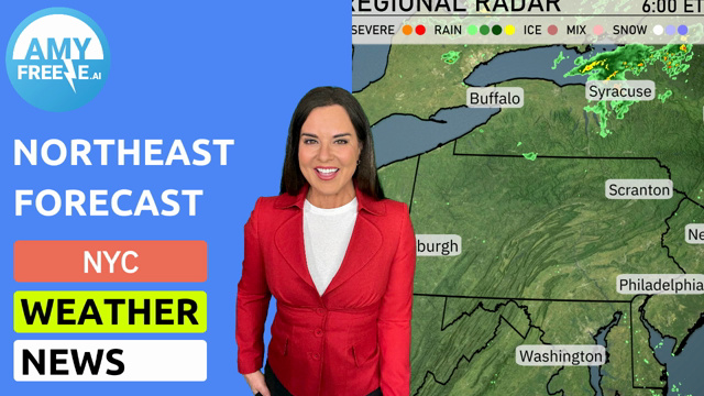
Across the Northeast, the regional radar shows precipitation primarily focused around upstate New York, with areas like Syracuse and Albany experiencing rain showers. To the east, light precipitation is evident near Scranton, as well as just off the coast near Boston, suggesting some coastal rain showers. Further west, towards Buffalo, conditions appear clearer with no significant precipitation detected.
Tomorrow morning in New York City, temperatures will start at 54 degrees at 8 AM with showers expected. By 10 AM, it will warm up to 59 degrees with winds from the west at 5 miles per hour. Skies will transition to cloudy conditions. At noon, expect mostly cloudy skies with temperatures reaching 64 degrees and west-southwest winds at 8 miles per hour.
New York City will see a high of 68 degrees, while Philadelphia warms up to 66. Boston is looking at 64 degrees, with Syracuse slightly cooler at 54. Pittsburgh will reach 52 degrees, showcasing below-average readings for this time of year. Buffalo struggles with cooler conditions at just 45 degrees, highlighting a stark contrast in temperatures across the region.
A band of rain moves into the Northeast from Pittsburgh by tomorrow morning, bringing showers primarily to Pennsylvania and New York. The heaviest rainfalls will impact areas west of Syracuse and Albany. Expect conditions to be damp through the day with potential flood advisories due to saturated grounds. By afternoon, showers become lighter as the system dissipates while cloud cover remains dense, leading to cooler temperatures across the region.
The UV index in New York City is moderate today, at 6, with a burn time of about 23 minutes under direct sunlight. For Tuesday, expect the UV index to reach 7, which is high, with a quicker burn time of 20 minutes.
Tuesday: Rain late with a high of 66 degrees, dipping down to 44 degrees overnight.
Wednesday: Partly cloudy skies, cooler temperatures expected with a high reaching 53 degrees and a low of 41 degrees.
Thursday: Mostly clear day with a slight warming trend as temperatures climb to 61 degrees during the day, cooling off to 43 degrees at night.
Friday: Warmer with mostly clear skies, high of 66 degrees, and a mild low of 55 degrees.
Saturday: Clouds move in with a warmer high of 76 degrees and an overnight low of 49 degrees.
Sunday: Expect mostly cloudy conditions, daytime high of 62 degrees, and a low of 47 degrees.
Monday: Partly cloudy skies as temperatures slightly drop to a high of 60 degrees and a low of 53 degrees.