Bright Mornings and Stormy Evenings: NYC’s Dynamic Weather Pattern
By
Amy Freeze
Explore the shifting skies of NYC from tranquil mornings to stormy evenings. Get all the weather updates and tips on how to enjoy the city safely.
New York City greets you with sunny mornings this week, but watch out for those sneaky afternoon thunderstorms! Prepare with our weather insights.
Starting your day in New York City with mostly sunny skies and mild temperatures? Make sure to enjoy it before the afternoon storms roll in. With temperatures soaring across the Northeast and a frontal system approaching, our detailed blog post guides you through each day’s weather, offers safety tips during high UV index days, and prepares you for sudden weather changes. Dive deeper into what these patterns mean for your daily plans!
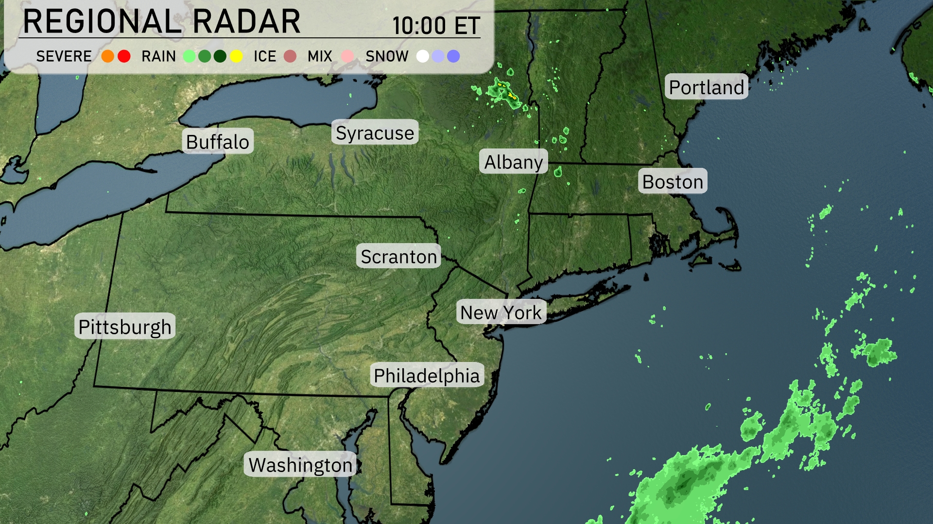
A tranquil start across much of the Northeast, with clear conditions dominating. However, isolated showers are spotted in upstate New York, particularly north of Albany. Southeast of New England, off the coast, showers are poised and may influence coastal weather later. Meanwhile, cities like Boston and New York remain dry as cloud cover stays minimal for now.
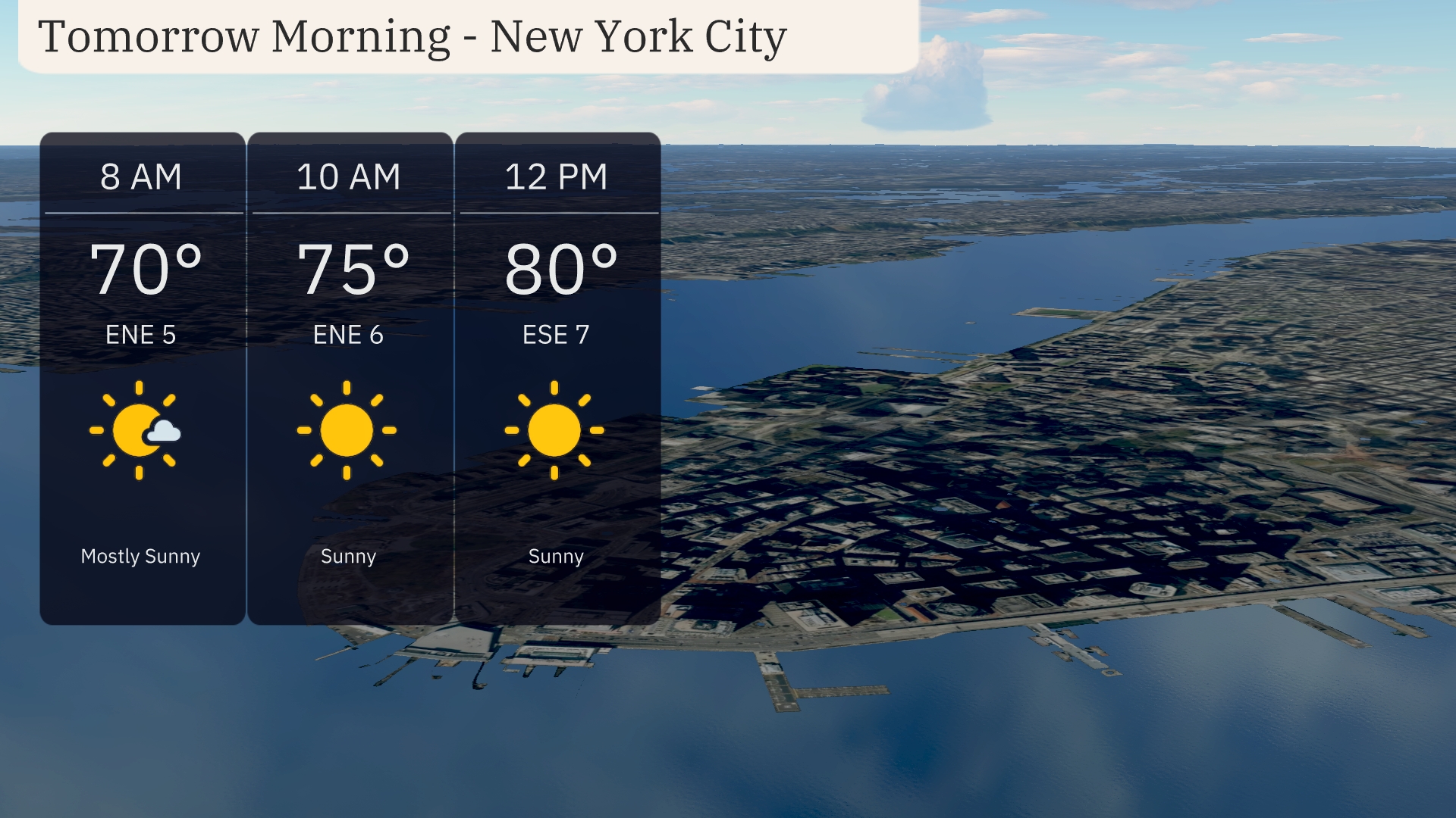
Tomorrow morning in New York City, start your day with mostly sunny skies and enjoy mild temperatures beginning at 70 degrees at 8 AM. By 10 AM, temperatures rise to 75 degrees as the sun shines brightly. A gentle southeast wind will accompany the warm-up, shifting from an east-northeast flow at 5 miles per hour to east-southeast at 7 miles per hour by noon, when temperatures reach a pleasant 80 degrees.
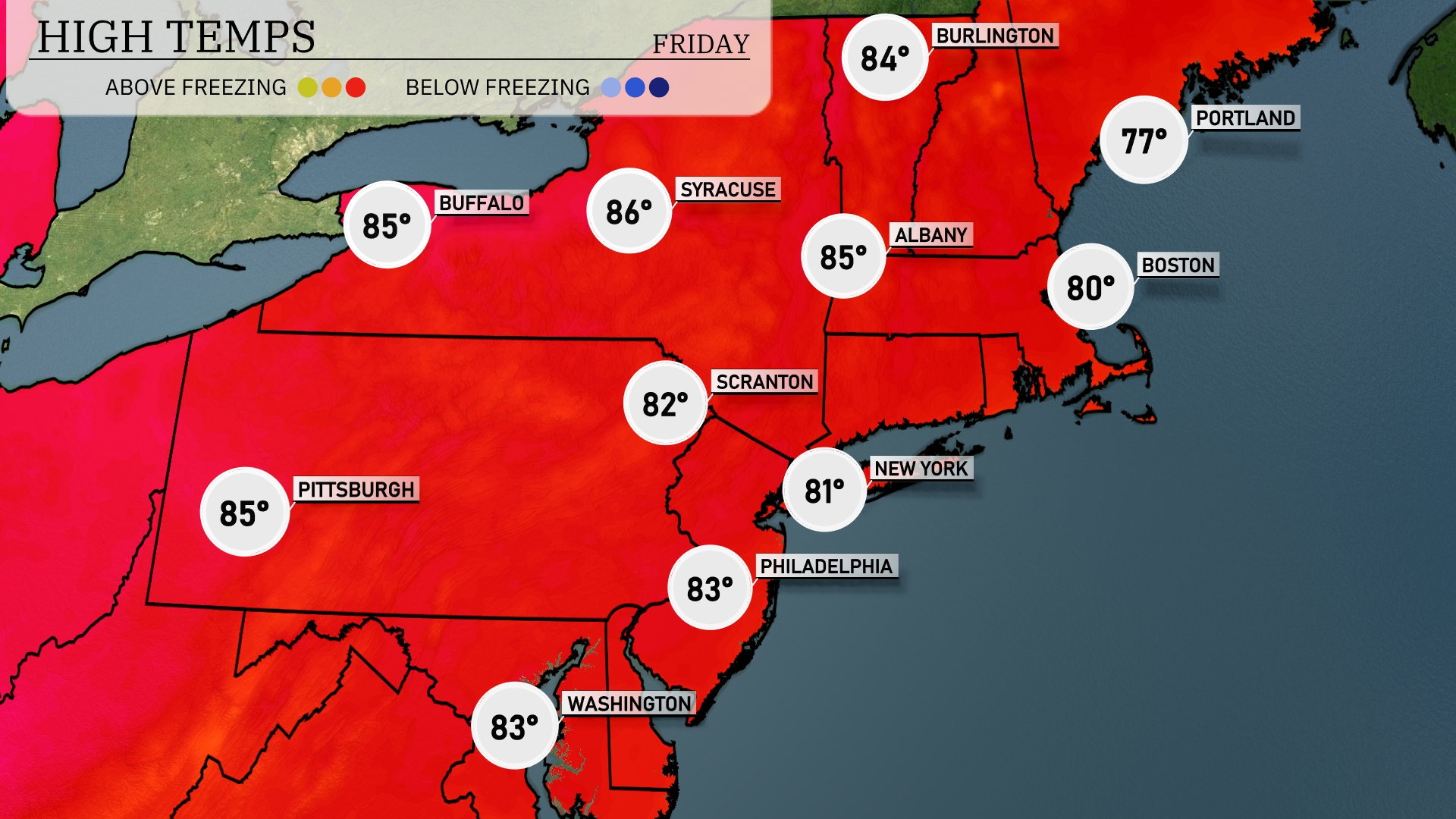
Tomorrow in the Northeast, temperatures will soar to the mid-80s. Buffalo and Pittsburgh are both expected to reach 85 degrees, while Syracuse tops out at an impressive 86 degrees. Philadelphia will see a high of 83 degrees, with New York City close behind at 81 degrees. Boston will enjoy a pleasant 80 degrees, slightly above average for this time of year.
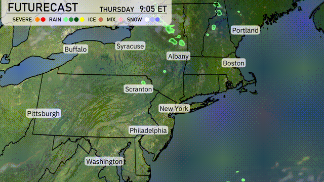
An approaching frontal system brings a round of showers and scattered thunderstorms to the Northeast beginning Thursday morning. Areas from Scranton to Albany should prepare for afternoon storms, some possibly reaching severe levels with gusty winds. Heavier rainfall could lead to localized flooding in spots, particularly across urban areas. A dip in temperatures follows the front, with mild air settling over Boston and New York as skies clear by late Thursday.
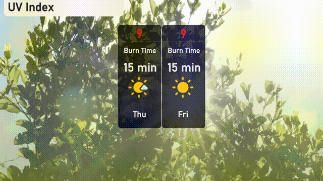
The UV index in New York City is a very high 9 on both Thursday and Friday, meaning sunburn can occur in as little as 15 minutes under direct sunlight. It’s crucial to frequently apply broad-spectrum sunscreen, wear a hat, and seek shade when possible to protect your skin. Stay sun-safe while enjoying the city!
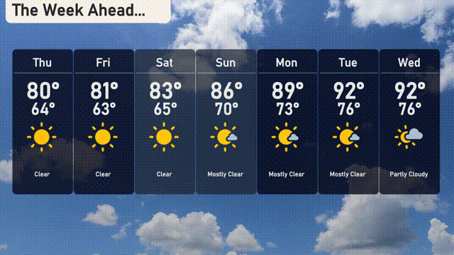
Thursday: Clear skies with a high of 80 degrees and a low of 64 degrees.
Friday: Enjoy another clear day, with temperatures reaching 81 degrees and dipping to 63 degrees at night.
Saturday: Sunshine continues with a high of 83 degrees and a low of 65 degrees.
Sunday: Mostly clear weather with temperatures peaking at 86 degrees and a nighttime low of 70 degrees.
Monday: The week starts with mostly clear skies and a high of 89 degrees, cooling to 73 degrees overnight.
Tuesday: Temperatures rise under mostly clear skies, hitting 92 degrees for the high and 76 degrees for the low.
Wednesday: Expect partly cloudy conditions, with highs reaching 92 degrees and lows around 76 degrees.