New York City is in for fluctuating weather conditions this week, from pleasant sunny mornings to unexpected heat waves and showers. Tap in to find out how to navigate this diverse weather!
Welcome to your NYC weather update! Expect a mixed bag this week, from sunshine to soaring temps and unexpected showers. Dive into our blog post for all the details and tips!
This is your comprehensive guide to navigating the fluctuating weather conditions in New York City. From the cool start of the morning with partly cloudy skies to the sizzling afternoons of a heat wave, New York presents a dynamic weather scenario. Prepare for scattered showers and possible thunderstorms moving from New York City to Boston, cooling down with highs in the mid-70s. Also, discover how the UV index will affect your day and tips on handling the high temps. Stay prepared and enjoy the week with our detailed 7-day forecast!
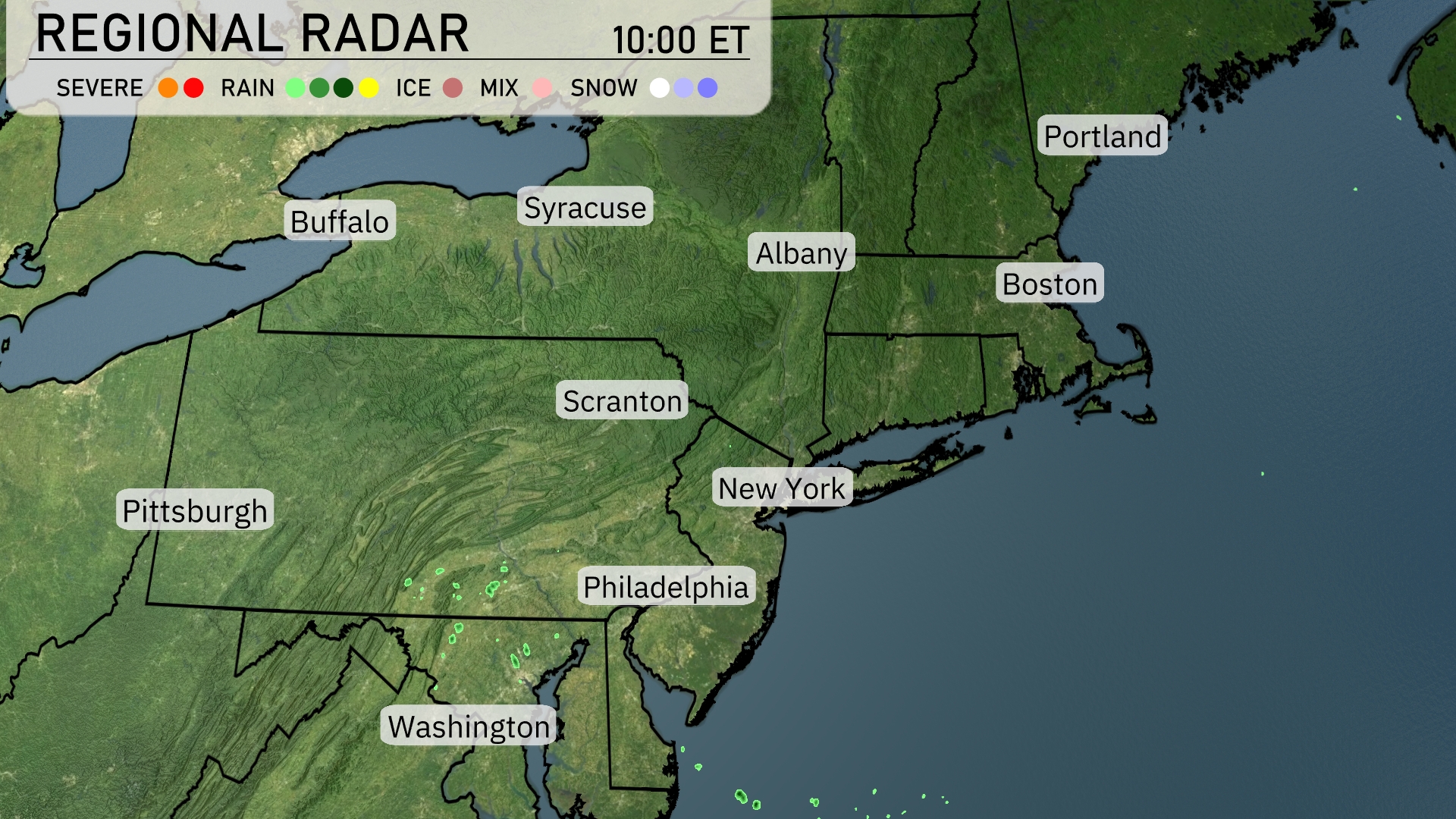
On the Regional Radar for the Northeast, we can see clear conditions dominating much of the region, with notable exceptions. Scattered showers are currently present near the areas south of Pittsburgh, with the potential to expand. Philadelphia and further southward show additional rain formation starting to take shape. Meanwhile, cities like New York, Boston, and Albany enjoy clear skies, making for a pleasant start to the day.
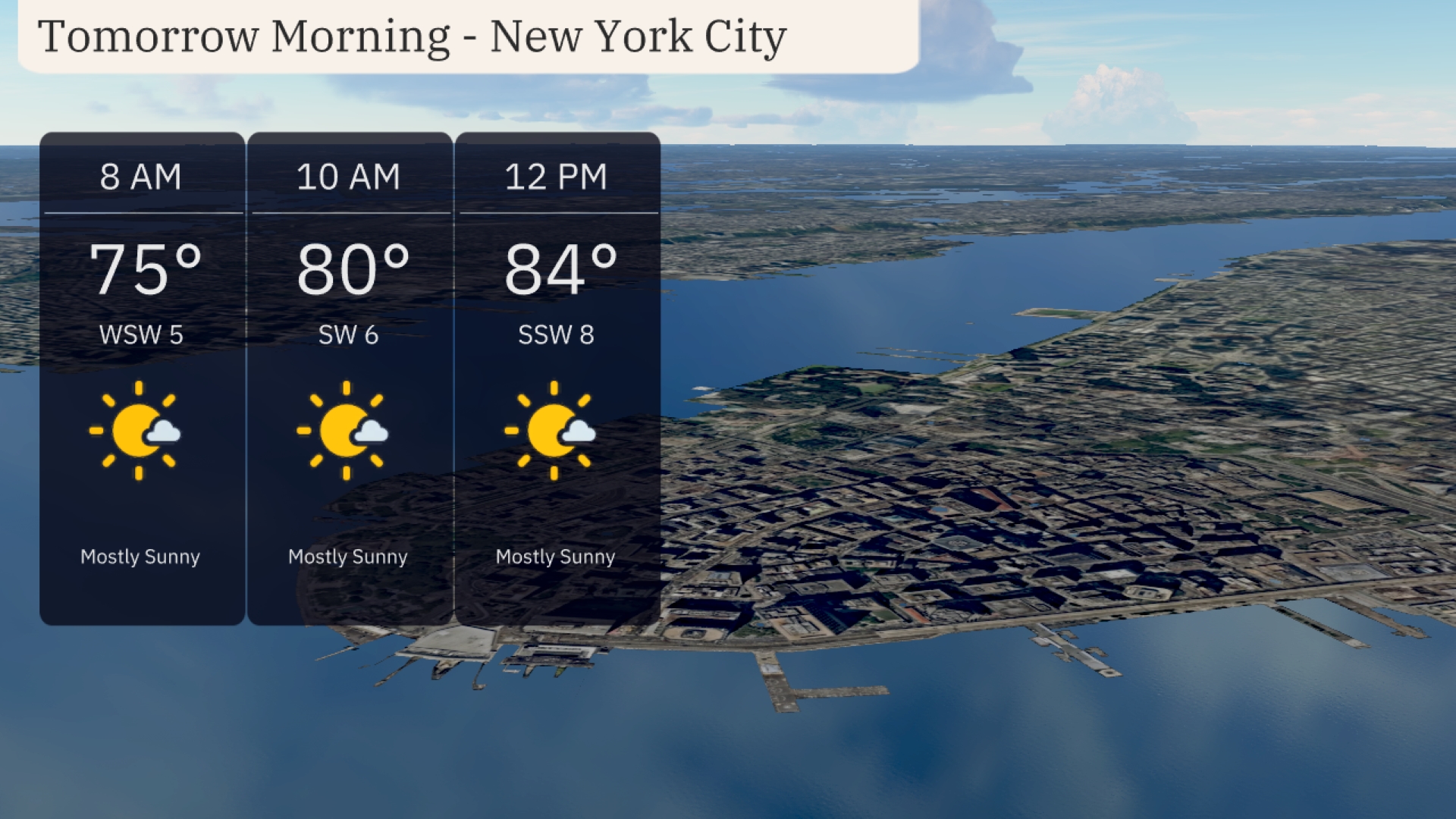
Tomorrow morning in New York City, we’ll start with mostly sunny skies. Temperatures will rise from 75 degrees at 8 AM to 80 degrees by 10 AM. Expect a light southwest breeze around 5 to 6 miles per hour, providing a pleasant start to the day. By midday, temperatures will increase to 84 degrees with winds shifting slightly to the south-southwest at 8 miles per hour.
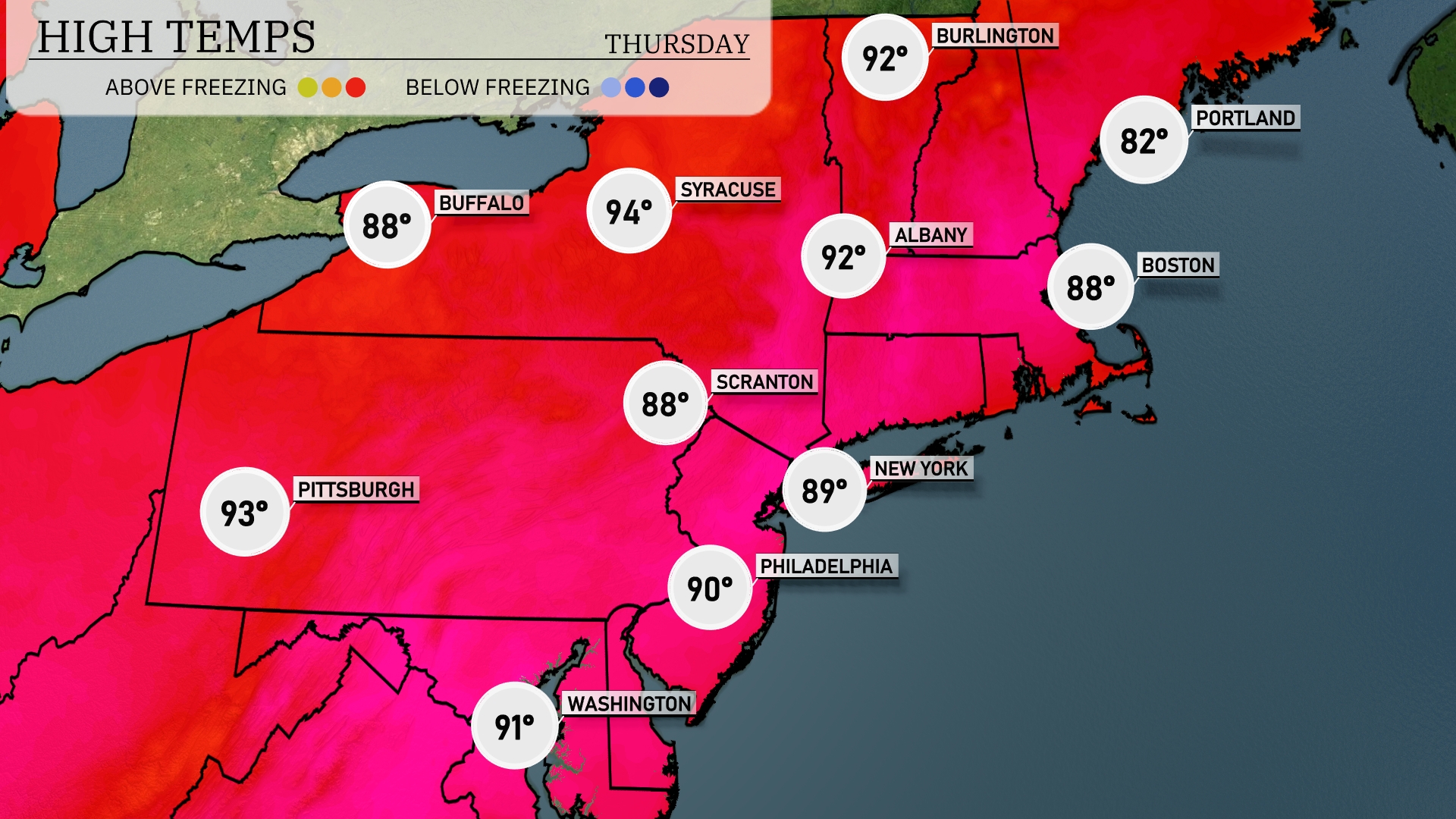
Tomorrow in the Northeast, high temperatures soar as we see a significant heat wave. Pittsburgh will peak at a sizzling 93 degrees, while Scranton reaches 88 degrees. In the New York City area, expect a high of 89 degrees, with Philadelphia not far behind at 90 degrees. Albany also joins the warm trend with a high of 92 degrees, and Buffalo is set for 88 degrees. Overall, these temperatures are well above seasonal averages, influenced by a dominant high-pressure system bringing warm, humid air.
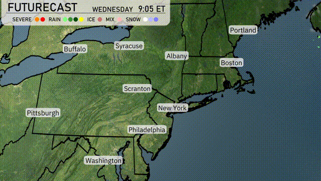
A cool front moves into the Northeast tomorrow morning, bringing showers and possible thunderstorms from New York City to Boston. Expect cooler temperatures with highs in the mid-70s in the afternoon. Scattered rains will continue throughout the day, tapering off by evening. Watch for gusty winds, particularly in coastal areas, which could lead to localized power outages. By late Thursday, clearer skies and more stable conditions will prevail as the system exits the region.
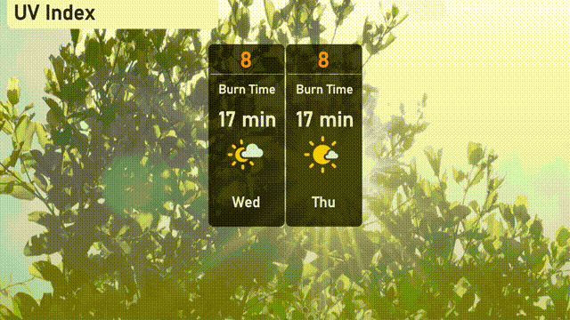
The UV index in New York City is high at 8 today and tomorrow, with a burn time of just 17 minutes in the sun. Make sure to wear protective clothing and apply sunscreen generously. Enjoy the sunshine responsibly!
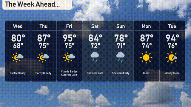
For the 7-day forecast in New York City:
Wednesday: Partly cloudy with a high of 80 degrees and a low of 68 degrees.
Thursday: More clouds with the temperature rising to 87 degrees, low of 75 degrees.
Friday: Look out for some clouds early on, as temperatures soar to 95 degrees, cooling to 75 degrees at night.
Saturday: Showers might develop late, with a high of 84 degrees and a low of 72 degrees.
Sunday: Expect late showers again, with the temperature peaking at 78 degrees, dipping to 71 degrees after sunset.
Monday: Clear skies bring a sunny day with the high reaching 87 degrees, cooling down to 74 degrees overnight.
Tuesday: Mostly clear conditions, with temperatures climbing to 94 degrees and a low of 76 degrees.
Stay prepared and enjoy the week!