Navigating New York’s Nimbostratus: A Week of Weather Wonders
By
Amy Freeze
Partly cloudy skies and chilly breezes headline this week's weather as a significant system brings varied precipitation from Pittsburgh to Portland. Stay informed on what this means for NYC with our full analysis.
Experience the tapestry of changing weather in NYC! Meteorologist Amy Freeze guides you through this week’s forecast, highlighting impending rain, potential snow, and the essentials to stay prepared.
Hello, NYC! Meteorologist Amy Freeze here. This week in the Northeast, we’re seeing a mixed bag of weather conditions, from light showers in Pittsburgh to heavy snowfalls in Buffalo. New York City holds steady today, but prepare for variability with temperatures peaking at mild levels before dropping overnight. Detailed insights into the daily changes upcoming and strategic tips on handling sudden weather shifts are all right here on our blog.
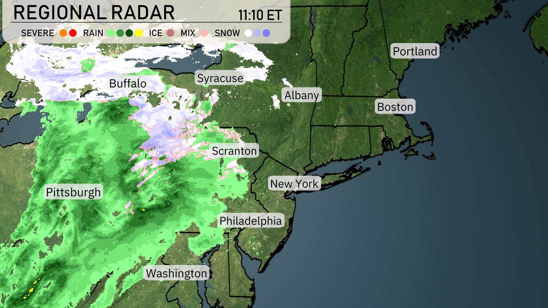
Over the Northeast, a significant weather system is bringing a mix of rain, ice, and snow across the region. Western Pennsylvania, around Pittsburgh, is experiencing consistent rain showers moving northeast. As this rain advances, it transitions into a wintry mix around Scranton, creating slick conditions.
Buffalo is bracing for heavy snowfall, with snow moving eastward across northern New York. Syracuse is currently under a snow cover, with conditions expected to persist throughout the day. Albany remains clear for now, but cloud cover is increasing as the wintry mix makes its way east.
Farther down the coast, Philadelphia and New York City are witnessing cloud cover thickening ahead of the incoming rain, which could lead to possible rain showers later in the day. Boston enjoys a brief respite under clear skies, but conditions might change as the system continues to move eastward.
Washington D.C. is under cloudy skies with rain showers approaching from the west. Meanwhile, Portland remains unaffected by this system and stays under clear conditions for the moment. The dynamic nature of this weather system highlights the need for attention and care, especially where the precipitation transitions occur.
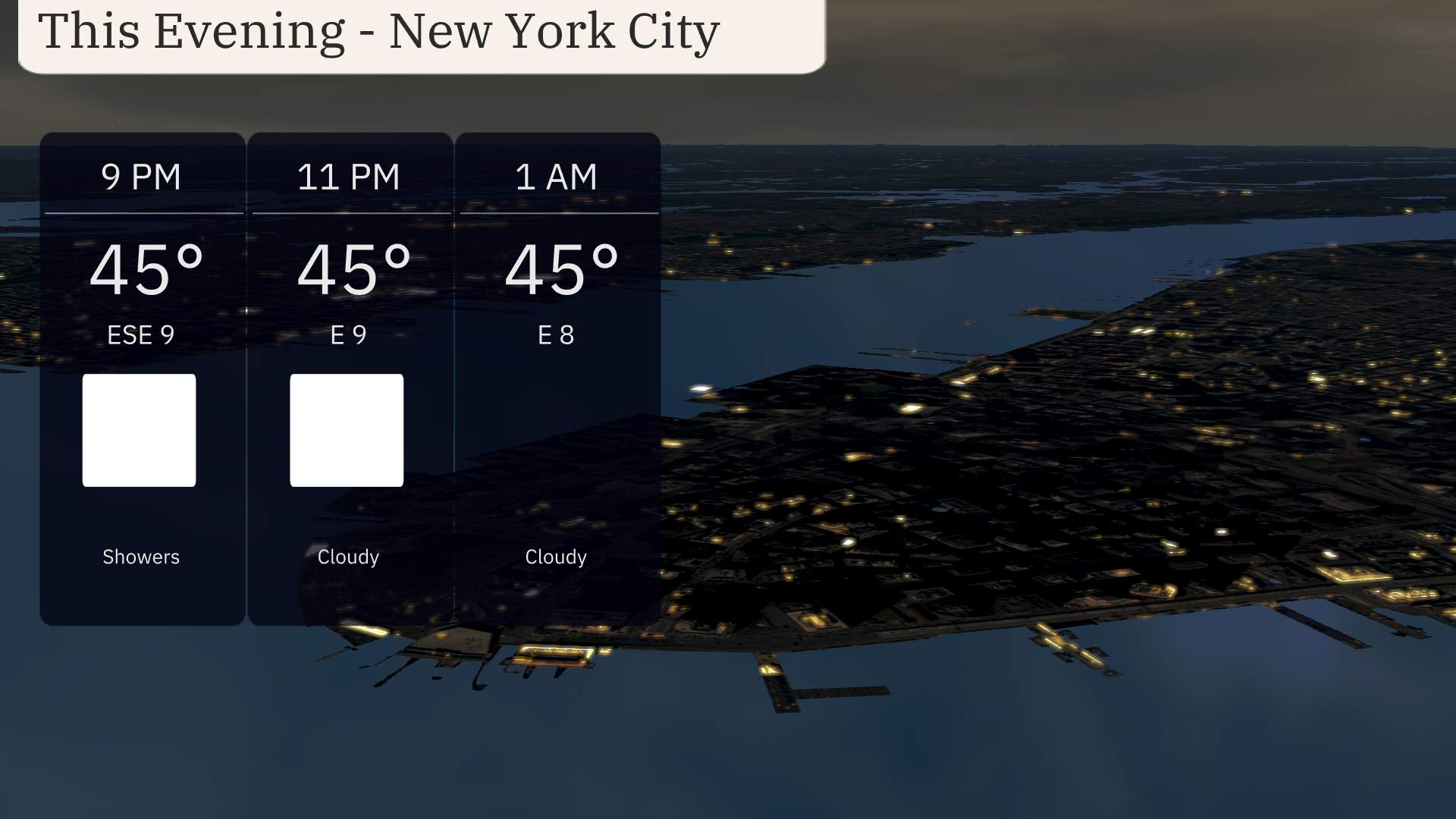
For this evening in New York City, the temperatures will hold steady at 45 degrees from 9 PM through 1 AM. Showers expected at 9 PM will taper off, giving way to cloudy skies as the night progresses. Winds will be easing as they shift from ESE at 9 PM to E by 11 PM, and then to E at 1 AM.
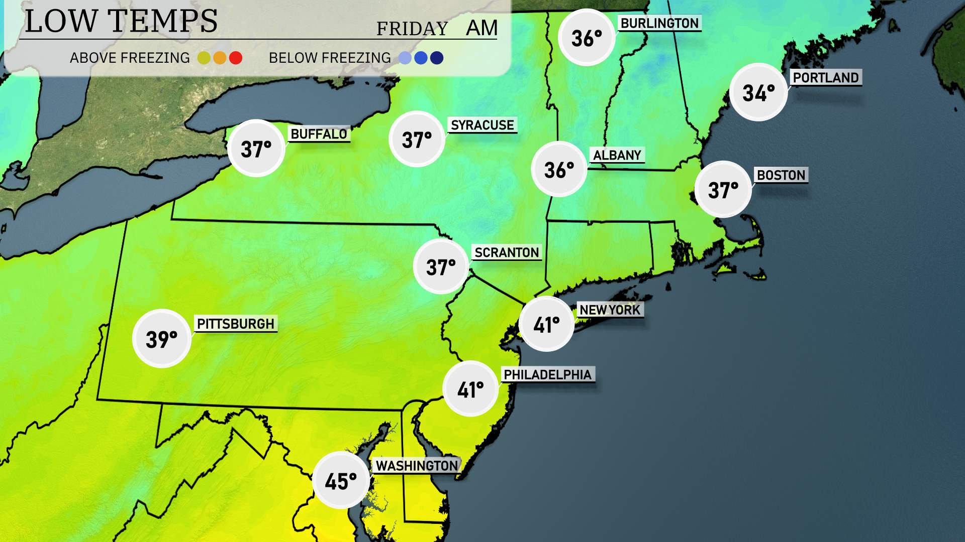
In the Northeast tonight, expect a noticeable drop in temperatures as cold air sweeps in. Boston will see a low of 37 degrees, while Portland dips even lower to 34 degrees. Moving inland, Albany can anticipate a low of 36, and Scranton will match that at 37 degrees. Pittsburgh will cool down to 39, with New York City at a mild 41. Philadelphia will also feel the chill with a low of 41 degrees.
High temperatures for tomorrow in the Northeast will show generally cool trends, with most areas experiencing readings below average for this time of year.
In Boston, expect a high of 46 degrees, while Portland will reach a similar 43 degrees. Philadelphia is forecasted to hit 48 degrees. Farther west, Pittsburgh will see a high of 48 degrees, and Scranton will struggle a bit, only reaching 46 degrees. The capital, Washington D.C., will top out at 52 degrees.
A chilly air mass is settling in, limiting warming trends across the region. Cloud cover and lingering cool winds will also contribute to these below-average temperatures.
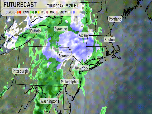
A weather system is pushing through the Northeast with impacts expected into tomorrow. A mix of rain and snow is anticipated across regions including Buffalo, Syracuse, and Albany, with rainfall becoming more prominent farther south near Philadelphia. Expect snow accumulations primarily in higher elevations. The system moves swiftly, clearing the area by evening. Temperatures will hover around freezing in the interior, while coastal areas remain a bit warmer. Be prepared for slippery travel conditions, especially during the morning commute. Stay alert for any weather warnings issued by the National Weather Service.
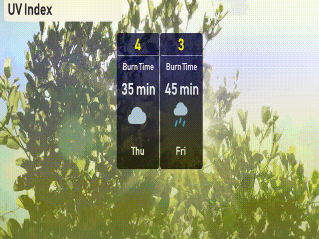
Today in New York City, the UV index is moderate with a rating of 4, meaning there’s a burn time of about 35 minutes if you’re in direct sunlight. As we move into tomorrow, clouds and possible showers will keep the UV index at a lower 3, reducing sun exposure risks.
For the 7-day forecast in New York City:
Thursday: Rainy with a high of 49°F and a low of 41°F.
Friday: More rain expected, temperatures reaching a high of 47°F and a low of 39°F.
Saturday: Cloudy skies with a high of 43°F, cooling down to 41°F at night.
Sunday: Partly cloudy and warmer, temperatures peak at 59°F with a low of 45°F.
Monday: Showers are anticipated, with a high of 66°F and a low of 52°F.
Tuesday: Expect partly cloudy conditions, highs around 62°F, and lows at 42°F.
Wednesday: Partly cloudy once more, with temperatures reaching up to 51°F and a low near 40°F.