NYC Weather Update: Navigating from Clouds to Clear Skies
By
Amy Freeze
Explore the shifting weather patterns over New York City as we move from intermittent rain showers to warm, sunny days, with insights on what to expect in the coming week.
This week in NYC, expect a roller coaster of weather conditions from cloudy with showers to clear sunny skies. Stay prepared with our detailed daily insights!
As New York City experiences a blend of weather conditions this week, from cloudy afternoons with periodic showers to bright, sunny days, our comprehensive forecast will guide you through. Whether you’re planning your commute or a weekend outing, understand how temperature fluctuations and potential thunderstorms could affect your plans. Detailed insights for each day are available, emphasizing temperature highs and lows and weather advisories for the Northeast area.
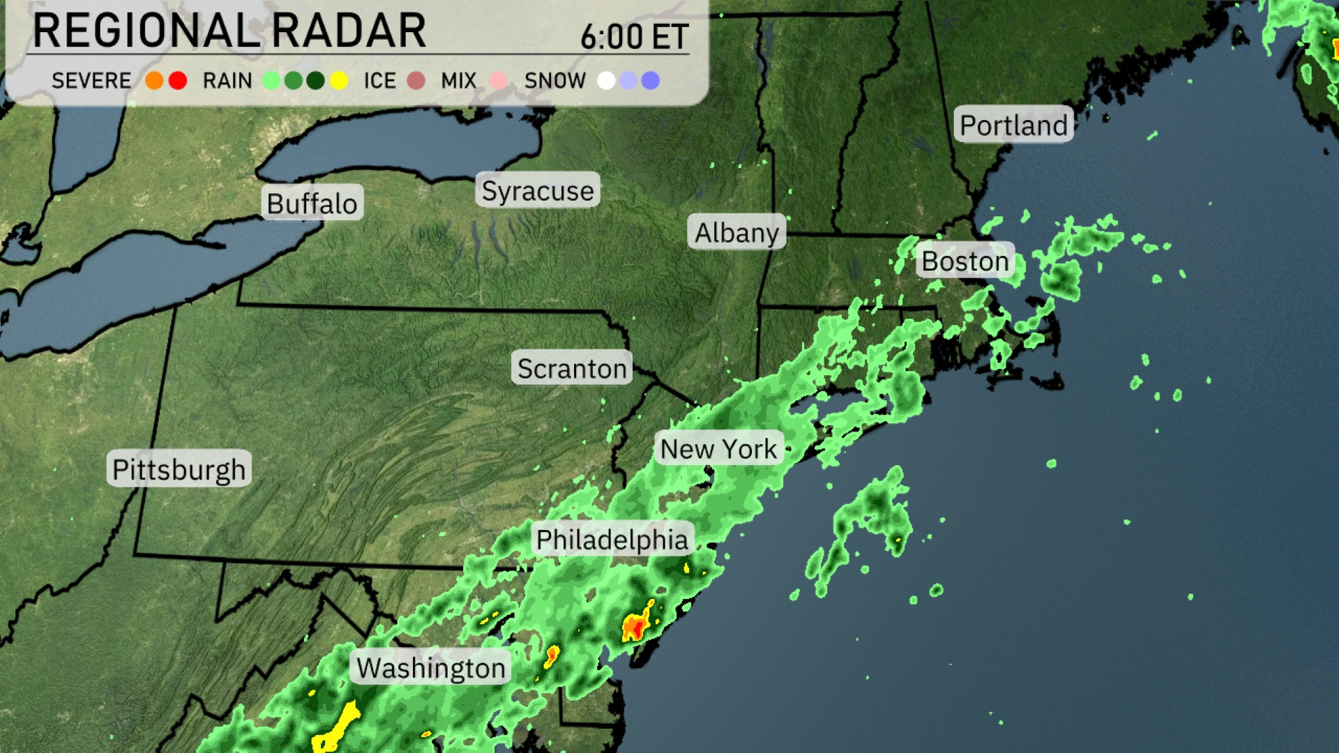
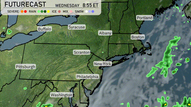
A band of rain showers extends from Washington D.C. through Philadelphia and New York before moving off the coast of Boston. The heaviest rainfall is currently found just east of Philadelphia, where isolated severe cells might bring gusty winds. Syracuse and Albany are experiencing overcast skies with no precipitation, while Buffalo and Pittsburgh remain mostly dry. Further north in Portland, expect a break in precipitation, but cloud cover persists as rain showers continue their journey offshore.
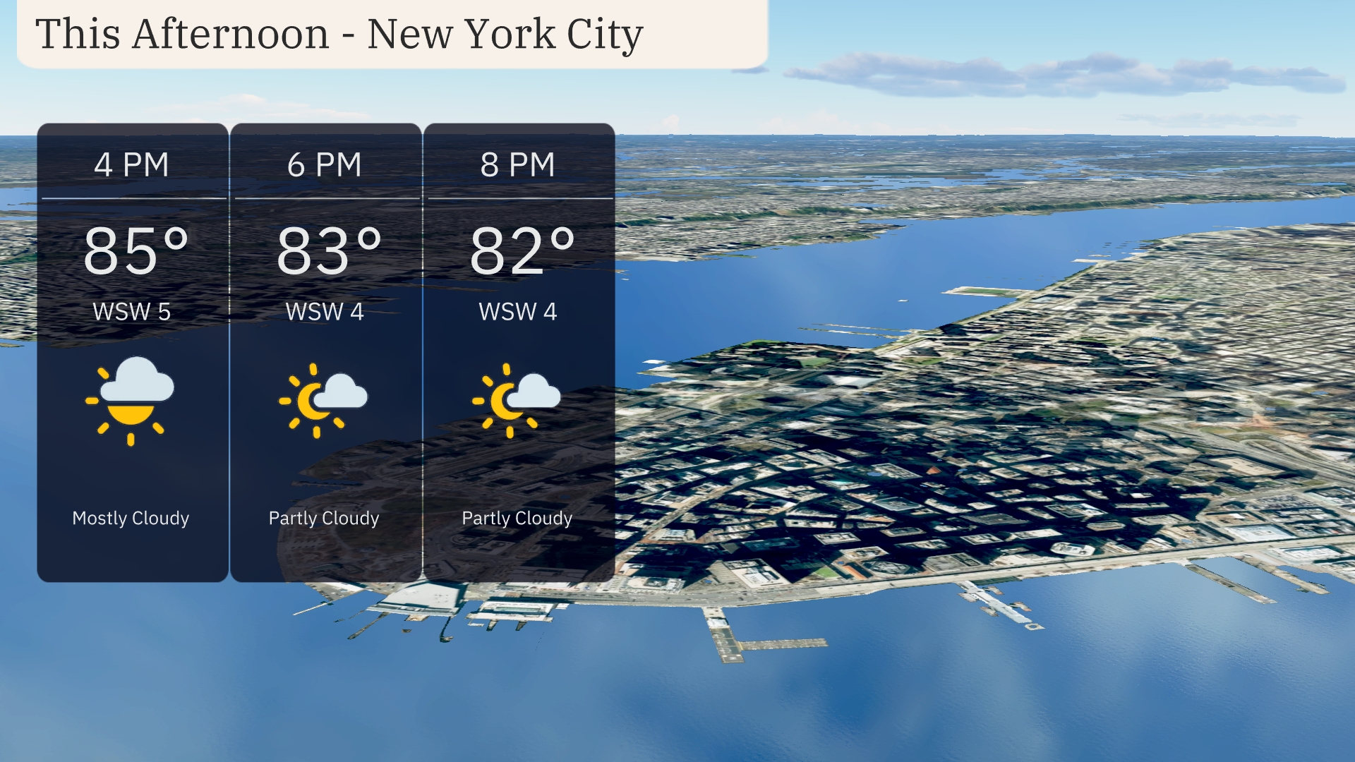
In New York City, the afternoon brings mostly cloudy skies with temperatures peaking at 85 degrees. Winds from the west-southwest at 5 miles per hour provide a gentle breeze. By early evening, the sky transitions to partly cloudy with temperatures slightly dipping to 83 degrees. Light winds continue as the temperature reaches 82 degrees by 8 PM.
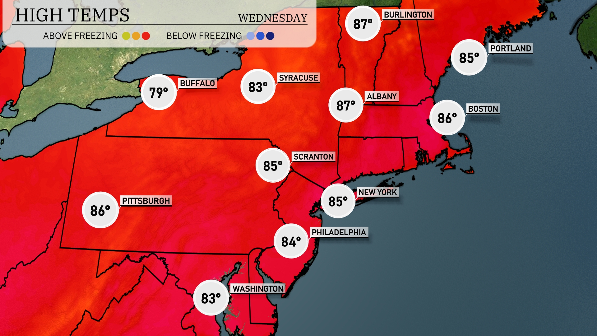
In the Northeast today, the temperatures are warming up nicely. New York City and Philadelphia both have highs around 85 degrees, while Boston will hit 86. Scranton is slightly cooler at 85 degrees, and Pittsburgh reaches a comfortable 86. Farther north, Albany is seeing a high of 87, while Syracuse comes in at a pleasant 83 degrees. Expect plenty of sunshine across the region, with minimal chances of precipitation.
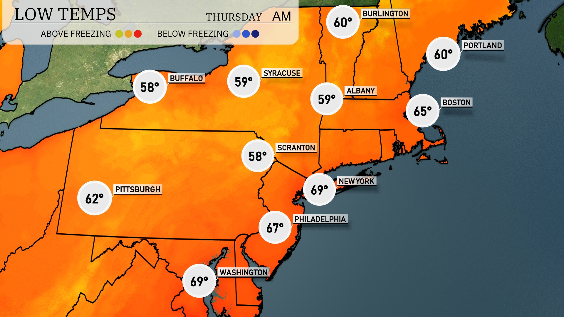
Tonight, temperatures will drop to 58 degrees in Scranton and 59 in Syracuse. Buffalo will see a low of 58 degrees, while New York City remains warmer at 69 degrees. Philadelphia will cool down to 67 degrees, and Boston will settle at 65 degrees.
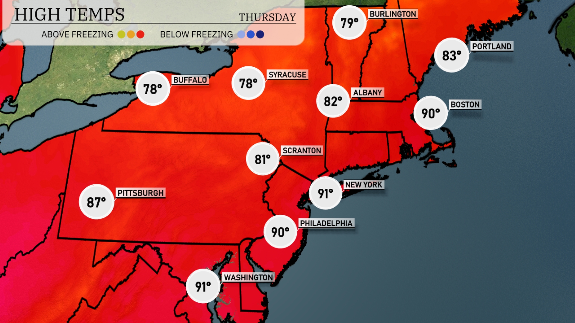
Tomorrow New York City will see a high of 91 degrees, while Philadelphia warms up to 90. Boston isn’t far behind with a high of 90 as well. Pittsburgh is expected to hit 87 degrees, showcasing a significant heat trend across the region.
Tomorrow a warm front near Albany may trigger isolated thunderstorms, while Syracuse and Buffalo should remain largely dry with temperatures climbing into the mid-80s. Coastal areas, including New York City and Boston, may see patchy morning fog transitioning to mostly sunny skies by midday. Temperatures will reach around 70 in Portland before a cool air mass brings a gentle dip towards evening. No major severe weather threats, but keep an eye on localized storm development in the afternoon.
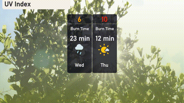
The UV index in New York City on Wednesday is moderate with a value of 6, meaning a sunburn can happen in about 23 minutes of direct exposure. By Thursday, the index jumps to an intense 10, reducing the burn time to just 12 minutes.